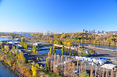
Directions to Île Notre-Dame (Montréal) with public transportation
The following transit lines have routes that pass near Île Notre-Dame
 Bus: 13, 777, 15, 613.
- Train: SH, VIA RAIL, VIA RAIL, VIA RAIL, VIA RAIL.
- Metro: LIGNE 4 - JAUNE.
How to get to Île Notre-Dame by bus?
Click on the bus route to see step by step directions with maps, line arrival times and updated time schedules.
How to get to Île Notre-Dame by metro?
Click on the metro route to see step by step directions with maps, line arrival times and updated time schedules.
Bus stops near Île Notre-Dame in Montréal
- Casino De Montréal, 8 min walk,
- Riverside / Argyle, 47 min walk,
- Riverside / Mercille, 52 min walk,
Metro station near Île Notre-Dame in Montréal
- Station Jean-Drapeau, 16 min walk,
Train stations near Île Notre-Dame in Montréal
- Gare Saint-Lambert, 59 min walk,
- St-Lambert Amtrak Station, 62 min walk,
Bus lines to Île Notre-Dame in Montréal
- 777, Ouest Destination Casino De Montréal,
- 13, Riverside / Secteurs P-V Brossard,
- 15, Riverside / Alexandra / Churchill,
- 613, Écoles privées / Collège Champlain,
- 6, Terminus Panama,
- 14, Terminus Brossard,
- 506, Pav. Durocher/St-Lambert,
- 600, Collèges Ndl / Durocher,
- 618, Pav. Durocher/St-Lambert,
- 606, Domicile,
- 614, Domicile,
What are the closest stations to Île Notre-Dame?
The closest stations to Île Notre-Dame are:
- Casino De Montréal is 552 meters away, 8 min walk.
- Station Jean-Drapeau is 1174 meters away, 16 min walk.
- Riverside / Argyle is 3655 meters away, 47 min walk.
- Riverside / Mercille is 4025 meters away, 52 min walk.
- Gare Saint-Lambert is 4560 meters away, 59 min walk.
- St-Lambert Amtrak Station is 4808 meters away, 62 min walk.
Which bus lines stop near Île Notre-Dame?
These bus lines stop near Île Notre-Dame: 13, 777.
Which metro line stops near Île Notre-Dame?
LIGNE 4 - JAUNE (Station Longueuil-Université De Sherbrooke -Zone B)
What’s the nearest metro station to Île Notre-Dame in Montréal?
The nearest metro station to Île Notre-Dame in Montréal is Station Jean-Drapeau. It’s a 16 min walk away.
What’s the nearest bus station to Île Notre-Dame in Montréal?
The nearest bus station to Île Notre-Dame in Montréal is Casino De Montréal. It’s a 8 min walk away.
What time is the first metro to Île Notre-Dame in Montréal?
The LIGNE 4 - JAUNE is the first metro that goes to Île Notre-Dame in Montréal. It stops nearby at 5:30 AM.
What time is the last metro to Île Notre-Dame in Montréal?
The LIGNE 4 - JAUNE is the last metro that goes to Île Notre-Dame in Montréal. It stops nearby at 1:06 AM.
What time is the first train to Île Notre-Dame in Montréal?
The SH is the first train that goes to Île Notre-Dame in Montréal. It stops nearby at 6:16 AM.
What time is the last train to Île Notre-Dame in Montréal?
The VIA RAIL is the last train that goes to Île Notre-Dame in Montréal. It stops nearby at 8:47 PM.
What time is the first bus to Île Notre-Dame in Montréal?
The 777 is the first bus that goes to Île Notre-Dame in Montréal. It stops nearby at 5:18 AM.
What time is the last bus to Île Notre-Dame in Montréal?
The 13 is the last bus that goes to Île Notre-Dame in Montréal. It stops nearby at 1:52 AM.
See Île Notre-Dame, Montréal, on the map
Public Transit to Île Notre-Dame in Montréal
Wondering how to get to Île Notre-Dame in Montréal? Moovit helps you find the best way to get to Île Notre-Dame with step-by-step directions from the nearest public transit station.
Moovit provides free maps and live directions to help you navigate through your city. View schedules, routes, timetables, and find out how long does it take to get to Île Notre-Dame in real time.
Looking for the nearest stop or station to Île Notre-Dame? Check out this list of stops closest to your destination: Casino De Montréal; Station Jean-Drapeau; Riverside / Argyle; Riverside / Mercille; Gare Saint-Lambert; St-Lambert Amtrak Station.
Bus: 13, 777, 15, 613.Train: SH, VIA RAIL, VIA RAIL, VIA RAIL, VIA RAIL, ADIRONDACK.Metro: LIGNE 4 - JAUNE.
Want to see if there’s another route that gets you there at an earlier time? Moovit helps you find alternative routes or times. Get directions from and directions to Île Notre-Dame easily from the Moovit App or Website.
We make riding to Île Notre-Dame easy, which is why over 1.5 million users, including users in Montréal, trust Moovit as the best app for public transit. You don’t need to download an individual bus app or train app, Moovit is your all-in-one transit app that helps you find the best bus time or train time available.
For information on prices of bus, metro and train, costs and ride fares to Île Notre-Dame, please check the Moovit app.
Use the app to navigate to popular places including to the airport, hospital, stadium, grocery store, mall, coffee shop, school, college, and university.
Île Notre-Dame Address: Chemin des Floralies street in Montréal
- 160 Chemin du Tour de l'isle,
- Montreal Olympic Basin,
- Montreal Casino,
- Evi* Casino Montreal,
- 1 Avenue du Casino,
- Pont de la Concorde,
- Grand Prix F1 Canada Inc,
- Complexe Aquatique du Parc Jean-Drapeau,
- Osheaga,
- P1 - Parc Jean Drapeau,
- Stationnement Casino de Mtl-Valet,
- Canadian Grand Prix,
- La Toundra,
- Jardins des Floralies,
- Stationnement Casino de Montréal,
- Parc Jean-Drapeau,
- 222 Circuit Gilles Villeneuve,
- P1-A,
- 5455 Avenue de Gaspé,
- STM Ligne 777 Le Casino
Places Near Île Notre-Dame (Montréal)
- Centre Bell, Montréal,
- Place Bell, Laval,
- CHUM - Centre Hospitalier de l'Université de Montréal, Montréal,
- Mtelus, Montréal,
- Le Centre Eaton de Montreal, Montréal,
- Place Versailles, Montréal,
- Bell Centre, Montréal,
- L'Arsenal, Montréal,
- Place Ville-Marie, Montréal,
- Jewish General Hospital, Montréal,
- Royalmount, Mont-Royal,
- Carrefour Laval, Laval,
- Vieux-Port, Montréal,
- Galeries d'Anjou, Anjou,
- Palais Des Congrès De Montréal, Montréal,
- Marché Central, Montréal,
- Theatre Rialto, Montréal,
- Stade Saputo, Montréal,
- Gare Centrale, Montréal,
- Casino De Montréal, Montréal
How to get to popular places in Montreal with public transit
Get around Montréal by public transit!
Traveling around Montréal has never been so easy. See step by step directions as you travel to any attraction, street or major public transit station. View bus and train schedules, arrival times, service alerts and detailed routes on a map, so you know exactly how to get to anywhere in Montréal.
When traveling to any destination around Montréal use Moovit's Live Directions with Get Off Notifications to know exactly where and how far to walk, how long to wait for your line, and how many stops are left. Moovit will alert you when it's time to get off — no need to constantly re-check whether yours is the next stop.
Wondering how to use public transit in Montréal or how to pay for public transit in Montréal? Moovit public transit app can help you navigate your way with public transit easily, and at minimum cost. It includes public transit fees, ticket prices, and costs. Looking for a map of Montréal public transit lines? Moovit public transit app shows all public transit maps in Montréal with all Bus, Train, Metro and Shuttle routes and stops on an interactive map.
Montreal has 4 transit type(s), including: Bus, Train, Metro and Shuttle, operated by several transit agencies, including RTL, STM, exo-Réseau de transport métropolitain, exo-Chambly-Richelieu-Carignan, exo-Haut-Saint-Laurent, exo-Laurentides, exo-La Presqu'île, CRT Lanaudière, exo-Le Richelain / Roussillon, exo-Sorel-Varennes, exo-Sud-Ouest, exo-Vallée du Richelieu, exo-L'Assomption, exo-Terrebonne-Mascouche and exo-Sainte-Julie