Directions to Đền Quán Thánh (Phường Quán Thánh) with public transportation
The following transit lines have routes that pass near Đền Quán Thánh
How to get to Đền Quán Thánh by bus?
Click on the bus route to see step by step directions with maps, line arrival times and updated time schedules.
How to get to Đền Quán Thánh by metro?
Click on the metro route to see step by step directions with maps, line arrival times and updated time schedules.
Bus stops near Đền Quán Thánh in Phường Quán Thánh
- Đối Diện Đền Quán Thánh - Thanh Niên, 3 min walk,
- 192a Quán Thánh, 4 min walk,
- Thành Cổ Hà Nội - Đối Diện 38 Phan Đình Phùng, 11 min walk,
- Trường Mạc Đĩnh Chi - Yên Phụ (Đường Xe Buýt), 16 min walk,
- Qua Nút Giao Cửa Bắc 120m - Yên Phụ (Đường Xe Buýt), 17 min walk,
Metro stations near Đền Quán Thánh in Phường Quán Thánh
- Thái Hà, 25 min walk,
- Cầu Giấy, 51 min walk,
Bus lines to Đền Quán Thánh in Phường Quán Thánh
- E05, Long Biên - E05,
- 41, (A) Bx Nam Thăng Long,
- 50, (B) Khu Đô Thị An Lạc (Hoài Đức).,
- 45, (B) Nam Thăng Long,
- E09, Khu Liên Cơ Quan Sở Ngành Hà Nội (Vườn Hoa Lạc Long Quân) - E09,
- 22A, (B) Khu Đô Thị Trung Văn,
- 23, (B) Nguyễn Công Trứ,
- 143, (B) Thị Trấn Đông Anh,
- 31, (A) Đại Học Bách Khoa,
- 55A, (A) Kđt Times City,
- 55B, (A)Tttm Aeon Mall,
- 58, (A) Long Biên,
- 146, (B) Hào Nam,
- 86, Ga Hà Nội - Sân bay Nội Bài,
- 86CT, Ga Hà Nội - Sân Bay Nội Bài,
What are the closest stations to Đền Quán Thánh?
The closest stations to Đền Quán Thánh are:
- Đối Diện Đền Quán Thánh - Thanh Niên is 169 meters away, 3 min walk.
- 192a Quán Thánh is 285 meters away, 4 min walk.
- Thành Cổ Hà Nội - Đối Diện 38 Phan Đình Phùng is 794 meters away, 11 min walk.
- Trường Mạc Đĩnh Chi - Yên Phụ (Đường Xe Buýt) is 1220 meters away, 16 min walk.
- Qua Nút Giao Cửa Bắc 120m - Yên Phụ (Đường Xe Buýt) is 1307 meters away, 17 min walk.
- Thái Hà is 1913 meters away, 25 min walk.
- Cầu Giấy is 3915 meters away, 51 min walk.
Which bus lines stop near Đền Quán Thánh?
These bus lines stop near Đền Quán Thánh: 41, 45, 50, E05.
Which metro line stops near Đền Quán Thánh?
C
What’s the nearest metro station to Đền Quán Thánh in Phường Quán Thánh?
The nearest metro station to Đền Quán Thánh in Phường Quán Thánh is Thái Hà. It’s a 25 min walk away.
What’s the nearest bus stop to Đền Quán Thánh in Phường Quán Thánh?
The nearest bus stop to Đền Quán Thánh in Phường Quán Thánh is Đối Diện Đền Quán Thánh - Thanh Niên. It’s a 3 min walk away.
What time is the first metro to Đền Quán Thánh in Phường Quán Thánh?
The V is the first metro that goes to Đền Quán Thánh in Phường Quán Thánh. It stops nearby at 5:00 AM.
What time is the last metro to Đền Quán Thánh in Phường Quán Thánh?
The V is the last metro that goes to Đền Quán Thánh in Phường Quán Thánh. It stops nearby at 11:11 PM.
What time is the first bus to Đền Quán Thánh in Phường Quán Thánh?
The 50 is the first bus that goes to Đền Quán Thánh in Phường Quán Thánh. It stops nearby at 5:04 AM.
What time is the last bus to Đền Quán Thánh in Phường Quán Thánh?
The E05 is the last bus that goes to Đền Quán Thánh in Phường Quán Thánh. It stops nearby at 10:36 PM.
See Đền Quán Thánh, Phường Quán Thánh, on the map
Public Transit to Đền Quán Thánh in Phường Quán Thánh
Wondering how to get to Đền Quán Thánh in Phường Quán Thánh, Vietnam? Moovit helps you find the best way to get to Đền Quán Thánh with step-by-step directions from the nearest public transit station.
Moovit provides free maps and live directions to help you navigate through your city. View schedules, routes, timetables, and find out how long does it take to get to Đền Quán Thánh in real time.
Looking for the nearest stop or station to Đền Quán Thánh? Check out this list of stops closest to your destination: Đối Diện Đền Quán Thánh - Thanh Niên; 192a Quán Thánh; Thành Cổ Hà Nội - Đối Diện 38 Phan Đình Phùng; Trường Mạc Đĩnh Chi - Yên Phụ (Đường Xe Buýt); Qua Nút Giao Cửa Bắc 120m - Yên Phụ (Đường Xe Buýt); Thái Hà; Cầu Giấy.
Bus: 41, 45, 50, E05, E09, 22A, 23, 143, 31, 55A, 55B, 58, 146.Metro: C, 2A, 3.
Want to see if there’s another route that gets you there at an earlier time? Moovit helps you find alternative routes or times. Get directions from and directions to Đền Quán Thánh easily from the Moovit App or Website.
We make riding to Đền Quán Thánh easy, which is why over 1.5 million users, including users in Phường Quán Thánh, trust Moovit as the best app for public transit. You don’t need to download an individual bus app or train app, Moovit is your all-in-one transit app that helps you find the best bus time or train time available.
For information on prices of bus and metro, costs and ride fares to Đền Quán Thánh, please check the Moovit app.
Use the app to navigate to popular places including to the airport, hospital, stadium, grocery store, mall, coffee shop, school, college, and university.
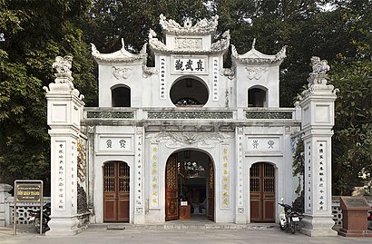
Đền Quán Thánh Address: Phố Quán Thánh street in Phường Quán Thánh
Attractions near Đền Quán Thánh
Vịt 184 Quán Thánh,Ngõ Nguyễn Cảnh Chân,Shop Thời Trang 9 Thanh Niên,Cafe Số 6 Trấn Vũ,Bể Bơi 10-10,Cafe Ban Mai Xanh,Lẩu Khô Yiboo Hong Kong,Trấn Vũ,Nhà Hàng Happy House,Nhà Hàng Hà Nội Marina - Hà Nội Marina,TượNg ĐàI Lý Tự TrọNg,Vườn Hoa Mai Xuân Thưởng,Công Viên Lý Tự Trọng,Bãi Tắm Chuồng Long Biên,Vườn Hoa Lý Tự Trọng,Highlands Coffee (Du thuyền hồ Trúc Bạch),Trấn Vũ 180 Quán Thánh,Đảng Bộ khối các cơ quan Trung Ương - Đảng ủy Ngoài Nước,Đảng Ủy Ngoài Nước,Highlands Hồ TâyHow to get to popular attractions in Phường Quán Thánh with public transit
Nguyễn Cảnh Dị, Định Công,Sở Tư pháp Hà Nội, Quận Hà Đông,Cầu Cống Mọc, Phường Láng Hạ,Trường Cao Đẳng Nghề Bách Khoa Hà Nội, Phường Bách Khoa,Hoàng Mai, Hoàng Liệt,Ba Vì, Tản Lĩnh,Trung tâm Chiếu phim Quốc gia, Phường Thành Công,Trần Thánh Tông Số 5, Quận Hai Bà Trưng,Hồ Linh Đàm, Hoàng Liệt,Trần Khát Chân, Quận Hai Bà Trưng,Chợ Hà Đông, Phường Nguyễn Trãi,Tòa nhà FPT Polytechnic - Nhà H, Phường Cầu Diễn,Tôn Đức Thắng, Phường Hàng Bột,Hà Đông, Phường Trung Văn,Bảo Tàng Thiên Nhiên Việt Nam, Quận Cầu Giấy,Cổng Nguyễn Đình Chiểu, Công viên Thống Nhất, Phường Lê Đại Hành,Khu Công Nghiệp Sài Đồng B, Phường Long Biên,Vinhomes Thăng Long Hoài Đức, Huyện Hoài Đức,Đại Học Y Tế Công Cộng, Quận Bắc Từ Liêm,Tân Dân Sóc Sơn Hà Nội, Huyện Sóc SơnGet around Hanoi by public transit!
Traveling around Hanoi has never been so easy. See step by step directions as you travel to any attraction, street or major public transit station. View bus and train schedules, arrival times, service alerts and detailed routes on a map, so you know exactly how to get to anywhere in Hanoi.
When traveling to any destination around Hanoi use Moovit's Live Directions with Get Off Notifications to know exactly where and how far to walk, how long to wait for your line, and how many stops are left. Moovit will alert you when it's time to get off — no need to constantly re-check whether yours is the next stop.
Wondering how to use public transit in Hanoi or how to pay for public transit in Hanoi? Moovit public transit app can help you navigate your way with public transit easily, and at minimum cost. It includes public transit fees, ticket prices, and costs. Looking for a map of Hanoi public transit lines? Moovit public transit app shows all public transit maps in Hanoi with all Bus and Metro routes and stops on an interactive map.
Hanoi has 2 transit type(s), including: Bus and Metro, operated by several transit agencies, including Công ty Đường sắt Hà Nội Hanoi Metro, Hanoibus - Xe buýt Hà Nội, Công ty CPVT Hà Tây, Bus KHÔNG TRỢ GIÁ ở Hà Nội