Directions to Гребной канал Крылатское with public transportation
The following transit lines have routes that pass near Гребной канал Крылатское
 Bus: 229, 829, 832, 732.
- Metro: 11, 3.
- Shuttle: 597М, 536.
How to get to Гребной канал Крылатское by metro?
Click on the metro route to see step by step directions with maps, line arrival times and updated time schedules.
Bus stops near Гребной канал Крылатское
- Стадион, 10 min walk,
- Гребной канал, 12 min walk,
- Островная ул., 13 min walk,
- Филёвская набережная, 16 min walk,
- Крылатский мост, 16 min walk,
Shuttle stations near Гребной канал Крылатское
- Крылатские Холмы (Рублёвское шоссе), 29 min walk,
- Метро Крылатское (Осенний бульвар), 35 min walk,
- Осенний бульвар, 35 min walk,
Metro station near Гребной канал Крылатское
- Терехово (Terekhovo), 40 min walk,
Bus lines to Гребной канал Крылатское
- 229, Дом быта,
- 829, Крылатский мост,
- 832, Дом быта,
- 732, Дом быта,
- 271, Центр досуга "Кунцево",
What are the closest stations to Гребной канал Крылатское?
The closest stations to Гребной канал Крылатское are:
- Стадион is 748 meters away, 10 min walk.
- Гребной канал is 904 meters away, 12 min walk.
- Островная ул. is 963 meters away, 13 min walk.
- Филёвская набережная is 1190 meters away, 16 min walk.
- Крылатский мост is 1235 meters away, 16 min walk.
- Крылатские Холмы (Рублёвское шоссе) is 2229 meters away, 29 min walk.
- Метро Крылатское (Осенний бульвар) is 2678 meters away, 35 min walk.
- Осенний бульвар is 2713 meters away, 35 min walk.
- Терехово (Terekhovo) is 3112 meters away, 40 min walk.
Which metro lines stop near Гребной канал Крылатское?
These metro lines stop near Гребной канал Крылатское: 11, 3.
Which shuttle line stops near Гребной канал Крылатское?
597М (Станция Ромашково→Метро Молодёжная)
What’s the nearest bus station to Гребной канал Крылатское?
The nearest bus station to Гребной канал Крылатское is Стадион. It’s a 10 min walk away.
What’s the nearest shuttle station to Гребной канал Крылатское?
The nearest shuttle station to Гребной канал Крылатское is Крылатские Холмы (Рублёвское шоссе). It’s a 29 min walk away.
What time is the first metro to Гребной канал Крылатское?
The 11 is the first metro that goes to Гребной канал Крылатское. It stops nearby at 6:09 AM.
What time is the last metro to Гребной канал Крылатское?
The 11 is the last metro that goes to Гребной канал Крылатское. It stops nearby at 1:27 AM.
What time is the first bus to Гребной канал Крылатское?
The 829 is the first bus that goes to Гребной канал Крылатское. It stops nearby at 5:18 AM.
What time is the last bus to Гребной канал Крылатское?
The 732 is the last bus that goes to Гребной канал Крылатское. It stops nearby at 2:02 AM.
What time is the first shuttle to Гребной канал Крылатское?
The 898 is the first shuttle that goes to Гребной канал Крылатское. It stops nearby at 5:05 AM.
What time is the last shuttle to Гребной канал Крылатское?
The 898 is the last shuttle that goes to Гребной канал Крылатское. It stops nearby at 12:58 AM.
See Гребной канал Крылатское on the map
Public Transportation to Гребной канал Крылатское
Wondering how to get to Гребной канал Крылатское? Moovit helps you find the best way to get to Гребной канал Крылатское with step-by-step directions from the nearest public transit station.
Moovit provides free maps and live directions to help you navigate through your city. View schedules, routes, timetables, and find out how long does it take to get to Гребной канал Крылатское in real time.
Looking for the nearest stop or station to Гребной канал Крылатское? Check out this list of stops closest to your destination: Стадион; Гребной канал; Островная ул.; Филёвская набережная; Крылатский мост; Крылатские Холмы (Рублёвское шоссе); Метро Крылатское (Осенний бульвар); Осенний бульвар; Терехово (Terekhovo).
Bus: 229, 829, 832, 732.Metro: 11, 3.Shuttle: 597М, 536.
Want to see if there’s another route that gets you there at an earlier time? Moovit helps you find alternative routes or times. Get directions from and directions to Гребной канал Крылатское easily from the Moovit App or Website.
We make riding to Гребной канал Крылатское easy, which is why over 1.5 million users, including users in Крылатское, trust Moovit as the best app for public transit. You don’t need to download an individual bus app or train app, Moovit is your all-in-one transit app that helps you find the best bus time or train time available.
For information on prices of metro, shuttle and train, costs and ride fares to Гребной канал Крылатское, please check the Moovit app.
Use the app to navigate to popular places including to the airport, hospital, stadium, grocery store, mall, coffee shop, school, college, and university.
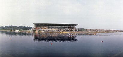
Гребной канал Крылатское Address: Москва street in Крылатское
- Стадион (ул. Крылатская),
- Мотошкола Александра Латышева,
- Крылатская улица 8,
- КРЫЛАТСКОЕ СТАДИОН ТЕХНИЧЕСКИХ ВИДОВ СПОРТА,
- RRG Moto,
- Гребной канал «Крылатское»,
- Отель Вояж парк,
- Остановка «Гребной канал»,
- Динамо Москва,
- Динамо в Крылатском,
- Дворец спорта Динамо в Крылатском,
- Островная улица 7,
- Дворец спорта «Динамо»,
- Крылатская улица, 2к4,
- Крылатская 2,
- Бизнес-центр,
- Горнолыжная школа Крыловых,
- Московская Федерация Адаптивной Академической Гребли,
- Физкультурно-Оздоровительный центр Роналда Макдоналда,
- Гребной канал
Places Near Гребной канал Крылатское
- ДК Горбунова, Филёвский Парк,
- МТС Live Арена,
- Склад Вайлдберриз, Подольск,
- Онкологический центр им. Н.Н.Блохина, Нагатино-Садовники,
- Антенна ТНА 1500 радиотелескопа РТ-64 «Медвежьи Озера», Балашиха,
- Городская клиническая больница №24, Савёловский,
- п. Алабино Военный Полигон, Наро-Фоминск,
- Государственный научный центр колопроктологии им. А. Н. Рыжих, Хорошёво-Мнёвники,
- Городская клиническая больница №1 им. Н. И. Пирогова, Якиманка,
- ТЦ "Город", Лефортово,
- Воинская Часть 61899, Мосрентген,
- 22 корпус ГКБ им. С.П. Боткина, Беговой,
- Аквапарк ""Мореон"", Ясенево,
- ТРЦ МЕГА Белая Дача, Котельники,
- проспект Мира 53, Реутов,
- Больница №15 им. О.М. Филатова, Вешняки,
- Леруа Мерлен,
- МОНИКИ им. М.Ф. Владимирского, Мещанский,
- Фуд Сити, Тёплый Стан,
- Городская клиническая больница № 36 им. Ф. И. Иноземцева, Соколиная Гора
How to get to popular places in Moscow with public transit
Get around Крылатское by public transit!
Traveling around Крылатское has never been so easy. See step by step directions as you travel to any attraction, street or major public transit station. View bus and train schedules, arrival times, service alerts and detailed routes on a map, so you know exactly how to get to anywhere in Крылатское.
When traveling to any destination around Крылатское use Moovit's Live Directions with Get Off Notifications to know exactly where and how far to walk, how long to wait for your line, and how many stops are left. Moovit will alert you when it's time to get off — no need to constantly re-check whether yours is the next stop.
Wondering how to use public transit in Крылатское or how to pay for public transit in Крылатское? Moovit public transit app can help you navigate your way with public transit easily, and at minimum cost. It includes public transit fees, ticket prices, and costs. Looking for a map of Крылатское public transit lines? Moovit public transit app shows all public transit maps in Крылатское with all Bus, Train, Metro, Light Rail, Trolleybus, Shuttle and Gondola routes and stops on an interactive map.
Moscow has 7 transit type(s), including: Bus, Train, Metro, Light Rail, Trolleybus, Shuttle and Gondola, operated by several transit agencies, including ГУП «Мосметро», ГУП «Мосгортранс», Маршруты "Магистраль", Мосгортранс, ГУП Мосгортранс, ООО «Гепарт», Аэроэкспресс, Маршрутка, АО «Центральная ППК», МП «Химкиэлектротранс», МУП «Подольский троллейбус», МУП «Видновский троллейбусный парк», ООО «ТК «Велес», ООО «Стартранс» and ГУП «Мострансавто»