Directions to Дом Наркомфина (Пресненский) with public transportation
The following transit lines have routes that pass near Дом Наркомфина
 Bus: 379, М2, М3, М7, С344.
- Train: БЕЛОРУССКОЕ НАПРАВЛЕНИЕ, КУРСКОЕ НАПРАВЛЕНИЕ.
- Metro: 3, 5, 7, 4.
How to get to Дом Наркомфина by bus?
Click on the bus route to see step by step directions with maps, line arrival times and updated time schedules.
How to get to Дом Наркомфина by train?
Click on the train route to see step by step directions with maps, line arrival times and updated time schedules.
How to get to Дом Наркомфина by metro?
Click on the metro route to see step by step directions with maps, line arrival times and updated time schedules.
Metro stations near Дом Наркомфина in Пресненский
- Смоленская (Smolenskaya), 2 min walk,
- Баррикадная (Barrikadnaya), 15 min walk,
- Краснопресненская (Krasnopresnenskaya), 15 min walk,
Bus stops near Дом Наркомфина in Пресненский
- Метро "Краснопресненская", 3 min walk,
- Метро "Баррикадная", 4 min walk,
- Ул. Заморенова, 4 min walk,
- Дом Шаляпина, 6 min walk,
Bus lines to Дом Наркомфина in Пресненский
- М31, МЦД Тестовская - Метро "Краснопресненская",
- М35, Метро "Краснопресненская" - Крылатское,
- 69, Парк "Фили" - Метро "Краснопресненская",
- 152, Метро "Краснопресненская" - Филевский бульв.,
- С216, Стадион "Лужники" (южн.) - Метро "Краснопресненская",
- С364, Метро "Краснопресненская" - Песчаная пл.,
- С511, Метро "Краснопресненская" - 6-й троллейбусный парк,
- М3, Водная станция "Труд",
- С344, Тверская пл.,
- С369, Ул. Барклая,
- 379, Спортзал "Дружба",
- 116, Б. Кондратьевский пер.,
- Б, Метро "Смоленская",
- БК, Зубовская пл.,
What are the closest stations to Дом Наркомфина?
The closest stations to Дом Наркомфина are:
- Смоленская (Smolenskaya) is 104 meters away, 2 min walk.
- Метро "Краснопресненская" is 174 meters away, 3 min walk.
- Метро "Баррикадная" is 226 meters away, 4 min walk.
- Ул. Заморенова is 227 meters away, 4 min walk.
- Дом Шаляпина is 365 meters away, 6 min walk.
- Баррикадная (Barrikadnaya) is 1087 meters away, 15 min walk.
- Краснопресненская (Krasnopresnenskaya) is 1087 meters away, 15 min walk.
Which bus lines stop near Дом Наркомфина?
These bus lines stop near Дом Наркомфина: 379, М2, М3, М7, С344, С369, С910.
Which train lines stop near Дом Наркомфина?
These train lines stop near Дом Наркомфина: БЕЛОРУССКОЕ НАПРАВЛЕНИЕ, КУРСКОЕ НАПРАВЛЕНИЕ.
Which metro lines stop near Дом Наркомфина?
These metro lines stop near Дом Наркомфина: 3, 5, 7.
What’s the nearest metro station to Дом Наркомфина in Пресненский?
The nearest metro station to Дом Наркомфина in Пресненский is Смоленская (Smolenskaya). It’s a 2 min walk away.
What’s the nearest bus station to Дом Наркомфина in Пресненский?
The nearest bus station to Дом Наркомфина in Пресненский is Метро "Краснопресненская". It’s a 3 min walk away.
What time is the first metro to Дом Наркомфина in Пресненский?
The 5 is the first metro that goes to Дом Наркомфина in Пресненский. It stops nearby at 5:52 AM.
What time is the last metro to Дом Наркомфина in Пресненский?
The 5 is the last metro that goes to Дом Наркомфина in Пресненский. It stops nearby at 1:56 AM.
What time is the first bus to Дом Наркомфина in Пресненский?
The М3 is the first bus that goes to Дом Наркомфина in Пресненский. It stops nearby at 3:00 AM.
What time is the last bus to Дом Наркомфина in Пресненский?
The Б is the last bus that goes to Дом Наркомфина in Пресненский. It stops nearby at 3:37 AM.
See Дом Наркомфина, Пресненский, on the map
Public Transit to Дом Наркомфина in Пресненский
Wondering how to get to Дом Наркомфина in Пресненский? Moovit helps you find the best way to get to Дом Наркомфина with step-by-step directions from the nearest public transit station.
Moovit provides free maps and live directions to help you navigate through your city. View schedules, routes, timetables, and find out how long does it take to get to Дом Наркомфина in real time.
Looking for the nearest stop or station to Дом Наркомфина? Check out this list of stops closest to your destination: Смоленская (Smolenskaya); Метро "Краснопресненская"; Метро "Баррикадная"; Ул. Заморенова; Дом Шаляпина; Баррикадная (Barrikadnaya); Краснопресненская (Krasnopresnenskaya).
Bus: 379, М2, М3, М7, С344, С369, С910, М31, М35, 69, 152, С216, 116.Train: БЕЛОРУССКОЕ НАПРАВЛЕНИЕ, КУРСКОЕ НАПРАВЛЕНИЕ.Metro: 3, 5, 7, 4.
Want to see if there’s another route that gets you there at an earlier time? Moovit helps you find alternative routes or times. Get directions from and directions to Дом Наркомфина easily from the Moovit App or Website.
We make riding to Дом Наркомфина easy, which is why over 1.5 million users, including users in Пресненский, trust Moovit as the best app for public transit. You don’t need to download an individual bus app or train app, Moovit is your all-in-one transit app that helps you find the best bus time or train time available.
For information on prices of metro, bus, train and light rail, costs and ride fares to Дом Наркомфина, please check the Moovit app.
Use the app to navigate to popular places including to the airport, hospital, stadium, grocery store, mall, coffee shop, school, college, and university.
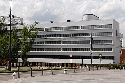
Дом Наркомфина Address: Малый Конюшковский переулок street in Пресненский
- Кудринский переулок, 3Бс2,
- Кудрино,
- Новинский пассаж,
- Новинский бульвар 31,
- Дом-музей Шаляпина,
- Michael Jackson Memorial Place (Стена памяти Майкла Джексона),
- Lamoda,
- Точка кипения (АСИ),
- ТДЦ "Новинский пассаж",
- Экипировочный центр Bosco Sport,
- U.S. Embassy (Посольство США),
- Новинский бульвар 21,
- Посольство США,
- Американское Посольство,
- No One Outlet,
- Фонтан на Кудринской,
- Кудринская площадь 1, строен. 1,
- Управление Судебного департамента в г. Москве,
- Кудринская площадь 1,
- Высотка на Кудринской пл.
Places Near Дом Наркомфина (Пресненский)
- Воинская Часть 61899, Мосрентген,
- МОНИКИ им. М.Ф. Владимирского, Мещанский,
- Онкологический центр им. Н.Н.Блохина, Нагатино-Садовники,
- Аквапарк ""Мореон"", Ясенево,
- Городская клиническая больница №24, Савёловский,
- Городская клиническая больница № 36 им. Ф. И. Иноземцева, Соколиная Гора,
- Леруа Мерлен,
- Антенна ТНА 1500 радиотелескопа РТ-64 «Медвежьи Озера», Балашиха,
- МТС Live Арена,
- ДК Горбунова, Филёвский Парк,
- п. Алабино Военный Полигон, Наро-Фоминск,
- ТЦ "Город", Лефортово,
- Фуд Сити, Тёплый Стан,
- ТРЦ МЕГА Белая Дача, Котельники,
- Склад Вайлдберриз, Подольск,
- Больница №15 им. О.М. Филатова, Вешняки,
- проспект Мира 53, Реутов,
- ТРЦ «Авиапарк», Хорошёвский,
- Городская клиническая больница №1 им. Н. И. Пирогова, Якиманка,
- Государственный научный центр колопроктологии им. А. Н. Рыжих, Хорошёво-Мнёвники
How to get to popular places in Moscow with public transit
Get around Пресненский by public transit!
Traveling around Пресненский has never been so easy. See step by step directions as you travel to any attraction, street or major public transit station. View bus and train schedules, arrival times, service alerts and detailed routes on a map, so you know exactly how to get to anywhere in Пресненский.
When traveling to any destination around Пресненский use Moovit's Live Directions with Get Off Notifications to know exactly where and how far to walk, how long to wait for your line, and how many stops are left. Moovit will alert you when it's time to get off — no need to constantly re-check whether yours is the next stop.
Wondering how to use public transit in Пресненский or how to pay for public transit in Пресненский? Moovit public transit app can help you navigate your way with public transit easily, and at minimum cost. It includes public transit fees, ticket prices, and costs. Looking for a map of Пресненский public transit lines? Moovit public transit app shows all public transit maps in Пресненский with all Bus, Train, Metro, Light Rail, Trolleybus, Shuttle and Gondola routes and stops on an interactive map.
Moscow has 7 transit type(s), including: Bus, Train, Metro, Light Rail, Trolleybus, Shuttle and Gondola, operated by several transit agencies, including ГУП «Мосметро», ГУП «Мосгортранс», Маршруты "Магистраль", Мосгортранс, ГУП Мосгортранс, ООО «Гепарт», Аэроэкспресс, Маршрутка, АО «Центральная ППК», МП «Химкиэлектротранс», МУП «Подольский троллейбус», МУП «Видновский троллейбусный парк», ООО «ТК «Велес», ООО «Стартранс» and ГУП «Мострансавто»