Directions to Заельцовское Кладбище (Заельцовский Район) with public transportation
The following transit lines have routes that pass near Заельцовское Кладбище
 Bus: 15, 46, 53, 95.
- Metro: 1.
- Shuttle: 17, 9, 15, 25, 46.
How to get to Заельцовское Кладбище by bus?
Click on the bus route to see step by step directions with maps, line arrival times and updated time schedules.
How to get to Заельцовское Кладбище by metro?
Click on the metro route to see step by step directions with maps, line arrival times and updated time schedules.
Shuttle station near Заельцовское Кладбище in Заельцовский Район
- Храм Святого Муч.Евгения, 15 min walk,
What are the closest stations to Заельцовское Кладбище?
The closest stations to Заельцовское Кладбище are:
- Храм Святого Муч.Евгения is 1098 meters away, 15 min walk.
Which bus lines stop near Заельцовское Кладбище?
These bus lines stop near Заельцовское Кладбище: 15, 46, 53, 95.
Which metro line stops near Заельцовское Кладбище?
1 (Заельцовская)
Which shuttle line stops near Заельцовское Кладбище?
17 (Заельцовский Санаторий)
What’s the nearest shuttle station to Заельцовское Кладбище in Заельцовский Район?
The nearest shuttle station to Заельцовское Кладбище in Заельцовский Район is Храм Святого Муч.Евгения. It’s a 15 min walk away.
What time is the first bus to Заельцовское Кладбище in Заельцовский Район?
The 53 is the first bus that goes to Заельцовское Кладбище in Заельцовский Район. It stops nearby at 6:08 AM.
What time is the last bus to Заельцовское Кладбище in Заельцовский Район?
The 46 is the last bus that goes to Заельцовское Кладбище in Заельцовский Район. It stops nearby at 11:05 PM.
What time is the first shuttle to Заельцовское Кладбище in Заельцовский Район?
The 65 is the first shuttle that goes to Заельцовское Кладбище in Заельцовский Район. It stops nearby at 6:14 AM.
What time is the last shuttle to Заельцовское Кладбище in Заельцовский Район?
The 311 is the last shuttle that goes to Заельцовское Кладбище in Заельцовский Район. It stops nearby at 11:20 PM.
See Заельцовское Кладбище, Заельцовский Район, on the map
Public Transit to Заельцовское Кладбище in Заельцовский Район
Wondering how to get to Заельцовское Кладбище in Заельцовский Район? Moovit helps you find the best way to get to Заельцовское Кладбище with step-by-step directions from the nearest public transit station.
Moovit provides free maps and live directions to help you navigate through your city. View schedules, routes, timetables, and find out how long does it take to get to Заельцовское Кладбище in real time.
Looking for the nearest stop or station to Заельцовское Кладбище? Check out this list of stops closest to your destination: Храм Святого Муч.Евгения.
Bus: 15, 46, 53, 95.Metro: 1.Shuttle: 17, 9, 15, 25, 46.
Want to see if there’s another route that gets you there at an earlier time? Moovit helps you find alternative routes or times. Get directions from and directions to Заельцовское Кладбище easily from the Moovit App or Website.
We make riding to Заельцовское Кладбище easy, which is why over 1.5 million users, including users in Заельцовский Район, trust Moovit as the best app for public transit. You don’t need to download an individual bus app or train app, Moovit is your all-in-one transit app that helps you find the best bus time or train time available.
For information on prices of bus, shuttle, metro and Trolleybus, costs and ride fares to Заельцовское Кладбище, please check the Moovit app.
Use the app to navigate to popular places including to the airport, hospital, stadium, grocery store, mall, coffee shop, school, college, and university.
Location: Заельцовский Район, Novosibirsk
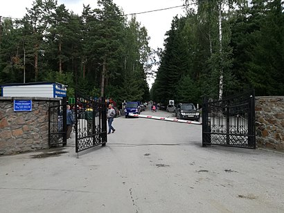
The Zayeltsovskoye Cemetery (Russian: Заельцовское кладбище) is a cemetery in the Zayeltsovsky City District of Novosibirsk, Russia. The area of the graveyard is about 200 hectares.Wiki
- Въезд На Заельцовское Кладбище,
- Красный Яр,
- Музей СССР,
- Малая Медведица,
- Заельцовское кладбище,
- Сибирские газоны,
- Рыбная Лавка,
- Мочищенское шоссе, 1,
- 1 Мочищенское шоссе,
- Епархиальный монастырь святого мученика Евгения,
- TRAP ХАТА 😂😎,
- СНТ Любитель,
- Храм Святого Мученика Евгения,
- Бывшая Военная Часть,
- поселок Лесной,
- 1-е Мочищенское шоссе, 6,
- Гигант,
- Красный Яр,
- Церковь Сурб Аствацацин,
- Кедровка
Places Near Заельцовское Кладбище (Заельцовский Район)
- улица Пирогова, 25, Советский Район,
- 71 улица Демьяна Бедного, Центральный Район,
- ТРЦ «Галерея Новосибирск», Центральный Район,
- Термы Мира. Сосновый бор, Калининский Район,
- Колхидская улица, 10, Ленинский Район,
- Светлая улица, 86, Дзержинский Район,
- Локомотив-Арена, Центральный Район,
- глорихол, Советский Район,
- Горбольница, Заельцовский Район,
- МНТК Микрохирургия глаза им. акад. С.Н. Федорова, Ленинский Район,
- улица Романова, 39, Центральный Район,
- Новосибирский зоопарк, Заельцовский Район,
- 6 улица Залесского, Заельцовский Район,
- Novosibirsk Zoo (Новосибирский зоопарк), Заельцовский Район,
- 2 улица Плахотного, Ленинский Район,
- Заельцовский парк, Заельцовский Район,
- ТРЦ Эдем, Советский Район,
- ТРЦ «Аура», Октябрьский Район,
- Областная клиническая больница, Кировский Район,
- ГБУЗ НСО «Государственная Новосибирская областная клиническая больница», Кировский Район
How to get to popular places in Novosibirsk with public transit
Get around Заельцовский Район by public transit!
Traveling around Заельцовский Район has never been so easy. See step by step directions as you travel to any attraction, street or major public transit station. View bus and train schedules, arrival times, service alerts and detailed routes on a map, so you know exactly how to get to anywhere in Заельцовский Район.
When traveling to any destination around Заельцовский Район use Moovit's Live Directions with Get Off Notifications to know exactly where and how far to walk, how long to wait for your line, and how many stops are left. Moovit will alert you when it's time to get off — no need to constantly re-check whether yours is the next stop.
Wondering how to use public transit in Заельцовский Район or how to pay for public transit in Заельцовский Район? Moovit public transit app can help you navigate your way with public transit easily, and at minimum cost. It includes public transit fees, ticket prices, and costs. Looking for a map of Заельцовский Район public transit lines? Moovit public transit app shows all public transit maps in Заельцовский Район with all Bus, Metro, Tram, Trolleybus and Shuttle routes and stops on an interactive map.
Novosibirsk has 5 transit type(s), including: Bus, Metro, Tram, Trolleybus and Shuttle, operated by several transit agencies, including Новосибирский метрополитен and ЦУГАЭТ