Directions to Петровский остров, 2 (Петроградский Район) with public transportation
The following transit lines have routes that pass near Петровский остров, 2
 Bus: * 227, * 249, * 275, 191, 1.
- Metro: 5.
- Trolleybus: 7.
How to get to Петровский остров, 2 by bus?
Click on the bus route to see step by step directions with maps, line arrival times and updated time schedules.
How to get to Петровский остров, 2 by metro?
Click on the metro route to see step by step directions with maps, line arrival times and updated time schedules.
Trolleybus stations near Петровский остров, 2 in Петроградский Район
- Стадион ''Петровский'', 5 min walk,
Bus stops near Петровский остров, 2 in Петроградский Район
- Ул. Красного Курсанта, 6 min walk,
- Малый проспект П.С., 6 min walk,
- Набережная Макарова, Ст. Метро "Спортивная", 7 min walk,
- станция метро Спортивная, 7 min walk,
Metro station near Петровский остров, 2 in Петроградский Район
- Спортивная (Sportivnaya), 8 min walk,
Bus lines to Петровский остров, 2 in Петроградский Район
- 1, А.С. Наличная Ул.,
- 191, Ст. Метро Петроградская,
- * 227, Арцеуловская аллея,
- 47, Университет,
- 128, А.С. Наличная Ул.,
- * 230, Уральская улица, угол Наличной улицы,
- * 249, АС железнодорожная станция Ручьи (посадки и высадки нет),
- * 275, станция метро Василеостровская,
- 10, Балтийский Вокзал,
What are the closest stations to Петровский остров, 2?
The closest stations to Петровский остров, 2 are:
- Стадион ''Петровский'' is 319 meters away, 5 min walk.
- Ул. Красного Курсанта is 439 meters away, 6 min walk.
- Малый проспект П.С. is 443 meters away, 6 min walk.
- Набережная Макарова, Ст. Метро "Спортивная" is 481 meters away, 7 min walk.
- станция метро Спортивная is 499 meters away, 7 min walk.
- Спортивная (Sportivnaya) is 600 meters away, 8 min walk.
Which bus lines stop near Петровский остров, 2?
These bus lines stop near Петровский остров, 2: * 227, * 249, * 275, 191.
Which metro line stops near Петровский остров, 2?
5 (Шушары)
Which Trolleybus line stops near Петровский остров, 2?
7 (Улица Стахановцев→Петровская пл.)
What’s the nearest metro station to Петровский остров, 2 in Петроградский Район?
The nearest metro station to Петровский остров, 2 in Петроградский Район is Спортивная (Sportivnaya). It’s a 8 min walk away.
What’s the nearest bus station to Петровский остров, 2 in Петроградский Район?
The nearest bus stations to Петровский остров, 2 in Петроградский Район are Ул. Красного Курсанта and Малый проспект П.С.. The closest one is a 6 min walk away.
What’s the nearest Trolleybus station to Петровский остров, 2 in Петроградский Район?
The nearest Trolleybus station to Петровский остров, 2 in Петроградский Район is Стадион ''Петровский''. It’s a 5 min walk away.
What time is the first metro to Петровский остров, 2 in Петроградский Район?
The 5 is the first metro that goes to Петровский остров, 2 in Петроградский Район. It stops nearby at 5:56 AM.
What time is the last metro to Петровский остров, 2 in Петроградский Район?
The 5 is the last metro that goes to Петровский остров, 2 in Петроградский Район. It stops nearby at 10:17 PM.
What time is the first bus to Петровский остров, 2 in Петроградский Район?
The * 275 is the first bus that goes to Петровский остров, 2 in Петроградский Район. It stops nearby at 5:34 AM.
What time is the last bus to Петровский остров, 2 in Петроградский Район?
The 191 is the last bus that goes to Петровский остров, 2 in Петроградский Район. It stops nearby at 12:55 AM.
What time is the first Trolleybus to Петровский остров, 2 in Петроградский Район?
The 7 is the first Trolleybus that goes to Петровский остров, 2 in Петроградский Район. It stops nearby at 6:17 AM.
What time is the last Trolleybus to Петровский остров, 2 in Петроградский Район?
The 7 is the last Trolleybus that goes to Петровский остров, 2 in Петроградский Район. It stops nearby at 12:16 AM.
See Петровский остров, 2, Петроградский Район, on the map
Public Transit to Петровский остров, 2 in Петроградский Район
Wondering how to get to Петровский остров, 2 in Петроградский Район? Moovit helps you find the best way to get to Петровский остров, 2 with step-by-step directions from the nearest public transit station.
Moovit provides free maps and live directions to help you navigate through your city. View schedules, routes, timetables, and find out how long does it take to get to Петровский остров, 2 in real time.
Looking for the nearest stop or station to Петровский остров, 2? Check out this list of stops closest to your destination: Стадион ''Петровский''; Ул. Красного Курсанта; Малый проспект П.С.; Набережная Макарова; станция метро Спортивная; Спортивная (Sportivnaya).
Bus: * 227, * 249, * 275, 191, 1, 47, 128, * 230.Metro: 5.Trolleybus: 7.
Want to see if there’s another route that gets you there at an earlier time? Moovit helps you find alternative routes or times. Get directions from and directions to Петровский остров, 2 easily from the Moovit App or Website.
We make riding to Петровский остров, 2 easy, which is why over 1.5 million users, including users in Петроградский Район, trust Moovit as the best app for public transit. You don’t need to download an individual bus app or train app, Moovit is your all-in-one transit app that helps you find the best bus time or train time available.
For information on prices of bus, metro and Trolleybus, costs and ride fares to Петровский остров, 2, please check the Moovit app.
Use the app to navigate to popular places including to the airport, hospital, stadium, grocery store, mall, coffee shop, school, college, and university.
Петровский остров, 2 Address: Санкт-Петербург, Петровский остров, 2 street in Петроградский Район
Petrovsky Island (Russian: Петро́вский о́стров) is an island in St. Petersburg, Russia, bordered by the Malaya Neva, Malaya Nevka, and Zhdanovka Rivers (in the delta of the Neva River).Wiki
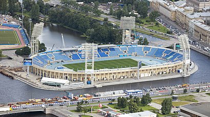
- Стадион «Петровский»,
- Малая спортивная арена «Петровский»,
- Пресс-центр МСА "Петровский",
- Зрение,
- Малый Пр. П. С. д.3,
- Бизнес-школа SWISSAM,
- проспект Добролюбова, 20к1,
- Ледокол «Невская застава»,
- Гомеопатическая фармация,
- metro Sportivnaya (Метро «Спортивная»),
- Часовня князя Александра Невского,
- Ждановская набережная,
- Доходный дом Н.С.Занина, двор-колодец,
- Малый проспект Петроградской стороны, 3,
- Каток в СК «Юбилейный»,
- Малая арена СК «Юбилейный»,
- 18 проспект Добролюбова,
- Notre Dame De Paris,
- Тучков мост,
- Раковая
Places Near Петровский остров, 2 (Петроградский Район)
- ДК «Выборгский», Выборгский Район,
- 21 Рижский проспект, Санкт-Петербург,
- (ТЦ) МЕГА Дыбенко, Санкт-Петербург,
- Питерлэнд, Санкт-Петербург,
- РНИИТО им. Р. Р. Вредена, Калининский Район,
- Театр Лдм, Санкт-Петербург,
- Литейный 37-39, Центральный Район,
- 22 Белоостровская улица, Санкт-Петербург,
- 54 улица Оптиков, Санкт-Петербург,
- Ладожский вокзал, Санкт-Петербург, Санкт-Петербург,
- СЗГМУ Больница Мечникова Пискаревский 47, Корпус 13., Калининский Район,
- Академика Байкова, 8, Санкт-Петербург,
- 2 улица Аккуратова, Приморский Район,
- 10-12 Красного Текстильщика ул., Санкт-Петербург,
- Полюстровский проспект, 12, Калининский Район,
- ТК «Китай город», Выборгский Район,
- Мариинский театр, Санкт-Петербург,
- ст. м. Удельная, Санкт-Петербург,
- 154 набережная реки Фонтанки, Санкт-Петербург,
- Охта Молл, Санкт-Петербург
How to get to popular places in Saint Petersburg with public transit
Get around Петроградский Район by public transit!
Traveling around Петроградский Район has never been so easy. See step by step directions as you travel to any attraction, street or major public transit station. View bus and train schedules, arrival times, service alerts and detailed routes on a map, so you know exactly how to get to anywhere in Петроградский Район.
When traveling to any destination around Петроградский Район use Moovit's Live Directions with Get Off Notifications to know exactly where and how far to walk, how long to wait for your line, and how many stops are left. Moovit will alert you when it's time to get off — no need to constantly re-check whether yours is the next stop.
Wondering how to use public transit in Петроградский Район or how to pay for public transit in Петроградский Район? Moovit public transit app can help you navigate your way with public transit easily, and at minimum cost. It includes public transit fees, ticket prices, and costs. Looking for a map of Петроградский Район public transit lines? Moovit public transit app shows all public transit maps in Петроградский Район with all Bus, Metro, Light Rail, Aquabus and Trolleybus routes and stops on an interactive map.
Saint Petersburg has 5 transit type(s), including: Bus, Metro, Light Rail, Aquabus and Trolleybus, operated by several transit agencies, including Петербургский метрополитен, * СПб ГУП "Горэлектротранс", СПб ГКУ "Организатор перевозок", Коммерческие автобусы, * ООО "Ленинградская АЭС-Авто", Областные автобусы, * ООО «Транс-Балт», * ООО «ВЕСТ-СЕРВИС», * ООО "Домтрансавто", * АО «Кингисеппский автобусный парк», * ООО «Волосово-Межрегионтранс», * ООО «ЭлисТранс», * ИП Будзинский Ю.В., * ООО «Сланцы-ПАП» and * ООО «Пассажиравтотранс»