Directions to Петроградская (Петроградский Район) with public transportation
The following transit lines have routes that pass near Петроградская
 Bus: * 227, * 230, * 275, 128, 191.
- Metro: 2.
- Light Rail: 40.
How to get to Петроградская by bus?
Click on the bus route to see step by step directions with maps, line arrival times and updated time schedules.
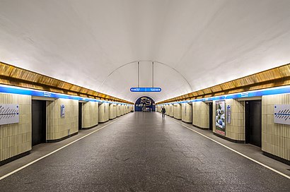
How to get to Петроградская by metro?
Click on the metro route to see step by step directions with maps, line arrival times and updated time schedules.
Light Rail stations near Петроградская in Петроградский Район
- 1-Й Медицинский Институт, 6 min walk,
Bus stops near Петроградская in Петроградский Район
- Ул. Рентгена, 6 min walk,
- улица Рентгена, 7 min walk,
- набережная реки Карповки, 12 min walk,
- Наб.Р. Карповки, 12 min walk,
Bus lines to Петроградская in Петроградский Район
- 14, А.С. Крестовский Остров,
- * 230, АС Пискарёвка (посадки и высадки нет),
- * 249, АС железнодорожная станция Ручьи (посадки и высадки нет),
- * 275, АС улица Жени Егоровой (посадки и высадки нет),
- 128, А.С. Наличная Ул.,
- 185, Ст. метро «Ладожская»,
What are the closest stations to Петроградская?
The closest stations to Петроградская are:
- 1-Й Медицинский Институт is 370 meters away, 6 min walk.
- Ул. Рентгена is 429 meters away, 6 min walk.
- улица Рентгена is 438 meters away, 7 min walk.
- набережная реки Карповки is 849 meters away, 12 min walk.
- Наб.Р. Карповки is 879 meters away, 12 min walk.
Which bus lines stop near Петроградская?
These bus lines stop near Петроградская: * 227, * 230, * 275, 128, 191.
Which metro line stops near Петроградская?
2 (Парнас)
Which light rail line stops near Петроградская?
40 (Ул. Кораблестроителей→Тихорецкий Пр.)
What’s the nearest light rail station to Петроградская in Петроградский Район?
The nearest light rail station to Петроградская in Петроградский Район is 1-Й Медицинский Институт. It’s a 6 min walk away.
What’s the nearest bus station to Петроградская in Петроградский Район?
The nearest bus station to Петроградская in Петроградский Район is Ул. Рентгена. It’s a 6 min walk away.
What time is the first light rail to Петроградская in Петроградский Район?
The 40 is the first light rail that goes to Петроградская in Петроградский Район. It stops nearby at 6:20 AM.
What time is the last light rail to Петроградская in Петроградский Район?
The 40 is the last light rail that goes to Петроградская in Петроградский Район. It stops nearby at 11:35 PM.
What time is the first bus to Петроградская in Петроградский Район?
The 128 is the first bus that goes to Петроградская in Петроградский Район. It stops nearby at 5:31 AM.
What time is the last bus to Петроградская in Петроградский Район?
The * 249 is the last bus that goes to Петроградская in Петроградский Район. It stops nearby at 12:43 AM.
See Петроградская, Петроградский Район, on the map
Public Transit to Петроградская in Петроградский Район
Wondering how to get to Петроградская in Петроградский Район? Moovit helps you find the best way to get to Петроградская with step-by-step directions from the nearest public transit station.
Moovit provides free maps and live directions to help you navigate through your city. View schedules, routes, timetables, and find out how long does it take to get to Петроградская in real time.
Looking for the nearest stop or station to Петроградская? Check out this list of stops closest to your destination: 1-Й Медицинский Институт; Ул. Рентгена; улица Рентгена; набережная реки Карповки; Наб.Р. Карповки.
Bus: * 227, * 230, * 275, 128, 191, 14, * 249, 185.Metro: 2.Light Rail: 40.
Want to see if there’s another route that gets you there at an earlier time? Moovit helps you find alternative routes or times. Get directions from and directions to Петроградская easily from the Moovit App or Website.
We make riding to Петроградская easy, which is why over 1.5 million users, including users in Петроградский Район, trust Moovit as the best app for public transit. You don’t need to download an individual bus app or train app, Moovit is your all-in-one transit app that helps you find the best bus time or train time available.
For information on prices of bus, metro and light rail, costs and ride fares to Петроградская, please check the Moovit app.
Use the app to navigate to popular places including to the airport, hospital, stadium, grocery store, mall, coffee shop, school, college, and university.
Location: Петроградский Район, Saint Petersburg
- Анатомический Эрмитаж,
- НИИ Пульмонологии,
- Аквариум,
- Клиника им. Павлова. институт Дет. Онкологии им. Горбачевой,
- НИИ Гематологии,
- Институт детской онкологии, гематологии и трансплантологии им. Р.М. Горбачевой,
- спбгму им. ак. И.П. Павлова онкологическое отделение,
- Институт детской онкологии, гематологии и транспланто,
- Сурдокабинет Клиники Оториноларингологии, Лаборатория Слуха и Речи Ниц Спбму им. Академика И.П.Павл,
- НИИ хирургии и неотложной медицины,
- Морг Первого Меда,
- Сад для людей с ограниченными возможностями,
- В. И. Колесову,
- 23 улица Рентгена,
- улица Рентгена, 10А,
- улица Льва Толстого, 6-8,
- 6/8 улица Льва Толстого,
- 88,
- Курсы Массажа СПбГМУ им. акад. И. П. Павлова,
- улица Рентгена
Places Near Петроградская (Петроградский Район)
- Литейный 37-39, Центральный Район,
- РНИИТО им. Р. Р. Вредена, Калининский Район,
- (ТЦ) МЕГА Дыбенко, Санкт-Петербург,
- ДК «Выборгский», Выборгский Район,
- 21 Рижский проспект, Санкт-Петербург,
- Охта Молл, Санкт-Петербург,
- ст. м. Удельная, Санкт-Петербург,
- 2 улица Аккуратова, Приморский Район,
- Мариинский театр, Санкт-Петербург,
- СЗГМУ Больница Мечникова Пискаревский 47, Корпус 13., Калининский Район,
- 22 Белоостровская улица, Санкт-Петербург,
- ТК «Китай город», Выборгский Район,
- 54 улица Оптиков, Санкт-Петербург,
- Ладожский вокзал, Санкт-Петербург, Санкт-Петербург,
- 154 набережная реки Фонтанки, Санкт-Петербург,
- Театр Лдм, Санкт-Петербург,
- Академика Байкова, 8, Санкт-Петербург,
- Питерлэнд, Санкт-Петербург,
- Полюстровский проспект, 12, Калининский Район,
- 10-12 Красного Текстильщика ул., Санкт-Петербург
How to get to popular places in Saint Petersburg with public transit
Get around Петроградский Район by public transit!
Traveling around Петроградский Район has never been so easy. See step by step directions as you travel to any attraction, street or major public transit station. View bus and train schedules, arrival times, service alerts and detailed routes on a map, so you know exactly how to get to anywhere in Петроградский Район.
When traveling to any destination around Петроградский Район use Moovit's Live Directions with Get Off Notifications to know exactly where and how far to walk, how long to wait for your line, and how many stops are left. Moovit will alert you when it's time to get off — no need to constantly re-check whether yours is the next stop.
Wondering how to use public transit in Петроградский Район or how to pay for public transit in Петроградский Район? Moovit public transit app can help you navigate your way with public transit easily, and at minimum cost. It includes public transit fees, ticket prices, and costs. Looking for a map of Петроградский Район public transit lines? Moovit public transit app shows all public transit maps in Петроградский Район with all Bus, Metro, Light Rail, Aquabus and Trolleybus routes and stops on an interactive map.
Saint Petersburg has 5 transit type(s), including: Bus, Metro, Light Rail, Aquabus and Trolleybus, operated by several transit agencies, including Петербургский метрополитен, * СПб ГУП "Горэлектротранс", СПб ГКУ "Организатор перевозок", Коммерческие автобусы, * ООО "Ленинградская АЭС-Авто", Областные автобусы, * ООО «Транс-Балт», * ООО «ВЕСТ-СЕРВИС», * ООО "Домтрансавто", * АО «Кингисеппский автобусный парк», * ООО «Волосово-Межрегионтранс», * ООО «ЭлисТранс», * ИП Будзинский Ю.В., * ООО «Сланцы-ПАП» and * ООО «Пассажиравтотранс»