Тверская ул. stop - Friday schedule
| Line | Direction | Time |
|---|---|---|
| М5 | Метро "Достоевская" | 5:45 |
| М5 | Метро "Достоевская" | 5:55 |
| М5 | Метро "Достоевская" | 6:05 |
| М5 | Метро "Достоевская" | 6:15 |
| М5 | Метро "Достоевская" | 6:25 |
| М5 | Метро "Достоевская" | 6:35 |
| М5 | Метро "Достоевская" | 6:45 |
| М5 | Метро "Достоевская" | 6:55 |
| М5 | Метро "Достоевская" | 7:06 |
| М5 | Метро "Достоевская" | 7:17 |
| М5 | Метро "Достоевская" | 7:29 |
| М5 | Метро "Достоевская" | 7:40 |
| М5 | Метро "Достоевская" | 7:46 |
| М5 | Метро "Достоевская" | 7:52 |
| М5 | Метро "Достоевская" | 7:58 |
| М5 | Метро "Достоевская" | 8:04 |
| М5 | Метро "Достоевская" | 8:10 |
| М5 | Метро "Достоевская" | 8:16 |
| М5 | Метро "Достоевская" | 8:22 |
| М5 | Метро "Достоевская" | 8:28 |
| М5 | Метро "Достоевская" | 8:34 |
| М5 | Метро "Достоевская" | 8:40 |
| М5 | Метро "Достоевская" | 8:47 |
| М5 | Метро "Достоевская" | 8:53 |
| М5 | Метро "Достоевская" | 8:59 |
Directions to Тверская ул. stop (Тверской) with public transit
The following transit lines have routes that pass near Тверская ул.
 Bus: Н11, М40, М5.
- Train: БЕЛОРУССКОЕ НАПРАВЛЕНИЕ, КУРСКОЕ НАПРАВЛЕНИЕ.
- Metro: 2, 7, 9, 1.
How to get to Тверская ул. stop by bus?
Click on the bus route to see step by step directions with maps, line arrival times and updated time schedules.
How to get to Тверская ул. stop by train?
Click on the train route to see step by step directions with maps, line arrival times and updated time schedules.
How to get to Тверская ул. stop by metro?
Click on the metro route to see step by step directions with maps, line arrival times and updated time schedules.
Metro stations near Тверская ул. station in Тверской
- Чеховская (Chekhovskaya), 1 min walk,
- Маяковская (Mayakovskaya), 9 min walk,
- Охотный Ряд (Okhotny Ryad), 14 min walk,
- Пушкинская (Pushkinskaya), 14 min walk,
Bus stops near Тверская ул. stop in Тверской
- Пушкинская пл., 3 min walk,
- Тверская ул., 3 min walk,
- Пушкинская Площадь, 4 min walk,
- Тверской бульв., 4 min walk,
- Метро "Чеховская", 5 min walk,
Bus lines to Тверская ул. stop in Тверской
- М40, Больница,
- М5, Хамовнический Вал,
- М1, Ул. Кравченко - Б-ца РЖД,
- Н1, Аэропорт Шереметьево - Терминал F - Метро "Китай-город",
- Н12, 4-й мкр. Митина - Метро "Китай-город",
- Е30, 4-й мкр. Митина - 4-й мкр. Митина,
- С511, Поликлиника,
- С344, Тверская пл.,
What are the closest stations to Тверская ул.?
The closest stations to Тверская ул. are:
- Чеховская (Chekhovskaya) is 9 meters away, 1 min walk.
- Пушкинская пл. is 168 meters away, 3 min walk.
- Тверская ул. is 168 meters away, 3 min walk.
- Пушкинская Площадь is 211 meters away, 4 min walk.
- Метро "Чеховская" is 301 meters away, 5 min walk.
- Тверской бульв. is 304 meters away, 4 min walk.
- Маяковская (Mayakovskaya) is 648 meters away, 9 min walk.
- Охотный Ряд (Okhotny Ryad) is 1008 meters away, 14 min walk.
- Пушкинская (Pushkinskaya) is 1077 meters away, 14 min walk.
Which bus line stops near Тверская ул.?
Н11 (аэропорт Внуково→метро Лубянка)
Which train lines stop near Тверская ул.?
These train lines stop near Тверская ул.: БЕЛОРУССКОЕ НАПРАВЛЕНИЕ, КУРСКОЕ НАПРАВЛЕНИЕ.
Which metro lines stop near Тверская ул.?
These metro lines stop near Тверская ул.: 2, 7, 9.
What’s the nearest metro station to Тверская ул. in Тверской?
The nearest metro station to Тверская ул. in Тверской is Чеховская (Chekhovskaya). It’s a 1 min walk away.
What’s the nearest bus station to Тверская ул. in Тверской?
The nearest bus stations to Тверская ул. in Тверской are Пушкинская пл. and Тверская ул.. The closest one is a 3 min walk away.
What time is the first metro to Тверская ул. in Тверской?
The 1 is the first metro that goes to Тверская ул. in Тверской. It stops nearby at 6:00 AM.
What time is the last metro to Тверская ул. in Тверской?
The 1 is the last metro that goes to Тверская ул. in Тверской. It stops nearby at 1:48 AM.
What time is the first bus to Тверская ул. in Тверской?
The М40 is the first bus that goes to Тверская ул. in Тверской. It stops nearby at 3:02 AM.
What time is the last bus to Тверская ул. in Тверской?
The Н12 is the last bus that goes to Тверская ул. in Тверской. It stops nearby at 4:23 AM.
See Тверская ул. stop, Тверской, on the map
Public transit to Тверская ул. stop in Тверской
Looking for directions to Тверская ул. in Тверской, Russia?
Download the Moovit App to find the current schedule and step-by-step directions for Metro, Train, Bus, Light Rail or Shuttle routes that pass through Тверская ул..
Looking for the nearest stops closest to Тверская ул. ? Check out this list of closest stops to your destination: Чеховская (Chekhovskaya); Пушкинская пл.; Тверская ул.; Пушкинская Площадь; Метро "Чеховская"; Тверской бульв.; Маяковская (Mayakovskaya); Охотный Ряд (Okhotny Ryad); Пушкинская (Pushkinskaya).
Bus: Н11, М40, М5.Train: БЕЛОРУССКОЕ НАПРАВЛЕНИЕ, КУРСКОЕ НАПРАВЛЕНИЕ.Metro: 2, 7, 9, 1.
We make riding on public transit to Тверская ул. easy, which is why over 1.5 million users, including users in Тверской trust Moovit as the best app for public transit.
Use the app to navigate to popular places including to the airport, hospital, stadium, grocery store, mall, coffee shop, school, college, and university.
The first line to this stop is М5, at 5:45, and the last line is М5 at 0:58.
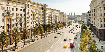
28 Тверской бульвар, Moscow, Russia
This stop serves Mosgortrans’s lines
Popular routes from Тверская ул. stop, Тверской
- Чеховская (Chekhovskaya),
- Маяковская (Mayakovskaya),
- Охотный Ряд (Okhotny Ryad),
- Пушкинская (Pushkinskaya)
Metro stations near Тверская ул. station
- Пушкинская пл.,
- Тверская ул.,
- Пушкинская Площадь,
- Тверской бульв.,
- Метро "Чеховская"
Bus stops near Тверская ул. stop
- Загородное ш.,
- Велозаводский рынок,
- Стадион "Наука",
- Покровские Ворота,
- Ул. Лавочкина - Дворец спорта "Динамо",
- ДК им. Горбунова,
- Метро "ВДНХ",
- Метро "Каховская",
- Театр Чихачева,
- Дубининская ул., 57,
- Совхоз им. Ленина,
- Калужская пл.,
- Сенежская ул.,
- Ул. Генерала Дорохова,
- Ул. Докукина,
- Беломорская ул.,
- Метро Домодедовская (Каширское шоссе),
- Ховрино,
- Митинский Радиорынок,
- Дом кино
Popular public transit stations in Тверской
Get around Тверской by public transit!
Traveling around Тверской has never been so easy. See step by step directions as you travel to any attraction, street or major public transit station. View bus and train schedules, arrival times, service alerts and detailed routes on a map, so you know exactly how to get to anywhere in Тверской.
When traveling to any destination around Тверской use Moovit's Live Directions with Get Off Notifications to know exactly where and how far to walk, how long to wait for your line, and how many stops are left. Moovit will alert you when it's time to get off — no need to constantly re-check whether yours is the next stop.
Wondering how to use public transit in Тверской or how to pay for public transit in Тверской? Moovit public transit app can help you navigate your way with public transit easily, and at minimum cost. It includes public transit fees, ticket prices, and costs. Looking for a map of Тверской public transit lines? Moovit public transit app shows all public transit maps in Тверской with all Bus, Train, Metro, Light Rail, Trolleybus, Shuttle and Gondola routes and stops on an interactive map.
Moscow has 7 transit type(s), including: Bus, Train, Metro, Light Rail, Trolleybus, Shuttle and Gondola, operated by several transit agencies, including ГУП «Мосметро», ГУП «Мосгортранс», Маршруты "Магистраль", Мосгортранс, ГУП Мосгортранс, ООО «Гепарт», Аэроэкспресс, Маршрутка, АО «Центральная ППК», МП «Химкиэлектротранс», МУП «Подольский троллейбус», МУП «Видновский троллейбусный парк», ООО «ТК «Велес», ООО «Стартранс» and ГУП «Мострансавто»