Directions to Харківська Площа (Дарницький Район) with public transportation
The following transit lines have routes that pass near Харківська Площа
 Bus: 104, 45, 51.
- Metro: М3.
- Light Rail: 29К.
- Shuttle: 316, 529, 535, 104, 317А.
How to get to Харківська Площа by bus?
Click on the bus route to see step by step directions with maps, line arrival times and updated time schedules.
How to get to Харківська Площа by metro?
Click on the metro route to see step by step directions with maps, line arrival times and updated time schedules.
Metro station near Харківська Площа in Дарницький Район
- Бориспільська, 2 min walk,
Shuttle stations near Харківська Площа in Дарницький Район
- Ст. М. Бориспільська, 3 min walk,
What are the closest stations to Харківська Площа?
The closest stations to Харківська Площа are:
- Бориспільська is 90 meters away, 2 min walk.
- Ст. М. Бориспільська is 137 meters away, 3 min walk.
Which bus lines stop near Харківська Площа?
These bus lines stop near Харківська Площа: 104, 45, 51.
Which metro line stops near Харківська Площа?
М3 (Червоний Хутір)
Which light rail line stops near Харківська Площа?
29К (Ст. М. Бориспільська)
Which shuttle lines stop near Харківська Площа?
These shuttle lines stop near Харківська Площа: 316, 529, 535.
What’s the nearest metro station to Харківська Площа in Дарницький Район?
The nearest metro station to Харківська Площа in Дарницький Район is Бориспільська. It’s a 2 min walk away.
What’s the nearest shuttle station to Харківська Площа in Дарницький Район?
The nearest shuttle station to Харківська Площа in Дарницький Район is Ст. М. Бориспільська. It’s a 3 min walk away.
What time is the first metro to Харківська Площа in Дарницький Район?
The М3 is the first metro that goes to Харківська Площа in Дарницький Район. It stops nearby at 5:31 AM.
What time is the last metro to Харківська Площа in Дарницький Район?
The М3 is the last metro that goes to Харківська Площа in Дарницький Район. It stops nearby at 10:08 PM.
What time is the first bus to Харківська Площа in Дарницький Район?
The 104 is the first bus that goes to Харківська Площа in Дарницький Район. It stops nearby at 6:33 AM.
What time is the last bus to Харківська Площа in Дарницький Район?
The 104 is the last bus that goes to Харківська Площа in Дарницький Район. It stops nearby at 9:35 PM.
What time is the first shuttle to Харківська Площа in Дарницький Район?
The 535 is the first shuttle that goes to Харківська Площа in Дарницький Район. It stops nearby at 6:00 AM.
What time is the last shuttle to Харківська Площа in Дарницький Район?
The 317А is the last shuttle that goes to Харківська Площа in Дарницький Район. It stops nearby at 10:47 PM.
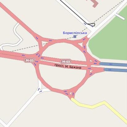
See Харківська Площа, Дарницький Район, on the map
Public Transit to Харківська Площа in Дарницький Район
Wondering how to get to Харківська Площа in Дарницький Район? Moovit helps you find the best way to get to Харківська Площа with step-by-step directions from the nearest public transit station.
Moovit provides free maps and live directions to help you navigate through your city. View schedules, routes, timetables, and find out how long does it take to get to Харківська Площа in real time.
Looking for the nearest stop or station to Харківська Площа? Check out this list of stops closest to your destination: Бориспільська; Ст. М. Бориспільська.
Bus: 104, 45, 51.Metro: М3.Light Rail: 29К.Shuttle: 316, 529, 535, 104, 317А, 324П, 330К, 324, 807, 808, 941.
Want to see if there’s another route that gets you there at an earlier time? Moovit helps you find alternative routes or times. Get directions from and directions to Харківська Площа easily from the Moovit App or Website.
We make riding to Харківська Площа easy, which is why over 1.5 million users, including users in Дарницький Район, trust Moovit as the best app for public transit. You don’t need to download an individual bus app or train app, Moovit is your all-in-one transit app that helps you find the best bus time or train time available.
For information on prices of bus, shuttle, metro and light rail, costs and ride fares to Харківська Площа, please check the Moovit app.
Use the app to navigate to popular places including to the airport, hospital, stadium, grocery store, mall, coffee shop, school, college, and university.
Харківська Площа Address: Харківська площа street in Дарницький Район
- 317 Маршрутка,
- Харьковское Шоссе 201-203,
- BF & GH Travel Retail Ltd.,
- Райффайзен Банк,
- Приватбанк,
- проспект Миколи Бажана 20,
- маршрутка Киев - Переяслав-Хмельницк,
- Микільський ліс,
- Stihl - Магазин Інструмент К - Офіційний Дилер,
- Маршрутка Киев Барышевка (м. Бориспольская),
- Академія Управління Мвс,
- Зупинка Маршруток на Баришівку,
- маршрутка "Киев-Березань",
- вулиця Вакуленчука 50А,
- вулиця Колекторна 4,
- школа 113,
- Харківське шосе 201-203,
- KOSTAL Ukraina AE,
- Ялинкова вул. 58/60,
- Колекторна 3
Places Near Харківська Площа (Дарницький Район)
- Київська обласна клінічна лікарня №1, Шевченківський Район,
- ТРЦ Ocean Plaza, Голосіївський Район,
- Маршрутка "Київ-Бородянка", Святошинський Район,
- Ботанічний сад ім. М. М. Гришка, Печерський Район,
- Трц «Скаймолл», Деснянський Район,
- проспект Валерія Лобановського, Солом’Янський Район,
- Національний Інститут Хірургії Та Трансплантології Імені О.О. Шалімова, Солом’Янський Район,
- Інститут Амосова, Солом’Янський Район,
- Національний інститут раку, Голосіївський Район,
- Контрактова Площа, Подільський Район,
- ТРЦ "RETROVILLE", Подільський Район,
- ТРЦ «Караван», Оболонський Район,
- Речовий Ринок «Троєщина», Деснянський Район,
- Інститут Травматології Та Ортопедії, Шевченківський Район,
- ТРЦ «Lavina», Святошинський Район,
- ВДНХ, Голосіївський Район,
- Трц River Mall, Дарницький Район,
- Байкове Кладовище, Голосіївський Район,
- Северное Кладбище,
- Трк «Республіка Парк», Голосіївський Район
How to get to popular places in Kyiv with public transit
Get around Дарницький Район by public transit!
Traveling around Дарницький Район has never been so easy. See step by step directions as you travel to any attraction, street or major public transit station. View bus and train schedules, arrival times, service alerts and detailed routes on a map, so you know exactly how to get to anywhere in Дарницький Район.
When traveling to any destination around Дарницький Район use Moovit's Live Directions with Get Off Notifications to know exactly where and how far to walk, how long to wait for your line, and how many stops are left. Moovit will alert you when it's time to get off — no need to constantly re-check whether yours is the next stop.
Wondering how to use public transit in Дарницький Район or how to pay for public transit in Дарницький Район? Moovit public transit app can help you navigate your way with public transit easily, and at minimum cost. It includes public transit fees, ticket prices, and costs. Looking for a map of Дарницький Район public transit lines? Moovit public transit app shows all public transit maps in Дарницький Район with all Bus, Train, Metro, Light Rail, Trolleybus and Shuttle routes and stops on an interactive map.
Kyiv has 6 transit type(s), including: Bus, Train, Metro, Light Rail, Trolleybus and Shuttle, operated by several transit agencies, including Київський метрополітен, КП "Київпастранс", Південно-Західна Залізниця, Бориспіль, Маршрутне таксі, Приміські маршрути and Бровари та район