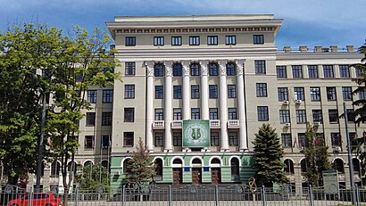
Directions to Харківський Національний Медичний Університет (Kharkiv) with public transportation
The following transit lines have routes that pass near Харківський Національний Медичний Університет
 Metro: 2, 3.
- Funicular: 119Е, 20Е.
How to get to Харківський Національний Медичний Університет by metro?
Click on the metro route to see step by step directions with maps, line arrival times and updated time schedules.
Metro station near Харківський Національний Медичний Університет in Kharkiv
- Держпром (Derzhprom), 2 min walk,
Funicular station near Харківський Національний Медичний Університет in Kharkiv
- Ст. М. Госпром, 2 min walk,
What are the closest stations to Харківський Національний Медичний Університет?
The closest stations to Харківський Національний Медичний Університет are:
- Держпром (Derzhprom) is 99 meters away, 2 min walk.
- Ст. М. Госпром is 133 meters away, 2 min walk.
Which metro lines stop near Харківський Національний Медичний Університет?
These metro lines stop near Харківський Національний Медичний Університет: 2, 3.
Which funicular line stops near Харківський Національний Медичний Університет?
119Е (Проспект Перемоги)
What’s the nearest metro station to Харківський Національний Медичний Університет in Kharkiv?
The nearest metro station to Харківський Національний Медичний Університет in Kharkiv is Держпром (Derzhprom). It’s a 2 min walk away.
What’s the nearest funicular station to Харківський Національний Медичний Університет in Kharkiv?
The nearest funicular station to Харківський Національний Медичний Університет in Kharkiv is Ст. М. Госпром. It’s a 2 min walk away.
What time is the first metro to Харківський Національний Медичний Університет in Kharkiv?
The 3 is the first metro that goes to Харківський Національний Медичний Університет in Kharkiv. It stops nearby at 5:35 AM.
What time is the last metro to Харківський Національний Медичний Університет in Kharkiv?
The 3 is the last metro that goes to Харківський Національний Медичний Університет in Kharkiv. It stops nearby at 12:09 AM.
What time is the first funicular to Харківський Національний Медичний Університет in Kharkiv?
The 119Е is the first funicular that goes to Харківський Національний Медичний Університет in Kharkiv. It stops nearby at 6:48 AM.
What time is the last funicular to Харківський Національний Медичний Університет in Kharkiv?
The 119Е is the last funicular that goes to Харківський Національний Медичний Університет in Kharkiv. It stops nearby at 10:20 PM.
See Харківський Національний Медичний Університет, Kharkiv, on the map
Public Transit to Харківський Національний Медичний Університет in Kharkiv
Wondering how to get to Харківський Національний Медичний Університет in Kharkiv? Moovit helps you find the best way to get to Харківський Національний Медичний Університет with step-by-step directions from the nearest public transit station.
Moovit provides free maps and live directions to help you navigate through your city. View schedules, routes, timetables, and find out how long does it take to get to Харківський Національний Медичний Університет in real time.
Looking for the nearest stop or station to Харківський Національний Медичний Університет? Check out this list of stops closest to your destination: Держпром (Derzhprom); Ст. М. Госпром.
Metro: 2, 3.Funicular: 119Е, 20Е.
Want to see if there’s another route that gets you there at an earlier time? Moovit helps you find alternative routes or times. Get directions from and directions to Харківський Національний Медичний Університет easily from the Moovit App or Website.
We make riding to Харківський Національний Медичний Університет easy, which is why over 1.5 million users, including users in Kharkiv, trust Moovit as the best app for public transit. You don’t need to download an individual bus app or train app, Moovit is your all-in-one transit app that helps you find the best bus time or train time available.
For information on prices of metro, funicular, bus and cable car, costs and ride fares to Харківський Національний Медичний Університет, please check the Moovit app.
Use the app to navigate to popular places including to the airport, hospital, stadium, grocery store, mall, coffee shop, school, college, and university.
Харківський Національний Медичний Університет Address: Незалежності проспект street in Kharkiv
Popular routes to Харківський Національний Медичний Університет, Kharkiv
- Багдад / Baghdad,
- Тенісні Корти в Хнму,
- Харківська Обласна Прокуратура,
- Медичний центр Здоров'я,
- ХНМУ, корпус УЛК,
- Massage Room,
- ХНМУ / Харьковский национальный медицинский университет ,
- Estet Bar,
- Туристичний Салон Хоменко-Тур,
- вулиця Данилевського 17,
- Харківський Апеляційний Господарський Суд,
- ул. Данилевского, 16,
- Ул. Клочковская, 191-А,
- Діагностичний Центр,
- P.E.R.V.Y.Y.,
- Данилевського Вулиця,
- Харьковская областная клиническая больница, отделение неотложной хирургии,
- Фабрика Звезд/,
- Харківський Національний Університет Імені Каразіна,
- Хрещатик
Places Near Харківський Національний Медичний Університет (Kharkiv)
- Харьковская областная клиническая больница, отделение неотложной хирургии, Kharkiv,
- Сад Імені Тараса Шевченка, Kharkiv,
- Остановка "22 Больница", Kharkiv,
- Офтальмологическая клиника им. Л.Л.Гиршмана, Kharkiv,
- Обласна Клінічна Лікарня, Kharkiv,
- 17 больница московский 195, Kharkiv,
- Барабашово Харьков, Kharkiv,
- Ост. 25 Гор. Больница, Kharkiv,
- ТРЦ «Французский Бульвар» (ТРЦ «Французький Бульвар»), Kharkiv,
- Вулиця Алчевських, Kharkiv,
- Харьковский зоопарк (Харківський зоопарк), Kharkiv,
- 15-я городская клиническая психиатрическая больница, Kharkiv,
- Конный рынок (Кінний ринок), Kharkiv,
- Парк «Саржин яр», Kharkiv,
- ТРЦ «Французький Бульвар», Kharkiv,
- Ул.Клочковская, Kharkiv,
- Ж / Д вокзал «Харьков-Пассажирский» (Залізничний вокзал «Харків-Пасажирський»), Kharkiv,
- Военный госпиталь, Kharkiv,
- Лікарня 4, Kharkiv,
- ТРЦ «Нікольський», Kharkiv
How to get to popular places in Kharkiv with public transit
Get around Kharkiv by public transit!
Traveling around Kharkiv has never been so easy. See step by step directions as you travel to any attraction, street or major public transit station. View bus and train schedules, arrival times, service alerts and detailed routes on a map, so you know exactly how to get to anywhere in Kharkiv.
When traveling to any destination around Kharkiv use Moovit's Live Directions with Get Off Notifications to know exactly where and how far to walk, how long to wait for your line, and how many stops are left. Moovit will alert you when it's time to get off — no need to constantly re-check whether yours is the next stop.
Wondering how to use public transit in Kharkiv or how to pay for public transit in Kharkiv? Moovit public transit app can help you navigate your way with public transit easily, and at minimum cost. It includes public transit fees, ticket prices, and costs. Looking for a map of Kharkiv public transit lines? Moovit public transit app shows all public transit maps in Kharkiv with all Bus, Metro, Light Rail, Cable Car and Funicular routes and stops on an interactive map.
Kharkiv has 5 transit type(s), including: Bus, Metro, Light Rail, Cable Car and Funicular, operated by several transit agencies, including Харківський метрополітен (Харьковский метрополитен), Тролейбусне депо №2 (Троллейбусное депо №2), Приватні перевізники (Частные перевозчики) and Салтівське трамвайне управління (Салтовское трамуправление)