Directions to ЮФУ (Ворошиловский Район) with public transportation
The following transit lines have routes that pass near ЮФУ
 Bus: 33, 35, 42, 49, 58.
- Shuttle: 25, 49, 65, 92, 93.
How to get to ЮФУ by bus?
Click on the bus route to see step by step directions with maps, line arrival times and updated time schedules.
Bus stops near ЮФУ in Ворошиловский Район
- Пр. Михаила Нагибина, 1 min walk,
- Ул. Ленина, 5 min walk,
- Ашхабадский Пер., 13 min walk,
Shuttle stations near ЮФУ in Ворошиловский Район
- Ул. Текучева, 15 min walk,
- Ул. Ларина, 17 min walk,
Bus lines to ЮФУ in Ворошиловский Район
- 1, мкр. Суворовский — Центральный рынок,
- 6, Центральный рынок — пр. Королёва,
- 25, ГПЗ-10 - В.Темерник,
- 33, В. Темерник — Главный автовокзал,
- 35, В. Темерник - Центральный рынок,
- 46, пл. Добровольского — Центральный рынок,
- 47, Стартовая — Центральный рынок,
- 47, Стартовая - Тургеневская,
- 49, Стройгородок — ул. Обороны,
- 58, Сельмаш — Центральный рынок,
- 65, ул. Обороны - Институт Сервиса,
- 65, Институт сервиса — Центральный рынок,
- 77, ул. Обороны - ул. Орбитальная 20,
- 77, Покровский храм — Центральный рынок,
- 78, В. Темерник — Центральный рынок,
- 83, В. Темерник — Центральный рынок,
- 90, Днепровский — Центральный рынок,
- 92, Ростовское море - Центральный рынок,
- 99, Стройгородок — Центральный рынок,
- 92A, Центральный рынок - СТ "Агропром",
What are the closest stations to ЮФУ?
The closest stations to ЮФУ are:
- Пр. Михаила Нагибина is 41 meters away, 1 min walk.
- Ул. Ленина is 293 meters away, 5 min walk.
- Ашхабадский Пер. is 1000 meters away, 13 min walk.
- Ул. Текучева is 1118 meters away, 15 min walk.
- Ул. Ларина is 1204 meters away, 17 min walk.
Which bus lines stop near ЮФУ?
These bus lines stop near ЮФУ: 33, 35, 42, 49, 58, 65.
Which shuttle lines stop near ЮФУ?
These shuttle lines stop near ЮФУ: 25, 49, 65, 92.
What’s the nearest bus station to ЮФУ in Ворошиловский Район?
The nearest bus station to ЮФУ in Ворошиловский Район is Пр. Михаила Нагибина. It’s a 1 min walk away.
What’s the nearest shuttle station to ЮФУ in Ворошиловский Район?
The nearest shuttle station to ЮФУ in Ворошиловский Район is Ул. Текучева. It’s a 15 min walk away.
What time is the first bus to ЮФУ in Ворошиловский Район?
The 49 is the first bus that goes to ЮФУ in Ворошиловский Район. It stops nearby at 5:13 AM.
What time is the last bus to ЮФУ in Ворошиловский Район?
The 65 is the last bus that goes to ЮФУ in Ворошиловский Район. It stops nearby at 11:32 PM.
What time is the first Trolleybus to ЮФУ in Ворошиловский Район?
The 6 is the first Trolleybus that goes to ЮФУ in Ворошиловский Район. It stops nearby at 6:05 AM.
What time is the last Trolleybus to ЮФУ in Ворошиловский Район?
The 6 is the last Trolleybus that goes to ЮФУ in Ворошиловский Район. It stops nearby at 8:44 PM.
What time is the first shuttle to ЮФУ in Ворошиловский Район?
The 49 is the first shuttle that goes to ЮФУ in Ворошиловский Район. It stops nearby at 5:43 AM.
What time is the last shuttle to ЮФУ in Ворошиловский Район?
The 94 is the last shuttle that goes to ЮФУ in Ворошиловский Район. It stops nearby at 11:37 PM.
See ЮФУ, Ворошиловский Район, on the map
Public Transit to ЮФУ in Ворошиловский Район
Wondering how to get to ЮФУ in Ворошиловский Район? Moovit helps you find the best way to get to ЮФУ with step-by-step directions from the nearest public transit station.
Moovit provides free maps and live directions to help you navigate through your city. View schedules, routes, timetables, and find out how long does it take to get to ЮФУ in real time.
Looking for the nearest stop or station to ЮФУ? Check out this list of stops closest to your destination: Пр. Михаила Нагибина; Ул. Ленина; Ашхабадский Пер.; Ул. Текучева; Ул. Ларина.
Bus: 33, 35, 42, 49, 58, 65, 1, 6, 25, 5, 22, 45, 45, 14, 17, 63, 63, 94, 94, 18П, 56.Shuttle: 25, 49, 65, 92, 93.
Want to see if there’s another route that gets you there at an earlier time? Moovit helps you find alternative routes or times. Get directions from and directions to ЮФУ easily from the Moovit App or Website.
We make riding to ЮФУ easy, which is why over 1.5 million users, including users in Ворошиловский Район, trust Moovit as the best app for public transit. You don’t need to download an individual bus app or train app, Moovit is your all-in-one transit app that helps you find the best bus time or train time available.
For information on prices of bus and shuttle, costs and ride fares to ЮФУ, please check the Moovit app.
Use the app to navigate to popular places including to the airport, hospital, stadium, grocery store, mall, coffee shop, school, college, and university.
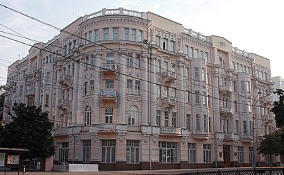
ЮФУ Address: Пр. М. Нагибина 13 street in Ворошиловский Район
- Турмалиновская 62,
- Новоебенёво,
- Бассейн Октябренок,
- улица Нансена,
- Кондитерская Три орешка,
- Кинотеатр "Победа",
- пятерочка соколова 72,
- Остановка "улица Турмалиновская",
- Турмалиновская Улица,
- улица Нансена, 135/11,
- Спортивный Комплекс ""Восход"",
- проспект Ленина, 105В,
- Факультет философии и культурологии ЮФУ,
- проспект Михаила Нагибина 13,
- Академия психологии и педагогики ЮФУ,
- РИО,
- улица Турмалиновская,
- Средняя Специальная Музыкальная школа,
- проспект Михаила Нагибина 14А,
- Зорька, детский оздоровительный лагерь
Places Near ЮФУ (Ворошиловский Район)
- Областная больница #2,
- Областная Клиническая Больница № 2, Первомайский Район,
- Уфпс в/ч 71609, Первомайский Район,
- Ростовский Научно-Исследовательский Онкологический Институт, Пролетарский Район,
- Пушкинская улица, 174, Кировский Район,
- Ростовский зоопарк, Октябрьский Район,
- Бсмп-2, Ворошиловский Район,
- набережная Ростова-на-Дону,
- КДЦ "Здоровье", Первомайский Район,
- Рынок Темерник, Первомайский Район,
- проспект Шолохова,
- станция Первомайская, Советский Район,
- улица Гайдара, Ленинский Район,
- Леруа Мерлен, Советский Район,
- улица Благодатная 170, Советский Район,
- Центральный Рынок,
- Городская клиническая больница № 20, Советский Район,
- Ростовская Областная Клиническая Больница, Советский Район,
- ТЦ "Горизонт", Ворошиловский Район,
- Больница Водников, Первомайский Район
How to get to popular places in Rostov-on-Don with public transit
Get around Ворошиловский Район by public transit!
Traveling around Ворошиловский Район has never been so easy. See step by step directions as you travel to any attraction, street or major public transit station. View bus and train schedules, arrival times, service alerts and detailed routes on a map, so you know exactly how to get to anywhere in Ворошиловский Район.
When traveling to any destination around Ворошиловский Район use Moovit's Live Directions with Get Off Notifications to know exactly where and how far to walk, how long to wait for your line, and how many stops are left. Moovit will alert you when it's time to get off — no need to constantly re-check whether yours is the next stop.
Wondering how to use public transit in Ворошиловский Район or how to pay for public transit in Ворошиловский Район? Moovit public transit app can help you navigate your way with public transit easily, and at minimum cost. It includes public transit fees, ticket prices, and costs. Looking for a map of Ворошиловский Район public transit lines? Moovit public transit app shows all public transit maps in Ворошиловский Район with all Bus, Light Rail, Trolleybus and Shuttle routes and stops on an interactive map.
Rostov-on-Don has 4 transit type(s), including: Bus, Light Rail, Trolleybus and Shuttle, operated by several transit agencies, including МУП МТК "Ростовпассажиртранс", МУП «РТК», ООО РТК «Русэлтранс» and Маршрутки