David Remez/Marzuk and Ezer stop - Saturday schedule
| Line | Direction | Time |
|---|---|---|
| 168 | Tel Aviv-Yafo | 18:19 |
| 28 | Tel Aviv-Yafo | 18:25 |
| 8A | Petah Tikva | 18:40 |
| 168 | Tel Aviv-Yafo | 19:04 |
| 28 | Tel Aviv-Yafo | 19:10 |
| 68 | Tel Aviv-Yafo | 19:14 |
| 8A | Petah Tikva | 19:35 |
| 168 | Tel Aviv-Yafo | 19:39 |
| 68 | Tel Aviv-Yafo | 19:39 |
| 28 | Tel Aviv-Yafo | 19:55 |
| 68 | Tel Aviv-Yafo | 20:04 |
| 68 | Tel Aviv-Yafo | 20:29 |
| 8A | Petah Tikva | 20:30 |
| 168 | Tel Aviv-Yafo | 20:34 |
| 28 | Tel Aviv-Yafo | 20:50 |
| 68 | Tel Aviv-Yafo | 20:54 |
| 68 | Tel Aviv-Yafo | 21:14 |
| 8A | Petah Tikva | 21:25 |
| 168 | Tel Aviv-Yafo | 21:29 |
| 28 | Tel Aviv-Yafo | 21:30 |
| 68 | Tel Aviv-Yafo | 21:34 |
| 68 | Tel Aviv-Yafo | 21:54 |
| 28 | Tel Aviv-Yafo | 22:05 |
| 68 | Tel Aviv-Yafo | 22:14 |
| 168 | Tel Aviv-Yafo | 22:24 |
Directions to David Remez/Marzuk and Ezer stop (Kiryat Ono) with public transit
The following transit lines have routes that pass near David Remez/Marzuk and Ezer
 Bus: 116, 168, 56, 68, 1.
How to get to David Remez/Marzuk and Ezer stop by bus?
Click on the bus route to see step by step directions with maps, line arrival times and updated time schedules.
Bus stops near David Remez/Marzuk and Ezer stop in Kiryat Ono
- Kiryat Ono Religious Council/David Remez, 3 min walk,
- Levi Eshkol Road/Yitzhak Rabin, 6 min walk,
- Sports Center/Levi Eshkol, 6 min walk,
- Sportek/Levi Eshkol Road, 8 min walk,
Light Rail stations near David Remez/Marzuk and Ezer station in Kiryat Ono
- Dankner Light Rail Station, 20 min walk,
- Aharonovich Light Rail Station, 43 min walk,
Bus lines to David Remez/Marzuk and Ezer stop in Kiryat Ono
- 1, Or Yehuda,
- 8A, Petah Tikva,
- 15, Or Yehuda,
- 28, Kiryat Ono,
- 55, Kiryat Ono,
- 68, Kiryat Ono,
- 168, Tel Aviv-Yafo,
- 41, Petah Tikva,
- 56, Yehud,
- 58, Ramat Gan,
- 77, Or Yehuda,
- 85, Bnei Brak,
- 116, Kiryat Ono,
- 137, Yehud,
- 139, Rishon LeZion,
- 446, Ben Gurion Airport,
- 710, Kiryat Ono,
- 8, Ramat Gan,
- 256, Ganei Tikva,
What are the closest stations to David Remez/Marzuk and Ezer?
The closest stations to David Remez/Marzuk and Ezer are:
- Kiryat Ono Religious Council/David Remez is 198 meters away, 3 min walk.
- Levi Eshkol Road/Yitzhak Rabin is 406 meters away, 6 min walk.
- Sports Center/Levi Eshkol is 431 meters away, 6 min walk.
- Sportek/Levi Eshkol Road is 564 meters away, 8 min walk.
- Dankner Light Rail Station is 1552 meters away, 20 min walk.
- Aharonovich Light Rail Station is 3301 meters away, 43 min walk.
Which bus lines stop near David Remez/Marzuk and Ezer?
These bus lines stop near David Remez/Marzuk and Ezer: 116, 168, 56, 68.
What’s the nearest light rail station to David Remez/Marzuk and Ezer in Kiryat Ono?
The nearest light rail station to David Remez/Marzuk and Ezer in Kiryat Ono is Dankner Light Rail Station. It’s a 20 min walk away.
What’s the nearest bus station to David Remez/Marzuk and Ezer in Kiryat Ono?
The nearest bus station to David Remez/Marzuk and Ezer in Kiryat Ono is Kiryat Ono Religious Council/David Remez. It’s a 3 min walk away.
What time is the first light rail to David Remez/Marzuk and Ezer in Kiryat Ono?
The R1 is the first light rail that goes to David Remez/Marzuk and Ezer in Kiryat Ono. It stops nearby at 5:35 AM.
What time is the last light rail to David Remez/Marzuk and Ezer in Kiryat Ono?
The R2 is the last light rail that goes to David Remez/Marzuk and Ezer in Kiryat Ono. It stops nearby at 1:04 AM.
What time is the first bus to David Remez/Marzuk and Ezer in Kiryat Ono?
The 116 is the first bus that goes to David Remez/Marzuk and Ezer in Kiryat Ono. It stops nearby at 5:05 AM.
What time is the last bus to David Remez/Marzuk and Ezer in Kiryat Ono?
The 446 is the last bus that goes to David Remez/Marzuk and Ezer in Kiryat Ono. It stops nearby at 1:15 AM.
David Remez/Marzuk and Ezer station
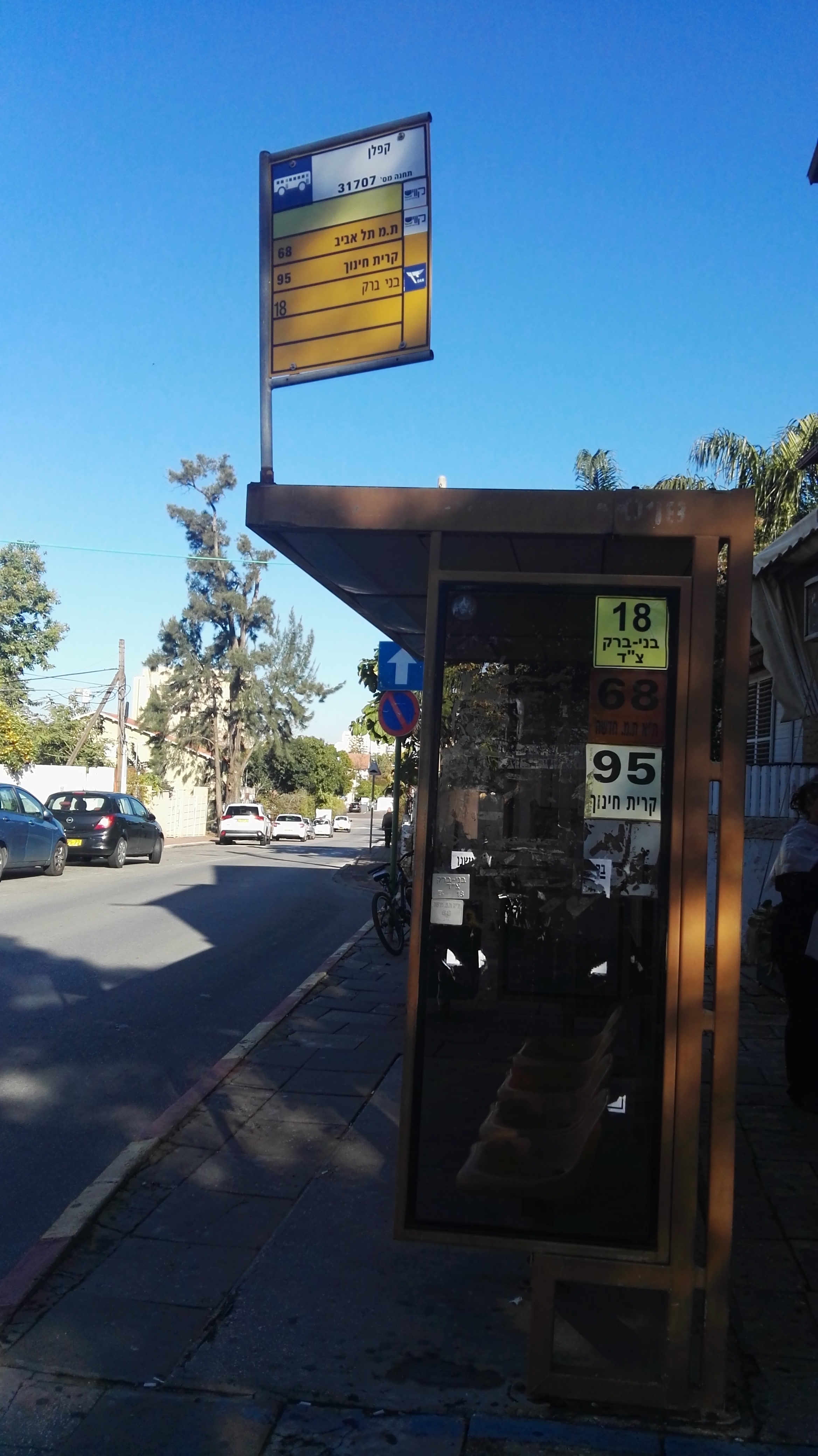 Taken by Hila Z.
See David Remez/Marzuk and Ezer stop, Kiryat Ono, on the map
Public transit to David Remez/Marzuk and Ezer stop (ID: 31707) in Kiryat Ono
Looking for directions to David Remez/Marzuk and Ezer in Kiryat Ono, Israel?
Download the Moovit App to find the current schedule and step-by-step directions for Bus or Light Rail routes that pass through David Remez/Marzuk and Ezer.
Looking for the nearest stops closest to David Remez/Marzuk and Ezer ? Check out this list of closest stops to your destination: Kiryat Ono Religious Council/David Remez; Levi Eshkol Road/Yitzhak Rabin; Sports Center/Levi Eshkol; Sportek/Levi Eshkol Road; Dankner Light Rail Station; Aharonovich Light Rail Station.
Bus: 116, 168, 56, 68, 1, 8A, 15, 28, 55, 41, 58, 77, 85, 8, 256.
We make riding on public transit to David Remez/Marzuk and Ezer easy, which is why over 1.5 million users, including users in Kiryat Ono trust Moovit as the best app for public transit.
Use the app to navigate to popular places including to the airport, hospital, stadium, grocery store, mall, coffee shop, school, college, and university.
David Remez/Marzuk and Ezer stop’s code is 31707
The first line to this stop is 168, at 18:19, and the last line is 28 at 23:55.
This stop serves Metropoline’s lines
- Kiryat Ono Religious Council/David Remez,
- Levi Eshkol Road/Yitzhak Rabin,
- Sports Center/Levi Eshkol,
- Sportek/Levi Eshkol Road
Bus stops near David Remez/Marzuk and Ezer stop
- Dankner Light Rail Station,
- Aharonovich Light Rail Station
Light Rail stations near David Remez/Marzuk and Ezer station
- Ashkelon Railway,
- Gush Etzion Junction,
- Levinsky College/Namir Road,
- Ela Prison,
- President Junction/Road 310,
- Ganim Beach,
- Carmel Market/Allenby,
- Bnei Brak Railway Station/Mivtza Kadesh,
- National Police School,
- Carmelit Terminal,
- Anne Frank/HaKomemiyut,
- Mount Keren Camp,
- Ashdod Ad Halom Railway,
- Jordan Camp/Ein Alamin,
- Aviation Industry Junction,
- Kibbutz Nachsholim,
- Tel Hadid,
- Hamat Gader,
- Givat Avni,
- Ministry of Interior
Popular public transit stations in Kiryat Ono
Get around Kiryat Ono by public transit!
Traveling around Kiryat Ono has never been so easy. See step by step directions as you travel to any attraction, street or major public transit station. View bus and train schedules, arrival times, service alerts and detailed routes on a map, so you know exactly how to get to anywhere in Kiryat Ono.
When traveling to any destination around Kiryat Ono use Moovit's Live Directions with Get Off Notifications to know exactly where and how far to walk, how long to wait for your line, and how many stops are left. Moovit will alert you when it's time to get off — no need to constantly re-check whether yours is the next stop.
Wondering how to use public transit in Kiryat Ono or how to pay for public transit in Kiryat Ono? Moovit public transit app can help you navigate your way with public transit easily, and at minimum cost. It includes public transit fees, ticket prices, and costs. Looking for a map of Kiryat Ono public transit lines? Moovit public transit app shows all public transit maps in Kiryat Ono with all Bus, Israel Railways, Light Rail, Carmelit / Rachbalit and Shuttle routes and stops on an interactive map.
Israel has 5 transit type(s), including: Bus, Israel Railways, Light Rail, Carmelit / Rachbalit and Shuttle, operated by several transit agencies, including Dan, Tel Aviv Light Rail - Tevel - Red Line, Israel Railways, Egged, Metropoline, Kavim, Electra Afikim, Nateev Express, Extra, Extra Jerusalem, Jerusalem Light Rail - Kfir, Egged Jerusalem Envelope Route, Dan Badarom, Dan Beer-Sheva and Electra Afikim Transport