The Stadium stop - Monday schedule
| Line | Direction | Time |
|---|---|---|
| 44 | Commercial Center/HaMaayan | 05:41 |
| 40 | Commercial Center/HaMaayan | 05:43 |
| 44 | Commercial Center/HaMaayan | 05:56 |
| 44 | Nof HaGalil Market | 06:02 |
| 40 | Commercial Center/HaMaayan | 06:03 |
| 40 | Nof HaGalil Market | 06:10 |
| 44 | Commercial Center/HaMaayan | 06:11 |
| 44 | Nof HaGalil Market | 06:17 |
| 40 | Commercial Center/HaMaayan | 06:23 |
| 44 | Commercial Center/HaMaayan | 06:26 |
| 40 | Nof HaGalil Market | 06:30 |
| 44 | Nof HaGalil Market | 06:32 |
| 44 | Commercial Center/HaMaayan | 06:41 |
| 40 | Commercial Center/HaMaayan | 06:43 |
| 44 | Nof HaGalil Market | 06:47 |
| 40 | Nof HaGalil Market | 06:50 |
| 44 | Commercial Center/HaMaayan | 06:56 |
| 44 | Nof HaGalil Market | 07:02 |
| 40 | Commercial Center/HaMaayan | 07:03 |
| 40 | Nof HaGalil Market | 07:10 |
| 16 | Nazareth Illit | 07:11 |
| 44 | Nof HaGalil Market | 07:17 |
| 44 | Commercial Center/HaMaayan | 07:21 |
| 40 | Commercial Center/HaMaayan | 07:23 |
| 16 | Nazareth | 07:29 |
Directions to The Stadium stop (Nof HaGalil) with public transit
The following transit lines have routes that pass near The Stadium
 Bus: 27, 3, 332 - Accessibility by advance reservation ♿, 356 - Accessible by advance request ♿, 431.
How to get to The Stadium stop by bus?
Click on the bus route to see step by step directions with maps, line arrival times and updated time schedules.
Bus stops near The Stadium stop in Nof HaGalil
- The Stadium, 4 min walk,
- Ariel Sharon Road/HaHatzav, 4 min walk,
- Yizrael/HaHatzav, 5 min walk,
- HaHatzav/Yizrael, 5 min walk,
- Keshet School/Savyon, 6 min walk,
Bus lines to The Stadium stop in Nof HaGalil
- 2, Nazareth Illit,
- 12, Nof HaGalil,
- 22A, Ein Mahel,
- 34, Nazareth Illit,
- 39, Admor of Belz/Dover Shalom,
- 40, Commercial Center/HaMaayan,
- 44, Nof HaGalil Market,
- 56, Al-Jalil/North Entrance,
- 38, Migdal HaEmek,
- 87, Nazareth,
- 332 - Accessibility by advance reservation ♿, Nof HaGalil,
- 338, Haifa,
- 340, Nazareth Illit,
- 341, Haifa,
- 342, Nof HaGalil,
- 356 - Accessible by advance request ♿, Nof HaGalil,
- 431, Migdal HaEmek,
- 73, Chabad School/HaTeena,
- 74, Ma'ale Yitzhak/Admor of Belz,
- 76, Yasmin/HaPisgot,
What are the closest stations to The Stadium?
The closest stations to The Stadium are:
- The Stadium is 264 meters away, 4 min walk.
- Ariel Sharon Road/HaHatzav is 284 meters away, 4 min walk.
- Yizrael/HaHatzav is 367 meters away, 5 min walk.
- HaHatzav/Yizrael is 379 meters away, 5 min walk.
- Keshet School/Savyon is 419 meters away, 6 min walk.
Which bus lines stop near The Stadium?
These bus lines stop near The Stadium: 27, 3, 332 - Accessibility by advance reservation ♿, 356 - Accessible by advance request ♿, 431, 56.
What’s the nearest bus station to The Stadium in Nof HaGalil?
The nearest bus stations to The Stadium in Nof HaGalil are The Stadium and Ariel Sharon Road/HaHatzav. The closest one is a 4 min walk away.
What time is the first bus to The Stadium in Nof HaGalil?
The 340 is the first bus that goes to The Stadium in Nof HaGalil. It stops nearby at 3:45 AM.
What time is the last bus to The Stadium in Nof HaGalil?
The 39 is the last bus that goes to The Stadium in Nof HaGalil. It stops nearby at 1:15 AM.
The Stadium station
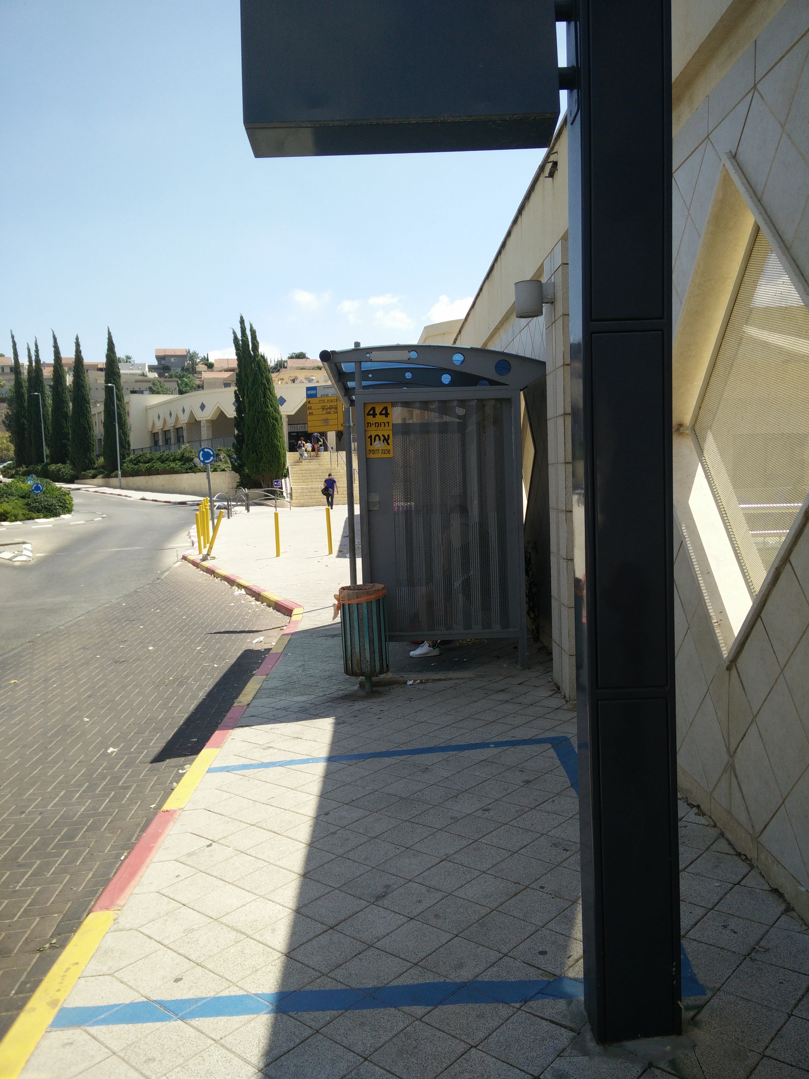 Taken by Anonymous
See The Stadium stop, Nof HaGalil, on the map
Public transit to The Stadium stop (ID: 51145) in Nof HaGalil
Looking for directions to The Stadium in Nof HaGalil, Israel?
Download the Moovit App to find the current schedule and step-by-step directions for Bus routes that pass through The Stadium.
Looking for the nearest stops closest to The Stadium ? Check out this list of closest stops to your destination: The Stadium; Ariel Sharon Road/HaHatzav; Yizrael/HaHatzav; HaHatzav/Yizrael; Keshet School/Savyon.
Bus: 27, 3, 332 - Accessibility by advance reservation ♿, 356 - Accessible by advance request ♿, 431, 56, 2, 12, 22A, 34, 39, 38, 87, 332 - Accessibility by advance reservation ♿, 338, 340, 73, 74, 76, 16, 5, 75.
We make riding on public transit to The Stadium easy, which is why over 1.5 million users, including users in Nof HaGalil trust Moovit as the best app for public transit.
Use the app to navigate to popular places including to the airport, hospital, stadium, grocery store, mall, coffee shop, school, college, and university.
The Stadium stop’s code is 51145
The first line to this stop is 44, at 05:41, and the last line is 44 at 23:22.
This stop serves SHAM (Nazareth-unbs)’s lines
- The Stadium,
- Ariel Sharon Road/HaHatzav,
- Yizrael/HaHatzav,
- HaHatzav/Yizrael,
- Keshet School/Savyon
Bus stops near The Stadium stop
- Nesi'ei Israel/Ofira Park,
- Banks Junction/Hebron Road,
- Yitzhak Rabin Road/Derech HaShalom,
- Herzl/Ein HaKore,
- Levi Eshkol Blvd/Einstein,
- Milano Square/Ibn Gabirol,
- Elisha Hospital/Wedgwood,
- Rafael/Shdema,
- University Railway Station/Rokach Blvd,
- Biblical Zoo,
- Clock Tower,
- Naomi Shemer/Yafa Yarkoni,
- Nof HaGalil/Exit,
- Carmel Center/Auditorium,
- Or Akiva West Interchange,
- Yad Vashem,
- Einstein E,
- Dead Sea/HaArava,
- Azrieli Mall,
- Kfar Blum/Center
Popular public transit stations in Nof HaGalil
Get around Nof HaGalil by public transit!
Traveling around Nof HaGalil has never been so easy. See step by step directions as you travel to any attraction, street or major public transit station. View bus and train schedules, arrival times, service alerts and detailed routes on a map, so you know exactly how to get to anywhere in Nof HaGalil.
When traveling to any destination around Nof HaGalil use Moovit's Live Directions with Get Off Notifications to know exactly where and how far to walk, how long to wait for your line, and how many stops are left. Moovit will alert you when it's time to get off — no need to constantly re-check whether yours is the next stop.
Wondering how to use public transit in Nof HaGalil or how to pay for public transit in Nof HaGalil? Moovit public transit app can help you navigate your way with public transit easily, and at minimum cost. It includes public transit fees, ticket prices, and costs. Looking for a map of Nof HaGalil public transit lines? Moovit public transit app shows all public transit maps in Nof HaGalil with all Bus, Israel Railways, Light Rail, Carmelit / Rachbalit and Shuttle routes and stops on an interactive map.
Israel has 5 transit type(s), including: Bus, Israel Railways, Light Rail, Carmelit / Rachbalit and Shuttle, operated by several transit agencies, including Dan, Tel Aviv Light Rail - Tevel - Red Line, Israel Railways, Egged, Metropoline, Kavim, Electra Afikim, Nateev Express, Extra, Extra Jerusalem, Jerusalem Light Rail - Kfir, Egged Jerusalem Envelope Route, Dan Badarom, Dan Beer-Sheva and Electra Afikim Transport