Directions to כרמי צור with public transportation
The following transit lines have routes that pass near כרמי צור
How to get to כרמי צור by bus?
Click on the bus route to see step by step directions with maps, line arrival times and updated time schedules.
Bus stations near כרמי צור
- כרמי צור/מזכירות, 6 min walk,
- צומת גוש עציון, 96 min walk,
Bus lines to כרמי צור
- 43, כרמי צור,
- 260, הר חברון,
- 262, עתניאל,
- 382, קריית ארבע,
- 380, קריית ארבע,
- 381, הר חברון,
- 384, קריית ארבע,
- 440, באר שבע,
- 264, כפר עציון,
- 361, ירושלים,
- 362, כפר עציון,
- 371, כפר עציון,
- 372, כפר עציון,
- 409, נווה דניאל,
- 410, כפר עציון,
What are the closest stations to כרמי צור?
The closest stations to כרמי צור are:
- כרמי צור/מזכירות is 355 meters away, 6 min walk.
- צומת גוש עציון is 7434 meters away, 96 min walk.
Which bus line stops near כרמי צור?
382
What’s the nearest bus stop to כרמי צור?
The nearest bus stop to כרמי צור is כרמי צור/מזכירות. It’s a 6 min walk away.
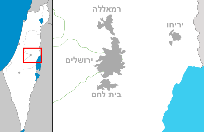
See כרמי צור on the map
Public Transportation to כרמי צור
Wondering how to get to כרמי צור, Israel? Moovit helps you find the best way to get to כרמי צור with step-by-step directions from the nearest public transit station.
Moovit provides free maps and live directions to help you navigate through your city. View schedules, routes, timetables, and find out how long does it take to get to כרמי צור in real time.
Looking for the nearest stop or station to כרמי צור? Check out this list of stops closest to your destination: כרמי צור/מזכירות; צומת גוש עציון.
Bus: 382, 43, 260, 262, 380, 381, 384, 440, 264, 361, 362, 371, 372.
Want to see if there’s another route that gets you there at an earlier time? Moovit helps you find alternative routes or times. Get directions from and directions to כרמי צור easily from the Moovit App or Website.
We make riding to כרמי צור easy, which is why over 1.5 million users, including users in כרמי צור, trust Moovit as the best app for public transit. You don’t need to download an individual bus app or train app, Moovit is your all-in-one transit app that helps you find the best bus time or train time available.
For information on prices of bus, costs and ride fares to כרמי צור, please check the Moovit app.
Use the app to navigate to popular places including to the airport, hospital, stadium, grocery store, mall, coffee shop, school, college, and university.
כרמי צור Address: 672, Gal'ed, Israel street in כרמי צור
Attractions near כרמי צור
כרמי צור Carmei Tzur,גוש עציון,דרך האבות/דרך שורק,מחנה כרמי צור,Karmei Zur,כרמי צור/מזכירות,עינב,הגת,Khirbat Um ed Daraj,‘Ayn ar Rashrāsh,Karme Ẕur,Khirbat al Qatt,מחנה כרמי צור,Bīr el Qaṭṭ,Bi’r al Qiţţ,Bi’r al Bu’ayrah,Bīr el Buweira,جمعية بيت امر للخريجين,مدخل حلحول الشمالي,Khirbat ‘AṣīdaHow to get to popular attractions in כרמי צור with public transit
דרך בן גוריון, רמת גן,חטמ״ר ערבה, מ.א. הערבה התיכונה,חוף הנודיסטים ים המלח,מחנה נחשונים, מ.א. חבל מודיעין,בית חולים אסף הרופא, באר יעקב,שגרירות ארצות הברית בישראל סניף תל אביב, תל אביב-יפו,Kever Rachel (Rachel's Tomb) קבר רחל, בית לחם,דרך מנחם בגין, תל אביב-יפו,בגין 125, תל אביב-יפו,מרפסת התצפית נתב""ג, נמל תעופה בן גוריון,גבעת התחמושת, ירושלים,מרכז סוזן דלל, תל אביב-יפו,בית חולים קפלן, רחובות,כפר סבא הירוקה, כפר סבא,גן הפעמון, ירושלים,בית חולים רמב"ם, חיפה,קרית אתא, חיפה,מרכז רפואי בני ציון, חיפה,מתחם שרונה, תל אביב-יפו,מצבור חרובית, מ.א. יואבGet around Israel by public transit!
Traveling around Israel has never been so easy. See step by step directions as you travel to any attraction, street or major public transit station. View bus and train schedules, arrival times, service alerts and detailed routes on a map, so you know exactly how to get to anywhere in Israel.
When traveling to any destination around Israel use Moovit's Live Directions with Get Off Notifications to know exactly where and how far to walk, how long to wait for your line, and how many stops are left. Moovit will alert you when it's time to get off — no need to constantly re-check whether yours is the next stop.
Wondering how to use public transit in Israel or how to pay for public transit in Israel? Moovit public transit app can help you navigate your way with public transit easily, and at minimum cost. It includes public transit fees, ticket prices, and costs. Looking for a map of Israel public transit lines? Moovit public transit app shows all public transit maps in Israel with all Bus, Israel Railways, Light Rail, Carmelit / Rachbalit and Shuttle routes and stops on an interactive map.
Israel has 5 transit type(s), including: Bus, Israel Railways, Light Rail, Carmelit / Rachbalit and Shuttle, operated by several transit agencies, including דן (Dan), הרכבת הקלה תל אביב - תבל - הקו האדום, רכבת ישראל (Israel Railways), אגד (Egged), מטרופולין (Metropoline), קווים (Kavim), אלקטרה אפיקים (Electra Afikim), נתיב אקספרס (Nateev Express), אקסטרה (Extra), אקסטרה ירושלים, הרכבת הקלה ירושלים - כפיר, דן בדרום (Dan Badarom), דן באר שבע (Dan Beer-Sheva), אלקטרה אפיקים תחבורה (Electra Afikim Tachbura), סופרבוס (Superbus)