Directions to בית אלפא with public transportation
The following transit lines have routes that pass near בית אלפא
How to get to בית אלפא by bus?
Click on the bus route to see step by step directions with maps, line arrival times and updated time schedules.
Bus stops near בית אלפא
- מסעף בית אלפא, 5 min walk,
- מסעף בית השיטה, 46 min walk,
- חניון האירוסים, 66 min walk,
Bus lines to בית אלפא
- 412, בית שאן,
- 832, תל אביב-יפו,
- 151, קצרין,
- 411, בית שאן,
- 413, עמק המעינות,
- 843, קצרין,
- 843, גולן,
- 53, מלכישוע,
What are the closest stations to בית אלפא?
The closest stations to בית אלפא are:
- מסעף בית אלפא is 311 meters away, 5 min walk.
- מסעף בית השיטה is 3464 meters away, 46 min walk.
- חניון האירוסים is 5048 meters away, 66 min walk.
Which bus line stops near בית אלפא?
412
What’s the nearest bus stop to בית אלפא?
The nearest bus stop to בית אלפא is מסעף בית אלפא. It’s a 5 min walk away.
See בית אלפא on the map
Public Transportation to בית אלפא
Wondering how to get to בית אלפא, Israel? Moovit helps you find the best way to get to בית אלפא with step-by-step directions from the nearest public transit station.
Moovit provides free maps and live directions to help you navigate through your city. View schedules, routes, timetables, and find out how long does it take to get to בית אלפא in real time.
Looking for the nearest stop or station to בית אלפא? Check out this list of stops closest to your destination: מסעף בית אלפא; מסעף בית השיטה; חניון האירוסים.
Bus: 412, 832, 832, 151, 411, 413, 843, 843, 53.
Want to see if there’s another route that gets you there at an earlier time? Moovit helps you find alternative routes or times. Get directions from and directions to בית אלפא easily from the Moovit App or Website.
We make riding to בית אלפא easy, which is why over 1.5 million users, including users in בית אלפא, trust Moovit as the best app for public transit. You don’t need to download an individual bus app or train app, Moovit is your all-in-one transit app that helps you find the best bus time or train time available.
For information on prices of bus, costs and ride fares to בית אלפא, please check the Moovit app.
Use the app to navigate to popular places including to the airport, hospital, stadium, grocery store, mall, coffee shop, school, college, and university.
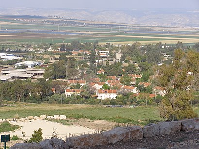
Location: בית אלפא, Israel
Attractions near בית אלפא
הפירות 517,Bet-Alefa,כל בו בית אלפא,האנקור 609,המוסכים 903,מסעף בית אלפא,גן יפני Japanese Garden,גן לאומי בית אלפא - Bet Alfa Synagogue National Park,גן קקטוסים,צומת בית אלפא,Ḥeftsi Bah,H̱efẕi Bah,חפציבה,חפציבה,עין חיים,En H̱ayyim,סונול,אל-אסאלה,צומת מעלה גלבוע,גן השלושה - הסחנהHow to get to popular attractions in בית אלפא with public transit
הלוחמים, חולון,תלפיות, ירושלים,אזור תעשיה ישן, נתניה,קרית חיים, חיפה,מרכז ויצמן – איכילוב, תל אביב-יפו,מחנה ברק, מ.א. גולן,מחנה בית ליד. אחרי לצנחנים, כפר יונה,טלז’ סטון, קריית יערים,איקאה קרית אתא, קריית אתא,תל אביב יפו, תל אביב-יפו,Bus 486 to Dead Sea, ירושלים,תחנה מרכזית, תל אביב-יפו,שוק הפשפשים, תל אביב-יפו,צומת סגולה, פתח תקווה,רכבל חיפה, חיפה,מחנה הרצוג, רמת השרון,האומן, ירושלים,בית כנסת עטרת אברהם, ירושלים,בית העלמין קריית שאול, תל אביב-יפו,גילה, ירושליםGet around Israel by public transit!
Traveling around Israel has never been so easy. See step by step directions as you travel to any attraction, street or major public transit station. View bus and train schedules, arrival times, service alerts and detailed routes on a map, so you know exactly how to get to anywhere in Israel.
When traveling to any destination around Israel use Moovit's Live Directions with Get Off Notifications to know exactly where and how far to walk, how long to wait for your line, and how many stops are left. Moovit will alert you when it's time to get off — no need to constantly re-check whether yours is the next stop.
Wondering how to use public transit in Israel or how to pay for public transit in Israel? Moovit public transit app can help you navigate your way with public transit easily, and at minimum cost. It includes public transit fees, ticket prices, and costs. Looking for a map of Israel public transit lines? Moovit public transit app shows all public transit maps in Israel with all Bus, Israel Railways, Light Rail, Carmelit / Rachbalit and Shuttle routes and stops on an interactive map.
Israel has 5 transit type(s), including: Bus, Israel Railways, Light Rail, Carmelit / Rachbalit and Shuttle, operated by several transit agencies, including דן (Dan), הרכבת הקלה תל אביב - תבל - הקו האדום, רכבת ישראל (Israel Railways), אגד (Egged), מטרופולין (Metropoline), קווים (Kavim), אלקטרה אפיקים (Electra Afikim), נתיב אקספרס (Nateev Express), אקסטרה (Extra), אקסטרה ירושלים, הרכבת הקלה ירושלים - כפיר, דן בדרום (Dan Badarom), דן באר שבע (Dan Beer-Sheva), אלקטרה אפיקים תחבורה (Electra Afikim Tachbura), סופרבוס (Superbus)