Raziel/Drezner stop - Wednesday schedule
| Line | Direction | Time |
|---|---|---|
| 90 | Herzog Hospital/Givat Shaul | 05:27 |
| 91 | Herzog Hospital/Givat Shaul | 05:32 |
| 90 | Herzog Hospital/Givat Shaul | 05:42 |
| 91 | Herzog Hospital/Givat Shaul | 05:47 |
| 78 | Rav HaHovel/Adam | 05:49 |
| 88 | Eliyahu Hakim/Meir Feinstein | 05:50 |
| 90 | Herzog Hospital/Givat Shaul | 05:57 |
| 91 | Herzog Hospital/Givat Shaul | 06:02 |
| 78 | Rav HaHovel/Adam | 06:04 |
| 88 | Eliyahu Hakim/Meir Feinstein | 06:10 |
| 90 | Herzog Hospital/Givat Shaul | 06:12 |
| 91 | Herzog Hospital/Givat Shaul | 06:17 |
| 78 | Rav HaHovel/Adam | 06:19 |
| 88 | Eliyahu Hakim/Meir Feinstein | 06:25 |
| 90 | Herzog Hospital/Givat Shaul | 06:27 |
| 78 | Rav HaHovel/Adam | 06:29 |
| 91 | Herzog Hospital/Givat Shaul | 06:32 |
| 78 | Rav HaHovel/Adam | 06:39 |
| 90 | Herzog Hospital/Givat Shaul | 06:42 |
| 88 | Eliyahu Hakim/Meir Feinstein | 06:45 |
| 91 | Herzog Hospital/Givat Shaul | 06:47 |
| 78 | Rav HaHovel/Adam | 06:49 |
| 90 | Herzog Hospital/Givat Shaul | 06:57 |
| 78 | Rav HaHovel/Adam | 06:59 |
| 91 | Herzog Hospital/Givat Shaul | 07:02 |
Directions to Raziel/Drezner stop (Jerusalem) with public transit
The following transit lines have routes that pass near Raziel/Drezner
 Bus: 510, 78, 88, 91, 90.
- Shuttle: Shuttle.
How to get to Raziel/Drezner stop by bus?
Click on the bus route to see step by step directions with maps, line arrival times and updated time schedules.
Bus stops near Raziel/Drezner stop in Jerusalem
- Raziel/Drezner, 3 min walk,
- Rav HaHovel/David Raziel, 6 min walk,
- Raziel/Alkahi, 6 min walk,
- Feinstein/Ben Yosef, 7 min walk,
Light Rail stations near Raziel/Drezner station in Jerusalem
- Shivtei Israel Light Rail Station, 14 min walk,
Shuttle stations near Raziel/Drezner station in Jerusalem
- HaKnesset, 26 min walk,
Bus lines to Raziel/Drezner stop in Jerusalem
- 78, Binyanei HaUma/HaNasi HaShishi,
- 88, Eliyahu Hakim/Meir Feinstein,
- 90, Herzog Hospital/Givat Shaul,
- 91, Herzog Hospital/Givat Shaul,
- 480, Tel Aviv-Yafo,
- 510, Rav HaHovel/Adam,
- 512, Rav HaHovel/Adam,
- 512, Jerusalem,
- 107, Police/Shmuel Meir,
- 870, Eliyahu Koren/Rabbi Khalfon Moshe HaCohen,
What are the closest stations to Raziel/Drezner?
The closest stations to Raziel/Drezner are:
- Raziel/Drezner is 191 meters away, 3 min walk.
- Rav HaHovel/David Raziel is 414 meters away, 6 min walk.
- Raziel/Alkahi is 438 meters away, 6 min walk.
- Feinstein/Ben Yosef is 512 meters away, 7 min walk.
- Shivtei Israel Light Rail Station is 1024 meters away, 14 min walk.
- HaKnesset is 1954 meters away, 26 min walk.
Which bus lines stop near Raziel/Drezner?
These bus lines stop near Raziel/Drezner: 510, 78, 88, 91.
What’s the nearest light rail station to Raziel/Drezner in Jerusalem?
The nearest light rail station to Raziel/Drezner in Jerusalem is Shivtei Israel Light Rail Station. It’s a 14 min walk away.
What’s the nearest bus station to Raziel/Drezner in Jerusalem?
The nearest bus station to Raziel/Drezner in Jerusalem is Raziel/Drezner. It’s a 3 min walk away.
What’s the nearest shuttle station to Raziel/Drezner in Jerusalem?
The nearest shuttle station to Raziel/Drezner in Jerusalem is HaKnesset. It’s a 26 min walk away.
What time is the first light rail to Raziel/Drezner in Jerusalem?
The 1 is the first light rail that goes to Raziel/Drezner in Jerusalem. It stops nearby at 5:14 AM.
What time is the last light rail to Raziel/Drezner in Jerusalem?
The 1 is the last light rail that goes to Raziel/Drezner in Jerusalem. It stops nearby at 12:37 AM.
What time is the first bus to Raziel/Drezner in Jerusalem?
The 88 is the first bus that goes to Raziel/Drezner in Jerusalem. It stops nearby at 5:25 AM.
What time is the last bus to Raziel/Drezner in Jerusalem?
The 78 is the last bus that goes to Raziel/Drezner in Jerusalem. It stops nearby at 2:28 AM.
What time is the first shuttle to Raziel/Drezner in Jerusalem?
The Shuttle is the first shuttle that goes to Raziel/Drezner in Jerusalem. It stops nearby at 6:02 PM.
What time is the last shuttle to Raziel/Drezner in Jerusalem?
The Shuttle is the last shuttle that goes to Raziel/Drezner in Jerusalem. It stops nearby at 8:02 PM.
Raziel/Drezner station
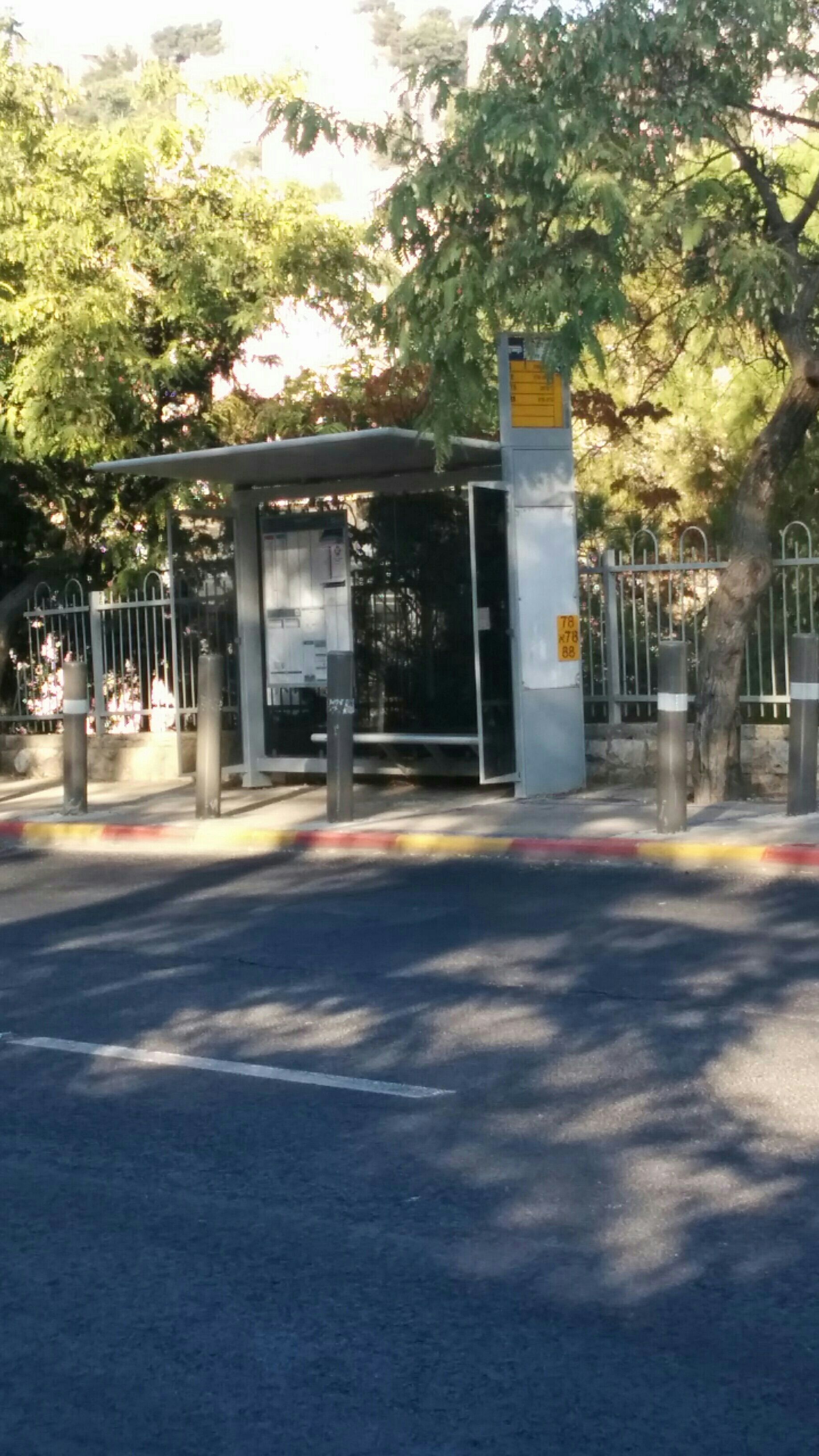 Taken by Anonymous
See Raziel/Drezner stop, Jerusalem, on the map
Public transit to Raziel/Drezner stop (ID: 2278) in Jerusalem
Looking for directions to Raziel/Drezner in Jerusalem, Israel?
Download the Moovit App to find the current schedule and step-by-step directions for Bus routes that pass through Raziel/Drezner.
Looking for the nearest stops closest to Raziel/Drezner ? Check out this list of closest stops to your destination: Raziel/Drezner; Rav HaHovel/David Raziel; Raziel/Alkahi; Feinstein/Ben Yosef; Shivtei Israel Light Rail Station; HaKnesset.
Bus: 510, 78, 88, 91, 90, 480, 512, 512, 107, 870.Shuttle: Shuttle.
We make riding on public transit to Raziel/Drezner easy, which is why over 1.5 million users, including users in Jerusalem trust Moovit as the best app for public transit.
Use the app to navigate to popular places including to the airport, hospital, stadium, grocery store, mall, coffee shop, school, college, and university.
Raziel/Drezner stop’s code is 2278
The first line to this stop is 90, at 05:27, and the last line is 78 at 02:19.
2 יחיאל דרזנר
This stop serves Superbus and Egged’s lines
- Raziel/Drezner,
- Rav HaHovel/David Raziel,
- Raziel/Alkahi,
- Feinstein/Ben Yosef
Bus stops near Raziel/Drezner stop
- Shivtei Israel Light Rail Station
Light Rail station near Raziel/Drezner station
- HaKnesset
Shuttle station near Raziel/Drezner station
- Mishmar HaNegev/Center,
- Givat Avni,
- Ramat Aviv Mall/Einstein,
- Mitzpe Modi'in Junction,
- Kibbutz Ein Gedi/Dining Hall,
- Ktzi'ot Prison,
- Geha Interchange/Road 4,
- National Police College,
- Sapir College,
- Petah Tikva Segula Railway Station,
- Geulim/HaHistadrut,
- HaMasger/HaRechev,
- Amphitheater,
- Ramat David,
- Beit Chilkiya Junction,
- Har Shmuel/Avnei HaChoshen,
- Avlayim Junction,
- Cable Car/HaAliya HaShniya,
- HaLeom Parking/6th President Blvd,
- Kalaniyot Junction
Popular public transit stations in Jerusalem
Get around Jerusalem by public transit!
Traveling around Jerusalem has never been so easy. See step by step directions as you travel to any attraction, street or major public transit station. View bus and train schedules, arrival times, service alerts and detailed routes on a map, so you know exactly how to get to anywhere in Jerusalem.
When traveling to any destination around Jerusalem use Moovit's Live Directions with Get Off Notifications to know exactly where and how far to walk, how long to wait for your line, and how many stops are left. Moovit will alert you when it's time to get off — no need to constantly re-check whether yours is the next stop.
Wondering how to use public transit in Jerusalem or how to pay for public transit in Jerusalem? Moovit public transit app can help you navigate your way with public transit easily, and at minimum cost. It includes public transit fees, ticket prices, and costs. Looking for a map of Jerusalem public transit lines? Moovit public transit app shows all public transit maps in Jerusalem with all Bus, Israel Railways, Light Rail, Carmelit / Rachbalit and Shuttle routes and stops on an interactive map.
Israel has 5 transit type(s), including: Bus, Israel Railways, Light Rail, Carmelit / Rachbalit and Shuttle, operated by several transit agencies, including Dan, Tel Aviv Light Rail - Tevel - Red Line, Israel Railways, Egged, Metropoline, Kavim, Electra Afikim, Nateev Express, Extra, Extra Jerusalem, Jerusalem Light Rail - Kfir, Egged Jerusalem Envelope Route, Dan Badarom, Dan Beer-Sheva and Electra Afikim Transport