Directions to ซอยทองหล่อ 4 (วัฒนา) with public transportation
The following transit lines have routes that pass near ซอยทองหล่อ 4
How to get to ซอยทองหล่อ 4 by bus?
Click on the bus route to see step by step directions with maps, line arrival times and updated time schedules.
How to get to ซอยทองหล่อ 4 by train?
Click on the train route to see step by step directions with maps, line arrival times and updated time schedules.
How to get to ซอยทองหล่อ 4 by metro?
Click on the metro route to see step by step directions with maps, line arrival times and updated time schedules.
How to get to ซอยทองหล่อ 4 by SkyTrain?
Click on the SkyTrain route to see step by step directions with maps, line arrival times and updated time schedules.
How to get to ซอยทองหล่อ 4 by ferry?
Click on the ferry route to see step by step directions with maps, line arrival times and updated time schedules.
Bus stops near ซอยทองหล่อ 4 in วัฒนา
- จุดขึ้นลง;Visual Stop, 6 min walk,
- Bts ทองหล่อ (ทางออก 1);Bts Thonglo (Exit 1), 12 min walk,
- ซอยศรียาภัย Pai Soi Si Ya Phai, 12 min walk,
SkyTrain stations near ซอยทองหล่อ 4 in วัฒนา
- Bts ทองหล่อ;Bts Thong Lo, 12 min walk,
Ferry station near ซอยทองหล่อ 4 in วัฒนา
- ท่าเรือทองหล่อ;Thong Lo Pier, 23 min walk,
Bus lines to ซอยทองหล่อ 4 in วัฒนา
- 1019, ปลายซอยทองหล่อ;Thong Lo,
- 3-1 (2), สะพานพุทธ;Saphan Phut,
- 3-8 (38), อนุสาวรีย์ชัยสมรภูมิ;Victory Monument,
- 1-39 (71), การท่าเรือแห่งประเทศไทย;Port Authority Of Thailand,
- 3-11 (48), ม.รามคำแหง 2;Ramkhamhaeng 2,
- 4-39 (40), สถานีขนส่งผู้โดยสารกรุงเทพฯ (เอกมัย);Bangkok Bus Terminal (Ekkamai),
- 1-53 (501), หมู่บ้านนักกีฬาแหลมทอง;Nakkila Laem Thong Village,
- 2, ท่าปล่อยรถ ช้างเอราวัณ Erawan Bus Terminal,
- 2, อู่เมกาบางนา Mega Bangna Bus Depot,
- 2, วัดไตร WAT Trai,
- 2 (ปอ.) (AC), ท่าปล่อยรถ ช้างเอราวัณ Erawan Bus Terminal,
- 25, ท่ารถสาย2(ปากคลองตลาด),
- 501, อู่มีนบุรี Minburi Bus Depot,
- 501 (ปอ.) (AC), อู่มีนบุรี Minburi Bus Depot,
- 508 (ปอ.) (AC), ท่ารถสาย2(ปากคลองตลาด),
- 511 (ปอ.) (AC), อู่ฟาร์มจระเข้สมุทรปราการ,
- 3-5 (23), เทเวศร์;Thewet,
- 1-77 (26ก), มีนบุรี;Minburi,
- 3-46 (72), คลองเตย;Klongtoey,
- 23, แยกประตูน้ำ Yaek Pratunam,
What are the closest stations to ซอยทองหล่อ 4?
The closest stations to ซอยทองหล่อ 4 are:
- จุดขึ้นลง;Visual Stop is 448 meters away, 6 min walk.
- Bts ทองหล่อ (ทางออก 1);Bts Thonglo (Exit 1) is 876 meters away, 12 min walk.
- ซอยศรียาภัย Pai Soi Si Ya Phai is 884 meters away, 12 min walk.
- Bts ทองหล่อ;Bts Thong Lo is 913 meters away, 12 min walk.
- ท่าเรือทองหล่อ;Thong Lo Pier is 1768 meters away, 23 min walk.
Which bus lines stop near ซอยทองหล่อ 4?
These bus lines stop near ซอยทองหล่อ 4: 2, 25, 511 (ปอ.) (AC).
Which train line stops near ซอยทองหล่อ 4?
367 (คลองหลวงแพ่ง;Khlong Luang Phaeng)
Which metro line stops near ซอยทองหล่อ 4?
BLUE (เตาปูน (วันเสาร์);Tao Poon (Saturday))
Which SkyTrain line stops near ซอยทองหล่อ 4?
SUKHUMVIT (Bts เคหะฯ;Bts Kheha)
Which ferry line stops near ซอยทองหล่อ 4?
เรือคลองแสนแสบ (ท่าวัดศรีบุญเรือง;Wat Sriboorueng Pier)
What’s the nearest SkyTrain station to ซอยทองหล่อ 4 in วัฒนา?
The nearest SkyTrain station to ซอยทองหล่อ 4 in วัฒนา is Bts ทองหล่อ;Bts Thong Lo. It’s a 12 min walk away.
What’s the nearest bus station to ซอยทองหล่อ 4 in วัฒนา?
The nearest bus station to ซอยทองหล่อ 4 in วัฒนา is จุดขึ้นลง;Visual Stop. It’s a 6 min walk away.
What’s the nearest ferry station to ซอยทองหล่อ 4 in วัฒนา?
The nearest ferry station to ซอยทองหล่อ 4 in วัฒนา is ท่าเรือทองหล่อ;Thong Lo Pier. It’s a 23 min walk away.
What time is the first SkyTrain to ซอยทองหล่อ 4 in วัฒนา?
The SUKHUMVIT is the first SkyTrain that goes to ซอยทองหล่อ 4 in วัฒนา. It stops nearby at 6:35 AM.
What time is the last SkyTrain to ซอยทองหล่อ 4 in วัฒนา?
The SUKHUMVIT is the last SkyTrain that goes to ซอยทองหล่อ 4 in วัฒนา. It stops nearby at 1:00 AM.
What time is the first bus to ซอยทองหล่อ 4 in วัฒนา?
The 23 is the first bus that goes to ซอยทองหล่อ 4 in วัฒนา. It stops nearby at 3:04 AM.
What time is the last bus to ซอยทองหล่อ 4 in วัฒนา?
The 1-39 (71) is the last bus that goes to ซอยทองหล่อ 4 in วัฒนา. It stops nearby at 4:38 AM.
What time is the first ferry to ซอยทองหล่อ 4 in วัฒนา?
The เรือคลองแสนแสบ is the first ferry that goes to ซอยทองหล่อ 4 in วัฒนา. It stops nearby at 6:56 AM.
What time is the last ferry to ซอยทองหล่อ 4 in วัฒนา?
The เรือคลองแสนแสบ is the last ferry that goes to ซอยทองหล่อ 4 in วัฒนา. It stops nearby at 7:51 PM.
See ซอยทองหล่อ 4, วัฒนา, on the map
Public Transit to ซอยทองหล่อ 4 in วัฒนา
How to get to ซอยทองหล่อ 4 in วัฒนา, Thailand?
It’s easy with Moovit. Type in your street address and Moovit’s route finder will locate the fastest way to get you there! Not sure where to get off on the street? Download the Moovit App to find live directions (including where to get off on ซอยทองหล่อ 4), see timetables and get the estimated arrival times for your favorite bus, metro, SkyTrain, ferry or train lines.
Looking for the nearest stop or station to ซอยทองหล่อ 4? Check out this list of closest stops available to your destination: จุดขึ้นลง;Visual Stop; Bts ทองหล่อ (ทางออก 1);Bts Thonglo (Exit 1); ซอยศรียาภัย Pai Soi Si Ya Phai; Bts ทองหล่อ;Bts Thong Lo; ท่าเรือทองหล่อ;Thong Lo Pier.
Bus: 2, 25, 511 (ปอ.) (AC), 1019, 3-1 (2), 3-8 (38), 1-39 (71), 3-11 (48), 4-39 (40), 3-5 (23), 1-77 (26ก), 3-46 (72), 23, 23.Train: 367.Metro: BLUE.SkyTrain: SUKHUMVIT.Ferry: เรือคลองแสนแสบ.
Download the Moovit App to see the current schedule and routes available for วัฒนา. No need to install a special bus app to check the bus time or a train app to get train time. Moovit is the only all-in-one transit app that helps you get where you need to go.
We make riding on public transit to ซอยทองหล่อ 4 easy, which is why over 1.5 million users, including users in วัฒนา trust Moovit as the best app for public transit.
Use the app to navigate to popular places including to the airport, hospital, stadium, grocery store, mall, coffee shop, school, college, and university.
Location: วัฒนา, Bangkok
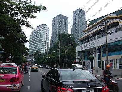
Streets near ซอยทองหล่อ 4, วัฒนา
Get around วัฒนา by public transit!
Traveling around วัฒนา has never been so easy. See step by step directions as you travel to any attraction, street or major public transit station. View bus and train schedules, arrival times, service alerts and detailed routes on a map, so you know exactly how to get to anywhere in วัฒนา.
When traveling to any destination around วัฒนา use Moovit's Live Directions with Get Off Notifications to know exactly where and how far to walk, how long to wait for your line, and how many stops are left. Moovit will alert you when it's time to get off — no need to constantly re-check whether yours is the next stop.
Wondering how to use public transit in วัฒนา or how to pay for public transit in วัฒนา? Moovit public transit app can help you navigate your way with public transit easily, and at minimum cost. It includes public transit fees, ticket prices, and costs. Looking for a map of วัฒนา public transit lines? Moovit public transit app shows all public transit maps in วัฒนา with all Bus, Train, Metro, SkyTrain and Ferry routes and stops on an interactive map.
Bangkok has 5 transit type(s), including: Bus, Train, Metro, SkyTrain and Ferry, operated by several transit agencies, including บีทีเอส BTS, MRT, ไทย สมายล์ บัส;Thai Smile Bus, ขสมก. BMTA, รถไฟฟ้ารฟท. SRTET, รถประจำทาง Transport Bus, บีอาร์ที BRT, เรือคลองโดยสาร Canal Ferry, เรือข้ามฟาก River Ferry, รถสองแถว Songthaew, จุฬาป๊อบบัส Chula Pop Bus, ขสมก BMTA, ขสมก. (BMTA), รถมินิบัส Minibus and รฟท. SRT