Directions to ถนนข้าวสาร (พระนคร) with public transportation
The following transit lines have routes that pass near ถนนข้าวสาร
How to get to ถนนข้าวสาร by bus?
Click on the bus route to see step by step directions with maps, line arrival times and updated time schedules.
How to get to ถนนข้าวสาร by metro?
Click on the metro route to see step by step directions with maps, line arrival times and updated time schedules.
How to get to ถนนข้าวสาร by SkyTrain?
Click on the SkyTrain route to see step by step directions with maps, line arrival times and updated time schedules.
Bus stops near ถนนข้าวสาร in พระนคร
- แยกคอกวัวตรงข้ามกองสลาก Khok Wua Intersection, 3 min walk,
- อนุสาวรีย์ประชาธิปไตย(ศึกษาภัณฑ์), 3 min walk,
- ก่อนอนุสาวรีย์ประชาธิปไตย;Before Democracy Monument, 3 min walk,
- แยกคอกวัว;Khok Wua Intersection, 3 min walk,
- วัดบวรนิเวศวิหาร,ท่ารถสาย 68 บางลำพู (ตรงข้ามไปรษณีย์บางลำภูบน), 4 min walk,
- กองสลาก Kong Salak, 4 min walk,
- ไปรษณีย์ไทย สาขาบางลำภูบน Post Office Banglampubon, 5 min walk,
- โรงเรียนสตรีวิทยา Satriwittaya School, 7 min walk,
Ferry stations near ถนนข้าวสาร in พระนคร
- ท่าเรือผ่านฟ้าลีลาศ;Panfa Leelard Pier, 13 min walk,
- ท่าเรือพระอาทิตย์;Phra Arthit Pier, 15 min walk,
- ท่าเรือพระจันทร์ (ข้ามฟาก);Tha Phra Chan Pier (Ferry), 19 min walk,
- ท่าเรือพระปิ่นเกล้า;Phra Pin Klao Bridge Pier, 19 min walk,
Bus lines to ถนนข้าวสาร in พระนคร
- 1-7E, รังสิต - สนามหลวง (ทางด่วน);Rangsit - Sanamluang (Expressway),
- 1-9E, มธ.ศูนย์รังสิต - สนามหลวง (ทางด่วน);Thammasat (Rangsit) - Sanam Luang,
- ต.31, บางนา (ทางด่วน) - สถานีขนส่งผู้โดยสารสายใต้;Bangna (Highway) - Bangkok Southern Bus Terminal,
- 3-2E, ปู่เจ้าสมิงพราย - ท่าเรือสะพานพุทธ (ทางด่วน);Pu Chao Samingphrai - Memorial Bridge,
- 68 มจธ, มจธ.บางขุนเทียน - บางลำพู;KMUTT Bangkhunthian - Bang Lamphu,
- 68 มหาชัย, สมุทรสาคร - บางลำพู;Samutsakhon - Bang Lamphu,
- ต.99, บางเขน - สนามหลวง;Bang Khen - Sanam Luang,
- ต.102, ท่าน้ำปากเกร็ด - สนามหลวง (ทางด่วน);Pak Kret Pier - Sanam Luang (Highway),
- ต.126, ท่าอากาศยานสุวรรณภูมิ - สถานีขนส่งผู้โดยสารกรุงเทพฯ (ตลิ่งชัน);Suvarnabhumi Airport - Bangkok Southern Bus Terminal (Taling Chan)(Highway),
- 1-63, ปัฐวิกรณ์ - สวนหลวงพระราม 8 ;Patthawikon - Suan Luang Rama VIII,
- 1-80E, สวนสยาม - สถานีรถไฟฟ้าสนามไชย (ทางด่วน);Siam Park - BTS Sanam Chai,
- 203, ท่าอิฐ - สนามหลวง;Tha It - Sanamluang,
- 3-1 (2), ปากน้ำ - สะพานพุทธ;Paknam - Saphan Phut,
- 4-1 (6), ท่าเรือพระประแดง - บางลำพู; Phra Pradaeng Pier - Banglamphu,
- 4-35L, วงกลมคลองสาน - เทเวศร์ (วนซ้าย);Khlong San - Thewes,
- 4-68, สวนผัก - ถนนตก;Suan Phak Rd. - Thanon Tok,
- 4-69, บรมราชชนนี - พระราม 9;Borommaratchachonnani - Phra Ram 9,
- 511 [ท], ฟาร์มจระเข้สมุทรปราการ - สายใต้ใหม่ (ตลิ่งชัน);Samut Prakan Crocodile Farm - Southern bus (Talingchan),
- 1-8 (59), รังสิต - สนามหลวง;Rangsit - Sanamluang,
- 2-5 (32), ปากเกร็ด - วัดโพธิ์;Pak Kret - Wat Pho,
What are the closest stations to ถนนข้าวสาร?
The closest stations to ถนนข้าวสาร are:
- แยกคอกวัวตรงข้ามกองสลาก Khok Wua Intersection is 205 meters away, 3 min walk.
- อนุสาวรีย์ประชาธิปไตย(ศึกษาภัณฑ์) is 212 meters away, 3 min walk.
- ก่อนอนุสาวรีย์ประชาธิปไตย;Before Democracy Monument is 212 meters away, 3 min walk.
- แยกคอกวัว;Khok Wua Intersection is 217 meters away, 3 min walk.
- วัดบวรนิเวศวิหาร,ท่ารถสาย 68 บางลำพู (ตรงข้ามไปรษณีย์บางลำภูบน) is 264 meters away, 4 min walk.
- กองสลาก Kong Salak is 289 meters away, 4 min walk.
- ไปรษณีย์ไทย สาขาบางลำภูบน Post Office Banglampubon is 348 meters away, 5 min walk.
- โรงเรียนสตรีวิทยา Satriwittaya School is 478 meters away, 7 min walk.
- ท่าเรือผ่านฟ้าลีลาศ;Panfa Leelard Pier is 950 meters away, 13 min walk.
- ท่าเรือพระอาทิตย์;Phra Arthit Pier is 1123 meters away, 15 min walk.
- ท่าเรือพระจันทร์ (ข้ามฟาก);Tha Phra Chan Pier (Ferry) is 1412 meters away, 19 min walk.
- ท่าเรือพระปิ่นเกล้า;Phra Pin Klao Bridge Pier is 1446 meters away, 19 min walk.
Which bus lines stop near ถนนข้าวสาร?
These bus lines stop near ถนนข้าวสาร: 1-8 (59), 2, 2-42 (44), 4-68, 511 (ปอ.) (AC), 511 [ท], 56 (ปอ.) (AC), 68 มจธ, ต.139.
Which metro line stops near ถนนข้าวสาร?
BLUE (บางหว้า (วันเสาร์);Bang Wa (Saturday))
Which SkyTrain line stops near ถนนข้าวสาร?
SUKHUMVIT (Bts คูคต;Bts Khu Khot)
What’s the nearest bus station to ถนนข้าวสาร in พระนคร?
The nearest bus stations to ถนนข้าวสาร in พระนคร are แยกคอกวัวตรงข้ามกองสลาก Khok Wua Intersection, อนุสาวรีย์ประชาธิปไตย(ศึกษาภัณฑ์), ก่อนอนุสาวรีย์ประชาธิปไตย;Before Democracy Monument and แยกคอกวัว;Khok Wua Intersection. The closest one is a 3 min walk away.
What’s the nearest ferry station to ถนนข้าวสาร in พระนคร?
The nearest ferry station to ถนนข้าวสาร in พระนคร is ท่าเรือผ่านฟ้าลีลาศ;Panfa Leelard Pier. It’s a 13 min walk away.
What time is the first bus to ถนนข้าวสาร in พระนคร?
The 80 is the first bus that goes to ถนนข้าวสาร in พระนคร. It stops nearby at 3:00 AM.
What time is the last bus to ถนนข้าวสาร in พระนคร?
The 3-1 (2) is the last bus that goes to ถนนข้าวสาร in พระนคร. It stops nearby at 4:31 AM.
What time is the first ferry to ถนนข้าวสาร in พระนคร?
The เรือข้ามฟาก is the first ferry that goes to ถนนข้าวสาร in พระนคร. It stops nearby at 5:00 AM.
What time is the last ferry to ถนนข้าวสาร in พระนคร?
The CITY LINE is the last ferry that goes to ถนนข้าวสาร in พระนคร. It stops nearby at 12:01 AM.
See ถนนข้าวสาร, พระนคร, on the map
Public Transit to ถนนข้าวสาร in พระนคร
Wondering how to get to ถนนข้าวสาร in พระนคร? Moovit helps you find the best way to get to ถนนข้าวสาร with step-by-step directions from the nearest public transit station.
Moovit provides free maps and live directions to help you navigate through your city. View schedules, routes, timetables, and find out how long does it take to get to ถนนข้าวสาร in real time.
Looking for the nearest stop or station to ถนนข้าวสาร? Check out this list of stops closest to your destination: แยกคอกวัวตรงข้ามกองสลาก Khok Wua Intersection; อนุสาวรีย์ประชาธิปไตย(ศึกษาภัณฑ์); ก่อนอนุสาวรีย์ประชาธิปไตย;Before Democracy Monument; แยกคอกวัว;Khok Wua Intersection; วัดบวรนิเวศวิหาร,ท่ารถสาย 68 บางลำพู (ตรงข้ามไปรษณีย์บางลำภูบน); กองสลาก Kong Salak; ไปรษณีย์ไทย สาขาบางลำภูบน Post Office Banglampubon; โรงเรียนสตรีวิทยา Satriwittaya School; ท่าเรือผ่านฟ้าลีลาศ;Panfa Leelard Pier; ท่าเรือพระอาทิตย์;Phra Arthit Pier; ท่าเรือพระจันทร์ (ข้ามฟาก);Tha Phra Chan Pier (Ferry); ท่าเรือพระปิ่นเกล้า;Phra Pin Klao Bridge Pier.
Bus: 1-8 (59), 2, 2-42 (44), 4-68, 511 (ปอ.) (AC), 511 [ท], 56 (ปอ.) (AC), 68 มจธ, ต.139, 1-7E, 1-9E, ต.31, 3-2E, S1, A4, ต.31, ต.99, ต.102, S1 (ปอ.) (AC), A4 (ปอ.) (AC), 4-37 (9), 4-2 (15L), 4-40 (56R).Metro: BLUE.SkyTrain: SUKHUMVIT.Ferry: เรือคลองแสนแสบ.
Want to see if there’s another route that gets you there at an earlier time? Moovit helps you find alternative routes or times. Get directions from and directions to ถนนข้าวสาร easily from the Moovit App or Website.
We make riding to ถนนข้าวสาร easy, which is why over 1.5 million users, including users in พระนคร, trust Moovit as the best app for public transit. You don’t need to download an individual bus app or train app, Moovit is your all-in-one transit app that helps you find the best bus time or train time available.
For information on prices of bus, metro and SkyTrain, costs and ride fares to ถนนข้าวสาร, please check the Moovit app.
Use the app to navigate to popular places including to the airport, hospital, stadium, grocery store, mall, coffee shop, school, college, and university.
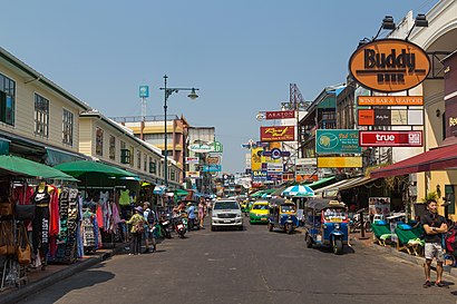
ถนนข้าวสาร Address: ถนนข้าวสาร - ถนนตะนาว แขวง วัดบวรนิเวศ เขต พระนคร กรุงเทพมหานคร 10200 ประเทศไทย street in พระนคร
Places Near ถนนข้าวสาร (พระนคร)
How to get to popular places in Bangkok with public transit
Get around พระนคร by public transit!
Traveling around พระนคร has never been so easy. See step by step directions as you travel to any attraction, street or major public transit station. View bus and train schedules, arrival times, service alerts and detailed routes on a map, so you know exactly how to get to anywhere in พระนคร.
When traveling to any destination around พระนคร use Moovit's Live Directions with Get Off Notifications to know exactly where and how far to walk, how long to wait for your line, and how many stops are left. Moovit will alert you when it's time to get off — no need to constantly re-check whether yours is the next stop.
Wondering how to use public transit in พระนคร or how to pay for public transit in พระนคร? Moovit public transit app can help you navigate your way with public transit easily, and at minimum cost. It includes public transit fees, ticket prices, and costs. Looking for a map of พระนคร public transit lines? Moovit public transit app shows all public transit maps in พระนคร with all Bus, Train, Metro, SkyTrain and Ferry routes and stops on an interactive map.
Bangkok has 5 transit type(s), including: Bus, Train, Metro, SkyTrain and Ferry, operated by several transit agencies, including บีทีเอส BTS, MRT, ไทย สมายล์ บัส;Thai Smile Bus, ขสมก. BMTA, รถไฟฟ้ารฟท. SRTET, รถประจำทาง Transport Bus, บีอาร์ที BRT, เรือคลองโดยสาร Canal Ferry, เรือข้ามฟาก River Ferry, รถสองแถว Songthaew, จุฬาป๊อบบัส Chula Pop Bus, ขสมก BMTA, ขสมก. (BMTA), รถมินิบัส Minibus and รฟท. SRT