Directions to ถนน จรัญสนิทวงศ์ (บางพลัด) with public transportation
The following transit lines have routes that pass near ถนน จรัญสนิทวงศ์
How to get to ถนน จรัญสนิทวงศ์ by bus?
Click on the bus route to see step by step directions with maps, line arrival times and updated time schedules.
How to get to ถนน จรัญสนิทวงศ์ by train?
Click on the train route to see step by step directions with maps, line arrival times and updated time schedules.
How to get to ถนน จรัญสนิทวงศ์ by metro?
Click on the metro route to see step by step directions with maps, line arrival times and updated time schedules.
How to get to ถนน จรัญสนิทวงศ์ by ferry?
Click on the ferry route to see step by step directions with maps, line arrival times and updated time schedules.
Metro station near ถนน จรัญสนิทวงศ์ in บางพลัด
- Mrt บางยี่ขัน;Mrt Bang Yi Khan, 2 min walk,
Bus stops near ถนน จรัญสนิทวงศ์ in บางพลัด
- Mrt บางยี่ขัน (ทางออก 1);Mrt Bang Yi Khan Station (Exit 1), 2 min walk,
- ตลาดพงษ์ทรัพย์ Talat Phong Sap, 4 min walk,
- จุดขึ้นลง;Visual Stop, 5 min walk,
- แยก 35 โบว์ Yaek 35 Bow, 12 min walk,
- ลุมพินีเพลส ปิ่นเกล้า;Lumpini Place Pinklao, 12 min walk,
- แยกบรมราชชนนี Separate Boromarajonani, 13 min walk,
Ferry stations near ถนน จรัญสนิทวงศ์ in บางพลัด
- ท่าเรือวัดคฤหบดี (ข้ามฟาก);Wat Kharue Habodi Pier (Ferry), 23 min walk,
- ท่าเรือวัดบวรมงคล (ข้ามฟาก);Wat Buanmongkhon Pier (Ferry), 23 min walk,
Train station near ถนน จรัญสนิทวงศ์ in บางพลัด
- Srt บางบำหรุ;Srt Bang Bamru, 58 min walk,
Bus lines to ถนน จรัญสนิทวงศ์ in บางพลัด
- 203, สนามหลวง;Sanamluang,
- 4-68, ถนนตก;Thanon Tok,
- 2-12 (66), สายใต้ (ปิ่นเกล้า);Bangkok Bus Terminal Southern (Pinklao),
- 4-38 (28), มหาวิทยาลัยราชภัฏจันทรเกษม;Chandrakasem Rajabhat University,
- 4-40 (56R), บางลำพู (วนขวา);Banglamphu,
- 2-22 (175), ท่าน้ำนนทบุรี;Nonthaburi Pier,
- 4-19 (108R), เดอะมอลล์ท่าพระ (วนขวา);The Mall Tha Phra R,
- 4-49 (170), กรุงเทพอภิวัฒน์;Krung Thep Aphiwat,
- 28 (ปอ.) (AC), อนุสาวรีย์ชัยสมรภูมิ (เกาะราชวิถี),
- 56 (ปอ.) (AC), วัดรวกบางบำหรุ,บ้านบรรหารศิลปอาชา,
- 66, ท่าปล่อยรถ สายใต้ใหม่ (ตลิ่งชัน),
- 66 (ปอ.) (AC), ท่าปล่อยรถ ศูนย์ราชการแจ้งวัฒนะ,
- 203, ท่าน้ำนนทบุรี Nonthaburi Pier,
- 203, อู่ท่าอิฐ Tha It Bus Depot,
- 208, สน.ตลิ่งชัน Talingchan Police Station,
- ต.47, สถานีขนส่งผู้โดยสารกรุงเทพฯ (ตลิ่งชัน);Bangkok Southern Bus Terminal (Taling Chan),
- ต.143, กระทุ่มแบน;Krathum Baen,
- ต.143, อ้อมใหญ่;Omyai,
- 4-40 (56L), บางลำพู (วนซ้าย);Banglamphu,
- 4-19 (108L), เดอะมอลล์ท่าพระ วนซ้าย;The Mall Tha Phra L,
What are the closest stations to ถนน จรัญสนิทวงศ์?
The closest stations to ถนน จรัญสนิทวงศ์ are:
- Mrt บางยี่ขัน;Mrt Bang Yi Khan is 94 meters away, 2 min walk.
- Mrt บางยี่ขัน (ทางออก 1);Mrt Bang Yi Khan Station (Exit 1) is 146 meters away, 2 min walk.
- ตลาดพงษ์ทรัพย์ Talat Phong Sap is 273 meters away, 4 min walk.
- จุดขึ้นลง;Visual Stop is 316 meters away, 5 min walk.
- แยก 35 โบว์ Yaek 35 Bow is 898 meters away, 12 min walk.
- ลุมพินีเพลส ปิ่นเกล้า;Lumpini Place Pinklao is 900 meters away, 12 min walk.
- แยกบรมราชชนนี Separate Boromarajonani is 963 meters away, 13 min walk.
- ท่าเรือวัดคฤหบดี (ข้ามฟาก);Wat Kharue Habodi Pier (Ferry) is 1735 meters away, 23 min walk.
- ท่าเรือวัดบวรมงคล (ข้ามฟาก);Wat Buanmongkhon Pier (Ferry) is 1742 meters away, 23 min walk.
- Srt บางบำหรุ;Srt Bang Bamru is 4521 meters away, 58 min walk.
Which bus lines stop near ถนน จรัญสนิทวงศ์?
These bus lines stop near ถนน จรัญสนิทวงศ์: 203, 28 (ปอ.) (AC), 4-19 (108L), 4-38 (28), 4-49 (170), 4-68, 66.
Which train line stops near ถนน จรัญสนิทวงศ์?
252 (ธนบุรี;Thon Buri)
Which metro line stops near ถนน จรัญสนิทวงศ์?
BLUE (ท่าพระ (วันเสาร์);Tha Phra (Saturday))
Which ferry lines stop near ถนน จรัญสนิทวงศ์?
These ferry lines stop near ถนน จรัญสนิทวงศ์: URBAN LINE, เรือข้ามฟาก.
What’s the nearest metro station to ถนน จรัญสนิทวงศ์ in บางพลัด?
The nearest metro station to ถนน จรัญสนิทวงศ์ in บางพลัด is Mrt บางยี่ขัน;Mrt Bang Yi Khan. It’s a 2 min walk away.
What’s the nearest bus station to ถนน จรัญสนิทวงศ์ in บางพลัด?
The nearest bus station to ถนน จรัญสนิทวงศ์ in บางพลัด is Mrt บางยี่ขัน (ทางออก 1);Mrt Bang Yi Khan Station (Exit 1). It’s a 2 min walk away.
What’s the nearest ferry station to ถนน จรัญสนิทวงศ์ in บางพลัด?
The nearest ferry stations to ถนน จรัญสนิทวงศ์ in บางพลัด are ท่าเรือวัดคฤหบดี (ข้ามฟาก);Wat Kharue Habodi Pier (Ferry) and ท่าเรือวัดบวรมงคล (ข้ามฟาก);Wat Buanmongkhon Pier (Ferry). The closest one is a 23 min walk away.
What time is the first metro to ถนน จรัญสนิทวงศ์ in บางพลัด?
The BLUE is the first metro that goes to ถนน จรัญสนิทวงศ์ in บางพลัด. It stops nearby at 6:13 AM.
What time is the last metro to ถนน จรัญสนิทวงศ์ in บางพลัด?
The BLUE is the last metro that goes to ถนน จรัญสนิทวงศ์ in บางพลัด. It stops nearby at 12:05 AM.
What time is the first train to ถนน จรัญสนิทวงศ์ in บางพลัด?
The 174 is the first train that goes to ถนน จรัญสนิทวงศ์ in บางพลัด. It stops nearby at 4:12 AM.
What time is the last train to ถนน จรัญสนิทวงศ์ in บางพลัด?
The 262 is the last train that goes to ถนน จรัญสนิทวงศ์ in บางพลัด. It stops nearby at 7:38 PM.
What time is the first bus to ถนน จรัญสนิทวงศ์ in บางพลัด?
The 203 is the first bus that goes to ถนน จรัญสนิทวงศ์ in บางพลัด. It stops nearby at 3:04 AM.
What time is the last bus to ถนน จรัญสนิทวงศ์ in บางพลัด?
The 203 is the last bus that goes to ถนน จรัญสนิทวงศ์ in บางพลัด. It stops nearby at 3:24 AM.
What time is the first ferry to ถนน จรัญสนิทวงศ์ in บางพลัด?
The เรือข้ามฟาก is the first ferry that goes to ถนน จรัญสนิทวงศ์ in บางพลัด. It stops nearby at 5:00 AM.
What time is the last ferry to ถนน จรัญสนิทวงศ์ in บางพลัด?
The เรือข้ามฟาก is the last ferry that goes to ถนน จรัญสนิทวงศ์ in บางพลัด. It stops nearby at 7:45 PM.
See ถนน จรัญสนิทวงศ์, บางพลัด, on the map
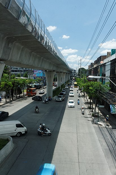
Public Transit to ถนน จรัญสนิทวงศ์ in บางพลัด
Wondering how to get to ถนน จรัญสนิทวงศ์ in บางพลัด? Moovit helps you find the best way to get to ถนน จรัญสนิทวงศ์ with step-by-step directions from the nearest public transit station.
Moovit provides free maps and live directions to help you navigate through your city. View schedules, routes, timetables, and find out how long does it take to get to ถนน จรัญสนิทวงศ์ in real time.
Looking for the nearest stop or station to ถนน จรัญสนิทวงศ์? Check out this list of stops closest to your destination: Mrt บางยี่ขัน;Mrt Bang Yi Khan; Mrt บางยี่ขัน (ทางออก 1);Mrt Bang Yi Khan Station (Exit 1); ตลาดพงษ์ทรัพย์ Talat Phong Sap; จุดขึ้นลง;Visual Stop; แยก 35 โบว์ Yaek 35 Bow; ลุมพินีเพลส ปิ่นเกล้า;Lumpini Place Pinklao; แยกบรมราชชนนี Separate Boromarajonani; ท่าเรือวัดคฤหบดี (ข้ามฟาก);Wat Kharue Habodi Pier (Ferry); ท่าเรือวัดบวรมงคล (ข้ามฟาก);Wat Buanmongkhon Pier (Ferry); Srt บางบำหรุ;Srt Bang Bamru.
Bus: 203, 28 (ปอ.) (AC), 4-19 (108L), 4-38 (28), 4-49 (170), 4-68, 66, 2-12 (66), 4-40 (56R), ต.47, ต.143, ต.143, 4-40 (56L), 1441.Train: 252, 31, 32, 38, 39, 43.Metro: BLUE.Ferry: URBAN LINE, เรือข้ามฟาก.
Want to see if there’s another route that gets you there at an earlier time? Moovit helps you find alternative routes or times. Get directions from and directions to ถนน จรัญสนิทวงศ์ easily from the Moovit App or Website.
We make riding to ถนน จรัญสนิทวงศ์ easy, which is why over 1.5 million users, including users in บางพลัด, trust Moovit as the best app for public transit. You don’t need to download an individual bus app or train app, Moovit is your all-in-one transit app that helps you find the best bus time or train time available.
For information on prices of bus, metro, train and ferry, costs and ride fares to ถนน จรัญสนิทวงศ์, please check the Moovit app.
Use the app to navigate to popular places including to the airport, hospital, stadium, grocery store, mall, coffee shop, school, college, and university.
ถนน จรัญสนิทวงศ์ Address: 14 ซอย จรัญสนิทวงศ์ 53 ถนน จรัญสนิทวงศ์ แขวง บางบำหรุ เขต บางพลัด กรุงเทพมหานคร 10700 ประเทศไทย street in บางพลัด
Places Near ถนน จรัญสนิทวงศ์ (บางพลัด)
How to get to popular places in Bangkok with public transit
Get around บางพลัด by public transit!
Traveling around บางพลัด has never been so easy. See step by step directions as you travel to any attraction, street or major public transit station. View bus and train schedules, arrival times, service alerts and detailed routes on a map, so you know exactly how to get to anywhere in บางพลัด.
When traveling to any destination around บางพลัด use Moovit's Live Directions with Get Off Notifications to know exactly where and how far to walk, how long to wait for your line, and how many stops are left. Moovit will alert you when it's time to get off — no need to constantly re-check whether yours is the next stop.
Wondering how to use public transit in บางพลัด or how to pay for public transit in บางพลัด? Moovit public transit app can help you navigate your way with public transit easily, and at minimum cost. It includes public transit fees, ticket prices, and costs. Looking for a map of บางพลัด public transit lines? Moovit public transit app shows all public transit maps in บางพลัด with all Bus, Train, Metro, SkyTrain and Ferry routes and stops on an interactive map.
Bangkok has 5 transit type(s), including: Bus, Train, Metro, SkyTrain and Ferry, operated by several transit agencies, including บีทีเอส BTS, MRT, ไทย สมายล์ บัส;Thai Smile Bus, ขสมก. BMTA, รถไฟฟ้ารฟท. SRTET, รถประจำทาง Transport Bus, บีอาร์ที BRT, เรือคลองโดยสาร Canal Ferry, เรือข้ามฟาก River Ferry, รถสองแถว Songthaew, จุฬาป๊อบบัส Chula Pop Bus, ขสมก BMTA, ขสมก. (BMTA), รถมินิบัส Minibus and รฟท. SRT