Directions to ถนน ประเสริฐมนูกิจ (บึงกุ่ม) with public transportation
The following transit lines have routes that pass near ถนน ประเสริฐมนูกิจ
How to get to ถนน ประเสริฐมนูกิจ by bus?
Click on the bus route to see step by step directions with maps, line arrival times and updated time schedules.
How to get to ถนน ประเสริฐมนูกิจ by metro?
Click on the metro route to see step by step directions with maps, line arrival times and updated time schedules.
Bus stops near ถนน ประเสริฐมนูกิจ in บึงกุ่ม
- หมู่บ้านลัดดารมย์ เอกมัย-รามอินทรา;Muban Laddarom Ekkamai-Ramintra, 5 min walk,
- ถนนคลองลำเจียก;Khlong Lamchiak Road, 7 min walk,
- ร้านอาหารประทุมทอง Ran Ahan Pra Thum Thong, 7 min walk,
- ซอยประเสริฐมนูกิจ 33;Soi Prasoet Manukit 33, 8 min walk,
- ตลาดสุคนธสวัสดิ์(ขาเข้า) Sukhonthasawat Market, 9 min walk,
- ร้านอาหารแมกไม้ Soi Ramkhamhaeng 25, 10 min walk,
Metro station near ถนน ประเสริฐมนูกิจ in บึงกุ่ม
- Mrt รามอินทรา กม.6;Mrt Ram Inthra Kor Mor 6, 15 min walk,
Bus lines to ถนน ประเสริฐมนูกิจ in บึงกุ่ม
- 1-29 (95เลียบด่วน), ม.รามคำแหง;Ramkhamhaeng University,
- 1-77 (26ก), มีนบุรี;Minburi,
- 3-38 (13), คลองเตย;Klong Toey,
- 2-49 (156L), อู่เลียบทางด่วนรามอินทรา (วนซ้าย);Liab Duan Ramintra Bus Depot,
- 2-49 (156R), อู่ใต้ทางด่วนรามอินทรา (วนขวา);Liab Duan Ramintra,
- 2-50 (178), เซ็นทรัลลาดพร้าว;Central Lardprao,
- ต.19, รามอินทรา กม.8 - อิมพิเรียลลาดพร้าว;Ram-intra km.8 - Imperial World Ladprao,
- ต.19, ช่วงรามอินทรา - ประตูน้ำ;Ram-intra - Pratunam,
- ต.32, ช่วงรามอินทรา 40 - ประตูน้ำ (ทางด่วน);Ram-intra 40 - Pratunam (Highway),
- ต.91, มีนบุรี - อนุสาวรีย์ชัยสมรภูมิ;Min Buri - Victory Monument,
- ต.92, มีนบุรี - อนุสาวรีย์ชัยสมรภูมิ;Min Buri - Victory Monument,
- 1-32E, บางเขน - สถานีรถไฟฟ้าตลาดพลู (ทางด่วน);Bang Khen - BTS Talat Phlu,
- 1526, ถนอมมิตรพาร์ค - ซอยลาดพร้าว 81;Thanommit Park - Soi Lat Phrao 81,
- 26ก, ตรงข้ามซอยเจียรสวัสดิ์ Good Cut Road,
- 1-62, มีนบุรี;Minburi,
- 178 เสริม, เกษตร;Kaset,
- 156, โรงเรียนลอยสายอนุสรณ์ Loysai Anusorn School,
- ต.19, รามอินทรา;Ram-Intra,
- ต.19, รามอินทรา กม.8;Ram-Intra Km.8,
- ต.42, ตลาดสะพานใหม่;Saphan Mai Market,
What are the closest stations to ถนน ประเสริฐมนูกิจ?
The closest stations to ถนน ประเสริฐมนูกิจ are:
- หมู่บ้านลัดดารมย์ เอกมัย-รามอินทรา;Muban Laddarom Ekkamai-Ramintra is 306 meters away, 5 min walk.
- ถนนคลองลำเจียก;Khlong Lamchiak Road is 495 meters away, 7 min walk.
- ร้านอาหารประทุมทอง Ran Ahan Pra Thum Thong is 516 meters away, 7 min walk.
- ซอยประเสริฐมนูกิจ 33;Soi Prasoet Manukit 33 is 562 meters away, 8 min walk.
- ตลาดสุคนธสวัสดิ์(ขาเข้า) Sukhonthasawat Market is 674 meters away, 9 min walk.
- ร้านอาหารแมกไม้ Soi Ramkhamhaeng 25 is 752 meters away, 10 min walk.
- Mrt รามอินทรา กม.6;Mrt Ram Inthra Kor Mor 6 is 1146 meters away, 15 min walk.
Which bus lines stop near ถนน ประเสริฐมนูกิจ?
These bus lines stop near ถนน ประเสริฐมนูกิจ: 1-29 (95เลียบด่วน), 1-62, 3-38 (13), ต.19.
Which metro line stops near ถนน ประเสริฐมนูกิจ?
PINK (มีนบุรี;Min Buri)
What’s the nearest metro station to ถนน ประเสริฐมนูกิจ in บึงกุ่ม?
The nearest metro station to ถนน ประเสริฐมนูกิจ in บึงกุ่ม is Mrt รามอินทรา กม.6;Mrt Ram Inthra Kor Mor 6. It’s a 15 min walk away.
What’s the nearest bus station to ถนน ประเสริฐมนูกิจ in บึงกุ่ม?
The nearest bus station to ถนน ประเสริฐมนูกิจ in บึงกุ่ม is หมู่บ้านลัดดารมย์ เอกมัย-รามอินทรา;Muban Laddarom Ekkamai-Ramintra. It’s a 5 min walk away.
What time is the first metro to ถนน ประเสริฐมนูกิจ in บึงกุ่ม?
The PINK is the first metro that goes to ถนน ประเสริฐมนูกิจ in บึงกุ่ม. It stops nearby at 6:14 AM.
What time is the last metro to ถนน ประเสริฐมนูกิจ in บึงกุ่ม?
The PINK is the last metro that goes to ถนน ประเสริฐมนูกิจ in บึงกุ่ม. It stops nearby at 12:30 AM.
What time is the first bus to ถนน ประเสริฐมนูกิจ in บึงกุ่ม?
The 95 is the first bus that goes to ถนน ประเสริฐมนูกิจ in บึงกุ่ม. It stops nearby at 4:20 AM.
What time is the last bus to ถนน ประเสริฐมนูกิจ in บึงกุ่ม?
The 2-49 (156R) is the last bus that goes to ถนน ประเสริฐมนูกิจ in บึงกุ่ม. It stops nearby at 11:37 PM.
See ถนน ประเสริฐมนูกิจ, บึงกุ่ม, on the map
Public Transit to ถนน ประเสริฐมนูกิจ in บึงกุ่ม
Wondering how to get to ถนน ประเสริฐมนูกิจ in บึงกุ่ม? Moovit helps you find the best way to get to ถนน ประเสริฐมนูกิจ with step-by-step directions from the nearest public transit station.
Moovit provides free maps and live directions to help you navigate through your city. View schedules, routes, timetables, and find out how long does it take to get to ถนน ประเสริฐมนูกิจ in real time.
Looking for the nearest stop or station to ถนน ประเสริฐมนูกิจ? Check out this list of stops closest to your destination: หมู่บ้านลัดดารมย์ เอกมัย-รามอินทรา;Muban Laddarom Ekkamai-Ramintra; ถนนคลองลำเจียก;Khlong Lamchiak Road; ร้านอาหารประทุมทอง Ran Ahan Pra Thum Thong; ซอยประเสริฐมนูกิจ 33;Soi Prasoet Manukit 33; ตลาดสุคนธสวัสดิ์(ขาเข้า) Sukhonthasawat Market; ร้านอาหารแมกไม้ Soi Ramkhamhaeng 25; Mrt รามอินทรา กม.6;Mrt Ram Inthra Kor Mor 6.
Bus: 1-29 (95เลียบด่วน), 1-62, 3-38 (13), ต.19, 1-77 (26ก), 2-49 (156L), 2-49 (156R), ต.32, ต.91, ต.92, 26ก, 178 เสริม, 156.Metro: PINK.
Want to see if there’s another route that gets you there at an earlier time? Moovit helps you find alternative routes or times. Get directions from and directions to ถนน ประเสริฐมนูกิจ easily from the Moovit App or Website.
We make riding to ถนน ประเสริฐมนูกิจ easy, which is why over 1.5 million users, including users in บึงกุ่ม, trust Moovit as the best app for public transit. You don’t need to download an individual bus app or train app, Moovit is your all-in-one transit app that helps you find the best bus time or train time available.
For information on prices of bus and metro, costs and ride fares to ถนน ประเสริฐมนูกิจ, please check the Moovit app.
Use the app to navigate to popular places including to the airport, hospital, stadium, grocery store, mall, coffee shop, school, college, and university.
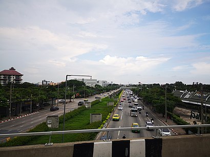
ถนน ประเสริฐมนูกิจ Address: ถนน ประเสริฐมนูกิจ กรุงเทพมหานคร ประเทศไทย street in บึงกุ่ม
Places Near ถนน ประเสริฐมนูกิจ (บึงกุ่ม)
How to get to popular places in Bangkok with public transit
Get around บึงกุ่ม by public transit!
Traveling around บึงกุ่ม has never been so easy. See step by step directions as you travel to any attraction, street or major public transit station. View bus and train schedules, arrival times, service alerts and detailed routes on a map, so you know exactly how to get to anywhere in บึงกุ่ม.
When traveling to any destination around บึงกุ่ม use Moovit's Live Directions with Get Off Notifications to know exactly where and how far to walk, how long to wait for your line, and how many stops are left. Moovit will alert you when it's time to get off — no need to constantly re-check whether yours is the next stop.
Wondering how to use public transit in บึงกุ่ม or how to pay for public transit in บึงกุ่ม? Moovit public transit app can help you navigate your way with public transit easily, and at minimum cost. It includes public transit fees, ticket prices, and costs. Looking for a map of บึงกุ่ม public transit lines? Moovit public transit app shows all public transit maps in บึงกุ่ม with all Bus, Train, Metro, SkyTrain and Ferry routes and stops on an interactive map.
Bangkok has 5 transit type(s), including: Bus, Train, Metro, SkyTrain and Ferry, operated by several transit agencies, including บีทีเอส BTS, MRT, ไทย สมายล์ บัส;Thai Smile Bus, ขสมก. BMTA, รถไฟฟ้ารฟท. SRTET, รถประจำทาง Transport Bus, บีอาร์ที BRT, เรือคลองโดยสาร Canal Ferry, เรือข้ามฟาก River Ferry, รถสองแถว Songthaew, จุฬาป๊อบบัส Chula Pop Bus, ขสมก BMTA, ขสมก. (BMTA), รถมินิบัส Minibus and รฟท. SRT