Directions to ถนน สาทรเหนือ with public transportation
The following transit lines have routes that pass near ถนน สาทรเหนือ
How to get to ถนน สาทรเหนือ by bus?
Click on the bus route to see step by step directions with maps, line arrival times and updated time schedules.
How to get to ถนน สาทรเหนือ by train?
Click on the train route to see step by step directions with maps, line arrival times and updated time schedules.
How to get to ถนน สาทรเหนือ by metro?
Click on the metro route to see step by step directions with maps, line arrival times and updated time schedules.
How to get to ถนน สาทรเหนือ by SkyTrain?
Click on the SkyTrain route to see step by step directions with maps, line arrival times and updated time schedules.
Bus stops near ถนน สาทรเหนือ
- แยกนรินธร,โรงพยาบาลบางรัก, 3 min walk,
- แยกสาทร-นราธิวาส;Sathon-Naradhiwas Intersection, 3 min walk,
- ศึกษาวิทยา;Suksa Wittaya, 4 min walk,
- Brt สาทร;Brt Sathorn, 4 min walk,
- ซอยนราธิวาสราชนครินทร์ 7,ตรงข้ามตึกเอ็มไพน์, 6 min walk,
SkyTrain stations near ถนน สาทรเหนือ
- Bts ศาลาแดง;Bts Sala Daeng, 12 min walk,
Metro station near ถนน สาทรเหนือ
- Mrt สามย่าน;Mrt Sam Yan, 14 min walk,
Bus lines to ถนน สาทรเหนือ
- 17, อนุสาวรีย์ชัยสมรภูมิ (เกาะพญาไท),
- 17 (ปอ.) (AC), ท่าจอดรถสาย 37,ซอยราษฎร์บูรณะ 39 Soi Rat Burana 39,
- 77, นิคมรถไฟ กม.11 Nikhom Rotfai Km.11,
- 77, อู่หมอชิต 2 Mochit 2 Bus Depot,
- 77 (ปอ.) (AC), อู่สาธุประดิษฐ์ Sathu Pradit Bus Depot,
- ต.29, สวนลุมพินี - บางปะแก้ว (ทางด่วน);Lum Phi Ni Park - Bang Pa Kaeo (Highway),
- ต.137, ช่วงสีลม - ห้างสรรพสินค้าเทสโก้ โลตัส พระราม 2 (ทางด่วน);Silom - Tesco Lotus Rama 2 Department Store (Highway),
- ต.137, มาบุญครอง - ห้างสรรพสินค้าเทสโก้ โลตัส พระราม 2 (ทางด่วน);Ma Bun Khrong - Tesco Lotus Rama 2 Department Store (Highway),
- 4-3 (17), พระประแดง - อนุสาวรีย์ชัยสมรภูมิ;Phra Pradaeng - Victory Monument,
- 4-7E (21), วัดคู่สร้าง - จุฬาลงกรณ์มหาวิทยาลัย ทางด่วน;Wat Kusang - Chulalongkorn University,
- 3-45 (77), หมอชิต 2 - เซ็นทรัลพระราม 3;Mochit 2 - Central RAMA 3,
- 3-51 (205L), วงกลมคลองเตย - สถานีรถไฟฟ้าตลาดพลู (วนซ้าย);Klongtoey - Talat Phlu Station,
- 4-26 (167), เคหะธนบุรี - สถานีรถไฟฟ้าลุมพินี; Kheha Thonubri Bus Terminal- Lumpini MRT Station,
- 4-53 (149), เอกมัย - พุทธมณฑลสาย 2;Akkamai - Phutthamonthon Sai 2,
- ต.29, บางปะแก้ว (ทางด่วน) - สวนลุมพินี;Bang Pa Keao (Highway) - Lumpini Park,
- ต.74, ซอยนวลจันทร์ (ทางด่วน) - ถนนนราธิวาสราชนครินทร์ - สีลม;Soi Nuanchan (Highway) - Naradhiwas Rajanagarindra Road - Silom,
- ต.75, ซอยลาดพร้าว 84 (ทางด่วน) - สีลม;Soi Ladprao 84 (Highway) - Silom,
- 3-51 (205R), วงกลมคลองเตย - สถานีรถไฟฟ้าตลาดพลู (วนขวา);Klongtoey - Talat Phlu Station,
- BRT, ราชพฤกษ์;Brt Station Ratchapruek,
- 3-52R, พระราม 3 วนขวา;Rama 3 R,
What are the closest stations to ถนน สาทรเหนือ?
The closest stations to ถนน สาทรเหนือ are:
- แยกนรินธร,โรงพยาบาลบางรัก is 186 meters away, 3 min walk.
- แยกสาทร-นราธิวาส;Sathon-Naradhiwas Intersection is 216 meters away, 3 min walk.
- ศึกษาวิทยา;Suksa Wittaya is 253 meters away, 4 min walk.
- Brt สาทร;Brt Sathorn is 287 meters away, 4 min walk.
- ซอยนราธิวาสราชนครินทร์ 7,ตรงข้ามตึกเอ็มไพน์ is 448 meters away, 6 min walk.
- Bts ศาลาแดง;Bts Sala Daeng is 920 meters away, 12 min walk.
- Mrt สามย่าน;Mrt Sam Yan is 1014 meters away, 14 min walk.
Which bus lines stop near ถนน สาทรเหนือ?
These bus lines stop near ถนน สาทรเหนือ: 17, 3-51 (205L), 4-26 (167), 4-53 (149), 4-7E (21), 77, ต.137, ต.29.
Which train line stops near ถนน สาทรเหนือ?
342 (กรุงเทพ;Bangkok)
Which metro line stops near ถนน สาทรเหนือ?
BLUE (บางหว้า (วันเสาร์);Bang Wa (Saturday))
Which SkyTrain line stops near ถนน สาทรเหนือ?
SILOM (บางหว้า;Bang Wa)
What’s the nearest SkyTrain station to ถนน สาทรเหนือ?
The nearest SkyTrain station to ถนน สาทรเหนือ is Bts ศาลาแดง;Bts Sala Daeng. It’s a 12 min walk away.
What’s the nearest metro station to ถนน สาทรเหนือ?
The nearest metro station to ถนน สาทรเหนือ is Mrt สามย่าน;Mrt Sam Yan. It’s a 14 min walk away.
What’s the nearest bus station to ถนน สาทรเหนือ?
The nearest bus stations to ถนน สาทรเหนือ are แยกนรินธร,โรงพยาบาลบางรัก and แยกสาทร-นราธิวาส;Sathon-Naradhiwas Intersection. The closest one is a 3 min walk away.
What time is the first SkyTrain to ถนน สาทรเหนือ?
The SILOM is the first SkyTrain that goes to ถนน สาทรเหนือ. It stops nearby at 6:07 AM.
What time is the last SkyTrain to ถนน สาทรเหนือ?
The SILOM is the last SkyTrain that goes to ถนน สาทรเหนือ. It stops nearby at 12:15 AM.
What time is the first metro to ถนน สาทรเหนือ?
The BLUE is the first metro that goes to ถนน สาทรเหนือ. It stops nearby at 6:16 AM.
What time is the last metro to ถนน สาทรเหนือ?
The BLUE is the last metro that goes to ถนน สาทรเหนือ. It stops nearby at 12:33 AM.
What time is the first bus to ถนน สาทรเหนือ?
The 77 is the first bus that goes to ถนน สาทรเหนือ. It stops nearby at 3:09 AM.
What time is the last bus to ถนน สาทรเหนือ?
The BRT is the last bus that goes to ถนน สาทรเหนือ. It stops nearby at 11:58 PM.
See ถนน สาทรเหนือ on the map
Public Transportation to ถนน สาทรเหนือ
Wondering how to get to ถนน สาทรเหนือ? Moovit helps you find the best way to get to ถนน สาทรเหนือ with step-by-step directions from the nearest public transit station.
Moovit provides free maps and live directions to help you navigate through your city. View schedules, routes, timetables, and find out how long does it take to get to ถนน สาทรเหนือ in real time.
Looking for the nearest stop or station to ถนน สาทรเหนือ? Check out this list of stops closest to your destination: แยกนรินธร,โรงพยาบาลบางรัก; แยกสาทร-นราธิวาส;Sathon-Naradhiwas Intersection; ศึกษาวิทยา;Suksa Wittaya; Brt สาทร;Brt Sathorn; ซอยนราธิวาสราชนครินทร์ 7,ตรงข้ามตึกเอ็มไพน์; Bts ศาลาแดง;Bts Sala Daeng; Mrt สามย่าน;Mrt Sam Yan.
Bus: 17, 3-51 (205L), 4-26 (167), 4-53 (149), 4-7E (21), 77, ต.137, ต.29, 17 (ปอ.) (AC), 77 (ปอ.) (AC), 4-3 (17), ต.74, ต.75, 3-51 (205R), BRT, 3-52R, 1272.Train: 342.Metro: BLUE.SkyTrain: SILOM.
Want to see if there’s another route that gets you there at an earlier time? Moovit helps you find alternative routes or times. Get directions from and directions to ถนน สาทรเหนือ easily from the Moovit App or Website.
We make riding to ถนน สาทรเหนือ easy, which is why over 1.5 million users, including users in สาทร, trust Moovit as the best app for public transit. You don’t need to download an individual bus app or train app, Moovit is your all-in-one transit app that helps you find the best bus time or train time available.
For information on prices of bus, SkyTrain, metro and train, costs and ride fares to ถนน สาทรเหนือ, please check the Moovit app.
Use the app to navigate to popular places including to the airport, hospital, stadium, grocery store, mall, coffee shop, school, college, and university.
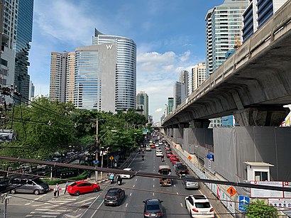
ถนน สาทรเหนือ Address: ถนน สาทรเหนือ เขต บางรัก กรุงเทพมหานคร ประเทศไทย street in สาทร
Places Near ถนน สาทรเหนือ
How to get to popular places in Bangkok with public transit
Get around สาทร by public transit!
Traveling around สาทร has never been so easy. See step by step directions as you travel to any attraction, street or major public transit station. View bus and train schedules, arrival times, service alerts and detailed routes on a map, so you know exactly how to get to anywhere in สาทร.
When traveling to any destination around สาทร use Moovit's Live Directions with Get Off Notifications to know exactly where and how far to walk, how long to wait for your line, and how many stops are left. Moovit will alert you when it's time to get off — no need to constantly re-check whether yours is the next stop.
Wondering how to use public transit in สาทร or how to pay for public transit in สาทร? Moovit public transit app can help you navigate your way with public transit easily, and at minimum cost. It includes public transit fees, ticket prices, and costs. Looking for a map of สาทร public transit lines? Moovit public transit app shows all public transit maps in สาทร with all Bus, Train, Metro, SkyTrain and Ferry routes and stops on an interactive map.
Bangkok has 5 transit type(s), including: Bus, Train, Metro, SkyTrain and Ferry, operated by several transit agencies, including บีทีเอส BTS, MRT, ไทย สมายล์ บัส;Thai Smile Bus, ขสมก. BMTA, รถไฟฟ้ารฟท. SRTET, รถประจำทาง Transport Bus, บีอาร์ที BRT, เรือคลองโดยสาร Canal Ferry, เรือข้ามฟาก River Ferry, รถสองแถว Songthaew, จุฬาป๊อบบัส Chula Pop Bus, ขสมก BMTA, ขสมก. (BMTA), รถมินิบัส Minibus and รฟท. SRT