Directions to ถนน สาทรใต้ with public transportation
The following transit lines have routes that pass near ถนน สาทรใต้
How to get to ถนน สาทรใต้ by bus?
Click on the bus route to see step by step directions with maps, line arrival times and updated time schedules.
How to get to ถนน สาทรใต้ by train?
Click on the train route to see step by step directions with maps, line arrival times and updated time schedules.
How to get to ถนน สาทรใต้ by metro?
Click on the metro route to see step by step directions with maps, line arrival times and updated time schedules.
How to get to ถนน สาทรใต้ by SkyTrain?
Click on the SkyTrain route to see step by step directions with maps, line arrival times and updated time schedules.
How to get to ถนน สาทรใต้ by ferry?
Click on the ferry route to see step by step directions with maps, line arrival times and updated time schedules.
Bus stops near ถนน สาทรใต้
- จุดขึ้นลง;Visual Stop, 3 min walk,
- แยกเฉลิมพันธุ์;Chaloem Phan Junction, 3 min walk,
- ตรงข้ามซอยเจริญกรุง 50;Opposite Charoen Krung 50, 4 min walk,
- ตรงข้ามวัดยานนาวา WAT Yan Nawa, 4 min walk,
- ตรงข้ามวัดยานนาวา;Wat Yannawa (Opposite), 4 min walk,
- ตรงข้ามโรบินสันบางรัก;Opposite Robinson Bangrak, 5 min walk,
- ตรงข้ามโรบินสันบางรัก Opp Robinson Bangrak, 5 min walk,
- วัดยานนาวา;Wat Yannawa, 5 min walk,
- โรบินสันบางรัก;Robinson Bang Rak, 6 min walk,
- มทร.กรุงเทพ วิทยาเขตพระนครใต้;Rmutt South Bangkok Campus Krugthep, 6 min walk,
Ferry stations near ถนน สาทรใต้
- ท่าโอเรียนเต็ล (ข้ามฟาก);Oriental Pier (Ferry), 14 min walk,
- ท่าเรือสาทร;Sathon (Taksin) Pier, 26 min walk,
- ท่าเรือสาทร (ข้ามฟาก);Sathon Pier (Ferry), 27 min walk,
Bus lines to ถนน สาทรใต้
- 1279, ถนนจันทน์;Chan Road,
- 1256, วัดช่องลม;Chong Lom Temple,
- 4-3 (17), พระประแดง;Phra Pradaeng,
- 3-45 (77), เซ็นทรัลพระราม 3;Central Rama 3,
- 1, ถนนตก;Thanon Tok,
- 1, หน่วยบัญชาการรักษาดินแดน,
- 1, วัดโพธิ์ท่าเตียน Tha Tian,
- 15, Brt ราชพฤกษ์ Rachapruek Brt Station,
- 17, อนุสาวรีย์ชัยสมรภูมิ (เกาะพญาไท),
- 17 (ปอ.) (AC), ท่าจอดรถสาย 37,ซอยราษฎร์บูรณะ 39 Soi Rat Burana 39,
- 75, แยกหัวลำโพง Hua Lamphong Intersection,
- 4-68, ถนนตก;Thanon Tok,
- 3-35 (1), ท่าเตียน;Tha Tien,
- 4-2 (15R), สถานีรถไฟฟ้าราชพฤกษ์ วนขวา;Brt Ratchapruek R,
- 4-8 (35), เคหะธนบุรี;Thonburi Housing,
- 4-13 (75), หัวลำโพง;Hua Lamphong,
- ต.132, หมู่บ้านเศรษฐกิจ;Setthakit Village,
- 77, อู่สาธุประดิษฐ์ Sathu Pradit Bus Depot,
- 77, นิคมรถไฟ กม.11 Nikhom Rotfai Km.11,
- 77 (ปอ.) (AC), อู่สาธุประดิษฐ์ Sathu Pradit Bus Depot,
What are the closest stations to ถนน สาทรใต้?
The closest stations to ถนน สาทรใต้ are:
- จุดขึ้นลง;Visual Stop is 154 meters away, 3 min walk.
- แยกเฉลิมพันธุ์;Chaloem Phan Junction is 206 meters away, 3 min walk.
- ตรงข้ามซอยเจริญกรุง 50;Opposite Charoen Krung 50 is 224 meters away, 4 min walk.
- ตรงข้ามวัดยานนาวา WAT Yan Nawa is 247 meters away, 4 min walk.
- ตรงข้ามวัดยานนาวา;Wat Yannawa (Opposite) is 257 meters away, 4 min walk.
- ตรงข้ามโรบินสันบางรัก;Opposite Robinson Bangrak is 298 meters away, 5 min walk.
- ตรงข้ามโรบินสันบางรัก Opp Robinson Bangrak is 303 meters away, 5 min walk.
- วัดยานนาวา;Wat Yannawa is 333 meters away, 5 min walk.
- โรบินสันบางรัก;Robinson Bang Rak is 390 meters away, 6 min walk.
- มทร.กรุงเทพ วิทยาเขตพระนครใต้;Rmutt South Bangkok Campus Krugthep is 432 meters away, 6 min walk.
- ท่าโอเรียนเต็ล (ข้ามฟาก);Oriental Pier (Ferry) is 1056 meters away, 14 min walk.
- ท่าเรือสาทร;Sathon (Taksin) Pier is 1964 meters away, 26 min walk.
- ท่าเรือสาทร (ข้ามฟาก);Sathon Pier (Ferry) is 2038 meters away, 27 min walk.
Which bus lines stop near ถนน สาทรใต้?
These bus lines stop near ถนน สาทรใต้: 1, 15, 3-45 (77), 4-2 (15R), 75, 77.
Which train lines stop near ถนน สาทรใต้?
These train lines stop near ถนน สาทรใต้: 276, 278.
Which metro line stops near ถนน สาทรใต้?
BLUE (บางหว้า (วันเสาร์);Bang Wa (Saturday))
Which SkyTrain line stops near ถนน สาทรใต้?
SILOM (บางหว้า;Bang Wa)
Which ferry line stops near ถนน สาทรใต้?
URBAN LINE (สาทร;Sathon)
What’s the nearest bus station to ถนน สาทรใต้?
The nearest bus stations to ถนน สาทรใต้ are จุดขึ้นลง;Visual Stop and แยกเฉลิมพันธุ์;Chaloem Phan Junction. The closest one is a 3 min walk away.
What’s the nearest ferry station to ถนน สาทรใต้?
The nearest ferry station to ถนน สาทรใต้ is ท่าโอเรียนเต็ล (ข้ามฟาก);Oriental Pier (Ferry). It’s a 14 min walk away.
What time is the first bus to ถนน สาทรใต้?
The 77 is the first bus that goes to ถนน สาทรใต้. It stops nearby at 3:13 AM.
What time is the last bus to ถนน สาทรใต้?
The 75 is the last bus that goes to ถนน สาทรใต้. It stops nearby at 11:31 PM.
What time is the first ferry to ถนน สาทรใต้?
The เรือข้ามฟาก is the first ferry that goes to ถนน สาทรใต้. It stops nearby at 5:00 AM.
What time is the last ferry to ถนน สาทรใต้?
The CITY LINE is the last ferry that goes to ถนน สาทรใต้. It stops nearby at 12:12 AM.
See ถนน สาทรใต้ on the map
Public Transportation to ถนน สาทรใต้
Wondering how to get to ถนน สาทรใต้? Moovit helps you find the best way to get to ถนน สาทรใต้ with step-by-step directions from the nearest public transit station.
Moovit provides free maps and live directions to help you navigate through your city. View schedules, routes, timetables, and find out how long does it take to get to ถนน สาทรใต้ in real time.
Looking for the nearest stop or station to ถนน สาทรใต้? Check out this list of stops closest to your destination: จุดขึ้นลง;Visual Stop; แยกเฉลิมพันธุ์;Chaloem Phan Junction; ตรงข้ามซอยเจริญกรุง 50;Opposite Charoen Krung 50; ตรงข้ามวัดยานนาวา WAT Yan Nawa; ตรงข้ามวัดยานนาวา;Wat Yannawa (Opposite); ตรงข้ามโรบินสันบางรัก;Opposite Robinson Bangrak; ตรงข้ามโรบินสันบางรัก Opp Robinson Bangrak; วัดยานนาวา;Wat Yannawa; โรบินสันบางรัก;Robinson Bang Rak; มทร.กรุงเทพ วิทยาเขตพระนครใต้;Rmutt South Bangkok Campus Krugthep; ท่าโอเรียนเต็ล (ข้ามฟาก);Oriental Pier (Ferry); ท่าเรือสาทร;Sathon (Taksin) Pier; ท่าเรือสาทร (ข้ามฟาก);Sathon Pier (Ferry).
Bus: 1, 15, 3-45 (77), 4-2 (15R), 75, 77, 1279, 1256, 4-3 (17), 17, 17 (ปอ.) (AC).Train: 276, 278.Metro: BLUE.SkyTrain: SILOM.Ferry: URBAN LINE, เรือข้ามฟาก, เรือด่วนธงส้ม, เรือประจำทาง (ไม่มีธง).
Want to see if there’s another route that gets you there at an earlier time? Moovit helps you find alternative routes or times. Get directions from and directions to ถนน สาทรใต้ easily from the Moovit App or Website.
We make riding to ถนน สาทรใต้ easy, which is why over 1.5 million users, including users in สาทร, trust Moovit as the best app for public transit. You don’t need to download an individual bus app or train app, Moovit is your all-in-one transit app that helps you find the best bus time or train time available.
For information on prices of bus, SkyTrain, metro, ferry and train, costs and ride fares to ถนน สาทรใต้, please check the Moovit app.
Use the app to navigate to popular places including to the airport, hospital, stadium, grocery store, mall, coffee shop, school, college, and university.
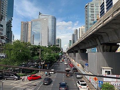
ถนน สาทรใต้ Address: S Thailand, ถนน สาทรใต้ แขวง ยานนาวา เขต สาทร กรุงเทพมหานคร 10120 ประเทศไทย street in สาทร
Places Near ถนน สาทรใต้
How to get to popular places in Bangkok with public transit
Get around สาทร by public transit!
Traveling around สาทร has never been so easy. See step by step directions as you travel to any attraction, street or major public transit station. View bus and train schedules, arrival times, service alerts and detailed routes on a map, so you know exactly how to get to anywhere in สาทร.
When traveling to any destination around สาทร use Moovit's Live Directions with Get Off Notifications to know exactly where and how far to walk, how long to wait for your line, and how many stops are left. Moovit will alert you when it's time to get off — no need to constantly re-check whether yours is the next stop.
Wondering how to use public transit in สาทร or how to pay for public transit in สาทร? Moovit public transit app can help you navigate your way with public transit easily, and at minimum cost. It includes public transit fees, ticket prices, and costs. Looking for a map of สาทร public transit lines? Moovit public transit app shows all public transit maps in สาทร with all Bus, Train, Metro, SkyTrain and Ferry routes and stops on an interactive map.
Bangkok has 5 transit type(s), including: Bus, Train, Metro, SkyTrain and Ferry, operated by several transit agencies, including บีทีเอส BTS, MRT, ไทย สมายล์ บัส;Thai Smile Bus, ขสมก. BMTA, รถไฟฟ้ารฟท. SRTET, รถประจำทาง Transport Bus, บีอาร์ที BRT, เรือคลองโดยสาร Canal Ferry, เรือข้ามฟาก River Ferry, รถสองแถว Songthaew, จุฬาป๊อบบัส Chula Pop Bus, ขสมก BMTA, ขสมก. (BMTA), รถมินิบัส Minibus and รฟท. SRT