Directions to ท่าน้ํานนท์ (เมืองนนทบุรี) with public transportation
The following transit lines have routes that pass near ท่าน้ํานนท์
How to get to ท่าน้ํานนท์ by bus?
Click on the bus route to see step by step directions with maps, line arrival times and updated time schedules.
How to get to ท่าน้ํานนท์ by metro?
Click on the metro route to see step by step directions with maps, line arrival times and updated time schedules.
How to get to ท่าน้ํานนท์ by ferry?
Click on the ferry route to see step by step directions with maps, line arrival times and updated time schedules.
Bus stops near ท่าน้ํานนท์ in เมืองนนทบุรี
- จุดขึ้นลง;Visual Stop, 2 min walk,
- ตลาดนนทบุรี;Nonthaburi Market, 3 min walk,
- ตลาดนนท์ Talat Non, 3 min walk,
- เมเจอร์นนทบุรี;Major Nontaburi, 4 min walk,
- ซอย ประชาราษฎ์ 13 Soi Pracha Rat 13, 7 min walk,
- ซอยประชาราษฎร์ 22;Pracharat 22, 7 min walk,
Ferry stations near ท่าน้ํานนท์ in เมืองนนทบุรี
- ท่าเรือสะพานพระราม 5;Rama 5 Bridge Pier, 22 min walk,
- ท่าเรือเทศบาลบางศรีเมือง (ข้ามฟาก);Bang Sri Mueang Municipality Pier (Ferry), 40 min walk,
- ท่าเรือนนทบุรี (ข้ามฟาก);Nonthaburi Pier (Ferry), 50 min walk,
Bus lines to ท่าน้ํานนท์ in เมืองนนทบุรี
- 2, ซอยพิบูลสงคราม 21;Soi Pibulsonggram 21,
- ต.12, เซ็นทรัลลาดพร้าว - ท่าน้ำนนทบุรี;Central Plaza Ladprao Department Store - Nonthaburi Pier,
- ต.12, ช่วงสวนจตุจักร - ถนนวงศ์สว่าง - ท่าน้ำนนทบุรี;Chatuchak Park - Wongsawang Road - Nonthaburi Pier,
- ต.80, มหาวิทยาลัยรามคำแหง - ท่าน้ำนนทบุรี;Ramkhamhaeng University - Nonthaburi Pier,
- 203, ท่าอิฐ - สนามหลวง;Tha It - Sanamluang,
- 367, รังสิต - นนทบุรี;Rangsit - Nonthaburi,
- 4-67, สถานีรถไฟศาลายา - กระทรวงพาณิชย์;Sala Ya Railway Station - Ministry of Commerce,
- 1024, (วนซ้าย)วงกลมบางบัวทอง - สะพานพระราม 5 (สะพานวัดนครอินทร์) - บริเวณอำเภอบางใหญ่;Bang Bua Thong - Rama 5 Bridge - Bang Yai District,
- 1025, วัดปากน้ำ - ปากเกร็ด;Paknam Temple - Pak Kret,
- 2-4 (30), วัดปากน้ำนนทบุรี - สายใต้ (ปิ่นเกล้า);Wat Paknam Nonthaburi - Southern Bus (Pinklao),
- 2-5 (32), ปากเกร็ด - วัดโพธิ์;Pak Kret - Wat Pho,
- 2-6 (33), ปทุมธานี - เทเวศร์;Pathumthani - Thewet,
- 6162, วัดชลอ - ท่าน้ำนนทบุรี;Chalo Temple - Nonthaburi Pier,
- 6262, ปากทางวัดรวกบางสีทอง - ท่าน้ำนนทบุรี;Ruak Bang Si Thong Temple - Nonthaburi Pier,
- 1-27 (90), BTS หมอชิต - ปทุมธานี;BTS Mochit - Pathumthani,
- 2-10E (63 ทางด่วน), นครอินทร์ - ประตูน้ำ (ทางด่วน);Nakorn In - Pratunam Market (Expressway),
- 2-11 (64), กระทรวงสาธารณสุข - สนามหลวง;Ministry of Public Health - Sanamluang,
- 2-15 (97), กระทรวงสาธารณสุข - รพ.สงฆ์;Ministry of Public Health - priest hospital,
- 1-21 (114), รังสิต - นครอินทร์; Rangsit - Nakhon In,
- 1-34 (543ก), นนทบุรี - บางเขน;Nonthaburi - Bangkhen,
What are the closest stations to ท่าน้ํานนท์?
The closest stations to ท่าน้ํานนท์ are:
- จุดขึ้นลง;Visual Stop is 143 meters away, 2 min walk.
- ตลาดนนทบุรี;Nonthaburi Market is 150 meters away, 3 min walk.
- ตลาดนนท์ Talat Non is 175 meters away, 3 min walk.
- เมเจอร์นนทบุรี;Major Nontaburi is 230 meters away, 4 min walk.
- ซอย ประชาราษฎ์ 13 Soi Pracha Rat 13 is 508 meters away, 7 min walk.
- ซอยประชาราษฎร์ 22;Pracharat 22 is 508 meters away, 7 min walk.
- ท่าเรือสะพานพระราม 5;Rama 5 Bridge Pier is 1673 meters away, 22 min walk.
- ท่าเรือเทศบาลบางศรีเมือง (ข้ามฟาก);Bang Sri Mueang Municipality Pier (Ferry) is 3079 meters away, 40 min walk.
- ท่าเรือนนทบุรี (ข้ามฟาก);Nonthaburi Pier (Ferry) is 3839 meters away, 50 min walk.
Which bus lines stop near ท่าน้ํานนท์?
These bus lines stop near ท่าน้ํานนท์: 1-21 (114), 117, 2-22 (175), 203, 32, ต.80.
Which metro line stops near ท่าน้ํานนท์?
PURPLE (คลองบางไผ่;Khlong Bang Phai)
Which ferry line stops near ท่าน้ํานนท์?
URBAN LINE (พระปิ่นเกล้า;Phra Pinklao)
What’s the nearest bus station to ท่าน้ํานนท์ in เมืองนนทบุรี?
The nearest bus station to ท่าน้ํานนท์ in เมืองนนทบุรี is จุดขึ้นลง;Visual Stop. It’s a 2 min walk away.
What’s the nearest ferry station to ท่าน้ํานนท์ in เมืองนนทบุรี?
The nearest ferry station to ท่าน้ํานนท์ in เมืองนนทบุรี is ท่าเรือสะพานพระราม 5;Rama 5 Bridge Pier. It’s a 22 min walk away.
What time is the first bus to ท่าน้ํานนท์ in เมืองนนทบุรี?
The 63 is the first bus that goes to ท่าน้ํานนท์ in เมืองนนทบุรี. It stops nearby at 3:00 AM.
What time is the last bus to ท่าน้ํานนท์ in เมืองนนทบุรี?
The 2-10E (63 ทางด่วน) is the last bus that goes to ท่าน้ํานนท์ in เมืองนนทบุรี. It stops nearby at 3:34 AM.
What time is the first ferry to ท่าน้ํานนท์ in เมืองนนทบุรี?
The เรือข้ามฟาก is the first ferry that goes to ท่าน้ํานนท์ in เมืองนนทบุรี. It stops nearby at 5:00 AM.
What time is the last ferry to ท่าน้ํานนท์ in เมืองนนทบุรี?
The เรือด่วนธงส้ม is the last ferry that goes to ท่าน้ํานนท์ in เมืองนนทบุรี. It stops nearby at 8:58 PM.
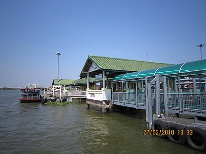
See ท่าน้ํานนท์, เมืองนนทบุรี, on the map
Public Transit to ท่าน้ํานนท์ in เมืองนนทบุรี
Wondering how to get to ท่าน้ํานนท์ in เมืองนนทบุรี? Moovit helps you find the best way to get to ท่าน้ํานนท์ with step-by-step directions from the nearest public transit station.
Moovit provides free maps and live directions to help you navigate through your city. View schedules, routes, timetables, and find out how long does it take to get to ท่าน้ํานนท์ in real time.
Looking for the nearest stop or station to ท่าน้ํานนท์? Check out this list of stops closest to your destination: จุดขึ้นลง;Visual Stop; ตลาดนนทบุรี;Nonthaburi Market; ตลาดนนท์ Talat Non; เมเจอร์นนทบุรี;Major Nontaburi; ซอย ประชาราษฎ์ 13 Soi Pracha Rat 13; ซอยประชาราษฎร์ 22;Pracharat 22; ท่าเรือสะพานพระราม 5;Rama 5 Bridge Pier; ท่าเรือเทศบาลบางศรีเมือง (ข้ามฟาก);Bang Sri Mueang Municipality Pier (Ferry); ท่าเรือนนทบุรี (ข้ามฟาก);Nonthaburi Pier (Ferry).
Bus: 1-21 (114), 117, 2-22 (175), 203, 32, ต.80, 2, ต.12, ต.12, 367, 63 (ปอ.) (AC), 65, 97, 97 (ปอ.) (AC), ต.12, ต.12, 63 เดิม, 1024, 63, 1103.Metro: PURPLE.Ferry: URBAN LINE, เรือด่วนธงส้ม, เรือด่วนธงเหลือง (กลางวัน), เรือประจำทาง (ไม่มีธง).
Want to see if there’s another route that gets you there at an earlier time? Moovit helps you find alternative routes or times. Get directions from and directions to ท่าน้ํานนท์ easily from the Moovit App or Website.
We make riding to ท่าน้ํานนท์ easy, which is why over 1.5 million users, including users in เมืองนนทบุรี, trust Moovit as the best app for public transit. You don’t need to download an individual bus app or train app, Moovit is your all-in-one transit app that helps you find the best bus time or train time available.
For information on prices of bus, metro and ferry, costs and ride fares to ท่าน้ํานนท์, please check the Moovit app.
Use the app to navigate to popular places including to the airport, hospital, stadium, grocery store, mall, coffee shop, school, college, and university.
ท่าน้ํานนท์ Address: ซอย พิบูลสงคราม 21, สวนใหญ่, นนทบุรี, นนทบุรี 11000 street in เมืองนนทบุรี
Places Near ท่าน้ํานนท์ (เมืองนนทบุรี)
How to get to popular places in Bangkok with public transit
Get around เมืองนนทบุรี by public transit!
Traveling around เมืองนนทบุรี has never been so easy. See step by step directions as you travel to any attraction, street or major public transit station. View bus and train schedules, arrival times, service alerts and detailed routes on a map, so you know exactly how to get to anywhere in เมืองนนทบุรี.
When traveling to any destination around เมืองนนทบุรี use Moovit's Live Directions with Get Off Notifications to know exactly where and how far to walk, how long to wait for your line, and how many stops are left. Moovit will alert you when it's time to get off — no need to constantly re-check whether yours is the next stop.
Wondering how to use public transit in เมืองนนทบุรี or how to pay for public transit in เมืองนนทบุรี? Moovit public transit app can help you navigate your way with public transit easily, and at minimum cost. It includes public transit fees, ticket prices, and costs. Looking for a map of เมืองนนทบุรี public transit lines? Moovit public transit app shows all public transit maps in เมืองนนทบุรี with all Bus, Train, Metro, SkyTrain and Ferry routes and stops on an interactive map.
Bangkok has 5 transit type(s), including: Bus, Train, Metro, SkyTrain and Ferry, operated by several transit agencies, including บีทีเอส BTS, MRT, ไทย สมายล์ บัส;Thai Smile Bus, ขสมก. BMTA, รถไฟฟ้ารฟท. SRTET, รถประจำทาง Transport Bus, บีอาร์ที BRT, เรือคลองโดยสาร Canal Ferry, เรือข้ามฟาก River Ferry, รถสองแถว Songthaew, จุฬาป๊อบบัส Chula Pop Bus, ขสมก BMTA, ขสมก. (BMTA), รถมินิบัส Minibus and รฟท. SRT