Directions to ท่าวังหลัง (พระนคร) with public transportation
The following transit lines have routes that pass near ท่าวังหลัง
How to get to ท่าวังหลัง by bus?
Click on the bus route to see step by step directions with maps, line arrival times and updated time schedules.
How to get to ท่าวังหลัง by train?
Click on the train route to see step by step directions with maps, line arrival times and updated time schedules.
How to get to ท่าวังหลัง by metro?
Click on the metro route to see step by step directions with maps, line arrival times and updated time schedules.
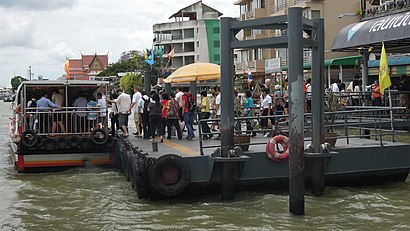
How to get to ท่าวังหลัง by ferry?
Click on the ferry route to see step by step directions with maps, line arrival times and updated time schedules.
Bus stops near ท่าวังหลัง in พระนคร
- วัดวิเศษการ WAT Wiset Kan, 7 min walk,
- โรงเรียนสทราวดี(ซอยศาลาต้นจันทร์), 8 min walk,
- วัดระฆังโฆสิตาราม;Wat Rakungkositaram, 9 min walk,
- ตรงข้ามวัดระฆังโฆสิตาราม;Wat Rakungkositaram (Opposite), 9 min walk,
- รพ.ศิริราช;Siriraj Hospital, 11 min walk,
Ferry station near ท่าวังหลัง in พระนคร
- ท่าเรือรถไฟ (ข้ามฟาก);Thonburi Railway Station Pier (Ferry), 28 min walk,
Bus lines to ท่าวังหลัง in พระนคร
- 91, สนามหลวง;Sanamluang,
- 91ก, สนามหลวง 2;Sanamluang 2,
- 4-35R, เทเวศร์ (วนขวา);Thewet,
- 4-53 (149), พุทธมณฑลสาย 2;Phutthamonthon Sai 2,
- 4-60 (509), หมู่บ้านเศรษฐกิจ;Setthakit Village,
- 91 (ปอ.) (AC), ท่าปล่อยรถ สนามหลวง (53l 59 503),
- 208, สน.ตลิ่งชัน Talingchan Police Station,
- 4-41 (57R), ธนบุรี;Thonburi,
- 4-41 (57L), ตลิ่งชัน (วนซ้าย);Talingchan,
- 4-45 (81), อ้อมน้อย;Om Noi,
What are the closest stations to ท่าวังหลัง?
The closest stations to ท่าวังหลัง are:
- วัดวิเศษการ WAT Wiset Kan is 498 meters away, 7 min walk.
- โรงเรียนสทราวดี(ซอยศาลาต้นจันทร์) is 559 meters away, 8 min walk.
- วัดระฆังโฆสิตาราม;Wat Rakungkositaram is 673 meters away, 9 min walk.
- ตรงข้ามวัดระฆังโฆสิตาราม;Wat Rakungkositaram (Opposite) is 680 meters away, 9 min walk.
- รพ.ศิริราช;Siriraj Hospital is 797 meters away, 11 min walk.
- ท่าเรือรถไฟ (ข้ามฟาก);Thonburi Railway Station Pier (Ferry) is 2172 meters away, 28 min walk.
Which bus lines stop near ท่าวังหลัง?
These bus lines stop near ท่าวังหลัง: 4-41 (57R), 4-53 (149), 4-60 (509), 91, 91 (ปอ.) (AC).
Which train line stops near ท่าวังหลัง?
252 (ธนบุรี;Thon Buri)
Which metro line stops near ท่าวังหลัง?
BLUE (ท่าพระ (วันเสาร์);Tha Phra (Saturday))
Which ferry lines stop near ท่าวังหลัง?
These ferry lines stop near ท่าวังหลัง: CITY LINE, URBAN LINE.
What’s the nearest bus station to ท่าวังหลัง in พระนคร?
The nearest bus station to ท่าวังหลัง in พระนคร is วัดวิเศษการ WAT Wiset Kan. It’s a 7 min walk away.
What’s the nearest ferry station to ท่าวังหลัง in พระนคร?
The nearest ferry station to ท่าวังหลัง in พระนคร is ท่าเรือรถไฟ (ข้ามฟาก);Thonburi Railway Station Pier (Ferry). It’s a 28 min walk away.
What time is the first bus to ท่าวังหลัง in พระนคร?
The 91 (ปอ.) (AC) is the first bus that goes to ท่าวังหลัง in พระนคร. It stops nearby at 5:06 AM.
What time is the last bus to ท่าวังหลัง in พระนคร?
The 4-45 (81) is the last bus that goes to ท่าวังหลัง in พระนคร. It stops nearby at 11:47 PM.
What time is the first ferry to ท่าวังหลัง in พระนคร?
The เรือข้ามฟาก is the first ferry that goes to ท่าวังหลัง in พระนคร. It stops nearby at 5:00 AM.
What time is the last ferry to ท่าวังหลัง in พระนคร?
The เรือข้ามฟาก is the last ferry that goes to ท่าวังหลัง in พระนคร. It stops nearby at 7:35 PM.
See ท่าวังหลัง, พระนคร, on the map
Public Transit to ท่าวังหลัง in พระนคร
Wondering how to get to ท่าวังหลัง in พระนคร? Moovit helps you find the best way to get to ท่าวังหลัง with step-by-step directions from the nearest public transit station.
Moovit provides free maps and live directions to help you navigate through your city. View schedules, routes, timetables, and find out how long does it take to get to ท่าวังหลัง in real time.
Looking for the nearest stop or station to ท่าวังหลัง? Check out this list of stops closest to your destination: วัดวิเศษการ WAT Wiset Kan; โรงเรียนสทราวดี(ซอยศาลาต้นจันทร์); วัดระฆังโฆสิตาราม;Wat Rakungkositaram; ตรงข้ามวัดระฆังโฆสิตาราม;Wat Rakungkositaram (Opposite); รพ.ศิริราช;Siriraj Hospital; ท่าเรือรถไฟ (ข้ามฟาก);Thonburi Railway Station Pier (Ferry).
Bus: 4-41 (57R), 4-53 (149), 4-60 (509), 91, 91 (ปอ.) (AC), 91ก, 4-35R, 208, 4-41 (57L), 4-45 (81).Train: 252.Metro: BLUE.Ferry: CITY LINE, URBAN LINE, เรือข้ามฟาก.
Want to see if there’s another route that gets you there at an earlier time? Moovit helps you find alternative routes or times. Get directions from and directions to ท่าวังหลัง easily from the Moovit App or Website.
We make riding to ท่าวังหลัง easy, which is why over 1.5 million users, including users in พระนคร, trust Moovit as the best app for public transit. You don’t need to download an individual bus app or train app, Moovit is your all-in-one transit app that helps you find the best bus time or train time available.
For information on prices of bus, ferry, metro and train, costs and ride fares to ท่าวังหลัง, please check the Moovit app.
Use the app to navigate to popular places including to the airport, hospital, stadium, grocery store, mall, coffee shop, school, college, and university.
ท่าวังหลัง Address: ถนนวังหล้ง street in พระนคร
Places Near ท่าวังหลัง (พระนคร)
How to get to popular places in Bangkok with public transit
Get around พระนคร by public transit!
Traveling around พระนคร has never been so easy. See step by step directions as you travel to any attraction, street or major public transit station. View bus and train schedules, arrival times, service alerts and detailed routes on a map, so you know exactly how to get to anywhere in พระนคร.
When traveling to any destination around พระนคร use Moovit's Live Directions with Get Off Notifications to know exactly where and how far to walk, how long to wait for your line, and how many stops are left. Moovit will alert you when it's time to get off — no need to constantly re-check whether yours is the next stop.
Wondering how to use public transit in พระนคร or how to pay for public transit in พระนคร? Moovit public transit app can help you navigate your way with public transit easily, and at minimum cost. It includes public transit fees, ticket prices, and costs. Looking for a map of พระนคร public transit lines? Moovit public transit app shows all public transit maps in พระนคร with all Bus, Train, Metro, SkyTrain and Ferry routes and stops on an interactive map.
Bangkok has 5 transit type(s), including: Bus, Train, Metro, SkyTrain and Ferry, operated by several transit agencies, including บีทีเอส BTS, MRT, ไทย สมายล์ บัส;Thai Smile Bus, ขสมก. BMTA, รถไฟฟ้ารฟท. SRTET, รถประจำทาง Transport Bus, บีอาร์ที BRT, เรือคลองโดยสาร Canal Ferry, เรือข้ามฟาก River Ferry, รถสองแถว Songthaew, จุฬาป๊อบบัส Chula Pop Bus, ขสมก BMTA, ขสมก. (BMTA), รถมินิบัส Minibus and รฟท. SRT