Directions to วังเทวะเวสม์ (พระนคร) with public transportation
The following transit lines have routes that pass near วังเทวะเวสม์
How to get to วังเทวะเวสม์ by bus?
Click on the bus route to see step by step directions with maps, line arrival times and updated time schedules.
How to get to วังเทวะเวสม์ by train?
Click on the train route to see step by step directions with maps, line arrival times and updated time schedules.
How to get to วังเทวะเวสม์ by metro?
Click on the metro route to see step by step directions with maps, line arrival times and updated time schedules.
How to get to วังเทวะเวสม์ by ferry?
Click on the ferry route to see step by step directions with maps, line arrival times and updated time schedules.
Bus stops near วังเทวะเวสม์ in พระนคร
- ธนาคารแห่งประเทศไทย;The Bank Of Thailand, 4 min walk,
- ตลาดรวมยาง;Ruam Yang Market, 5 min walk,
- ตลาดรวมยาง(ถนนสามเสน) Rubber Market (Samsen Road), 5 min walk,
- แยกเทเวศร์ Thewet Intersection, 5 min walk,
- ตรงข้าม มทร.พระนครศูนย์เทเวศร์ [Opp.] Rmutp Thewet, 7 min walk,
Ferry stations near วังเทวะเวสม์ in พระนคร
- ท่าเรือตลาดเทวราช;Dhevaraj Market Pier, 10 min walk,
- ท่าเรือเทเวศร์ (ข้ามฟาก);Thewet Pier (Ferry), 12 min walk,
- ท่าเรือเทเวศน์;Thewej Pier, 12 min walk,
Bus lines to วังเทวะเวสม์ in พระนคร
- 4-35R, เทเวศร์ (วนขวา);Thewet,
- 4-69, บรมราชชนนี;Borommaratchachonnani,
- 2-37 (3), คลองสาน;Klongsan,
- 2-4 (30), สายใต้ (ปิ่นเกล้า);Southern Bus (Pinklao),
- 2-5 (32), วัดโพธิ์;Wat Pho,
- 2-9 (53R), สนามหลวง;Sanamluang,
- 4-37 (9), สถานีรถไฟสามเสน;Samsen Station,
- 2-43 (49), กรุงเทพอภิวัฒน์;Krung Thep Aphiwat,
- 4-35L, เทเวศร์ (วนซ้าย);Thewes,
- 2-9 (53L), เทเวศร์ ;Thewet,
- 4-11 (43), รร.ศึกษานารีวิทยา;Suksanareewittaya School,
- 2-25 (516), ม.บัวทองเคหะ;Buathong Keha Village,
- 53, [เปลี่ยนรถ] ท่าปล่อยรถ สนามหลวง,
- 3, Btsกรุงธนบุรี(ทางออก3) Bts Krungthonburi (Exit 3),
- 3 (ปอ.) (AC), อู่หมอชิต 2 Mochit 2 Bus Depot,
- 32, พระอาทิตย์ Phra Athit,
- 49, สถานีรถไฟหัวลำโพง Hua Lamphong,
- 49 (ปอ.) (AC), อู่หมอชิต 2 Mochit 2 Bus Depot,
- 65, ตรงข้ามโรงเรียนสตรีนนทบุรี-วัดปากน้ำ,
- 516 (ปอ.) (AC), อู่เคหะบางบัวทอง,
What are the closest stations to วังเทวะเวสม์?
The closest stations to วังเทวะเวสม์ are:
- ธนาคารแห่งประเทศไทย;The Bank Of Thailand is 278 meters away, 4 min walk.
- ตลาดรวมยาง;Ruam Yang Market is 308 meters away, 5 min walk.
- ตลาดรวมยาง(ถนนสามเสน) Rubber Market (Samsen Road) is 311 meters away, 5 min walk.
- แยกเทเวศร์ Thewet Intersection is 319 meters away, 5 min walk.
- ตรงข้าม มทร.พระนครศูนย์เทเวศร์ [Opp.] Rmutp Thewet is 511 meters away, 7 min walk.
- ท่าเรือตลาดเทวราช;Dhevaraj Market Pier is 690 meters away, 10 min walk.
- ท่าเรือเทเวศร์ (ข้ามฟาก);Thewet Pier (Ferry) is 884 meters away, 12 min walk.
- ท่าเรือเทเวศน์;Thewej Pier is 892 meters away, 12 min walk.
Which bus lines stop near วังเทวะเวสม์?
These bus lines stop near วังเทวะเวสม์: 23, 32, 4-37 (9), 4-69, 49, 65.
Which train lines stop near วังเทวะเวสม์?
These train lines stop near วังเทวะเวสม์: 318, 388.
Which metro line stops near วังเทวะเวสม์?
BLUE (เตาปูน (วันเสาร์);Tao Poon (Saturday))
Which ferry lines stop near วังเทวะเวสม์?
These ferry lines stop near วังเทวะเวสม์: URBAN LINE, เรือคลองแสนแสบ.
What’s the nearest bus station to วังเทวะเวสม์ in พระนคร?
The nearest bus station to วังเทวะเวสม์ in พระนคร is ธนาคารแห่งประเทศไทย;The Bank Of Thailand. It’s a 4 min walk away.
What’s the nearest ferry station to วังเทวะเวสม์ in พระนคร?
The nearest ferry station to วังเทวะเวสม์ in พระนคร is ท่าเรือตลาดเทวราช;Dhevaraj Market Pier. It’s a 10 min walk away.
What time is the first bus to วังเทวะเวสม์ in พระนคร?
The 3 is the first bus that goes to วังเทวะเวสม์ in พระนคร. It stops nearby at 3:00 AM.
What time is the last bus to วังเทวะเวสม์ in พระนคร?
The 3 is the last bus that goes to วังเทวะเวสม์ in พระนคร. It stops nearby at 3:09 AM.
What time is the first ferry to วังเทวะเวสม์ in พระนคร?
The เรือข้ามฟาก is the first ferry that goes to วังเทวะเวสม์ in พระนคร. It stops nearby at 5:00 AM.
What time is the last ferry to วังเทวะเวสม์ in พระนคร?
The เรือข้ามฟาก is the last ferry that goes to วังเทวะเวสม์ in พระนคร. It stops nearby at 7:51 PM.
See วังเทวะเวสม์, พระนคร, on the map
Public Transit to วังเทวะเวสม์ in พระนคร
Wondering how to get to วังเทวะเวสม์ in พระนคร? Moovit helps you find the best way to get to วังเทวะเวสม์ with step-by-step directions from the nearest public transit station.
Moovit provides free maps and live directions to help you navigate through your city. View schedules, routes, timetables, and find out how long does it take to get to วังเทวะเวสม์ in real time.
Looking for the nearest stop or station to วังเทวะเวสม์? Check out this list of stops closest to your destination: ธนาคารแห่งประเทศไทย;The Bank Of Thailand; ตลาดรวมยาง;Ruam Yang Market; ตลาดรวมยาง(ถนนสามเสน) Rubber Market (Samsen Road); แยกเทเวศร์ Thewet Intersection; ตรงข้าม มทร.พระนครศูนย์เทเวศร์ [Opp.] Rmutp Thewet; ท่าเรือตลาดเทวราช;Dhevaraj Market Pier; ท่าเรือเทเวศร์ (ข้ามฟาก);Thewet Pier (Ferry); ท่าเรือเทเวศน์;Thewej Pier.
Bus: 23, 32, 4-37 (9), 4-69, 49, 65, 4-35R, 2-37 (3), 2-4 (30), 2-5 (32), 4-35L, 2-9 (53L), 4-11 (43), 2-25 (516), 53, 3, 3 (ปอ.) (AC), 49 (ปอ.) (AC), 2-6 (33), 2-35 (110).Train: 318, 388.Metro: BLUE.Ferry: URBAN LINE, เรือคลองแสนแสบ, เรือคลองผดุงกรุงเกษม.
Want to see if there’s another route that gets you there at an earlier time? Moovit helps you find alternative routes or times. Get directions from and directions to วังเทวะเวสม์ easily from the Moovit App or Website.
We make riding to วังเทวะเวสม์ easy, which is why over 1.5 million users, including users in พระนคร, trust Moovit as the best app for public transit. You don’t need to download an individual bus app or train app, Moovit is your all-in-one transit app that helps you find the best bus time or train time available.
For information on prices of bus, metro, train, SkyTrain and ferry, costs and ride fares to วังเทวะเวสม์, please check the Moovit app.
Use the app to navigate to popular places including to the airport, hospital, stadium, grocery store, mall, coffee shop, school, college, and university.
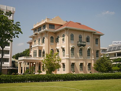
วังเทวะเวสม์ Address: Sam Sen Rd street in พระนคร
Places Near วังเทวะเวสม์ (พระนคร)
How to get to popular places in Bangkok with public transit
Get around พระนคร by public transit!
Traveling around พระนคร has never been so easy. See step by step directions as you travel to any attraction, street or major public transit station. View bus and train schedules, arrival times, service alerts and detailed routes on a map, so you know exactly how to get to anywhere in พระนคร.
When traveling to any destination around พระนคร use Moovit's Live Directions with Get Off Notifications to know exactly where and how far to walk, how long to wait for your line, and how many stops are left. Moovit will alert you when it's time to get off — no need to constantly re-check whether yours is the next stop.
Wondering how to use public transit in พระนคร or how to pay for public transit in พระนคร? Moovit public transit app can help you navigate your way with public transit easily, and at minimum cost. It includes public transit fees, ticket prices, and costs. Looking for a map of พระนคร public transit lines? Moovit public transit app shows all public transit maps in พระนคร with all Bus, Train, Metro, SkyTrain and Ferry routes and stops on an interactive map.
Bangkok has 5 transit type(s), including: Bus, Train, Metro, SkyTrain and Ferry, operated by several transit agencies, including บีทีเอส BTS, MRT, ไทย สมายล์ บัส;Thai Smile Bus, ขสมก. BMTA, รถไฟฟ้ารฟท. SRTET, รถประจำทาง Transport Bus, บีอาร์ที BRT, เรือคลองโดยสาร Canal Ferry, เรือข้ามฟาก River Ferry, รถสองแถว Songthaew, จุฬาป๊อบบัส Chula Pop Bus, ขสมก BMTA, ขสมก. (BMTA), รถมินิบัส Minibus and รฟท. SRT