Directions to วัดราชนัดดา (พระนคร) with public transportation
The following transit lines have routes that pass near วัดราชนัดดา
How to get to วัดราชนัดดา by bus?
Click on the bus route to see step by step directions with maps, line arrival times and updated time schedules.
How to get to วัดราชนัดดา by train?
Click on the train route to see step by step directions with maps, line arrival times and updated time schedules.
How to get to วัดราชนัดดา by metro?
Click on the metro route to see step by step directions with maps, line arrival times and updated time schedules.
How to get to วัดราชนัดดา by ferry?
Click on the ferry route to see step by step directions with maps, line arrival times and updated time schedules.
Bus stops near วัดราชนัดดา in พระนคร
- ตรงข้ามนิทรรศน์รัตนโกสินทร์;Opposite Rattanakosin Exhibition Hall, 1 min walk,
- ศาลาว่าการกรุงเทพมหานคร;City Hall Bangkok, 3 min walk,
- เสาชิงช้า;Sao Chingcha, 4 min walk,
- โรงเรียนสตรีวิทยา Satriwittaya School, 5 min walk,
- อนุสาวรีย์ประชาธิปไตย(ตรงข้ามศึกษาภัณฑ์), 6 min walk,
- วัดราชนัดดา,ลานพลับพลามหาเจษฎาบดินทร์, 6 min walk,
- วัดราชนัดดาราม(มหาไชย), 6 min walk,
- ก่อนอนุสาวรีย์ประชาธิปไตย;Before Democracy Monument, 6 min walk,
- ตรงข้ามวัดราชนัดดาราม(มหาไชย), 7 min walk,
Ferry stations near วัดราชนัดดา in พระนคร
- ท่าเรือผ่านฟ้าลีลาศ;Panfa Leelard Pier, 6 min walk,
- ท่าเรือราชดำเนินนอก;Rajadamnoen Nok Pier, 17 min walk,
- ท่าเรือพระอาทิตย์;Phra Arthit Pier, 22 min walk,
Metro station near วัดราชนัดดา in พระนคร
- Mrt สามยอด;Mrt Sam Yot, 17 min walk,
Bus lines to วัดราชนัดดา in พระนคร
- ต.31, บางนา;Bangna,
- ต.99, บางเขน;Bang Khen,
- ต.102, ท่าน้ำปากเกร็ด;Pak Kret Pier,
- ต.125, มหาวิทยาลัยรามคำแหง;Ramkhamhaeng University,
- ต.125, แฮปปี้แลนด์;Happy Land,
- ต.139, ประตูน้ำ;Phatunam,
- ต.139, มหาวิทยาลัยรามคำแหง วิทยาเขตบางนา;Ramkhamhaeng University,Bangna Campus,
- ต.139, มาบุญครอง;Ma Bun Khrong,
- 4-68, ถนนตก;Thanon Tok,
- 1-8 (59), สนามหลวง;Sanam Luang,
- 2-14 (70), สนามหลวง;Sanamluang,
- 2-32E (70 ทางด่วน), ประชานิเวศน์ 3;Prachaniwet 3,
- 2-42 (44), เคหะคลองจั่น;Housing Khlong Chan,
- 4-60 (509), หมู่บ้านเศรษฐกิจ;Setthakit Village,
- S1 (ปอ.) (AC), ท่าอากาศยานสุวรรณภูมิ (อาคารผู้โดยสารชั้น1 ประตู7),
- 2 (ปอ.) (AC), ท่าปล่อยรถ ช้างเอราวัณ Erawan Bus Terminal,
- 59 (ปอ.) (AC), อู่รังสิต Rangsit Bus Depot,
- 60 (ปอ.) (AC), อู่สวนสยาม Siam Park Bus Depot,
- 70, ประชานิเวศน์ 3 Pracha Niwet 3,
- 70 (ปอ.) (AC), ประชานิเวศน์ 3 Pracha Niwet 3,
What are the closest stations to วัดราชนัดดา?
The closest stations to วัดราชนัดดา are:
- ตรงข้ามนิทรรศน์รัตนโกสินทร์;Opposite Rattanakosin Exhibition Hall is 55 meters away, 1 min walk.
- ศาลาว่าการกรุงเทพมหานคร;City Hall Bangkok is 149 meters away, 3 min walk.
- เสาชิงช้า;Sao Chingcha is 298 meters away, 4 min walk.
- โรงเรียนสตรีวิทยา Satriwittaya School is 328 meters away, 5 min walk.
- อนุสาวรีย์ประชาธิปไตย(ตรงข้ามศึกษาภัณฑ์) is 384 meters away, 6 min walk.
- วัดราชนัดดา,ลานพลับพลามหาเจษฎาบดินทร์ is 387 meters away, 6 min walk.
- วัดราชนัดดาราม(มหาไชย) is 423 meters away, 6 min walk.
- ท่าเรือผ่านฟ้าลีลาศ;Panfa Leelard Pier is 428 meters away, 6 min walk.
- ก่อนอนุสาวรีย์ประชาธิปไตย;Before Democracy Monument is 432 meters away, 6 min walk.
- ตรงข้ามวัดราชนัดดาราม(มหาไชย) is 490 meters away, 7 min walk.
- ท่าเรือราชดำเนินนอก;Rajadamnoen Nok Pier is 1236 meters away, 17 min walk.
- Mrt สามยอด;Mrt Sam Yot is 1257 meters away, 17 min walk.
- ท่าเรือพระอาทิตย์;Phra Arthit Pier is 1681 meters away, 22 min walk.
Which bus lines stop near วัดราชนัดดา?
These bus lines stop near วัดราชนัดดา: 1-63, 1-8 (59), 12, 12 (ปอ.) (AC), 2-42 (44), 3-53, 32, 509 (ปอ.) (AC), 60 (ปอ.) (AC).
Which train lines stop near วัดราชนัดดา?
These train lines stop near วัดราชนัดดา: 318, 378.
Which metro line stops near วัดราชนัดดา?
BLUE (บางหว้า (วันเสาร์);Bang Wa (Saturday))
Which ferry line stops near วัดราชนัดดา?
เรือคลองแสนแสบ (ผ่านฟ้าลีลาศ;Panfa Leelard Pier)
What’s the nearest metro station to วัดราชนัดดา in พระนคร?
The nearest metro station to วัดราชนัดดา in พระนคร is Mrt สามยอด;Mrt Sam Yot. It’s a 17 min walk away.
What’s the nearest bus station to วัดราชนัดดา in พระนคร?
The nearest bus station to วัดราชนัดดา in พระนคร is ตรงข้ามนิทรรศน์รัตนโกสินทร์;Opposite Rattanakosin Exhibition Hall. It’s a 1 min walk away.
What’s the nearest ferry station to วัดราชนัดดา in พระนคร?
The nearest ferry station to วัดราชนัดดา in พระนคร is ท่าเรือผ่านฟ้าลีลาศ;Panfa Leelard Pier. It’s a 6 min walk away.
What time is the first metro to วัดราชนัดดา in พระนคร?
The BLUE is the first metro that goes to วัดราชนัดดา in พระนคร. It stops nearby at 6:10 AM.
What time is the last metro to วัดราชนัดดา in พระนคร?
The BLUE is the last metro that goes to วัดราชนัดดา in พระนคร. It stops nearby at 12:40 AM.
What time is the first bus to วัดราชนัดดา in พระนคร?
The 3-1 (2) is the first bus that goes to วัดราชนัดดา in พระนคร. It stops nearby at 3:00 AM.
What time is the last bus to วัดราชนัดดา in พระนคร?
The 3-1 (2) is the last bus that goes to วัดราชนัดดา in พระนคร. It stops nearby at 4:30 AM.
What time is the first ferry to วัดราชนัดดา in พระนคร?
The เรือคลองแสนแสบ is the first ferry that goes to วัดราชนัดดา in พระนคร. It stops nearby at 6:00 AM.
What time is the last ferry to วัดราชนัดดา in พระนคร?
The เรือคลองแสนแสบ is the last ferry that goes to วัดราชนัดดา in พระนคร. It stops nearby at 8:52 PM.
See วัดราชนัดดา, พระนคร, on the map
Public Transit to วัดราชนัดดา in พระนคร
Wondering how to get to วัดราชนัดดา in พระนคร? Moovit helps you find the best way to get to วัดราชนัดดา with step-by-step directions from the nearest public transit station.
Moovit provides free maps and live directions to help you navigate through your city. View schedules, routes, timetables, and find out how long does it take to get to วัดราชนัดดา in real time.
Looking for the nearest stop or station to วัดราชนัดดา? Check out this list of stops closest to your destination: ตรงข้ามนิทรรศน์รัตนโกสินทร์;Opposite Rattanakosin Exhibition Hall; ศาลาว่าการกรุงเทพมหานคร;City Hall Bangkok; เสาชิงช้า;Sao Chingcha; โรงเรียนสตรีวิทยา Satriwittaya School; อนุสาวรีย์ประชาธิปไตย(ตรงข้ามศึกษาภัณฑ์); วัดราชนัดดา,ลานพลับพลามหาเจษฎาบดินทร์; วัดราชนัดดาราม(มหาไชย); ท่าเรือผ่านฟ้าลีลาศ;Panfa Leelard Pier; ก่อนอนุสาวรีย์ประชาธิปไตย;Before Democracy Monument; ตรงข้ามวัดราชนัดดาราม(มหาไชย); ท่าเรือราชดำเนินนอก;Rajadamnoen Nok Pier; Mrt สามยอด;Mrt Sam Yot; ท่าเรือพระอาทิตย์;Phra Arthit Pier.
Bus: 1-63, 1-8 (59), 12, 12 (ปอ.) (AC), 2-42 (44), 3-53, 32, 509 (ปอ.) (AC), 60 (ปอ.) (AC), ต.31, ต.99, ต.102, ต.125, ต.125, 3-37 (12), 4-10 (42R), 5, 4-40 (56R), S1, A4, 68 มจธ, 68 มหาชัย, 4-2 (15L).Train: 318, 378.Metro: BLUE.Ferry: เรือคลองแสนแสบ.
Want to see if there’s another route that gets you there at an earlier time? Moovit helps you find alternative routes or times. Get directions from and directions to วัดราชนัดดา easily from the Moovit App or Website.
We make riding to วัดราชนัดดา easy, which is why over 1.5 million users, including users in พระนคร, trust Moovit as the best app for public transit. You don’t need to download an individual bus app or train app, Moovit is your all-in-one transit app that helps you find the best bus time or train time available.
For information on prices of bus, metro, ferry and train, costs and ride fares to วัดราชนัดดา, please check the Moovit app.
Use the app to navigate to popular places including to the airport, hospital, stadium, grocery store, mall, coffee shop, school, college, and university.
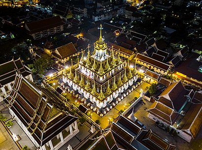
วัดราชนัดดา Address: วัดราชนัดดา - ซอย ดำเนินกลางใต้ แขวง วัดบวรนิเวศ เขต พระนคร กรุงเทพมหานคร 10200 ประเทศไทย street in พระนคร
Places Near วัดราชนัดดา (พระนคร)
How to get to popular places in Bangkok with public transit
Get around พระนคร by public transit!
Traveling around พระนคร has never been so easy. See step by step directions as you travel to any attraction, street or major public transit station. View bus and train schedules, arrival times, service alerts and detailed routes on a map, so you know exactly how to get to anywhere in พระนคร.
When traveling to any destination around พระนคร use Moovit's Live Directions with Get Off Notifications to know exactly where and how far to walk, how long to wait for your line, and how many stops are left. Moovit will alert you when it's time to get off — no need to constantly re-check whether yours is the next stop.
Wondering how to use public transit in พระนคร or how to pay for public transit in พระนคร? Moovit public transit app can help you navigate your way with public transit easily, and at minimum cost. It includes public transit fees, ticket prices, and costs. Looking for a map of พระนคร public transit lines? Moovit public transit app shows all public transit maps in พระนคร with all Bus, Train, Metro, SkyTrain and Ferry routes and stops on an interactive map.
Bangkok has 5 transit type(s), including: Bus, Train, Metro, SkyTrain and Ferry, operated by several transit agencies, including บีทีเอส BTS, MRT, ไทย สมายล์ บัส;Thai Smile Bus, ขสมก. BMTA, รถไฟฟ้ารฟท. SRTET, รถประจำทาง Transport Bus, บีอาร์ที BRT, เรือคลองโดยสาร Canal Ferry, เรือข้ามฟาก River Ferry, รถสองแถว Songthaew, จุฬาป๊อบบัส Chula Pop Bus, ขสมก BMTA, ขสมก. (BMTA), รถมินิบัส Minibus and รฟท. SRT