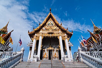
Directions to วัดหัวลำโพง (ปทุมวัน) with public transportation
The following transit lines have routes that pass near วัดหัวลำโพง
How to get to วัดหัวลำโพง by bus?
Click on the bus route to see step by step directions with maps, line arrival times and updated time schedules.
How to get to วัดหัวลำโพง by metro?
Click on the metro route to see step by step directions with maps, line arrival times and updated time schedules.
How to get to วัดหัวลำโพง by SkyTrain?
Click on the SkyTrain route to see step by step directions with maps, line arrival times and updated time schedules.
How to get to วัดหัวลำโพง by ferry?
Click on the ferry route to see step by step directions with maps, line arrival times and updated time schedules.
Bus stops near วัดหัวลำโพง in ปทุมวัน
- สยามเซ็นเตอร์;Siam Center, 5 min walk,
- สยามเซ็นเตอร์ Siam Center, 5 min walk,
- ตรงข้ามมาบุญครอง Opp Mbk Center, 6 min walk,
- สยามสแควร์;Siam Square, 6 min walk,
- สยามสแควร์ Siam Square, 6 min walk,
- จุฬาฯ (หอพักนิสิต);Opposite Triam Udom Suksa School, 7 min walk,
- จุดขึ้นลง;Visual Stop, 8 min walk,
- วิทยาลัยพยาบาลตำรวจ Police Nursing College, 12 min walk,
SkyTrain stations near วัดหัวลำโพง in ปทุมวัน
- Bts สนามกีฬาแห่งชาติ;Bts National Stadium, 6 min walk,
- Bts สยาม;Bts Siam, 13 min walk,
Ferry station near วัดหัวลำโพง in ปทุมวัน
- ท่าเรือสะพานหัวช้าง;Saphan Hua Chang Pier, 13 min walk,
Bus lines to วัดหัวลำโพง in ปทุมวัน
- 2-2, ท่าเรือปากเกร็ด; Pak Kret Pier,
- 2-34L, สถานีรถไฟสามเสน (วนซ้าย);Samsen Railway Station,
- 2-46, อู่สวนสยาม;Siam Park,
- 4-2 (15R), สถานีรถไฟฟ้าราชพฤกษ์ วนขวา;Brt Ratchapruek R,
- 1-40 (93), หมู่บ้านนักกีฬา;Nakkila Village,
- 2-44 (54), สุทธิสาร (วนขวา);Suthisan,
- 2-45 (73), สะพานพุทธ;Saphan Phut,
- 3-11 (48), ม.รามคำแหง 2;Ramkhamhaeng 2,
- 4-39 (40), ถนนบรมราชชนนี;Borommaratchachonnani Rd.,
- 4-42 (79), ราชประสงค์;Ratchaprasong,
- 1-53 (501), ท่าช้าง;Tha Chang,
- 2-52 (204), ท่าน้ำราชวงศ์;Ratchawong Pier,
- 15, Brt ราชพฤกษ์ Rachapruek Brt Station,
- 16, อู่หมอชิต 2 Mochit 2 Bus Depot,
- 16 (ปอ.) (AC), สภากาชาดไทย the Thai Red Cross Society,
- 25, ท่ารถสาย2(ปากคลองตลาด),
- 54, ศูนย์อีซูซุถนนเทียมร่วมมิตร Izuzu Show Room,
- 73 (ปอ.) (AC), โรงแรมดิเอมเมอรัล Rongraem Di Em Moe Ran,
- 73ก (ปอ.) (AC), ท่าปล่อยรถ สะพานพุทธ Saphan Phut Bus Terminal,
- 79 (ปอ.) (AC), เซ็นทรัลเวิลด์ Central World,
What are the closest stations to วัดหัวลำโพง?
The closest stations to วัดหัวลำโพง are:
- สยามเซ็นเตอร์;Siam Center is 313 meters away, 5 min walk.
- สยามเซ็นเตอร์ Siam Center is 334 meters away, 5 min walk.
- Bts สนามกีฬาแห่งชาติ;Bts National Stadium is 399 meters away, 6 min walk.
- ตรงข้ามมาบุญครอง Opp Mbk Center is 402 meters away, 6 min walk.
- สยามสแควร์;Siam Square is 446 meters away, 6 min walk.
- สยามสแควร์ Siam Square is 446 meters away, 6 min walk.
- จุฬาฯ (หอพักนิสิต);Opposite Triam Udom Suksa School is 456 meters away, 7 min walk.
- จุดขึ้นลง;Visual Stop is 559 meters away, 8 min walk.
- วิทยาลัยพยาบาลตำรวจ Police Nursing College is 874 meters away, 12 min walk.
- ท่าเรือสะพานหัวช้าง;Saphan Hua Chang Pier is 914 meters away, 13 min walk.
- Bts สยาม;Bts Siam is 961 meters away, 13 min walk.
Which bus lines stop near วัดหัวลำโพง?
These bus lines stop near วัดหัวลำโพง: 15, 2-44 (54), 2-45 (73), 204, 47, 501 (ปอ.) (AC), 54, 73ก (ปอ.) (AC).
Which metro line stops near วัดหัวลำโพง?
BLUE (บางหว้า (วันเสาร์);Bang Wa (Saturday))
Which SkyTrain lines stop near วัดหัวลำโพง?
These SkyTrain lines stop near วัดหัวลำโพง: SILOM, SUKHUMVIT.
Which ferry line stops near วัดหัวลำโพง?
เรือคลองแสนแสบ (ผ่านฟ้าลีลาศ;Panfa Leelard Pier)
What’s the nearest SkyTrain station to วัดหัวลำโพง in ปทุมวัน?
The nearest SkyTrain station to วัดหัวลำโพง in ปทุมวัน is Bts สนามกีฬาแห่งชาติ;Bts National Stadium. It’s a 6 min walk away.
What’s the nearest bus station to วัดหัวลำโพง in ปทุมวัน?
The nearest bus stations to วัดหัวลำโพง in ปทุมวัน are สยามเซ็นเตอร์;Siam Center and สยามเซ็นเตอร์ Siam Center. The closest one is a 5 min walk away.
What’s the nearest ferry station to วัดหัวลำโพง in ปทุมวัน?
The nearest ferry station to วัดหัวลำโพง in ปทุมวัน is ท่าเรือสะพานหัวช้าง;Saphan Hua Chang Pier. It’s a 13 min walk away.
What time is the first SkyTrain to วัดหัวลำโพง in ปทุมวัน?
The SILOM is the first SkyTrain that goes to วัดหัวลำโพง in ปทุมวัน. It stops nearby at 6:00 AM.
What time is the last SkyTrain to วัดหัวลำโพง in ปทุมวัน?
The SUKHUMVIT is the last SkyTrain that goes to วัดหัวลำโพง in ปทุมวัน. It stops nearby at 12:49 AM.
What time is the first bus to วัดหัวลำโพง in ปทุมวัน?
The 54 is the first bus that goes to วัดหัวลำโพง in ปทุมวัน. It stops nearby at 3:00 AM.
What time is the last bus to วัดหัวลำโพง in ปทุมวัน?
The 1-2E (34E) is the last bus that goes to วัดหัวลำโพง in ปทุมวัน. It stops nearby at 4:18 AM.
What time is the first ferry to วัดหัวลำโพง in ปทุมวัน?
The เรือคลองแสนแสบ is the first ferry that goes to วัดหัวลำโพง in ปทุมวัน. It stops nearby at 6:13 AM.
What time is the last ferry to วัดหัวลำโพง in ปทุมวัน?
The เรือคลองแสนแสบ is the last ferry that goes to วัดหัวลำโพง in ปทุมวัน. It stops nearby at 8:40 PM.
See วัดหัวลำโพง, ปทุมวัน, on the map
Public Transit to วัดหัวลำโพง in ปทุมวัน
Wondering how to get to วัดหัวลำโพง in ปทุมวัน? Moovit helps you find the best way to get to วัดหัวลำโพง with step-by-step directions from the nearest public transit station.
Moovit provides free maps and live directions to help you navigate through your city. View schedules, routes, timetables, and find out how long does it take to get to วัดหัวลำโพง in real time.
Looking for the nearest stop or station to วัดหัวลำโพง? Check out this list of stops closest to your destination: สยามเซ็นเตอร์;Siam Center; สยามเซ็นเตอร์ Siam Center; Bts สนามกีฬาแห่งชาติ;Bts National Stadium; ตรงข้ามมาบุญครอง Opp Mbk Center; สยามสแควร์;Siam Square; สยามสแควร์ Siam Square; จุฬาฯ (หอพักนิสิต);Opposite Triam Udom Suksa School; จุดขึ้นลง;Visual Stop; วิทยาลัยพยาบาลตำรวจ Police Nursing College; ท่าเรือสะพานหัวช้าง;Saphan Hua Chang Pier; Bts สยาม;Bts Siam.
Bus: 15, 2-44 (54), 2-45 (73), 204, 47, 501 (ปอ.) (AC), 54, 73ก (ปอ.) (AC), 2-2, 2-34L, 2-46, 4-2 (15R), 1-40 (93), 16, 16 (ปอ.) (AC), 25, ต.27, 34, ต.65, ต.121, ต.124, 2-34R, 4-2 (15L), 204 (ปอ.) (AC).Metro: BLUE.SkyTrain: SILOM, SUKHUMVIT.Ferry: เรือคลองแสนแสบ.
Want to see if there’s another route that gets you there at an earlier time? Moovit helps you find alternative routes or times. Get directions from and directions to วัดหัวลำโพง easily from the Moovit App or Website.
We make riding to วัดหัวลำโพง easy, which is why over 1.5 million users, including users in ปทุมวัน, trust Moovit as the best app for public transit. You don’t need to download an individual bus app or train app, Moovit is your all-in-one transit app that helps you find the best bus time or train time available.
For information on prices of bus, SkyTrain, metro and ferry, costs and ride fares to วัดหัวลำโพง, please check the Moovit app.
Use the app to navigate to popular places including to the airport, hospital, stadium, grocery store, mall, coffee shop, school, college, and university.
Location: ปทุมวัน, Bangkok
Places Near วัดหัวลำโพง (ปทุมวัน)
How to get to popular places in Bangkok with public transit
Get around ปทุมวัน by public transit!
Traveling around ปทุมวัน has never been so easy. See step by step directions as you travel to any attraction, street or major public transit station. View bus and train schedules, arrival times, service alerts and detailed routes on a map, so you know exactly how to get to anywhere in ปทุมวัน.
When traveling to any destination around ปทุมวัน use Moovit's Live Directions with Get Off Notifications to know exactly where and how far to walk, how long to wait for your line, and how many stops are left. Moovit will alert you when it's time to get off — no need to constantly re-check whether yours is the next stop.
Wondering how to use public transit in ปทุมวัน or how to pay for public transit in ปทุมวัน? Moovit public transit app can help you navigate your way with public transit easily, and at minimum cost. It includes public transit fees, ticket prices, and costs. Looking for a map of ปทุมวัน public transit lines? Moovit public transit app shows all public transit maps in ปทุมวัน with all Bus, Train, Metro, SkyTrain and Ferry routes and stops on an interactive map.
Bangkok has 5 transit type(s), including: Bus, Train, Metro, SkyTrain and Ferry, operated by several transit agencies, including บีทีเอส BTS, MRT, ไทย สมายล์ บัส;Thai Smile Bus, ขสมก. BMTA, รถไฟฟ้ารฟท. SRTET, รถประจำทาง Transport Bus, บีอาร์ที BRT, เรือคลองโดยสาร Canal Ferry, เรือข้ามฟาก River Ferry, รถสองแถว Songthaew, จุฬาป๊อบบัส Chula Pop Bus, ขสมก BMTA, ขสมก. (BMTA), รถมินิบัส Minibus and รฟท. SRT