Directions to สถานีรถไฟศาลายา (พุทธมณฑล) with public transportation
The following transit lines have routes that pass near สถานีรถไฟศาลายา
How to get to สถานีรถไฟศาลายา by bus?
Click on the bus route to see step by step directions with maps, line arrival times and updated time schedules.
How to get to สถานีรถไฟศาลายา by train?
Click on the train route to see step by step directions with maps, line arrival times and updated time schedules.
Train station near สถานีรถไฟศาลายา in พุทธมณฑล
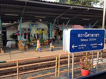
- Srt ศาลายา;Srt Sala Ya, 1 min walk,
Bus stops near สถานีรถไฟศาลายา in พุทธมณฑล
- จุดขึ้นลง;Visual Stop, 5 min walk,
Bus lines to สถานีรถไฟศาลายา in พุทธมณฑล
- 8268, หมู่บ้านพฤกษา 4 (ซอย 51) บ้านห้วยพลู;Phrueksa 4 Village (Soi 51),
- 6147, บ้านศาลายา;Baan Salaya,
- 8500, ตลาดศาลายา;Salaya Market,
What are the closest stations to สถานีรถไฟศาลายา?
The closest stations to สถานีรถไฟศาลายา are:
- Srt ศาลายา;Srt Sala Ya is 16 meters away, 1 min walk.
- จุดขึ้นลง;Visual Stop is 357 meters away, 5 min walk.
Which bus lines stop near สถานีรถไฟศาลายา?
These bus lines stop near สถานีรถไฟศาลายา: 387, 4-55 (163), 4-63 (547), 4-70E, 6147.
Which train line stops near สถานีรถไฟศาลายา?
261 (โพรงมะเดื่อ;Phrong Madua)
What’s the nearest train station to สถานีรถไฟศาลายา in พุทธมณฑล?
The nearest train station to สถานีรถไฟศาลายา in พุทธมณฑล is Srt ศาลายา;Srt Sala Ya. It’s a 1 min walk away.
What’s the nearest bus station to สถานีรถไฟศาลายา in พุทธมณฑล?
The nearest bus station to สถานีรถไฟศาลายา in พุทธมณฑล is จุดขึ้นลง;Visual Stop. It’s a 5 min walk away.
What time is the first train to สถานีรถไฟศาลายา in พุทธมณฑล?
The 174 is the first train that goes to สถานีรถไฟศาลายา in พุทธมณฑล. It stops nearby at 4:00 AM.
What time is the last train to สถานีรถไฟศาลายา in พุทธมณฑล?
The 480 is the last train that goes to สถานีรถไฟศาลายา in พุทธมณฑล. It stops nearby at 8:05 PM.
What time is the first bus to สถานีรถไฟศาลายา in พุทธมณฑล?
The 515 (ปอ.) (AC) is the first bus that goes to สถานีรถไฟศาลายา in พุทธมณฑล. It stops nearby at 4:23 AM.
What time is the last bus to สถานีรถไฟศาลายา in พุทธมณฑล?
The Y70E is the last bus that goes to สถานีรถไฟศาลายา in พุทธมณฑล. It stops nearby at 12:45 AM.
See สถานีรถไฟศาลายา, พุทธมณฑล, on the map
Public Transit to สถานีรถไฟศาลายา in พุทธมณฑล
Wondering how to get to สถานีรถไฟศาลายา in พุทธมณฑล? Moovit helps you find the best way to get to สถานีรถไฟศาลายา with step-by-step directions from the nearest public transit station.
Moovit provides free maps and live directions to help you navigate through your city. View schedules, routes, timetables, and find out how long does it take to get to สถานีรถไฟศาลายา in real time.
Looking for the nearest stop or station to สถานีรถไฟศาลายา? Check out this list of stops closest to your destination: Srt ศาลายา;Srt Sala Ya; จุดขึ้นลง;Visual Stop.
Bus: 387, 4-55 (163), 4-63 (547), 4-70E, 6147, 8268, 8500.Train: 261, 31, 32, 38, 39, 43.
Want to see if there’s another route that gets you there at an earlier time? Moovit helps you find alternative routes or times. Get directions from and directions to สถานีรถไฟศาลายา easily from the Moovit App or Website.
We make riding to สถานีรถไฟศาลายา easy, which is why over 1.5 million users, including users in พุทธมณฑล, trust Moovit as the best app for public transit. You don’t need to download an individual bus app or train app, Moovit is your all-in-one transit app that helps you find the best bus time or train time available.
For information on prices of bus and train, costs and ride fares to สถานีรถไฟศาลายา, please check the Moovit app.
Use the app to navigate to popular places including to the airport, hospital, stadium, grocery store, mall, coffee shop, school, college, and university.
สถานีรถไฟศาลายา Address: ชร รถรับจ้าง 0890611541 street in พุทธมณฑล
Places Near สถานีรถไฟศาลายา (พุทธมณฑล)
How to get to popular places in Bangkok with public transit
Get around พุทธมณฑล by public transit!
Traveling around พุทธมณฑล has never been so easy. See step by step directions as you travel to any attraction, street or major public transit station. View bus and train schedules, arrival times, service alerts and detailed routes on a map, so you know exactly how to get to anywhere in พุทธมณฑล.
When traveling to any destination around พุทธมณฑล use Moovit's Live Directions with Get Off Notifications to know exactly where and how far to walk, how long to wait for your line, and how many stops are left. Moovit will alert you when it's time to get off — no need to constantly re-check whether yours is the next stop.
Wondering how to use public transit in พุทธมณฑล or how to pay for public transit in พุทธมณฑล? Moovit public transit app can help you navigate your way with public transit easily, and at minimum cost. It includes public transit fees, ticket prices, and costs. Looking for a map of พุทธมณฑล public transit lines? Moovit public transit app shows all public transit maps in พุทธมณฑล with all Bus, Train, Metro, SkyTrain and Ferry routes and stops on an interactive map.
Bangkok has 5 transit type(s), including: Bus, Train, Metro, SkyTrain and Ferry, operated by several transit agencies, including บีทีเอส BTS, MRT, ไทย สมายล์ บัส;Thai Smile Bus, ขสมก. BMTA, รถไฟฟ้ารฟท. SRTET, รถประจำทาง Transport Bus, บีอาร์ที BRT, เรือคลองโดยสาร Canal Ferry, เรือข้ามฟาก River Ferry, รถสองแถว Songthaew, จุฬาป๊อบบัส Chula Pop Bus, ขสมก BMTA, ขสมก. (BMTA), รถมินิบัส Minibus and รฟท. SRT