サンシャインシティ stop - Tuesday schedule
| Line | Direction | Time |
|---|---|---|
| 赤51 | 池袋駅東口 | 06:56 |
| 赤51 | 池袋駅東口 | 07:12 |
| 赤51 | 池袋駅東口 | 07:28 |
| 赤51 | 池袋駅東口 | 07:47 |
| 赤51 | 池袋駅東口 | 08:00 |
| 光02 | 池袋駅東口 | 08:09 |
| 赤51 | 池袋駅東口 | 08:12 |
| 赤51 | 池袋駅東口 | 08:24 |
| 池55 | 池袋駅東口 | 08:28 |
| 赤51 | 池袋駅東口 | 08:36 |
| 光02 | 池袋駅東口 | 08:39 |
| 赤51 | 池袋駅東口 | 08:48 |
| 赤51 | 池袋駅東口 | 09:00 |
| 光02 | 池袋駅東口 | 09:09 |
| 赤51 | 池袋駅東口 | 09:13 |
| 赤51 | 池袋駅東口 | 09:26 |
| 池55 | 池袋駅東口 | 09:29 |
| 光02 | 池袋駅東口 | 09:32 |
| 赤51 | 池袋駅東口 | 09:38 |
| 赤51 | 池袋駅東口 | 09:50 |
| 光02 | 池袋駅東口 | 09:55 |
| 赤51 | 池袋駅東口 | 10:02 |
| 赤51 | 池袋駅東口 | 10:14 |
| 光02 | 池袋駅東口 | 10:17 |
| 赤51 | 池袋駅東口 | 10:26 |
Directions to サンシャインシティ stop (豊島区) with public transit
The following transit lines have routes that pass near サンシャインシティ
 Bus: 光02, 池86, 王40甲, 草63, 赤51.
- Train: 東上線.
- Metro: 副都心線, 埼京線・川越線 SAIKYO-KAWAGOE LINE, 山手線 YAMANOTE LINE, 有楽町線, 湘南新宿ライン SHONAN-SHINJUKU LINE.
How to get to サンシャインシティ stop by bus?
Click on the bus route to see step by step directions with maps, line arrival times and updated time schedules.
How to get to サンシャインシティ stop by metro?
Click on the metro route to see step by step directions with maps, line arrival times and updated time schedules.
Bus stops near サンシャインシティ stop in 豊島区
- サンシャインシティ, 3 min walk,
- 東池袋一丁目, 4 min walk,
- 六ツ又陸橋, 6 min walk,
- Hareza池袋, 6 min walk,
Metro stations near サンシャインシティ station in 豊島区
- 東池袋, 5 min walk,
- 池袋, 9 min walk,
- 池袋 Ikebukuro, 10 min walk,
Light Rail stations near サンシャインシティ station in 豊島区
- 東池袋四丁目, 9 min walk,
Train stations near サンシャインシティ station in 豊島区
- 池袋, 11 min walk,
Bus lines to サンシャインシティ stop in 豊島区
- 光02, 光が丘駅 - 池袋駅東口,
- 池07, サンシャインシティ南 - 江古田二又,
- 池55, 池袋駅東口 - 小茂根五丁目,
- 赤51, 池袋駅東口 - 赤羽駅西口,
- 赤97, 池袋駅東口 - 赤羽車庫,
- 池86, 池袋サンシャインシティ,
- 草63, とげぬき地蔵前,
- 都02乙, 一ツ橋,
- 上60, 池袋駅東口,
- 王40出入, 北車庫前,
- 王40甲, 西新井駅前,
- 王55, 池袋駅東口,
- 草64, 浅草雷門南,
What are the closest stations to サンシャインシティ?
The closest stations to サンシャインシティ are:
- サンシャインシティ is 199 meters away, 3 min walk.
- 東池袋一丁目 is 263 meters away, 4 min walk.
- 東池袋 is 360 meters away, 5 min walk.
- 六ツ又陸橋 is 383 meters away, 6 min walk.
- Hareza池袋 is 453 meters away, 6 min walk.
- 東池袋四丁目 is 633 meters away, 9 min walk.
- 池袋 is 647 meters away, 9 min walk.
- 池袋 Ikebukuro is 746 meters away, 10 min walk.
Which bus lines stop near サンシャインシティ?
These bus lines stop near サンシャインシティ: 光02, 池86, 王40甲, 草63, 赤51.
Which metro lines stop near サンシャインシティ?
These metro lines stop near サンシャインシティ: 副都心線, 埼京線・川越線 SAIKYO-KAWAGOE LINE, 山手線 YAMANOTE LINE, 有楽町線, 湘南新宿ライン SHONAN-SHINJUKU LINE.
What’s the nearest light rail station to サンシャインシティ in 豊島区?
The nearest light rail station to サンシャインシティ in 豊島区 is 東池袋四丁目. It’s a 9 min walk away.
What’s the nearest metro station to サンシャインシティ in 豊島区?
The nearest metro station to サンシャインシティ in 豊島区 is 東池袋. It’s a 5 min walk away.
What’s the nearest train station to サンシャインシティ in 豊島区?
The nearest train station to サンシャインシティ in 豊島区 is 池袋. It’s a 11 min walk away.
What’s the nearest bus station to サンシャインシティ in 豊島区?
The nearest bus station to サンシャインシティ in 豊島区 is サンシャインシティ. It’s a 3 min walk away.
What time is the first light rail to サンシャインシティ in 豊島区?
The 東京さくらトラム(都電荒川線) is the first light rail that goes to サンシャインシティ in 豊島区. It stops nearby at 5:47 AM.
What time is the last light rail to サンシャインシティ in 豊島区?
The 東京さくらトラム(都電荒川線) is the last light rail that goes to サンシャインシティ in 豊島区. It stops nearby at 11:12 PM.
What time is the first metro to サンシャインシティ in 豊島区?
The 山手線 YAMANOTE LINE is the first metro that goes to サンシャインシティ in 豊島区. It stops nearby at 4:25 AM.
What time is the last metro to サンシャインシティ in 豊島区?
The 山手線 YAMANOTE LINE is the last metro that goes to サンシャインシティ in 豊島区. It stops nearby at 1:04 AM.
What time is the first train to サンシャインシティ in 豊島区?
The 東上線 is the first train that goes to サンシャインシティ in 豊島区. It stops nearby at 5:02 AM.
What time is the last train to サンシャインシティ in 豊島区?
The 東上線 is the last train that goes to サンシャインシティ in 豊島区. It stops nearby at 12:35 AM.
What time is the first bus to サンシャインシティ in 豊島区?
The 草63 is the first bus that goes to サンシャインシティ in 豊島区. It stops nearby at 6:09 AM.
What time is the last bus to サンシャインシティ in 豊島区?
The 草63 is the last bus that goes to サンシャインシティ in 豊島区. It stops nearby at 10:45 PM.
See サンシャインシティ stop, 豊島区, on the map
Public transit to サンシャインシティ stop in 豊島区
Looking for directions to サンシャインシティ in 豊島区, Japan?
Download the Moovit App to find the current schedule and step-by-step directions for Metro or Bus routes that pass through サンシャインシティ.
Looking for the nearest stops closest to サンシャインシティ ? Check out this list of closest stops to your destination: サンシャインシティ; 東池袋一丁目; 東池袋; 六ツ又陸橋; Hareza池袋; 東池袋四丁目; 池袋; 池袋 Ikebukuro.
Bus: 光02, 池86, 王40甲, 草63, 赤51, 池07, 池55, 赤97, 都02乙.Train: 東上線.Metro: 副都心線, 埼京線・川越線 SAIKYO-KAWAGOE LINE, 山手線 YAMANOTE LINE, 有楽町線, 湘南新宿ライン SHONAN-SHINJUKU LINE, 丸ノ内線.
We make riding on public transit to サンシャインシティ easy, which is why over 1.5 million users, including users in 豊島区 trust Moovit as the best app for public transit.
Use the app to navigate to popular places including to the airport, hospital, stadium, grocery store, mall, coffee shop, school, college, and university.
The first line to this stop is 赤51, at 06:56, and the last line is 赤51 at 21:38.
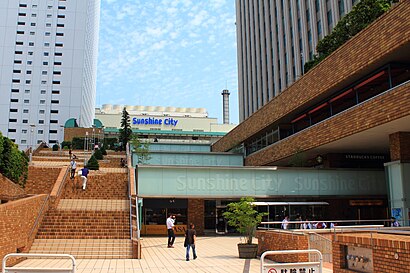
3-9 東池袋三丁目, Tokyo, Japan
This stop serves Kokusai Kogyo Bus’s lines
Popular routes from サンシャインシティ stop, 豊島区
- 東池袋,
- 池袋,
- 池袋 Ikebukuro
Metro stations near サンシャインシティ station
- 東池袋四丁目
Light Rail station near サンシャインシティ station
- 池袋
Train station near サンシャインシティ station
Get around 豊島区 by public transit!
Traveling around 豊島区 has never been so easy. See step by step directions as you travel to any attraction, street or major public transit station. View bus and train schedules, arrival times, service alerts and detailed routes on a map, so you know exactly how to get to anywhere in 豊島区.
When traveling to any destination around 豊島区 use Moovit's Live Directions with Get Off Notifications to know exactly where and how far to walk, how long to wait for your line, and how many stops are left. Moovit will alert you when it's time to get off — no need to constantly re-check whether yours is the next stop.
Wondering how to use public transit in 豊島区 or how to pay for public transit in 豊島区? Moovit public transit app can help you navigate your way with public transit easily, and at minimum cost. It includes public transit fees, ticket prices, and costs. Looking for a map of 豊島区 public transit lines? Moovit public transit app shows all public transit maps in 豊島区 with all Bus, Train, Metro and Light Rail routes and stops on an interactive map.
Tokyo has 4 transit type(s), including: Bus, Train, Metro and Light Rail, operated by several transit agencies, including JR East, Sagami Railway, 都営バス, Kokusai Kogyo Bus, 町田市コミュニティ, 東京メトロ, 羽村市(はむらん), 京成トランジットバス株式会社, 東京都交通局, 八王子市(はちバス), 日の出町(ぐるりーんひのでちゃん), 日立自動車交通株式会社, 西武バス, あきる野市(るのバス) and 西東京バス株式会社