Directions to モノレール浜松町 (港区) with public transportation
The following transit lines have routes that pass near モノレール浜松町
 Bus: 東98, 浜95, 都06, 橋86.
- Metro: 京浜東北線・根岸線 KEIHIN-TOHOKU-NEGISHI LINE, 大江戸線, 山手線 YAMANOTE LINE, 浅草線, 三田線.
How to get to モノレール浜松町 by bus?
Click on the bus route to see step by step directions with maps, line arrival times and updated time schedules.
How to get to モノレール浜松町 by metro?
Click on the metro route to see step by step directions with maps, line arrival times and updated time schedules.
Metro stations near モノレール浜松町 in 港区
- 浜松町 Hamamatsucho, 2 min walk,
- 大門, 5 min walk,
- 芝公園, 11 min walk,
Bus stops near モノレール浜松町 in 港区
- 浜松町駅前, 6 min walk,
- 大門駅前, 9 min walk,
- 新橋六丁目, 14 min walk,
Bus lines to モノレール浜松町 in 港区
- 浜95, 品川駅港南口,
- 都06, 渋谷駅前,
- 橋86, 目黒駅前,
What are the closest stations to モノレール浜松町?
The closest stations to モノレール浜松町 are:
- 浜松町 Hamamatsucho is 77 meters away, 2 min walk.
- 大門 is 228 meters away, 5 min walk.
- 浜松町駅前 is 310 meters away, 6 min walk.
- 大門駅前 is 516 meters away, 9 min walk.
- 芝公園 is 823 meters away, 11 min walk.
- 新橋六丁目 is 905 meters away, 14 min walk.
Which bus lines stop near モノレール浜松町?
These bus lines stop near モノレール浜松町: 東98, 浜95, 都06.
Which metro lines stop near モノレール浜松町?
These metro lines stop near モノレール浜松町: 京浜東北線・根岸線 KEIHIN-TOHOKU-NEGISHI LINE, 大江戸線, 山手線 YAMANOTE LINE.
What’s the nearest metro station to モノレール浜松町 in 港区?
The nearest metro station to モノレール浜松町 in 港区 is 浜松町 Hamamatsucho. It’s a 2 min walk away.
What’s the nearest bus station to モノレール浜松町 in 港区?
The nearest bus station to モノレール浜松町 in 港区 is 浜松町駅前. It’s a 6 min walk away.
What time is the first metro to モノレール浜松町 in 港区?
The 京浜東北線・根岸線 KEIHIN-TOHOKU-NEGISHI LINE is the first metro that goes to モノレール浜松町 in 港区. It stops nearby at 4:38 AM.
What time is the last metro to モノレール浜松町 in 港区?
The 山手線 YAMANOTE LINE is the last metro that goes to モノレール浜松町 in 港区. It stops nearby at 12:52 AM.
What time is the first bus to モノレール浜松町 in 港区?
The 都06 is the first bus that goes to モノレール浜松町 in 港区. It stops nearby at 6:38 AM.
What time is the last bus to モノレール浜松町 in 港区?
The 都06 is the last bus that goes to モノレール浜松町 in 港区. It stops nearby at 10:13 PM.
See モノレール浜松町, 港区, on the map
Public Transit to モノレール浜松町 in 港区
How to get to モノレール浜松町 in 港区, Japan?
It’s easy with Moovit. Type in your street address and Moovit’s route finder will locate the fastest way to get you there! Not sure where to get off on the street? Download the Moovit App to find live directions (including where to get off on モノレール浜松町), see timetables and get the estimated arrival times for your favorite metro, bus or train lines.
Looking for the nearest stop or station to モノレール浜松町? Check out this list of closest stops available to your destination: 浜松町 Hamamatsucho; 大門; 浜松町駅前; 大門駅前; 芝公園; 新橋六丁目.
Bus: 東98, 浜95, 都06, 橋86.Metro: 京浜東北線・根岸線 KEIHIN-TOHOKU-NEGISHI LINE, 大江戸線, 山手線 YAMANOTE LINE, 浅草線, 三田線.
Download the Moovit App to see the current schedule and routes available for 港区. No need to install a special bus app to check the bus time or a train app to get train time. Moovit is the only all-in-one transit app that helps you get where you need to go.
We make riding on public transit to モノレール浜松町 easy, which is why over 1.5 million users, including users in 港区 trust Moovit as the best app for public transit.
Use the app to navigate to popular places including to the airport, hospital, stadium, grocery store, mall, coffee shop, school, college, and university.
Location: 港区, Tokyo
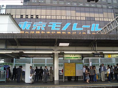
Hamamatsuchō Station (浜松町駅, Hamamatsuchō-eki) is a railway station in Hamamatsuchō, Minato, Tokyo, Japan, operated by East Japan Railway Company (JR East) and Tokyo Monorail.Wiki
Get around 港区 by public transit!
Traveling around 港区 has never been so easy. See step by step directions as you travel to any attraction, street or major public transit station. View bus and train schedules, arrival times, service alerts and detailed routes on a map, so you know exactly how to get to anywhere in 港区.
When traveling to any destination around 港区 use Moovit's Live Directions with Get Off Notifications to know exactly where and how far to walk, how long to wait for your line, and how many stops are left. Moovit will alert you when it's time to get off — no need to constantly re-check whether yours is the next stop.
Wondering how to use public transit in 港区 or how to pay for public transit in 港区? Moovit public transit app can help you navigate your way with public transit easily, and at minimum cost. It includes public transit fees, ticket prices, and costs. Looking for a map of 港区 public transit lines? Moovit public transit app shows all public transit maps in 港区 with all Bus, Train, Metro and Light Rail routes and stops on an interactive map.
Tokyo has 4 transit type(s), including: Bus, Train, Metro and Light Rail, operated by several transit agencies, including JR East, Sagami Railway, 都営バス, Kokusai Kogyo Bus, 町田市コミュニティ, 東京メトロ, 羽村市(はむらん), 京成トランジットバス株式会社, 東京都交通局, 八王子市(はちバス), 日の出町(ぐるりーんひのでちゃん), 日立自動車交通株式会社, 西武バス, あきる野市(るのバス) and 西東京バス株式会社