一号桥 stop - Saturday schedule
| Line | Direction | Time |
|---|---|---|
| 621路 | 塘沽南站 | 04:45 |
| 621路 | 塘沽南站 | 04:55 |
| 621路 | 塘沽南站 | 05:05 |
| 30路区间 | 二号桥 | 05:15 |
| 621路 | 塘沽南站 | 05:16 |
| 30路区间 | 二号桥 | 05:25 |
| 621路 | 塘沽南站 | 05:26 |
| 30路区间 | 二号桥 | 05:35 |
| 621路 | 塘沽南站 | 05:36 |
| 30路区间 | 二号桥 | 05:45 |
| 621路 | 塘沽南站 | 05:46 |
| 30路区间 | 二号桥 | 05:55 |
| 621路 | 塘沽南站 | 05:56 |
| 30路区间 | 二号桥 | 06:05 |
| 621路 | 塘沽南站 | 06:06 |
| 30路区间 | 二号桥 | 06:15 |
| 621路 | 塘沽南站 | 06:16 |
| 857路 | 张贵庄公交站 | 06:25 |
| 30路区间 | 二号桥 | 06:25 |
| 621路 | 塘沽南站 | 06:26 |
| 679路 | 丰年村公交站 | 06:32 |
| 857路 | 张贵庄公交站 | 06:35 |
| 30路区间 | 二号桥 | 06:35 |
| 840路 | 贵环小区 | 06:35 |
| 621路 | 塘沽南站 | 06:36 |
Directions to 一号桥 stop (Tianjin) with public transit
The following transit lines have routes that pass near 一号桥
 Bus: 503路, 621路, 840路, 856路, 857路.
- Metro: 9号线 (津滨轻轨), 1号线.
How to get to 一号桥 stop by bus?
Click on the bus route to see step by step directions with maps, line arrival times and updated time schedules.
How to get to 一号桥 stop by metro?
Click on the metro route to see step by step directions with maps, line arrival times and updated time schedules.
Bus stops near 一号桥 stop in Tianjin
- 月牙河南路, 3 min walk,
- 变电所路, 8 min walk,
- 万明园, 12 min walk,
- 金地紫乐府, 13 min walk,
- 欣园小区, 18 min walk,
- 一号桥, 18 min walk,
Metro stations near 一号桥 station in Tianjin
- 复兴门, 24 min walk,
- 二号桥, 31 min walk,
Bus lines to 一号桥 stop in Tianjin
- 快速1路, 动物园公交站 - 丽苑公交站,
- 92路, 宁月花园 - 渤海大楼,
- 668路, 丽苑公交站 - 水上公园东门,
- 673路, 倚虹东里 - 商业大学公交站,
- 677路, 体院北公交站 - 空港经济区公交站,
- 679路, 丰年村公交站 - 泗阳道公交站,
- 697路, 体院北公交站 - 丽苑公交站,
- 706路, 第六大道公交站 - 西青开发区公交站,
- 观光3路, 天津青旅公司 - 怡然庭院,
- 30路, 崔家码头 - 泗阳道,
- 185路, 无暇花园 - 中心公园,
- 715路, 金钟新市镇 - 万科魅力城,
- 806路, 大胡同商贸中心 - 万科魅力城,
- 830路, 中心公园 - 万科魅力城,
- 840路, 西站公交站 - 贵环小区,
- 856路, 水木天成公交站 - 万科魅力城,
- 857路, 张贵庄公交站 - 阳光100公交站,
- 860路, 福天道 - 本溪路公交站,
- 872路, 东丽开发区 - 华苑雅士道,
- 30路区间, 泗阳道公交站,
What are the closest stations to 一号桥?
The closest stations to 一号桥 are:
- 月牙河南路 is 174 meters away, 3 min walk.
- 变电所路 is 560 meters away, 8 min walk.
- 万明园 is 882 meters away, 12 min walk.
- 金地紫乐府 is 970 meters away, 13 min walk.
- 欣园小区 is 1291 meters away, 18 min walk.
- 一号桥 is 1294 meters away, 18 min walk.
- 复兴门 is 1807 meters away, 24 min walk.
- 二号桥 is 2312 meters away, 31 min walk.
Which bus lines stop near 一号桥?
These bus lines stop near 一号桥: 503路, 621路, 840路, 856路, 857路, 860路, 872路.
Which metro line stops near 一号桥?
9号线 (津滨轻轨) (东海路)
What’s the nearest metro station to 一号桥 in Tianjin?
The nearest metro station to 一号桥 in Tianjin is 复兴门. It’s a 24 min walk away.
What’s the nearest bus station to 一号桥 in Tianjin?
The nearest bus station to 一号桥 in Tianjin is 月牙河南路. It’s a 3 min walk away.
What time is the first metro to 一号桥 in Tianjin?
The 9号线 (津滨轻轨) is the first metro that goes to 一号桥 in Tianjin. It stops nearby at 6:00 AM.
What time is the last metro to 一号桥 in Tianjin?
The 9号线 (津滨轻轨) is the last metro that goes to 一号桥 in Tianjin. It stops nearby at 11:19 PM.
What time is the first bus to 一号桥 in Tianjin?
The 92路 is the first bus that goes to 一号桥 in Tianjin. It stops nearby at 5:00 AM.
What time is the last bus to 一号桥 in Tianjin?
The 92路 is the last bus that goes to 一号桥 in Tianjin. It stops nearby at 11:23 PM.
See 一号桥 stop, Tianjin, on the map
Public transit to 一号桥 stop in Tianjin
Looking for directions to 一号桥 in Tianjin, China?
Download the Moovit App to find the current schedule and step-by-step directions for Bus or Metro routes that pass through 一号桥.
Looking for the nearest stops closest to 一号桥 ? Check out this list of closest stops to your destination: 月牙河南路; 变电所路; 万明园; 金地紫乐府; 欣园小区; 一号桥; 复兴门; 二号桥.
Bus: 503路, 621路, 840路, 856路, 857路, 860路, 872路, 快速1路, 92路, 668路, 673路, 677路, 观光3路, 30路, 185路, 715路, 806路, 30路区间, 656路.Metro: 9号线 (津滨轻轨), 1号线.
We make riding on public transit to 一号桥 easy, which is why over 1.5 million users, including users in Tianjin trust Moovit as the best app for public transit.
Use the app to navigate to popular places including to the airport, hospital, stadium, grocery store, mall, coffee shop, school, college, and university.
The first line to this stop is 621路, at 04:45, and the last line is 30路区间 at 23:13.
This stop serves Public Transit Company 4, Bus Company No.2, Binhai New Area Transit and Public Transit Company 3’s lines
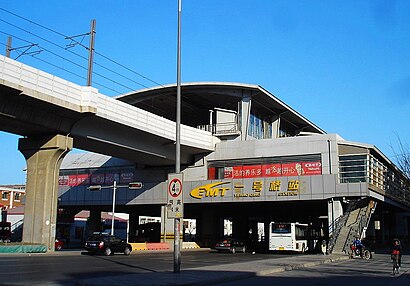
Yihaoqiao Station (Chinese: 一号桥站), is a station of Line 9 of the Tianjin Metro. It started operations on 28 March 2004.Wiki
Get around Tianjin by public transit!
Traveling around Tianjin has never been so easy. See step by step directions as you travel to any attraction, street or major public transit station. View bus and train schedules, arrival times, service alerts and detailed routes on a map, so you know exactly how to get to anywhere in Tianjin.
When traveling to any destination around Tianjin use Moovit's Live Directions with Get Off Notifications to know exactly where and how far to walk, how long to wait for your line, and how many stops are left. Moovit will alert you when it's time to get off — no need to constantly re-check whether yours is the next stop.
Wondering how to use public transit in Tianjin or how to pay for public transit in Tianjin? Moovit public transit app can help you navigate your way with public transit easily, and at minimum cost. It includes public transit fees, ticket prices, and costs. Looking for a map of Tianjin public transit lines? Moovit public transit app shows all public transit maps in Tianjin with all Bus and Metro routes and stops on an interactive map.
Tianjin has 2 transit type(s), including: Bus and Metro, operated by several transit agencies, including 轨道交通, 公交一公司, 公交二公司, 公交三公司, 公交四公司, 滨海新区公交, 天津公交, 巴士实业 and 机场大巴