万寿路口北 stop - Monday schedule
| Line | Direction | Time |
|---|---|---|
| 夜16 | 航天桥西 | 03:11 |
| 夜16 | 航天桥西 | 03:51 |
| 夜16 | 航天桥西 | 04:31 |
| 夜16 | 航天桥西 | 05:01 |
| 夜16 | 航天桥西 | 05:22 |
| 32 | 国家工商总局 | 05:34 |
| 夜16 | 航天桥西 | 05:44 |
| 32 | 国家工商总局 | 05:44 |
| 32 | 国家工商总局 | 05:54 |
| 32 | 国家工商总局 | 06:04 |
| 32 | 国家工商总局 | 06:14 |
| 32 | 国家工商总局 | 06:24 |
| 32 | 国家工商总局 | 06:34 |
| 32 | 国家工商总局 | 06:44 |
| 32 | 国家工商总局 | 06:54 |
| 32 | 国家工商总局 | 07:05 |
| 32 | 国家工商总局 | 07:15 |
| 32 | 国家工商总局 | 07:25 |
| 32 | 国家工商总局 | 07:35 |
| 32 | 国家工商总局 | 07:45 |
| 32 | 国家工商总局 | 07:55 |
| 32 | 国家工商总局 | 08:05 |
| 32 | 国家工商总局 | 08:15 |
| 32 | 国家工商总局 | 08:25 |
| 32 | 国家工商总局 | 08:35 |
Directions to 万寿路口北 stop (万寿路街道) with public transit
The following transit lines have routes that pass near 万寿路口北
 Bus: 1, 627, 76, 32, 33.
- Metro: 1, 10.
How to get to 万寿路口北 stop by bus?
Click on the bus route to see step by step directions with maps, line arrival times and updated time schedules.
How to get to 万寿路口北 stop by metro?
Click on the metro route to see step by step directions with maps, line arrival times and updated time schedules.
Bus stops near 万寿路口北 stop in 万寿路街道
- 万寿路口北, 2 min walk,
- 翠微南里, 4 min walk,
- 万寿路口西, 5 min walk,
- 万寿路口东, 6 min walk,
- 翠微路口, 10 min walk,
Metro stations near 万寿路口北 station in 万寿路街道
- 万寿路 Wanshou Lu, 13 min walk,
- 公主坟 Gongzhufen, 23 min walk,
Bus lines to 万寿路口北 stop in 万寿路街道
- 32, 国家工商总局,
- 33, 公主坟西,
- 627, 花乡驾校,
- 夜16, 晓月苑公交总站,
- 78, 鲁谷公交场站,
- 1, 四惠枢纽站 - 老山公交场站,
- 64, 公主坟西 - 青塔小区,
- 76, 张仪村公交总站 - 广安门,
- 89, 红莲南里 - 恩济里小区,
- 337, 公主坟西 - 石景山,
- 370, 公主坟西 - 门头沟圈门,
- 624, 航天桥南 - 槐树岭公交场站,
- 夜1, 四惠枢纽站 - 老山公交场站,
- 运通120, 吴庄 - 首科花园南门,
- 68, 马官营西,
- 77, 晓月苑小区,
- 308, 白云路,
- 335, 东大街南口,
- 夜5, 北京站东,
- 快速直达专线6, 燕堤南路西口,
What are the closest stations to 万寿路口北?
The closest stations to 万寿路口北 are:
- 万寿路口北 is 103 meters away, 2 min walk.
- 翠微南里 is 288 meters away, 4 min walk.
- 万寿路口西 is 301 meters away, 5 min walk.
- 万寿路口东 is 384 meters away, 6 min walk.
- 翠微路口 is 763 meters away, 10 min walk.
- 万寿路 Wanshou Lu is 962 meters away, 13 min walk.
- 公主坟 Gongzhufen is 1724 meters away, 23 min walk.
Which bus lines stop near 万寿路口北?
These bus lines stop near 万寿路口北: 1, 627, 76.
Which metro line stops near 万寿路口北?
1 (往苹果园 Towards Pingguo Yuan)
What’s the nearest metro station to 万寿路口北 in 万寿路街道?
The nearest metro station to 万寿路口北 in 万寿路街道 is 万寿路 Wanshou Lu. It’s a 13 min walk away.
What’s the nearest bus station to 万寿路口北 in 万寿路街道?
The nearest bus station to 万寿路口北 in 万寿路街道 is 万寿路口北. It’s a 2 min walk away.
What time is the first metro to 万寿路口北 in 万寿路街道?
The 10 is the first metro that goes to 万寿路口北 in 万寿路街道. It stops nearby at 5:01 AM.
What time is the last metro to 万寿路口北 in 万寿路街道?
The 1 is the last metro that goes to 万寿路口北 in 万寿路街道. It stops nearby at 12:31 AM.
What time is the first bus to 万寿路口北 in 万寿路街道?
The 夜5 is the first bus that goes to 万寿路口北 in 万寿路街道. It stops nearby at 3:02 AM.
What time is the last bus to 万寿路口北 in 万寿路街道?
The 夜1 is the last bus that goes to 万寿路口北 in 万寿路街道. It stops nearby at 3:13 AM.
See 万寿路口北 stop, 万寿路街道, on the map
Public transit to 万寿路口北 stop in 万寿路街道
Looking for directions to 万寿路口北 in 万寿路街道, China?
Download the Moovit App to find the current schedule and step-by-step directions for Metro or Bus routes that pass through 万寿路口北.
Looking for the nearest stops closest to 万寿路口北 ? Check out this list of closest stops to your destination: 万寿路口北; 翠微南里; 万寿路口西; 万寿路口东; 翠微路口; 万寿路 Wanshou Lu; 公主坟 Gongzhufen.
Bus: 1, 627, 76, 32, 33, 夜16, 78, 64, 89, 337, 68, 77, 308, 335, 夜5.Metro: 1, 10.
We make riding on public transit to 万寿路口北 easy, which is why over 1.5 million users, including users in 万寿路街道 trust Moovit as the best app for public transit.
Use the app to navigate to popular places including to the airport, hospital, stadium, grocery store, mall, coffee shop, school, college, and university.
The first line to this stop is 夜16, at 03:11, and the last line is 夜16 at 02:31.
This stop serves Beijing Public Transport’s lines
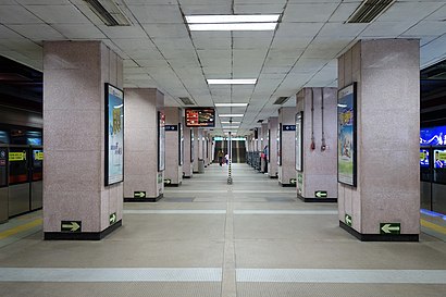
Wanshou Lu station (simplified Chinese: 万寿路站; traditional Chinese: 萬壽路站; pinyin: Wànshòu Lù zhàn; lit. 'Wanshou Road station') is a station on Line 1 of the Beijing Subway.Wiki
- 万寿路 Wanshou Lu,
- 公主坟 Gongzhufen
Metro stations near 万寿路口北 station
Get around 万寿路街道 by public transit!
Traveling around 万寿路街道 has never been so easy. See step by step directions as you travel to any attraction, street or major public transit station. View bus and train schedules, arrival times, service alerts and detailed routes on a map, so you know exactly how to get to anywhere in 万寿路街道.
When traveling to any destination around 万寿路街道 use Moovit's Live Directions with Get Off Notifications to know exactly where and how far to walk, how long to wait for your line, and how many stops are left. Moovit will alert you when it's time to get off — no need to constantly re-check whether yours is the next stop.
Wondering how to use public transit in 万寿路街道 or how to pay for public transit in 万寿路街道? Moovit public transit app can help you navigate your way with public transit easily, and at minimum cost. It includes public transit fees, ticket prices, and costs. Looking for a map of 万寿路街道 public transit lines? Moovit public transit app shows all public transit maps in 万寿路街道 with all Bus, Train, Metro, Cable Car and Funicular routes and stops on an interactive map.
Beijing has 5 transit type(s), including: Bus, Train, Metro, Cable Car and Funicular, operated by several transit agencies, including 北京地铁, 北京公交有轨电车有限公司, 北京市郊铁路局 and 北京公交