Directions to 三創生活園區 (中正區) with public transportation
The following transit lines have routes that pass near 三創生活園區
How to get to 三創生活園區 by bus?
Click on the bus route to see step by step directions with maps, line arrival times and updated time schedules.
How to get to 三創生活園區 by metro?
Click on the metro route to see step by step directions with maps, line arrival times and updated time schedules.
Bus stops near 三創生活園區 in 中正區
- 光華商場 Guanghua Market, 2 min walk,
- 臺北科技大學 National Taipei U. Of Technology, 3 min walk,
- 忠孝國小 Zhongxiao Elementary School, 5 min walk,
- 正守公園 Zhengshou Park, 5 min walk,
- 長安國小(長安) Changan Elementary School (Chang’An), 6 min walk,
- 華山文創園區 Huashan Cultural And Creative Industries Park, 7 min walk,
Metro stations near 三創生活園區 in 中正區
- 忠孝復興 Zhongxiao Fuxing, 3 min walk,
- 松江南京 Songjiang Nanjing, 9 min walk,
- 東門 Dongmen, 21 min walk,
Bus lines to 三創生活園區 in 中正區
- 669路, 信義松仁路口(松仁) Xinyi And Songren Rd. Intersection (Songren),
- 205, 光仁國小 Guangren Elementary School,
- 257路, 榮華中平路口 Ronghua & Zhongping Intersection,
- 276, 二二八和平公園 2/28 Peace Park,
- 1550, 大慶大城社區 Daqingdacheng Community - 自來水處(辛亥) Taipei Water Department(Xinhai),
- 1550B, 大慶大城社區 Daqingdacheng Community - 自來水處(辛亥) Taipei Water Department(Xinhai),
- 1550C, 大慶大城社區 Daqingdacheng Community - 自來水處(辛亥) Taipei Water Department(Xinhai),
- 109, 萬芳社區 Wanfang Community - 陽明山 Yangmingshan,
- 214, 中和 Zhonghe - 內湖 Neihu,
- 214直, 中和 Zhonghe - 松山機場 Taipei Songshan Airport,
- 222, 內湖 Neihu - 衡陽路 Hengyang Rd.,
- 226, 三重 Sanchong - 吳興街 Wuxing St.,
- 280, 天母 Tianmu - 公館 Gongguan,
- 280直, 天母 Tianmu - 公館 Gongguan,
- 505, 撫遠街 Fuyuan St. - 景美 Jingmei,
- 643, 錦繡山莊 Jinxiu Moubtaion Villa - 復興北村 Fuxing Bei Village,
- 668, 汐止 Xizhi - 公館 Gongguan,
- 672, 大鵬新城 Dapeng New Village - 民生社區 Mingsheng Community,
- 675, 汐止 Xizhi - 捷運公館站 MRT Gongguan Sta.,
- 676, 動物園 Taipei Zoo - 行天宮 Xingtiangong,
What are the closest stations to 三創生活園區?
The closest stations to 三創生活園區 are:
- 光華商場 Guanghua Market is 88 meters away, 2 min walk.
- 臺北科技大學 National Taipei U. Of Technology is 136 meters away, 3 min walk.
- 忠孝復興 Zhongxiao Fuxing is 202 meters away, 3 min walk.
- 忠孝國小 Zhongxiao Elementary School is 292 meters away, 5 min walk.
- 正守公園 Zhengshou Park is 328 meters away, 5 min walk.
- 長安國小(長安) Changan Elementary School (Chang’An) is 407 meters away, 6 min walk.
- 華山文創園區 Huashan Cultural And Creative Industries Park is 462 meters away, 7 min walk.
- 松江南京 Songjiang Nanjing is 641 meters away, 9 min walk.
- 東門 Dongmen is 1570 meters away, 21 min walk.
Which bus lines stop near 三創生活園區?
These bus lines stop near 三創生活園區: 203往天母, 222, 226, 262區, 280, 41, 672, 松江新生幹線.
Which metro lines stop near 三創生活園區?
These metro lines stop near 三創生活園區: 中和新蘆線, 板南線.
What’s the nearest metro station to 三創生活園區 in 中正區?
The nearest metro station to 三創生活園區 in 中正區 is 忠孝復興 Zhongxiao Fuxing. It’s a 3 min walk away.
What’s the nearest bus stop to 三創生活園區 in 中正區?
The nearest bus stop to 三創生活園區 in 中正區 is 光華商場 Guanghua Market. It’s a 2 min walk away.
What time is the first metro to 三創生活園區 in 中正區?
The 淡水信義線 is the first metro that goes to 三創生活園區 in 中正區. It stops nearby at 6:03 AM.
What time is the last metro to 三創生活園區 in 中正區?
The 淡水信義線 is the last metro that goes to 三創生活園區 in 中正區. It stops nearby at 12:44 AM.
What time is the first bus to 三創生活園區 in 中正區?
The 299(三重) is the first bus that goes to 三創生活園區 in 中正區. It stops nearby at 5:15 AM.
What time is the last bus to 三創生活園區 in 中正區?
The 212夜 is the last bus that goes to 三創生活園區 in 中正區. It stops nearby at 12:46 AM.
See 三創生活園區, 中正區, on the map
Public Transit to 三創生活園區 in 中正區
Wondering how to get to 三創生活園區 in 中正區, Taiwan? Moovit helps you find the best way to get to 三創生活園區 with step-by-step directions from the nearest public transit station.
Moovit provides free maps and live directions to help you navigate through your city. View schedules, routes, timetables, and find out how long does it take to get to 三創生活園區 in real time.
Looking for the nearest stop or station to 三創生活園區? Check out this list of stops closest to your destination: 光華商場 Guanghua Market; 臺北科技大學 National Taipei U. Of Technology; 忠孝復興 Zhongxiao Fuxing; 忠孝國小 Zhongxiao Elementary School; 正守公園 Zhengshou Park; 長安國小(長安) Changan Elementary School (Chang’An); 華山文創園區 Huashan Cultural And Creative Industries Park; 松江南京 Songjiang Nanjing; 東門 Dongmen.
Bus: 203往天母, 222, 226, 262區, 280, 41, 672, 松江新生幹線, 669路, 205, 257路, 276, 1550, 1550B, 1550C, 109, 214.Metro: 中和新蘆線, 板南線, 文湖線, 松山新店線, 淡水信義線.
Want to see if there’s another route that gets you there at an earlier time? Moovit helps you find alternative routes or times. Get directions from and directions to 三創生活園區 easily from the Moovit App or Website.
We make riding to 三創生活園區 easy, which is why over 1.5 million users, including users in 中正區, trust Moovit as the best app for public transit. You don’t need to download an individual bus app or train app, Moovit is your all-in-one transit app that helps you find the best bus time or train time available.
For information on prices of bus and metro, costs and ride fares to 三創生活園區, please check the Moovit app.
Use the app to navigate to popular places including to the airport, hospital, stadium, grocery store, mall, coffee shop, school, college, and university.
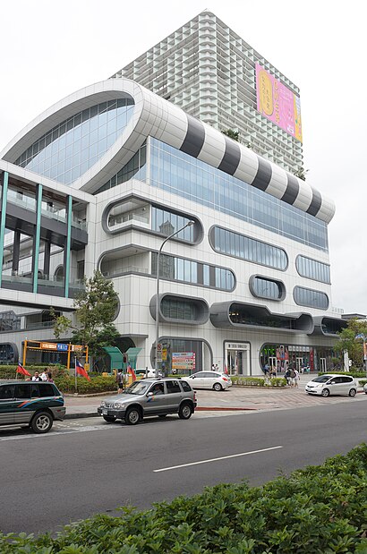
三創生活園區 Address: 市民大道三段2號 street in 中正區
Attractions near 三創生活園區
Syntrend (三創生活園區),Cooldesign 創意倉庫三創生活館,Syntrend 三創生活園區美食街,小米三創生活館,Gundam Base Taiwan No.1,中華電信台北三創服務中心,CLAPPER STUDIO,普雷伊電視遊樂器專賣店 八德門市,光華商場,八德路一段 31號,原價屋現代店,全球人壽希望園區,臺北科技大學,欣亞數位3c,原價屋 Coolpc,Upside Down House (華山顛倒屋),823 彈藥庫,審計部,原價屋,噽香鐵板燒便當嘉義雞肉飯How to get to popular attractions in 中正區 with public transit
三峽火化場, New Taipei,國光客運金山站, 金山區,新埔國小, 板橋區,新北市立圖書館三重分館, 三重區,第一殯儀館, 中山區,濱江街180巷, 松山區,新店市寶橋路235巷, 新店區,地藏庵, 新莊區,林森北路, 中山區,桃園忠烈祠(桃園神社), Taoyuan,臺灣新北地方法院 三重簡易庭, 三重區,一郎日本料理, 中山區,淡水海宴庭園餐廳, 淡水區,林森北路/錦州街口, 中山區,松山霞海城隍廟 - 五路財神, 松山區,宏匯廣場 HONHUI PLAZA, 新莊區,特力屋 B&Q(台北士林店), 士林區,板橋大遠百 Mega City, 中正區,宜家家居 IKEA, 新莊區,MRT Taipei 101 / World Trade Center Station (捷運台北101 / 世貿站), 信義區Get around Taipei - New Taipei by public transit!
Traveling around Taipei - New Taipei has never been so easy. See step by step directions as you travel to any attraction, street or major public transit station. View bus and train schedules, arrival times, service alerts and detailed routes on a map, so you know exactly how to get to anywhere in Taipei - New Taipei.
When traveling to any destination around Taipei - New Taipei use Moovit's Live Directions with Get Off Notifications to know exactly where and how far to walk, how long to wait for your line, and how many stops are left. Moovit will alert you when it's time to get off — no need to constantly re-check whether yours is the next stop.
Wondering how to use public transit in Taipei - New Taipei or how to pay for public transit in Taipei - New Taipei? Moovit public transit app can help you navigate your way with public transit easily, and at minimum cost. It includes public transit fees, ticket prices, and costs. Looking for a map of Taipei - New Taipei public transit lines? Moovit public transit app shows all public transit maps in Taipei - New Taipei with all Bus, Train, Metro, Light Rail and Gondola routes and stops on an interactive map.
Taipei - New Taipei has 5 transit type(s), including: Bus, Train, Metro, Light Rail and Gondola, operated by several transit agencies, including 臺北捷運 Taipei Metro, 新北捷運 New Taipei Metro, 桃園捷運Taoyuan Metro, 臺鐵 Taiwan Railway, 貓空纜車 Maokong Gondola, 首都客運 Capital Bus Co., Ltd., 欣欣客運 Shin-Shin Bus Co., Ltd., 大都會客運 Metropolitan Bus Co., Ltd., 大有巴士 Citiair Bus Co., Ltd., 東南客運 Southeast Bus Co., Ltd., 大南汽車 Danan Bus Co., Ltd., 指南客運 Zhinan Bus Co., Ltd., 光華巴士 Kuang-Hua Bus Co., Ltd., 中興巴士 Zhongxing Bus, 皇家客運 Royal Bus Co., Ltd.