东林广场 station - Tuesday schedule
| Line | Direction | Time |
|---|---|---|
| 2号线 | 无锡东站 | 06:11 |
| 2号线 | 无锡东站 | 06:19 |
| 2号线 | 梅园开原寺 | 06:21 |
| 2号线 | 无锡东站 | 06:27 |
| 2号线 | 梅园开原寺 | 06:29 |
| 2号线 | 无锡东站 | 06:35 |
| 2号线 | 梅园开原寺 | 06:37 |
| 2号线 | 无锡东站 | 06:43 |
| 2号线 | 梅园开原寺 | 06:45 |
| 2号线 | 无锡东站 | 06:51 |
| 2号线 | 梅园开原寺 | 06:53 |
| 2号线 | 无锡东站 | 06:59 |
| 2号线 | 梅园开原寺 | 07:01 |
| 2号线 | 无锡东站 | 07:07 |
| 2号线 | 梅园开原寺 | 07:09 |
| 2号线 | 无锡东站 | 07:15 |
| 2号线 | 梅园开原寺 | 07:17 |
| 2号线 | 无锡东站 | 07:22 |
| 2号线 | 梅园开原寺 | 07:25 |
| 2号线 | 无锡东站 | 07:29 |
| 2号线 | 梅园开原寺 | 07:32 |
| 2号线 | 无锡东站 | 07:36 |
| 2号线 | 梅园开原寺 | 07:39 |
| 2号线 | 无锡东站 | 07:43 |
| 2号线 | 梅园开原寺 | 07:46 |
Directions to 东林广场 station (梁溪区) with public transit
The following transit lines have routes that pass near 东林广场
 Bus: 102路, 19路, 23路, 3路区间, 57路.
- Metro: 2号线, 1号线, 3号线.
How to get to 东林广场 station by bus?
Click on the bus route to see step by step directions with maps, line arrival times and updated time schedules.
How to get to 东林广场 station by metro?
Click on the metro route to see step by step directions with maps, line arrival times and updated time schedules.
Bus stops near 东林广场 stop in 梁溪区
- 长庆路(人民东路), 1 min walk,
- 新生路(人民中路), 4 min walk,
- 东门, 4 min walk,
- 东林书院, 5 min walk,
Metro stations near 东林广场 station in 梁溪区
- 三阳广场, 9 min walk,
- 无锡火车, 26 min walk,
Bus lines to 东林广场 station in 梁溪区
- 3路, 双桥村公交停车场 - 梁溪大桥,
- 28路, 火车站 - 新世界国际总站,
- 55路, 天鹏食品城 - 招商城汽车南站,
- 61路, 向阳 - 彩印厂,
- 75路, 向阳 - 惠畅里,
- 80路, 火车站 - 东北塘公交总站,
- 87路, 鼋头渚(充山) - 靖海新村,
- 100路, 火车站 - 红星美凯龙,
- 102路, 春江花园(学前东路) - 盛岸公交停车场,
- 112路, 梅园公交总站 - 广益佳苑(广泽路),
- 501路, 南禅寺 - 太湖花园三期,
- 722路, 崇安寺 - 安镇公交总站,
- 63路内环, 宁海里 - 宁海里,
- 3路区间, 梁溪大桥 - 东北塘公交总站,
- 722路夜班, 安镇公交总站 - 火车站,
- 715路专线, 国际饭店,
- 63路外环, 宁海里,
- 15路, 招商城汽车南,
- 宜家专线, 宜家家居(团结路) - 无锡汽车站,
- 19路, 火车站 - 公交梅村总站,
What are the closest stations to 东林广场?
The closest stations to 东林广场 are:
- 长庆路(人民东路) is 45 meters away, 1 min walk.
- 新生路(人民中路) is 253 meters away, 4 min walk.
- 东门 is 264 meters away, 4 min walk.
- 东林书院 is 297 meters away, 5 min walk.
- 三阳广场 is 635 meters away, 9 min walk.
- 无锡火车 is 1991 meters away, 26 min walk.
Which bus lines stop near 东林广场?
These bus lines stop near 东林广场: 102路, 19路, 23路, 3路区间, 57路, 87路.
Which metro line stops near 东林广场?
2号线 (无锡东站)
What’s the nearest metro station to 东林广场 in 梁溪区?
The nearest metro station to 东林广场 in 梁溪区 is 三阳广场. It’s a 9 min walk away.
What’s the nearest bus station to 东林广场 in 梁溪区?
The nearest bus station to 东林广场 in 梁溪区 is 长庆路(人民东路). It’s a 1 min walk away.
What time is the first metro to 东林广场 in 梁溪区?
The 2号线 is the first metro that goes to 东林广场 in 梁溪区. It stops nearby at 6:10 AM.
What time is the last metro to 东林广场 in 梁溪区?
The 3号线 is the last metro that goes to 东林广场 in 梁溪区. It stops nearby at 10:59 PM.
What time is the first bus to 东林广场 in 梁溪区?
The 15路 is the first bus that goes to 东林广场 in 梁溪区. It stops nearby at 5:35 AM.
What time is the last bus to 东林广场 in 梁溪区?
The 722路夜班 is the last bus that goes to 东林广场 in 梁溪区. It stops nearby at 11:50 PM.
See 东林广场 station, 梁溪区, on the map
Public transit to 东林广场 station in 梁溪区
Looking for directions to 东林广场 in 梁溪区, China?
Download the Moovit App to find the current schedule and step-by-step directions for Bus or Metro routes that pass through 东林广场.
Looking for the nearest stops closest to 东林广场 ? Check out this list of closest stops to your destination: 长庆路(人民东路); 新生路(人民中路); 东门; 东林书院; 三阳广场; 无锡火车.
Bus: 102路, 19路, 23路, 3路区间, 57路, 87路, 3路, 28路, 55路, 61路, 75路, 715路专线, 63路外环, 15路, 宜家专线, 611路, 712路.Metro: 2号线, 1号线, 3号线.
We make riding on public transit to 东林广场 easy, which is why over 1.5 million users, including users in 梁溪区 trust Moovit as the best app for public transit.
Use the app to navigate to popular places including to the airport, hospital, stadium, grocery store, mall, coffee shop, school, college, and university.
The first line to this station is 2号线, at 06:11, and the last line is 2号线 at 22:26.
This station serves 无锡地铁’s lines
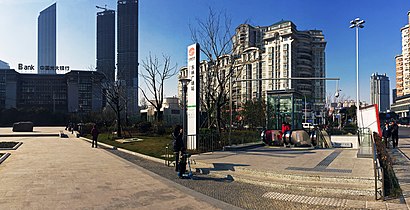
Donglin Plaza Station (Chinese: 东林广场站), is a metro station of Line 2, Wuxi Metro. It started operations on 28 December 2014. The station is near Donglin Academy.Wiki
Get around 梁溪区 by public transit!
Traveling around 梁溪区 has never been so easy. See step by step directions as you travel to any attraction, street or major public transit station. View bus and train schedules, arrival times, service alerts and detailed routes on a map, so you know exactly how to get to anywhere in 梁溪区.
When traveling to any destination around 梁溪区 use Moovit's Live Directions with Get Off Notifications to know exactly where and how far to walk, how long to wait for your line, and how many stops are left. Moovit will alert you when it's time to get off — no need to constantly re-check whether yours is the next stop.
Wondering how to use public transit in 梁溪区 or how to pay for public transit in 梁溪区? Moovit public transit app can help you navigate your way with public transit easily, and at minimum cost. It includes public transit fees, ticket prices, and costs. Looking for a map of 梁溪区 public transit lines? Moovit public transit app shows all public transit maps in 梁溪区 with all Bus and Metro routes and stops on an interactive map.
Wuxi has 2 transit type(s), including: Bus and Metro, operated by several transit agencies, including 无锡地铁 and 无锡公交