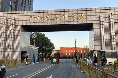
中国农业科学院 stop - Sunday schedule
| Line | Direction | Time |
|---|---|---|
| 夜8 | 小马厂 | 03:22 |
| 夜8 | 小马厂 | 04:02 |
| 夜8 | 小马厂 | 04:32 |
| 夜8 | 小马厂 | 04:52 |
| 夜8 | 小马厂 | 05:13 |
| 320 | 北京西站 | 05:40 |
| 320 | 北京西站 | 05:50 |
| 运通105 | 中苑宾馆 | 05:55 |
| 332 | 前门西 | 05:56 |
| 320 | 北京西站 | 06:00 |
| 特15 | 西直门北 | 06:01 |
| 658 | 定慧桥南 | 06:04 |
| 运通105 | 中苑宾馆 | 06:05 |
| 332 | 前门西 | 06:06 |
| 26 | 西便门 | 06:07 |
| 320 | 北京西站 | 06:10 |
| 特15 | 西直门北 | 06:11 |
| 658 | 定慧桥南 | 06:14 |
| 运通105 | 中苑宾馆 | 06:15 |
| 332 | 前门西 | 06:16 |
| 26 | 西便门 | 06:17 |
| 320 | 北京西站 | 06:20 |
| 特15 | 西直门北 | 06:21 |
| 特4 | 前门 | 06:21 |
| 658 | 定慧桥南 | 06:24 |
Directions to 中国农业科学院 stop (紫竹院街道) with public transit
The following transit lines have routes that pass near 中国农业科学院
 Bus: 332, 651, 658, 特15, 特4.
- Metro: 4号线大兴线 LINE 4 - DAXING LINE, 16, 10.
How to get to 中国农业科学院 stop by bus?
Click on the bus route to see step by step directions with maps, line arrival times and updated time schedules.
How to get to 中国农业科学院 stop by metro?
Click on the metro route to see step by step directions with maps, line arrival times and updated time schedules.
Bus stops near 中国农业科学院 stop in 紫竹院街道
- 四通桥东, 7 min walk,
- 中国农业科学院南门, 11 min walk,
- 友谊宾馆, 11 min walk,
- 中国农业科学院, 11 min walk,
- 魏公村路东口, 11 min walk,
- 为公桥, 12 min walk,
- 四通桥西, 12 min walk,
Metro stations near 中国农业科学院 station in 紫竹院街道
- 人民大学 Renmin Univ., 9 min walk,
- 苏州桥 Suzhou Qiao, 17 min walk,
- 海淀黄庄 Haidian Huangzhuang, 22 min walk,
Bus lines to 中国农业科学院 stop in 紫竹院街道
- 79, 知春路 - 鲁谷公交场站,
- 302, 巴沟村 - 辛庄,
- 323, 知春里 - 富丰桥西,
- 361, 巴沟村 - 望京科技创业园,
- 425, 小营公交场站 - 南坞,
- 549, 四通桥东 - 厢白旗桥,
- 614, 单村 - 大钟寺,
- 658, 嘉铭园 - 定慧桥南,
- 695, 时代庄园北站 -动物园枢纽站,
- 921, 地铁阜通站Ditie Futong Zhan - 城子Chengzi,
- 368外, 城南嘉园北 - 城南嘉园北,
- 夜30外, 十里河桥北-十里河桥西,
- 425快车, 大屯东 - 南坞,
- 运通201, 来广营北 - 六里桥长途站,
- 645, 航天桥北,
- 651, 柳林村,
- 660, 善各庄,
- 运通103, 西三旗,
- 机场4线 (公主坟线), 首都机场三号航站楼,
- 26, 二里庄,
What are the closest stations to 中国农业科学院?
The closest stations to 中国农业科学院 are:
- 四通桥东 is 510 meters away, 7 min walk.
- 人民大学 Renmin Univ. is 646 meters away, 9 min walk.
- 中国农业科学院南门 is 699 meters away, 11 min walk.
- 友谊宾馆 is 795 meters away, 11 min walk.
- 中国农业科学院 is 821 meters away, 11 min walk.
- 魏公村路东口 is 831 meters away, 11 min walk.
- 为公桥 is 893 meters away, 12 min walk.
- 四通桥西 is 912 meters away, 12 min walk.
- 苏州桥 Suzhou Qiao is 1220 meters away, 17 min walk.
- 海淀黄庄 Haidian Huangzhuang is 1666 meters away, 22 min walk.
Which bus lines stop near 中国农业科学院?
These bus lines stop near 中国农业科学院: 332, 651, 658, 特15, 特4.
Which metro line stops near 中国农业科学院?
4号线大兴线 LINE 4 - DAXING LINE (往安河桥北 Towards Anheqiao Bei(N))
What’s the nearest metro station to 中国农业科学院 in 紫竹院街道?
The nearest metro station to 中国农业科学院 in 紫竹院街道 is 人民大学 Renmin Univ.. It’s a 9 min walk away.
What’s the nearest bus station to 中国农业科学院 in 紫竹院街道?
The nearest bus station to 中国农业科学院 in 紫竹院街道 is 四通桥东. It’s a 7 min walk away.
What time is the first metro to 中国农业科学院 in 紫竹院街道?
The 10 is the first metro that goes to 中国农业科学院 in 紫竹院街道. It stops nearby at 4:58 AM.
What time is the last metro to 中国农业科学院 in 紫竹院街道?
The 10 is the last metro that goes to 中国农业科学院 in 紫竹院街道. It stops nearby at 12:17 AM.
What time is the first bus to 中国农业科学院 in 紫竹院街道?
The 夜30外 is the first bus that goes to 中国农业科学院 in 紫竹院街道. It stops nearby at 3:01 AM.
What time is the last bus to 中国农业科学院 in 紫竹院街道?
The 夜30外 is the last bus that goes to 中国农业科学院 in 紫竹院街道. It stops nearby at 3:47 AM.
See 中国农业科学院 stop, 紫竹院街道, on the map
Public transit to 中国农业科学院 stop in 紫竹院街道
Looking for directions to 中国农业科学院 in 紫竹院街道, China?
Download the Moovit App to find the current schedule and step-by-step directions for Bus or Metro routes that pass through 中国农业科学院.
Looking for the nearest stops closest to 中国农业科学院 ? Check out this list of closest stops to your destination: 四通桥东; 人民大学 Renmin Univ.; 中国农业科学院南门; 友谊宾馆; 中国农业科学院; 魏公村路东口; 为公桥; 四通桥西; 苏州桥 Suzhou Qiao; 海淀黄庄 Haidian Huangzhuang.
Bus: 332, 651, 658, 特15, 特4, 79, 302, 323, 361, 425, 645, 660, 运通103, 机场4线 (公主坟线).Metro: 4号线大兴线 LINE 4 - DAXING LINE, 16, 10.
We make riding on public transit to 中国农业科学院 easy, which is why over 1.5 million users, including users in 紫竹院街道 trust Moovit as the best app for public transit.
Use the app to navigate to popular places including to the airport, hospital, stadium, grocery store, mall, coffee shop, school, college, and university.
The first line to this stop is 夜8, at 03:22, and the last line is 夜8 at 02:42.
This stop serves Beijing Public Transport’s lines
- 人民大学 Renmin Univ.,
- 苏州桥 Suzhou Qiao,
- 海淀黄庄 Haidian Huangzhuang
Metro stations near 中国农业科学院 station
Get around 紫竹院街道 by public transit!
Traveling around 紫竹院街道 has never been so easy. See step by step directions as you travel to any attraction, street or major public transit station. View bus and train schedules, arrival times, service alerts and detailed routes on a map, so you know exactly how to get to anywhere in 紫竹院街道.
When traveling to any destination around 紫竹院街道 use Moovit's Live Directions with Get Off Notifications to know exactly where and how far to walk, how long to wait for your line, and how many stops are left. Moovit will alert you when it's time to get off — no need to constantly re-check whether yours is the next stop.
Wondering how to use public transit in 紫竹院街道 or how to pay for public transit in 紫竹院街道? Moovit public transit app can help you navigate your way with public transit easily, and at minimum cost. It includes public transit fees, ticket prices, and costs. Looking for a map of 紫竹院街道 public transit lines? Moovit public transit app shows all public transit maps in 紫竹院街道 with all Bus, Train, Metro, Cable Car and Funicular routes and stops on an interactive map.
Beijing has 5 transit type(s), including: Bus, Train, Metro, Cable Car and Funicular, operated by several transit agencies, including 北京地铁, 北京公交有轨电车有限公司, 北京市郊铁路局 and 北京公交