Directions to 佘山天文台 with public transportation
The following transit lines have routes that pass near 佘山天文台
 Bus: 上佘定班线, 南青专线, 松重线, 松青线, 沪陈线.
- Metro: 9号线 LINE 9.
- Cable Car: 松江有轨电车2号线.
How to get to 佘山天文台 by bus?
Click on the bus route to see step by step directions with maps, line arrival times and updated time schedules.
Bus stops near 佘山天文台
- 佘山, 7 min walk,
Cable Car station near 佘山天文台
- 广富林路 (东华大学), 8 min walk,
Metro station near 佘山天文台
- 洞泾 Dongjing, 56 min walk,
Bus lines to 佘山天文台
- 松重线, 松江大学城,
- 南青专线, 青浦汽车站,
- 松江92路, 佘山汽车站,
- 上佘定班线, 佘山汽车站 - 上海体育馆,
- 松江33路, 松江汽车东站 - 佘山汽车站,
- 松青线, 青浦汽车站 - 松江汽车东站,
- 沪陈线, 佘山汽车站 - 西区汽车站,
- 沪佘昆专线, 小昆山,
What are the closest stations to 佘山天文台?
The closest stations to 佘山天文台 are:
- 佘山 is 472 meters away, 7 min walk.
- 广富林路 (东华大学) is 594 meters away, 8 min walk.
- 洞泾 Dongjing is 4408 meters away, 56 min walk.
Which bus lines stop near 佘山天文台?
These bus lines stop near 佘山天文台: 上佘定班线, 南青专线, 松重线, 松青线, 沪陈线.
What’s the nearest bus station to 佘山天文台?
The nearest bus station to 佘山天文台 is 佘山. It’s a 7 min walk away.
What’s the nearest cable car station to 佘山天文台?
The nearest cable car station to 佘山天文台 is 广富林路 (东华大学). It’s a 8 min walk away.
What time is the first metro to 佘山天文台?
The 9号线 LINE 9 is the first metro that goes to 佘山天文台. It stops nearby at 5:58 AM.
What time is the last metro to 佘山天文台?
The 9号线 LINE 9 is the last metro that goes to 佘山天文台. It stops nearby at 11:54 PM.
What time is the first bus to 佘山天文台?
The 松青线 is the first bus that goes to 佘山天文台. It stops nearby at 5:34 AM.
What time is the last bus to 佘山天文台?
The 松江92路 is the last bus that goes to 佘山天文台. It stops nearby at 10:25 PM.
What time is the first cable car to 佘山天文台?
The 松江有轨电车2号线 is the first cable car that goes to 佘山天文台. It stops nearby at 6:06 AM.
What time is the last cable car to 佘山天文台?
The 松江有轨电车2号线 is the last cable car that goes to 佘山天文台. It stops nearby at 11:10 PM.
See 佘山天文台 on the map
Public Transportation to 佘山天文台
Wondering how to get to 佘山天文台? Moovit helps you find the best way to get to 佘山天文台 with step-by-step directions from the nearest public transit station.
Moovit provides free maps and live directions to help you navigate through your city. View schedules, routes, timetables, and find out how long does it take to get to 佘山天文台 in real time.
Looking for the nearest stop or station to 佘山天文台? Check out this list of stops closest to your destination: 佘山; 广富林路 (东华大学); 洞泾 Dongjing.
Bus: 上佘定班线, 南青专线, 松重线, 松青线, 沪陈线, 松江92路, 松江33路, 沪佘昆专线.Metro: 9号线 LINE 9.Cable Car: 松江有轨电车2号线.
Want to see if there’s another route that gets you there at an earlier time? Moovit helps you find alternative routes or times. Get directions from and directions to 佘山天文台 easily from the Moovit App or Website.
We make riding to 佘山天文台 easy, which is why over 1.5 million users, including users in 佘山, trust Moovit as the best app for public transit. You don’t need to download an individual bus app or train app, Moovit is your all-in-one transit app that helps you find the best bus time or train time available.
For information on prices of bus and metro, costs and ride fares to 佘山天文台, please check the Moovit app.
Use the app to navigate to popular places including to the airport, hospital, stadium, grocery store, mall, coffee shop, school, college, and university.
佘山天文台 Address: 佘山 street in 佘山
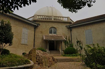
The Sheshan Observatory (Chinese: 佘山天文台; pinyin: Shéshān tiānwéntái) is an observatory on Sheshan Hill in Shanghai.Wiki
- 上海天文博物馆-检票处出入口,
- 上海天文博物馆-售票处,
- 西佘山天文食品商店,
- 百年天文台,
- 聚焦望远镜,
- 上海天文博物馆,
- 上海教区天主教圣物供应处,
- 外青松公路山后桥,
- 佘山林荫大道,
- 耶稣力尽首次跌倒,
- 佘山天主教堂,
- 紫圆大酒店,
- 佘山进教之佑圣母大殿 Sheshan Basilica,
- Sheshan Basilica (佘山进教之佑圣母大殿),
- 佘山进教之佑圣母大殿,
- West Sheshan Park (西佘山公园),
- 佘山花苑,
- 阿牛家常菜,
- 佘山国家森林公园-公共厕所,
- Shanghai Observatory, Sheshan Telescope
Places Near 佘山天文台
- Fairmont Peace Hotel (和平饭店), 外滩街道,
- 新场古镇, 新场镇,
- Wukang Building (武康大楼), 天平路街道,
- 大悦城(上海), 北站街道,
- 新场古镇, 新场镇,
- 南京路步行街, 南京东路街道,
- 武康大楼, 天平路街道,
- 复旦大学附属肿瘤医院,
- 上海城隍庙, 豫园街道,
- Bailian Outlets Plaza (百联奥特莱斯广场),
- 朵云书院旗舰店, 陆家嘴,
- 陆家嘴 Lujiazui, 陆家嘴,
- 上海吴淞国际邮轮码头,
- 余庆路/武康路(路口),
- 宝华寺, 彭浦镇,
- Wukang Road | 武康路, 湖南路街道,
- 上海滩(外滩店), 外滩街道,
- 上海新天地, 淮海中路街道,
- LuOne凯德晶萃广场(地铁站出口), 打浦桥街道,
- 七浦路服装批发市场, 北站街道
How to get to popular places in Shanghai with public transit
Get around 佘山 by public transit!
Traveling around 佘山 has never been so easy. See step by step directions as you travel to any attraction, street or major public transit station. View bus and train schedules, arrival times, service alerts and detailed routes on a map, so you know exactly how to get to anywhere in 佘山.
When traveling to any destination around 佘山 use Moovit's Live Directions with Get Off Notifications to know exactly where and how far to walk, how long to wait for your line, and how many stops are left. Moovit will alert you when it's time to get off — no need to constantly re-check whether yours is the next stop.
Wondering how to use public transit in 佘山 or how to pay for public transit in 佘山? Moovit public transit app can help you navigate your way with public transit easily, and at minimum cost. It includes public transit fees, ticket prices, and costs. Looking for a map of 佘山 public transit lines? Moovit public transit app shows all public transit maps in 佘山 with all Bus, Train, Metro, Tram, Ferry, Cable Car and Maglev routes and stops on an interactive map.
Shanghai has 7 transit type(s), including: Bus, Train, Metro, Tram, Ferry, Cable Car and Maglev, operated by several transit agencies, including 上海地铁, 金山铁路, 张江有轨电车, 上海磁悬浮, 上海巴士, 浦东公交, 松江公交, 闵行客运, 金山巴士, 奉贤客运, 奉贤巴士, 金球出租, 青浦巴士, 众兴客运 and 智迅客运