倪家桥站 stop - Tuesday schedule
| Line | Direction | Time |
|---|---|---|
| 16路 | 火车南站公交站 | 06:32 |
| 16路 | 火车南站公交站 | 06:42 |
| 16路 | 火车南站公交站 | 06:52 |
| 99路 | 火车南综合交通枢纽 | 06:56 |
| 16路 | 火车南站公交站 | 07:02 |
| 99路 | 火车南综合交通枢纽 | 07:08 |
| 118路 | 新会展中心公交站 | 07:11 |
| 16路 | 火车南站公交站 | 07:15 |
| 118路 | 新会展中心公交站 | 07:16 |
| 118路 | 新会展中心公交站 | 07:21 |
| 99路 | 火车南综合交通枢纽 | 07:21 |
| 118路 | 新会展中心公交站 | 07:26 |
| 16路 | 火车南站公交站 | 07:28 |
| 118路 | 新会展中心公交站 | 07:31 |
| 99路 | 火车南综合交通枢纽 | 07:34 |
| 118路 | 新会展中心公交站 | 07:36 |
| 99路 | 火车南综合交通枢纽 | 07:39 |
| 118路 | 新会展中心公交站 | 07:41 |
| 16路 | 火车南站公交站 | 07:41 |
| 99路 | 火车南综合交通枢纽 | 07:44 |
| 118路 | 新会展中心公交站 | 07:46 |
| 16路 | 火车南站公交站 | 07:46 |
| 99路 | 火车南综合交通枢纽 | 07:49 |
| 118路 | 新会展中心公交站 | 07:51 |
| 16路 | 火车南站公交站 | 07:51 |
Directions to 倪家桥站 stop (武侯区) with public transit
The following transit lines have routes that pass near 倪家桥站
 Bus: 114路, 118路, 16路, 504路, 77路.
- Metro: 1号线, 3号线.
How to get to 倪家桥站 stop by bus?
Click on the bus route to see step by step directions with maps, line arrival times and updated time schedules.
How to get to 倪家桥站 stop by metro?
Click on the metro route to see step by step directions with maps, line arrival times and updated time schedules.
Bus stops near 倪家桥站 stop in 武侯区
- 人民南路四段北站, 3 min walk,
- 倪家桥站, 4 min walk,
- 倪家桥路站, 6 min walk,
- 倪家桥路东站, 6 min walk,
- 玉林街倪家桥路口站, 7 min walk,
- 人南立交东站, 9 min walk,
- 盛隆街二环路口站, 10 min walk,
Metro stations near 倪家桥站 station in 武侯区
- 倪家桥, 12 min walk,
- 省体育馆, 24 min walk,
Bus lines to 倪家桥站 stop in 武侯区
- 16路, 八里桥公交站,
- 78路, 石羊场公交站,
- 99路, 动物园公交站,
- 118路, 人民南路一段,
- 504路, 人南立交东,
- 76路, 八里小区,
- 77路空调, 桦林园,
- 114路, 文德路,
- 77路, 万家湾公交站,
- 79路, 芳草街站,
- 153路, 百花中心,
- 247路环线, 桂溪公交站,
- 501路, 华阳客运站,
- 1112路, 中环人南路口,
- K2A环线快速公交线, 建设南路口,
- K2环线快速公交线, 杉板桥,
- K1A环线快速公交线, 双林北支路口,
- K1环线快速公交线, 杉板桥,
What are the closest stations to 倪家桥站?
The closest stations to 倪家桥站 are:
- 人民南路四段北站 is 177 meters away, 3 min walk.
- 倪家桥站 is 254 meters away, 4 min walk.
- 倪家桥路站 is 408 meters away, 6 min walk.
- 倪家桥路东站 is 409 meters away, 6 min walk.
- 玉林街倪家桥路口站 is 511 meters away, 7 min walk.
- 人南立交东站 is 666 meters away, 9 min walk.
- 盛隆街二环路口站 is 690 meters away, 10 min walk.
- 倪家桥 is 891 meters away, 12 min walk.
- 省体育馆 is 1834 meters away, 24 min walk.
Which bus lines stop near 倪家桥站?
These bus lines stop near 倪家桥站: 114路, 118路, 16路, 504路, 77路, 79路, 99路.
Which metro line stops near 倪家桥站?
1号线 (广都)
What’s the nearest metro station to 倪家桥站 in 武侯区?
The nearest metro station to 倪家桥站 in 武侯区 is 倪家桥. It’s a 12 min walk away.
What’s the nearest bus station to 倪家桥站 in 武侯区?
The nearest bus station to 倪家桥站 in 武侯区 is 人民南路四段北站. It’s a 3 min walk away.
See 倪家桥站 stop, 武侯区, on the map
Public transit to 倪家桥站 stop in 武侯区
Looking for directions to 倪家桥站 in 武侯区, China?
Download the Moovit App to find the current schedule and step-by-step directions for Bus or Metro routes that pass through 倪家桥站.
Looking for the nearest stops closest to 倪家桥站 ? Check out this list of closest stops to your destination: 人民南路四段北站; 倪家桥站; 倪家桥路站; 倪家桥路东站; 玉林街倪家桥路口站; 人南立交东站; 盛隆街二环路口站; 倪家桥; 省体育馆.
Bus: 114路, 118路, 16路, 504路, 77路, 79路, 99路, 78路, 76路, 77路空调.Metro: 1号线, 3号线.
We make riding on public transit to 倪家桥站 easy, which is why over 1.5 million users, including users in 武侯区 trust Moovit as the best app for public transit.
Use the app to navigate to popular places including to the airport, hospital, stadium, grocery store, mall, coffee shop, school, college, and university.
The first line to this stop is 16路, at 06:32, and the last line is 16路 at 23:29.
This stop serves 成都公交’s lines
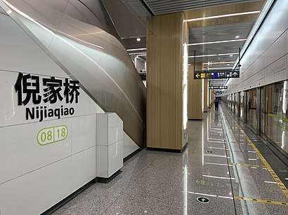
Nijiaqiao (Chinese: 倪家桥) is a station on Line 1 and Line 8 of the Chengdu Metro in China.Wiki
Popular routes from 倪家桥站 stop, 武侯区
Get around 武侯区 by public transit!
Traveling around 武侯区 has never been so easy. See step by step directions as you travel to any attraction, street or major public transit station. View bus and train schedules, arrival times, service alerts and detailed routes on a map, so you know exactly how to get to anywhere in 武侯区.
When traveling to any destination around 武侯区 use Moovit's Live Directions with Get Off Notifications to know exactly where and how far to walk, how long to wait for your line, and how many stops are left. Moovit will alert you when it's time to get off — no need to constantly re-check whether yours is the next stop.
Wondering how to use public transit in 武侯区 or how to pay for public transit in 武侯区? Moovit public transit app can help you navigate your way with public transit easily, and at minimum cost. It includes public transit fees, ticket prices, and costs. Looking for a map of 武侯区 public transit lines? Moovit public transit app shows all public transit maps in 武侯区 with all Bus and Metro routes and stops on an interactive map.
Chengdu has 2 transit type(s), including: Bus and Metro, operated by several transit agencies, including 成都地铁, 成都公交, 都江堰公交 and 金堂县公交