六沟垅 stop - Thursday schedule
| Line | Direction | Time |
|---|---|---|
| 401路 | 长沙火车 | 05:58 |
| 临117路 | 长沙火车 | 06:04 |
| 401路 | 长沙火车 | 06:08 |
| 308路 | 德政园 | 06:10 |
| 临117路 | 长沙火车 | 06:14 |
| 401路 | 长沙火车 | 06:18 |
| 811路 | 新开铺路口 | 06:19 |
| 308路 | 德政园 | 06:20 |
| 118区间线 | 望月湖 | 06:24 |
| 临117路 | 长沙火车 | 06:24 |
| 临118路 | 长沙火车 | 06:26 |
| 401路 | 长沙火车 | 06:28 |
| 811路 | 新开铺路口 | 06:29 |
| 308路 | 德政园 | 06:30 |
| 913路 | 桃花村 | 06:31 |
| 118区间线 | 望月湖 | 06:34 |
| 临117路 | 长沙火车 | 06:34 |
| 临118路 | 长沙火车 | 06:36 |
| 401路 | 长沙火车 | 06:38 |
| 811路 | 新开铺路口 | 06:39 |
| 308路 | 德政园 | 06:40 |
| 临109路 | 陈家湖 | 06:40 |
| 913路 | 桃花村 | 06:41 |
| 308区间线 | 德政园 | 06:42 |
| 临318路 | 桃子湖路口 | 06:42 |
Directions to 六沟垅 stop (岳麓区) with public transit
The following transit lines have routes that pass near 六沟垅
 Bus: 109路, 118区间线, 118路, 308区间线, 348路.
- Metro: 4号线, 2号线.
How to get to 六沟垅 stop by bus?
Click on the bus route to see step by step directions with maps, line arrival times and updated time schedules.
How to get to 六沟垅 stop by metro?
Click on the metro route to see step by step directions with maps, line arrival times and updated time schedules.
Bus stops near 六沟垅 stop in 岳麓区
- 六沟垅, 6 min walk,
- 中联重科科技园(银盆岭), 7 min walk,
- 四水厂, 9 min walk,
- 银双路银盆岭路口, 10 min walk,
- 潇湘北路(黄泥河路口), 14 min walk,
Metro stations near 六沟垅 station in 岳麓区
- 六沟垅, 23 min walk,
- 西湖公园, 37 min walk,
Bus lines to 六沟垅 stop in 岳麓区
- W106路, 望城环球奥特莱斯 - 东方红镇,
- 临117路, 长沙火车站 - 观沙岭小区,
- 临149路, 汽车西站 - 楚家湖公园,
- 临401路, 长沙火车站 - 茶子山小区,
- 66路, 长沙火车南站 - 汽车西站,
- 102路, 潇湘北路黄泥河路口 - 汽车南站,
- 132路, 牌楼口 - 世界之窗,
- 318路, 桃子湖路口 - 银杉路岳华路口,
- 348路, 汽车西站 - 长沙火车南站,
- 401路, 茶子山小区 - 长沙火车站,
- 405路, 汽车西站 - 荷花路东,
- 704路, 汽车西站 - 泉塘安置小区,
- 811路, 嘉年华公交基地戴家河 - 新开铺路口,
- 903路, 桃子湖路口 - 望城汽车站,
- 临318路, 桃子湖路口,
- 星沙704路, 汽车西,
- 临109路, 陈家湖,
- 临118路, 长沙火车,
- 118区间线, 望月湖,
- 308区间线, 德政园,
What are the closest stations to 六沟垅?
The closest stations to 六沟垅 are:
- 六沟垅 is 393 meters away, 6 min walk.
- 中联重科科技园(银盆岭) is 521 meters away, 7 min walk.
- 四水厂 is 668 meters away, 9 min walk.
- 银双路银盆岭路口 is 701 meters away, 10 min walk.
- 潇湘北路(黄泥河路口) is 1108 meters away, 14 min walk.
- 西湖公园 is 2869 meters away, 37 min walk.
Which bus lines stop near 六沟垅?
These bus lines stop near 六沟垅: 109路, 118区间线, 118路, 308区间线, 348路, 66路, 811路, 星沙704路.
Which metro line stops near 六沟垅?
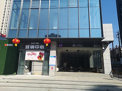
4号线 (罐子岭)
What’s the nearest metro station to 六沟垅 in 岳麓区?
The nearest metro station to 六沟垅 in 岳麓区 is 六沟垅. It’s a 23 min walk away.
What’s the nearest bus station to 六沟垅 in 岳麓区?
The nearest bus station to 六沟垅 in 岳麓区 is 六沟垅. It’s a 6 min walk away.
What time is the first metro to 六沟垅 in 岳麓区?
The 4号线 is the first metro that goes to 六沟垅 in 岳麓区. It stops nearby at 6:30 AM.
What time is the last metro to 六沟垅 in 岳麓区?
The 4号线 is the last metro that goes to 六沟垅 in 岳麓区. It stops nearby at 11:43 PM.
What time is the first bus to 六沟垅 in 岳麓区?
The 401路 is the first bus that goes to 六沟垅 in 岳麓区. It stops nearby at 5:57 AM.
What time is the last bus to 六沟垅 in 岳麓区?
The 401路 is the last bus that goes to 六沟垅 in 岳麓区. It stops nearby at 11:45 PM.
See 六沟垅 stop, 岳麓区, on the map
Public transit to 六沟垅 stop in 岳麓区
Looking for directions to 六沟垅 in 岳麓区, China?
Download the Moovit App to find the current schedule and step-by-step directions for Bus or Metro routes that pass through 六沟垅.
Looking for the nearest stops closest to 六沟垅 ? Check out this list of closest stops to your destination: 六沟垅; 中联重科科技园(银盆岭); 四水厂; 银双路银盆岭路口; 潇湘北路(黄泥河路口); 西湖公园.
Bus: 109路, 118区间线, 118路, 308区间线, 348路, 66路, 811路, 星沙704路, W106路, 临117路, 临149路, 临401路, 临318路, 临109路, 临118路, 308路, 211路.Metro: 4号线, 2号线.
We make riding on public transit to 六沟垅 easy, which is why over 1.5 million users, including users in 岳麓区 trust Moovit as the best app for public transit.
Use the app to navigate to popular places including to the airport, hospital, stadium, grocery store, mall, coffee shop, school, college, and university.
The first line to this stop is 401路, at 05:58, and the last line is 401路 at 23:38.
This stop serves Changsha Bus Group’s lines
Popular routes from 六沟垅 stop, 岳麓区
- 六沟垅,
- 中联重科科技园(银盆岭),
- 四水厂,
- 银双路银盆岭路口,
- 潇湘北路(黄泥河路口)
Bus stops near 六沟垅 stop
Get around 岳麓区 by public transit!
Traveling around 岳麓区 has never been so easy. See step by step directions as you travel to any attraction, street or major public transit station. View bus and train schedules, arrival times, service alerts and detailed routes on a map, so you know exactly how to get to anywhere in 岳麓区.
When traveling to any destination around 岳麓区 use Moovit's Live Directions with Get Off Notifications to know exactly where and how far to walk, how long to wait for your line, and how many stops are left. Moovit will alert you when it's time to get off — no need to constantly re-check whether yours is the next stop.
Wondering how to use public transit in 岳麓区 or how to pay for public transit in 岳麓区? Moovit public transit app can help you navigate your way with public transit easily, and at minimum cost. It includes public transit fees, ticket prices, and costs. Looking for a map of 岳麓区 public transit lines? Moovit public transit app shows all public transit maps in 岳麓区 with all Bus and Metro routes and stops on an interactive map.
Changsha has 2 transit type(s), including: Bus and Metro, operated by several transit agencies, including 长沙地铁 and 长沙公交集团