Directions to 凤起路桥 (西湖区) with public transportation
The following transit lines have routes that pass near 凤起路桥
 Bus: 10路, 14路, 1路, 45路, 49路.
- Metro: 1号线, 2号线.
How to get to 凤起路桥 by bus?
Click on the bus route to see step by step directions with maps, line arrival times and updated time schedules.
How to get to 凤起路桥 by metro?
Click on the metro route to see step by step directions with maps, line arrival times and updated time schedules.
Bus stops near 凤起路桥 in 西湖区
- 环城西路十四中, 3 min walk,
- 凤起路十四中, 5 min walk,
- 少年宫, 5 min walk,
- 钱塘门外, 6 min walk,
- 江山弄, 8 min walk,
- 省府大楼, 8 min walk,
Metro station near 凤起路桥 in 西湖区
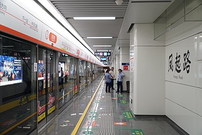
- 凤起路, 10 min walk,
Bus lines to 凤起路桥 in 西湖区
- 10路, 平海路岳王路口,
- 45路, 长板巷,
- 49路, 城站火车站,
- 295路, 滨盛路信诚路口,
- 73路, 省府大楼,
- 1路, 凤起路十四中,
- 12路, 丝绸博物馆 - 三塘竹苑,
- 12路区间, 三塘竹苑 - 清波门,
- 25路, 吴山公交站 - 蒋村公交中心站,
- 26路, 凤起路十四中 - 大关小区北,
- 46路, 费家塘 - 六公园,
- 103路, 岳王路 - 九溪,
- 130路, 凤起路十四中 - 蒋村兴达苑,
- 78路, 沈家村,
- 6路, 草庵公交站,
- 16路, 岳王路,
- 7路, 城站火车站 - 灵隐,
- 27路, 岳王路 - 龙井山园,
- 27路定时班, 岳王路 - 龙井村,
- 52路环线, 旅游集散(黄龙)中心 - 旅游集散(黄龙)中心,
What are the closest stations to 凤起路桥?
The closest stations to 凤起路桥 are:
- 环城西路十四中 is 179 meters away, 3 min walk.
- 凤起路十四中 is 317 meters away, 5 min walk.
- 少年宫 is 361 meters away, 5 min walk.
- 钱塘门外 is 399 meters away, 6 min walk.
- 江山弄 is 563 meters away, 8 min walk.
- 省府大楼 is 581 meters away, 8 min walk.
- 凤起路 is 688 meters away, 10 min walk.
Which bus lines stop near 凤起路桥?
These bus lines stop near 凤起路桥: 10路, 14路, 1路, 45路, 49路.
Which metro lines stop near 凤起路桥?
These metro lines stop near 凤起路桥: 1号线, 2号线.
What’s the nearest metro station to 凤起路桥 in 西湖区?
The nearest metro station to 凤起路桥 in 西湖区 is 凤起路. It’s a 10 min walk away.
What’s the nearest bus station to 凤起路桥 in 西湖区?
The nearest bus station to 凤起路桥 in 西湖区 is 环城西路十四中. It’s a 3 min walk away.
What time is the first metro to 凤起路桥 in 西湖区?
The 1号线 is the first metro that goes to 凤起路桥 in 西湖区. It stops nearby at 6:03 AM.
What time is the last metro to 凤起路桥 in 西湖区?
The 2号线 is the last metro that goes to 凤起路桥 in 西湖区. It stops nearby at 11:36 PM.
What time is the first bus to 凤起路桥 in 西湖区?
The 16路 is the first bus that goes to 凤起路桥 in 西湖区. It stops nearby at 5:07 AM.
What time is the last bus to 凤起路桥 in 西湖区?
The 10路 is the last bus that goes to 凤起路桥 in 西湖区. It stops nearby at 10:38 PM.
See 凤起路桥, 西湖区, on the map
Public Transit to 凤起路桥 in 西湖区
Wondering how to get to 凤起路桥 in 西湖区? Moovit helps you find the best way to get to 凤起路桥 with step-by-step directions from the nearest public transit station.
Moovit provides free maps and live directions to help you navigate through your city. View schedules, routes, timetables, and find out how long does it take to get to 凤起路桥 in real time.
Looking for the nearest stop or station to 凤起路桥? Check out this list of stops closest to your destination: 环城西路十四中; 凤起路十四中; 少年宫; 钱塘门外; 江山弄; 省府大楼; 凤起路.
Bus: 10路, 14路, 1路, 45路, 49路, 295路, 73路, 12路, 12路区间, 25路, 26路, 46路, 78路.Metro: 1号线, 2号线.
Want to see if there’s another route that gets you there at an earlier time? Moovit helps you find alternative routes or times. Get directions from and directions to 凤起路桥 easily from the Moovit App or Website.
We make riding to 凤起路桥 easy, which is why over 1.5 million users, including users in 西湖区, trust Moovit as the best app for public transit. You don’t need to download an individual bus app or train app, Moovit is your all-in-one transit app that helps you find the best bus time or train time available.
For information on prices of bus and metro, costs and ride fares to 凤起路桥, please check the Moovit app.
Use the app to navigate to popular places including to the airport, hospital, stadium, grocery store, mall, coffee shop, school, college, and university.
凤起路桥 Address: 浙江省杭州市西湖区 street in 西湖区
- 琴茶馆,
- 红绿灯@环城西路/凤起路,
- 太音琴社(太音古琴),
- 省直住房公积金管理中心地下停车场-出入口,
- 太音茶楼,
- 浙江省委党史研究室,
- 浙江省戏剧发展促进会,
- 阿月堡,
- 凤起路与环城西路交叉口,
- 人民政协报浙江记者站,
- 环城西路38号-2单元,
- 西湖龙井(杭州西湖省府店),
- 杭州地方铁路开发有限公司,
- 武林街道安吉社区,
- 彩虹舞,
- 美劳世界,
- 科技美劳创意中心,
- 东入口@青少年活动中心,
- 锦绣天地停车场-出入口,
- 浙江省人民大会堂-地下停车库
Places Near 凤起路桥 (西湖区)
- 浙江大学医学院附属第一医院,
- 灵隐寺, 杭州市,
- 灵隐寺, 西湖区,
- 杭州市第三人民医院,
- 浙江大学医学院附属妇产科医院-门诊部,
- Hefang Street (河坊街),
- 杭州市中医院, 西湖区,
- 杭州市西湖区文化馆, 西湖区,
- 龙湖天街, 滨江区,
- 杭州奥体中心体育场, 滨江区,
- 杭州湖滨银泰in77商场入口,
- 湖滨银泰in77,
- 浙江大学医学院附属妇产科医院, 萧山区,
- 杭州西站, 西湖区,
- 浙江医院, 西湖区,
- 杭州西湖店, 西湖区,
- ZI HAN, 杭州市,
- 瑞幸咖啡店,
- 小河直街, 拱墅区,
- 杭州西湖, 西湖区
How to get to popular places in Hangzhou with public transit
Get around 西湖区 by public transit!
Traveling around 西湖区 has never been so easy. See step by step directions as you travel to any attraction, street or major public transit station. View bus and train schedules, arrival times, service alerts and detailed routes on a map, so you know exactly how to get to anywhere in 西湖区.
When traveling to any destination around 西湖区 use Moovit's Live Directions with Get Off Notifications to know exactly where and how far to walk, how long to wait for your line, and how many stops are left. Moovit will alert you when it's time to get off — no need to constantly re-check whether yours is the next stop.
Wondering how to use public transit in 西湖区 or how to pay for public transit in 西湖区? Moovit public transit app can help you navigate your way with public transit easily, and at minimum cost. It includes public transit fees, ticket prices, and costs. Looking for a map of 西湖区 public transit lines? Moovit public transit app shows all public transit maps in 西湖区 with all Bus and Metro routes and stops on an interactive map.
Hangzhou has 2 transit type(s), including: Bus and Metro, operated by several transit agencies, including 杭州地铁, 杭州公交, 桐庐县富鑫达汽车运输有限公司, 建德市公共交通运输有限公司, 桐庐恒祥汽车客运有限公司, 杭州淳安长运发展有限公司, 桐庐宏泰汽车客运有限公司 and 桐庐鸿盛汽车客运有限公司