Directions to 臺北市立第一女子高級中學 (中正區) with public transportation
The following transit lines have routes that pass near 臺北市立第一女子高級中學
How to get to 臺北市立第一女子高級中學 by bus?
Click on the bus route to see step by step directions with maps, line arrival times and updated time schedules.
How to get to 臺北市立第一女子高級中學 by train?
Click on the train route to see step by step directions with maps, line arrival times and updated time schedules.
How to get to 臺北市立第一女子高級中學 by metro?
Click on the metro route to see step by step directions with maps, line arrival times and updated time schedules.
Bus stops near 臺北市立第一女子高級中學 in 中正區
- 一女中(貴陽) Taipei First Girls High School (Guiyang), 2 min walk,
- 一女中(公園) Taipei First Girls High School (Gongyuan), 3 min walk,
- 一女中(重慶) Taipei First Girls High School (Chongqing), 4 min walk,
- 景福門 Jingfu Gate, 6 min walk,
- 臺北市立大學 University Of Taipei, 7 min walk,
- 捷運中正紀念堂站(中山) Mrt Cks Memorial Hall Station(Zhongshan), 7 min walk,
Metro stations near 臺北市立第一女子高級中學 in 中正區
- 台大醫院 N.T.U Hospital, 6 min walk,
- 西門 Ximen, 7 min walk,
Bus lines to 臺北市立第一女子高級中學 in 中正區
- 241, 中和站 Zhonghe Stop,
- 245, 四海站 Sihai Station,
- 656, 四海站 Sihai Station,
- 235, 交通部觀光署 Tourism Administration, Motc,
- 270, 捷運西門站 Mrt Ximen Sta.,
- 38, 綜合市場 General Market,
- 621, 二重站 Erchong Station,
- 662, 分子尾 Fenziwei,
- 663, 民安站 Minan Stop,
- 758(五股發車), 明日世界 Ming Ri Shi Jie,
- 243, 中和站 Zhonghe Stop,
- 706, 三峽二站 Sanxia Second Stations,
- 204, 華中河濱公園 Huazhong Riverside Park,
- 251, 臺北車站(開封) Taipei Main Sta. (Kaifeng),
- 5, 中和保養廠 Zhonghe Maintenance Plant,
- 630(欣欣), 忠三街口 Zhong 3rd St. Entrance,
- 644, 博愛路 Boai Rd.,
- 羅斯福路幹線, 捷運動物園站 Mrt Taipei Zoo Sta.,
- 262區, 中和 Zhonghe - 民生社區 Mingsheng Community,
- 262去程半, 宏國德霖科技大學 Hungkuo DeLin University of Technology - 民生社區 Mingsheng Community,
What are the closest stations to 臺北市立第一女子高級中學?
The closest stations to 臺北市立第一女子高級中學 are:
- 一女中(貴陽) Taipei First Girls High School (Guiyang) is 48 meters away, 2 min walk.
- 一女中(公園) Taipei First Girls High School (Gongyuan) is 120 meters away, 3 min walk.
- 一女中(重慶) Taipei First Girls High School (Chongqing) is 220 meters away, 4 min walk.
- 景福門 Jingfu Gate is 327 meters away, 6 min walk.
- 台大醫院 N.T.U Hospital is 422 meters away, 6 min walk.
- 臺北市立大學 University Of Taipei is 454 meters away, 7 min walk.
- 捷運中正紀念堂站(中山) Mrt Cks Memorial Hall Station(Zhongshan) is 468 meters away, 7 min walk.
- 西門 Ximen is 513 meters away, 7 min walk.
Which bus lines stop near 臺北市立第一女子高級中學?
These bus lines stop near 臺北市立第一女子高級中學: 235, 245, 648, 656, 706, 849.
Which train lines stop near 臺北市立第一女子高級中學?
These train lines stop near 臺北市立第一女子高級中學: 區間, 區間快, 新自強.
Which metro lines stop near 臺北市立第一女子高級中學?
These metro lines stop near 臺北市立第一女子高級中學: 松山新店線, 板南線, 淡水信義線.
What’s the nearest metro station to 臺北市立第一女子高級中學 in 中正區?
The nearest metro station to 臺北市立第一女子高級中學 in 中正區 is 台大醫院 N.T.U Hospital. It’s a 6 min walk away.
What’s the nearest bus stop to 臺北市立第一女子高級中學 in 中正區?
The nearest bus stop to 臺北市立第一女子高級中學 in 中正區 is 一女中(貴陽) Taipei First Girls High School (Guiyang). It’s a 2 min walk away.
What time is the first metro to 臺北市立第一女子高級中學 in 中正區?
The 松山新店線 is the first metro that goes to 臺北市立第一女子高級中學 in 中正區. It stops nearby at 6:04 AM.
What time is the last metro to 臺北市立第一女子高級中學 in 中正區?
The 淡水信義線 is the last metro that goes to 臺北市立第一女子高級中學 in 中正區. It stops nearby at 12:40 AM.
What time is the first bus to 臺北市立第一女子高級中學 in 中正區?
The 706 is the first bus that goes to 臺北市立第一女子高級中學 in 中正區. It stops nearby at 5:02 AM.
What time is the last bus to 臺北市立第一女子高級中學 in 中正區?
The 羅斯福路幹線 is the last bus that goes to 臺北市立第一女子高級中學 in 中正區. It stops nearby at 12:56 AM.
See 臺北市立第一女子高級中學, 中正區, on the map
Public Transit to 臺北市立第一女子高級中學 in 中正區
Wondering how to get to 臺北市立第一女子高級中學 in 中正區, Taiwan? Moovit helps you find the best way to get to 臺北市立第一女子高級中學 with step-by-step directions from the nearest public transit station.
Moovit provides free maps and live directions to help you navigate through your city. View schedules, routes, timetables, and find out how long does it take to get to 臺北市立第一女子高級中學 in real time.
Looking for the nearest stop or station to 臺北市立第一女子高級中學? Check out this list of stops closest to your destination: 一女中(貴陽) Taipei First Girls High School (Guiyang); 一女中(公園) Taipei First Girls High School (Gongyuan); 一女中(重慶) Taipei First Girls High School (Chongqing); 景福門 Jingfu Gate; 台大醫院 N.T.U Hospital; 臺北市立大學 University Of Taipei; 捷運中正紀念堂站(中山) Mrt Cks Memorial Hall Station(Zhongshan); 西門 Ximen.
Bus: 235, 245, 648, 656, 706, 849, 241, 270, 38, 621, 662, 243, 204, 251, 5, 630(欣欣), 644.Train: 區間, 區間快, 新自強.Metro: 松山新店線, 板南線, 淡水信義線.
Want to see if there’s another route that gets you there at an earlier time? Moovit helps you find alternative routes or times. Get directions from and directions to 臺北市立第一女子高級中學 easily from the Moovit App or Website.
We make riding to 臺北市立第一女子高級中學 easy, which is why over 1.5 million users, including users in 中正區, trust Moovit as the best app for public transit. You don’t need to download an individual bus app or train app, Moovit is your all-in-one transit app that helps you find the best bus time or train time available.
For information on prices of bus, metro and train, costs and ride fares to 臺北市立第一女子高級中學, please check the Moovit app.
Use the app to navigate to popular places including to the airport, hospital, stadium, grocery store, mall, coffee shop, school, college, and university.
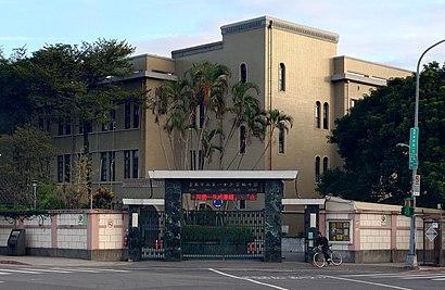
臺北市立第一女子高級中學 Address: 貴陽街一段 street in 中正區
Attractions near 臺北市立第一女子高級中學
中央氣象局,臺北氣象站,一女中(公園),中央氣象局天文站,臺北市立第一女子高級中學 Taipei First Girls High School,北一女中(重慶),市立弘道國中補校,市立弘道國中,信元牙醫,臺灣高等法院圖書館,司法院,弘道國中,司法大廈,總統府前廣場,凯达格兰大道,總統府前廣場(正門廣場),臺北市立弘道國民中學 Taipei Municipal HongDao Junior High School,重慶南路一段126巷 1,台北市立弘道國民中學,中華民國外交部How to get to popular attractions in 中正區 with public transit
君悅酒店, 信義區,覺風佛教藝術學院, 北投區,環南批發市場, 萬華區,國泰醫院健康檢查中心, 大安區,新北地方法院板橋院區, 板橋區,三立電視台 Sanlih E-Television, 內湖區,日月光廣場, 土城區,大盤商花市, 北投區,樹林監理站, 樹林區,臺北市立景美女子高級中學, 文山區,吳興國小, 信義區,竹林山觀音寺, 林口區,錢櫃Ktv永和樂華店, 永和區,懷寧街 60, 中正區,公車松仁路站, 信義區,公車第二果菜市場站, 中山區,Leeco outlet, 內湖區,松滿樓餐廳, 大安區,捷運中原站, 中和區,台北魚市, 中山區Get around Taipei - New Taipei by public transit!
Traveling around Taipei - New Taipei has never been so easy. See step by step directions as you travel to any attraction, street or major public transit station. View bus and train schedules, arrival times, service alerts and detailed routes on a map, so you know exactly how to get to anywhere in Taipei - New Taipei.
When traveling to any destination around Taipei - New Taipei use Moovit's Live Directions with Get Off Notifications to know exactly where and how far to walk, how long to wait for your line, and how many stops are left. Moovit will alert you when it's time to get off — no need to constantly re-check whether yours is the next stop.
Wondering how to use public transit in Taipei - New Taipei or how to pay for public transit in Taipei - New Taipei? Moovit public transit app can help you navigate your way with public transit easily, and at minimum cost. It includes public transit fees, ticket prices, and costs. Looking for a map of Taipei - New Taipei public transit lines? Moovit public transit app shows all public transit maps in Taipei - New Taipei with all Bus, Train, Metro, Light Rail and Gondola routes and stops on an interactive map.
Taipei - New Taipei has 5 transit type(s), including: Bus, Train, Metro, Light Rail and Gondola, operated by several transit agencies, including 臺北捷運 Taipei Metro, 新北捷運 New Taipei Metro, 桃園捷運Taoyuan Metro, 臺鐵 Taiwan Railway, 貓空纜車 Maokong Gondola, 首都客運 Capital Bus Co., Ltd., 欣欣客運 Shin-Shin Bus Co., Ltd., 大都會客運 Metropolitan Bus Co., Ltd., 大有巴士 Citiair Bus Co., Ltd., 東南客運 Southeast Bus Co., Ltd., 大南汽車 Danan Bus Co., Ltd., 指南客運 Zhinan Bus Co., Ltd., 光華巴士 Kuang-Hua Bus Co., Ltd., 中興巴士 Zhongxing Bus, 皇家客運 Royal Bus Co., Ltd.