北京大学西门 stop - Monday schedule
| Line | Direction | Time |
|---|---|---|
| 夜8 | 小马厂 | 03:07 |
| 夜8 | 小马厂 | 03:47 |
| 夜8 | 小马厂 | 04:17 |
| 夜8 | 小马厂 | 04:37 |
| 夜8 | 小马厂 | 04:57 |
| 运通124 | 金庄 | 05:36 |
| 运通124 | 金庄 | 05:46 |
| 运通124 | 金庄 | 05:56 |
| 584 | 大钟寺 | 06:04 |
| 运通124 | 金庄 | 06:06 |
| 运通106 | 田村北路 | 06:11 |
| 运通118 | 祥龙公交公司 | 06:12 |
| 584 | 大钟寺 | 06:14 |
| 运通124 | 金庄 | 06:16 |
| 333外 | 安宁庄东路南口 | 06:17 |
| 运通106 | 田村北路 | 06:21 |
| 运通118 | 祥龙公交公司 | 06:22 |
| 584 | 大钟寺 | 06:24 |
| 运通124 | 金庄 | 06:26 |
| 333外 | 安宁庄东路南口 | 06:27 |
| 运通106 | 田村北路 | 06:31 |
| 运通118 | 祥龙公交公司 | 06:32 |
| 584 | 大钟寺 | 06:34 |
| 运通124 | 金庄 | 06:36 |
| 333外 | 安宁庄东路南口 | 06:37 |
Directions to 北京大学西门 stop (燕园街道) with public transit
The following transit lines have routes that pass near 北京大学西门
 Bus: 332, 333外, 584, 运通106, 运通124.
- Metro: 4号线大兴线 LINE 4 - DAXING LINE, 16.
How to get to 北京大学西门 stop by bus?
Click on the bus route to see step by step directions with maps, line arrival times and updated time schedules.
How to get to 北京大学西门 stop by metro?
Click on the metro route to see step by step directions with maps, line arrival times and updated time schedules.
Bus stops near 北京大学西门 stop in 燕园街道
- 清华大学西门, 2 min walk,
- 北京大学西门, 3 min walk,
- 颐和园路东口, 8 min walk,
- 芙蓉里小区, 10 min walk,
- 西苑医院, 13 min walk,
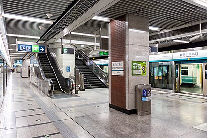
Metro stations near 北京大学西门 station in 燕园街道
- 万泉河桥 Wanquanhe Qiao, 12 min walk,
- 中关村 Zhongguancun, 14 min walk,
Bus lines to 北京大学西门 stop in 燕园街道
- 快速直达专线81, 东北旺中路,
- 332, 地铁北宫门站,
- 584, 颐和山庄,
- 333内, 安宁庄东路南口,
- 夜8, 小马厂,
- 运通106, 田村北路,
- 运通114, 吴庄,
- 运通118, 祥龙公交公司,
- 331, 香山,
- 432, 西苑枢纽站,
- 438, 西直门北,
- 498, 中央党校北门,
- 508, 西苑,
- 579, 杏坛路南口,
- 594, 颐和园北宫门,
- 601, 和平东桥,
- 664, 地铁西二旗站,
- 333外, 安宁庄东路南口,
- 特19, 北京西站,
- 运通124, 厢白旗桥,
What are the closest stations to 北京大学西门?
The closest stations to 北京大学西门 are:
- 清华大学西门 is 137 meters away, 2 min walk.
- 北京大学西门 is 165 meters away, 3 min walk.
- 颐和园路东口 is 587 meters away, 8 min walk.
- 芙蓉里小区 is 753 meters away, 10 min walk.
- 万泉河桥 Wanquanhe Qiao is 864 meters away, 12 min walk.
- 西苑医院 is 964 meters away, 13 min walk.
- 中关村 Zhongguancun is 1071 meters away, 14 min walk.
Which bus lines stop near 北京大学西门?
These bus lines stop near 北京大学西门: 332, 333外, 584, 运通106, 运通124.
Which metro line stops near 北京大学西门?
4号线大兴线 LINE 4 - DAXING LINE (往安河桥北 Towards Anheqiao Bei(N))
What’s the nearest metro station to 北京大学西门 in 燕园街道?
The nearest metro station to 北京大学西门 in 燕园街道 is 万泉河桥 Wanquanhe Qiao. It’s a 12 min walk away.
What’s the nearest bus station to 北京大学西门 in 燕园街道?
The nearest bus station to 北京大学西门 in 燕园街道 is 清华大学西门. It’s a 2 min walk away.
What time is the first metro to 北京大学西门 in 燕园街道?
The 4号线大兴线 LINE 4 - DAXING LINE is the first metro that goes to 北京大学西门 in 燕园街道. It stops nearby at 5:04 AM.
What time is the last metro to 北京大学西门 in 燕园街道?
The 4号线大兴线 LINE 4 - DAXING LINE is the last metro that goes to 北京大学西门 in 燕园街道. It stops nearby at 12:25 AM.
What time is the first bus to 北京大学西门 in 燕园街道?
The 夜8 is the first bus that goes to 北京大学西门 in 燕园街道. It stops nearby at 3:05 AM.
What time is the last bus to 北京大学西门 in 燕园街道?
The 夜8 is the last bus that goes to 北京大学西门 in 燕园街道. It stops nearby at 3:22 AM.
See 北京大学西门 stop, 燕园街道, on the map
Public transit to 北京大学西门 stop in 燕园街道
Looking for directions to 北京大学西门 in 燕园街道, China?
Download the Moovit App to find the current schedule and step-by-step directions for Bus or Metro routes that pass through 北京大学西门.
Looking for the nearest stops closest to 北京大学西门 ? Check out this list of closest stops to your destination: 清华大学西门; 北京大学西门; 颐和园路东口; 芙蓉里小区; 万泉河桥 Wanquanhe Qiao; 西苑医院; 中关村 Zhongguancun.
Bus: 332, 333外, 584, 运通106, 运通124, 快速直达专线81, 333内, 夜8, 运通114, 331, 432, 438, 498, 508.Metro: 4号线大兴线 LINE 4 - DAXING LINE, 16.
We make riding on public transit to 北京大学西门 easy, which is why over 1.5 million users, including users in 燕园街道 trust Moovit as the best app for public transit.
Use the app to navigate to popular places including to the airport, hospital, stadium, grocery store, mall, coffee shop, school, college, and university.
The first line to this stop is 夜8, at 03:07, and the last line is 夜8 at 02:27.
This stop serves 北京公交’s lines
- 万泉河桥 Wanquanhe Qiao,
- 中关村 Zhongguancun
Metro stations near 北京大学西门 station
Get around 燕园街道 by public transit!
Traveling around 燕园街道 has never been so easy. See step by step directions as you travel to any attraction, street or major public transit station. View bus and train schedules, arrival times, service alerts and detailed routes on a map, so you know exactly how to get to anywhere in 燕园街道.
When traveling to any destination around 燕园街道 use Moovit's Live Directions with Get Off Notifications to know exactly where and how far to walk, how long to wait for your line, and how many stops are left. Moovit will alert you when it's time to get off — no need to constantly re-check whether yours is the next stop.
Wondering how to use public transit in 燕园街道 or how to pay for public transit in 燕园街道? Moovit public transit app can help you navigate your way with public transit easily, and at minimum cost. It includes public transit fees, ticket prices, and costs. Looking for a map of 燕园街道 public transit lines? Moovit public transit app shows all public transit maps in 燕园街道 with all Bus, Train, Metro, Cable Car and Funicular routes and stops on an interactive map.
Beijing has 5 transit type(s), including: Bus, Train, Metro, Cable Car and Funicular, operated by several transit agencies, including 北京地铁, 北京公交有轨电车有限公司, 北京市郊铁路局 and 北京公交