Directions to 北星学園大学 (札幌市) with public transportation
The following transit lines have routes that pass near 北星学園大学
 Bus: 1, 61月寒東線, 大34, 大88真栄団地線, 札幌急行線.
How to get to 北星学園大学 by bus?
Click on the bus route to see step by step directions with maps, line arrival times and updated time schedules.
Bus stops near 北星学園大学 in 札幌市
- 大谷地駅, 9 min walk,
- 大谷地バスターミナル, 9 min walk,
- 大谷地ターミナル, 10 min walk,
- 北星大学通, 12 min walk,
- 清幌園前, 15 min walk,
Bus lines to 北星学園大学 in 札幌市
- 真105真駒内線, 大谷地駅,
- 大92上野幌線, 緑ヶ丘団地,
- 大66平岡ニュータウン線, 大66平岡ニュータウン線,
- 大67平岡ニュータウン線, 大67平岡ニュータウン線,
- 大70平岡シュヴァービング線, 大70平岡シュヴァービング線,
- 札幌急行線, 新さっぽろ駅前,
- 大33, 北広島駅,
- 大34, 長沼東町,
- 大35, 大谷地ターミナル,
- 32, 北広島西高校,
- 大69大谷地, 柏葉台団地,
- 大87有明線, 真栄高校,
- 大88真栄団地線, 大谷地駅,
- 札幌~八丁平, 室蘭,
- 札幌~室蘭, 白鳥号,
- 札幌~帯広, 札幌~帯広,
- 札幌~根室, 札幌~根室,
- 札幌~様似, 襟裳,
- 札幌~浦河, 札幌~浦河,
- 札幌~登別温泉, 札幌~登別温泉,
What are the closest stations to 北星学園大学?
The closest stations to 北星学園大学 are:
- 大谷地駅 is 512 meters away, 9 min walk.
- 大谷地バスターミナル is 553 meters away, 9 min walk.
- 大谷地ターミナル is 557 meters away, 10 min walk.
- 北星大学通 is 706 meters away, 12 min walk.
- 清幌園前 is 1023 meters away, 15 min walk.
Which bus lines stop near 北星学園大学?
These bus lines stop near 北星学園大学: 1, 61月寒東線, 大34, 大88真栄団地線, 札幌急行線.
What’s the nearest bus station to 北星学園大学 in 札幌市?
The nearest bus stations to 北星学園大学 in 札幌市 are 大谷地駅 and 大谷地バスターミナル. The closest one is a 9 min walk away.
What time is the first bus to 北星学園大学 in 札幌市?
The 大66平岡ニュータウン線 is the first bus that goes to 北星学園大学 in 札幌市. It stops nearby at 5:51 AM.
What time is the last bus to 北星学園大学 in 札幌市?
The 1 is the last bus that goes to 北星学園大学 in 札幌市. It stops nearby at 11:04 PM.
See 北星学園大学, 札幌市, on the map
Public Transit to 北星学園大学 in 札幌市
Wondering how to get to 北星学園大学 in 札幌市? Moovit helps you find the best way to get to 北星学園大学 with step-by-step directions from the nearest public transit station.
Moovit provides free maps and live directions to help you navigate through your city. View schedules, routes, timetables, and find out how long does it take to get to 北星学園大学 in real time.
Looking for the nearest stop or station to 北星学園大学? Check out this list of stops closest to your destination: 大谷地駅; 大谷地バスターミナル; 大谷地ターミナル; 北星大学通; 清幌園前.
Bus: 1, 61月寒東線, 大34, 大88真栄団地線, 札幌急行線, 真105真駒内線, 大92上野幌線, 大66平岡ニュータウン線, 大67平岡ニュータウン線, 大70平岡シュヴァービング線, 大33, 大35, 32, 大69大谷地, 大87有明線.
Want to see if there’s another route that gets you there at an earlier time? Moovit helps you find alternative routes or times. Get directions from and directions to 北星学園大学 easily from the Moovit App or Website.
We make riding to 北星学園大学 easy, which is why over 1.5 million users, including users in 札幌市, trust Moovit as the best app for public transit. You don’t need to download an individual bus app or train app, Moovit is your all-in-one transit app that helps you find the best bus time or train time available.
For information on prices of bus, costs and ride fares to 北星学園大学, please check the Moovit app.
Use the app to navigate to popular places including to the airport, hospital, stadium, grocery store, mall, coffee shop, school, college, and university.
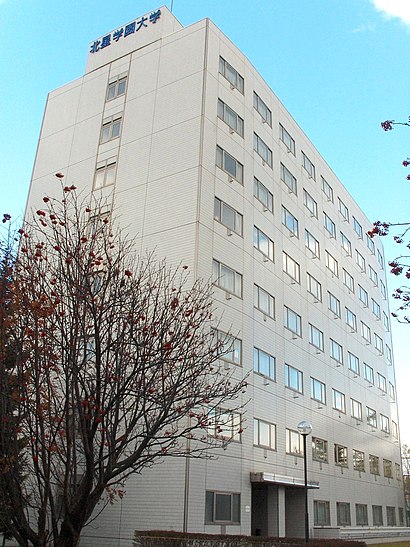
北星学園大学 Address: 札幌新道 street in 札幌市
Popular routes to 北星学園大学, 札幌市
- ツルハドラッグ,
- 居酒屋伸ちゃん,
- マルハン,
- 大谷地東一丁目,
- ランチカフェ&ダイニングバー母庵,
- 大谷地病院,
- 札幌トヨペット厚別店,
- 北野六条四丁目,
- 北野循環器クリニック,
- すし処 喜多乃寿司,
- 家具の丸越 札幌厚別店,
- 創成材木店,
- 北のたまゆら厚別店,
- 株式会社つうけんアドバンスシステムズ,
- 北野コーポ,
- 一岡ビル,
- 厚別中央一条二丁目,
- コープさっぽろルーシー,
- 札幌市立北野台小学校,
- 厚別南まちづくりセンター
Places Near 北星学園大学 (札幌市)
- 北海道岩見沢緑陵高等学校, 岩見沢市,
- 北海道札幌東陵高等学校, 札幌市,
- あさひかわラーメン村, 旭川市,
- 市営墓地, 江別市,
- 市立札幌旭丘高等学校, 札幌市,
- 道の駅花ロードえにわ, 恵庭市,
- 札幌西陵高校, 札幌市,
- 札幌西陵高等学校, 札幌市,
- イオン上磯店, 北斗市,
- アレフ 札幌白石施設, 札幌市,
- 札幌コンベンションセンター, 札幌市,
- 三角山 山の手側登山口, 札幌市,
- 江別蔦屋書店, 江別市,
- ウエスタンパワーズ, 旭川市,
- 旭川市総合体育館, 旭川市,
- コストコ 札幌店 (Costco Sapporo), 札幌市,
- 西野神社, 札幌市,
- 北海道警察学校, 札幌市,
- 豊平桜の杜公園, 札幌市,
- 回転寿しトリトン 旭神店, 旭川市
How to get to popular places in Hokkaido with public transit
Get around 札幌市 by public transit!
Traveling around 札幌市 has never been so easy. See step by step directions as you travel to any attraction, street or major public transit station. View bus and train schedules, arrival times, service alerts and detailed routes on a map, so you know exactly how to get to anywhere in 札幌市.
When traveling to any destination around 札幌市 use Moovit's Live Directions with Get Off Notifications to know exactly where and how far to walk, how long to wait for your line, and how many stops are left. Moovit will alert you when it's time to get off — no need to constantly re-check whether yours is the next stop.
Wondering how to use public transit in 札幌市 or how to pay for public transit in 札幌市? Moovit public transit app can help you navigate your way with public transit easily, and at minimum cost. It includes public transit fees, ticket prices, and costs. Looking for a map of 札幌市 public transit lines? Moovit public transit app shows all public transit maps in 札幌市 with all Bus, Light Rail and Ferry routes and stops on an interactive map.
Hokkaido has 3 transit type(s), including: Bus, Light Rail and Ferry, operated by several transit agencies, including 北海道中央バス, ジェイ・アール北海道バス, 函館市電, 道北バス, 宗谷バス, じょうてつ, 空知交通, 旭川電気軌道, 士幌町コミュニティ, 白糠町コミュニティ, 恵庭市, 斜里町コミュニティ, 蘭越町コミュニティ, 浦臼町コミュニティ and 札幌ばんけい