南沙客运站 stop - Sunday schedule
| Line | Direction | Time |
|---|---|---|
| 南5路 | 蕉门地铁站 | 06:39 |
| 番143路 | 洛溪新城总站 | 06:40 |
| 南5路 | 蕉门地铁站 | 06:49 |
| 番143路 | 洛溪新城总站 | 06:50 |
| 南5路 | 蕉门地铁站 | 06:59 |
| 番143路 | 洛溪新城总站 | 07:00 |
| 番143路 | 洛溪新城总站 | 07:10 |
| 南5路 | 蕉门地铁站 | 07:12 |
| 番143路 | 洛溪新城总站 | 07:20 |
| 南5路 | 蕉门地铁站 | 07:22 |
| 番141路 | 市桥汽车站 | 07:30 |
| 番143路 | 洛溪新城总站 | 07:30 |
| 南5路 | 蕉门地铁站 | 07:32 |
| 番143路 | 洛溪新城总站 | 07:40 |
| 番141路 | 市桥汽车站 | 07:40 |
| 南5路 | 蕉门地铁站 | 07:42 |
| 番141路 | 市桥汽车站 | 07:50 |
| 番143路 | 洛溪新城总站 | 07:50 |
| 南5路 | 蕉门地铁站 | 07:52 |
| 番141路 | 市桥汽车站 | 08:00 |
| 番143路 | 洛溪新城总站 | 08:00 |
| 南5路 | 蕉门地铁站 | 08:02 |
| 番141路 | 市桥汽车站 | 08:10 |
| 番143路 | 洛溪新城总站 | 08:10 |
| 南5路 | 蕉门地铁站 | 08:12 |
Directions to 南沙客运站 stop (南沙街道) with public transit
The following transit lines have routes that pass near 南沙客运站
 Bus: 南3路, 南5路, 番143路, 番141B路, 番141路.
- Metro: 4号线 LINE 4.
How to get to 南沙客运站 stop by bus?
Click on the bus route to see step by step directions with maps, line arrival times and updated time schedules.
How to get to 南沙客运站 stop by metro?
Click on the metro route to see step by step directions with maps, line arrival times and updated time schedules.
Bus stops near 南沙客运站 stop in 南沙街道
- 南沙客运站, 1 min walk,
- 金业小学, 10 min walk,
- 南沙世贸中心大厦, 11 min walk,
Metro stations near 南沙客运站 station in 南沙街道
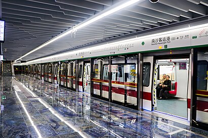
- 南沙客运港 Nansha Passenger Port, 20 min walk,
Bus lines to 南沙客运站 stop in 南沙街道
- 南5路, 蕉门地铁站,
- 番141B路, 番禺汽车客运站,
- 番141路, 市桥汽车站,
- 南18路环线, 虎门渡口,
- 南3路, 黄阁公交总站,
- 南19路环线, 虎门渡口,
What are the closest stations to 南沙客运站?
The closest stations to 南沙客运站 are:
- 南沙客运站 is 11 meters away, 1 min walk.
- 金业小学 is 514 meters away, 10 min walk.
- 南沙世贸中心大厦 is 768 meters away, 11 min walk.
- 南沙客运港 Nansha Passenger Port is 1510 meters away, 20 min walk.
Which bus lines stop near 南沙客运站?
These bus lines stop near 南沙客运站: 南3路, 南5路, 番143路.
Which metro line stops near 南沙客运站?
4号线 LINE 4 (往金洲 To Jinzhou)
What’s the nearest metro station to 南沙客运站 in 南沙街道?
The nearest metro station to 南沙客运站 in 南沙街道 is 南沙客运港 Nansha Passenger Port. It’s a 20 min walk away.
What’s the nearest bus station to 南沙客运站 in 南沙街道?
The nearest bus station to 南沙客运站 in 南沙街道 is 南沙客运站. It’s a 1 min walk away.
What time is the first metro to 南沙客运站 in 南沙街道?
The 4号线 LINE 4 is the first metro that goes to 南沙客运站 in 南沙街道. It stops nearby at 6:00 AM.
What time is the last metro to 南沙客运站 in 南沙街道?
The 4号线 LINE 4 is the last metro that goes to 南沙客运站 in 南沙街道. It stops nearby at 12:21 AM.
What time is the first bus to 南沙客运站 in 南沙街道?
The 南18路环线 is the first bus that goes to 南沙客运站 in 南沙街道. It stops nearby at 6:29 AM.
What time is the last bus to 南沙客运站 in 南沙街道?
The 南19路环线 is the last bus that goes to 南沙客运站 in 南沙街道. It stops nearby at 12:04 AM.
See 南沙客运站 stop, 南沙街道, on the map
Public transit to 南沙客运站 stop in 南沙街道
Looking for directions to 南沙客运站 in 南沙街道, China?
Download the Moovit App to find the current schedule and step-by-step directions for Bus or Metro routes that pass through 南沙客运站.
Looking for the nearest stops closest to 南沙客运站 ? Check out this list of closest stops to your destination: 南沙客运站; 金业小学; 南沙世贸中心大厦; 南沙客运港 Nansha Passenger Port.
Bus: 南3路, 南5路, 番143路, 番141B路, 番141路, 南19路环线, 南18路环线.Metro: 4号线 LINE 4.
We make riding on public transit to 南沙客运站 easy, which is why over 1.5 million users, including users in 南沙街道 trust Moovit as the best app for public transit.
Use the app to navigate to popular places including to the airport, hospital, stadium, grocery store, mall, coffee shop, school, college, and university.
The first line to this stop is 南5路, at 06:39, and the last line is 番143路 at 22:10.
This stop serves Guangzhou Bus’s lines
- 南沙客运港 Nansha Passenger Port
Metro station near 南沙客运站 station
- 解放北路总站(应元路),
- 番禺监狱,
- 沙溪村,
- 嘉禾总站(长红双和工业区),
- 地铁白云文化广场,
- 华南师范大学(南海校区),
- 王子山森林公园,
- 齐富路(云城东路口),
- 西涌,
- 亚艺公园南门,
- 增城宾馆,
- 碧桂园天玺湾,
- 江村,
- 瑶池西街口,
- 番安教考场,
- 罗岗村(嘉禾),
- 西樵城区,
- 马岗市场,
- 三水汽车站,
- 丰乐南路总站
Popular public transit stations in 南沙街道
Get around 南沙街道 by public transit!
Traveling around 南沙街道 has never been so easy. See step by step directions as you travel to any attraction, street or major public transit station. View bus and train schedules, arrival times, service alerts and detailed routes on a map, so you know exactly how to get to anywhere in 南沙街道.
When traveling to any destination around 南沙街道 use Moovit's Live Directions with Get Off Notifications to know exactly where and how far to walk, how long to wait for your line, and how many stops are left. Moovit will alert you when it's time to get off — no need to constantly re-check whether yours is the next stop.
Wondering how to use public transit in 南沙街道 or how to pay for public transit in 南沙街道? Moovit public transit app can help you navigate your way with public transit easily, and at minimum cost. It includes public transit fees, ticket prices, and costs. Looking for a map of 南沙街道 public transit lines? Moovit public transit app shows all public transit maps in 南沙街道 with all Bus, Metro, Tram and Ferry routes and stops on an interactive map.
Guangzhou has 4 transit type(s), including: Bus, Metro, Tram and Ferry, operated by several transit agencies, including 广州地铁, BRT, 广州公交, 广州客轮公司, 广州有轨电车有限责任公司 and 佛山公交