Directions to 台北文化清真寺 (中正區) with public transportation
The following transit lines have routes that pass near 台北文化清真寺
 Bus: 1, 208, 254, 278區, 311路.
- Metro: 松山新店線, 中和新蘆線, 淡水信義線.
How to get to 台北文化清真寺 by bus?
Click on the bus route to see step by step directions with maps, line arrival times and updated time schedules.
How to get to 台北文化清真寺 by metro?
Click on the metro route to see step by step directions with maps, line arrival times and updated time schedules.
Bus stops near 台北文化清真寺 in 中正區
- 三軍總醫院(辛亥) Tri-Service General Hospital (Xinhai Rd.), 1 min walk,
- 三軍總醫院(辛亥) Tri-Service General Hospital, 1 min walk,
- 耕莘文教院 Xinhua Educational Center, 2 min walk,
- 捷運台電大樓站 Mrt Taipower Building Sta., 3 min walk,
- 晉江師大路口 Jinjiang & Shida Roads, 6 min walk,
Metro stations near 台北文化清真寺 in 中正區
- 公館 Gongguan, 11 min walk,
- 頂溪 Dingxi, 12 min walk,
- 東門 Dongmen, 13 min walk,
Bus lines to 台北文化清真寺 in 中正區
- 943三峽, 臺北大學正門 Nat'L Taipei U. (Main Gate),
- 671, 臺北車站(忠孝) Mrt Taipei Main Station,
- 673, 中正環河路口 Zhongzheng & Huanhe Intersection,
- 棕12, 客家文化主題公園(師大路) Taipei City Hakka Cultural Park(Shida Rd.),
- 棕22, 青年公園(青年) Youth Park (Qingnian),
- 253路, 景美女中 Jingmei Girls High School,
- 311路, 松山車站 Songshan Rail Sta.,
- 849, 烏來 Wulai,
- 849屈尺社區, 捷運台大醫院站 Mrt Ntu Hospital Station,
- 1, 萬華 Wanhua - 松仁路 Songren Rd.,
- 208, 新店 Xindian - 大直 Dazhi,
- 208直, 大直 Dazhi - 新店 Xindian,
- 251, 深坑 Shenkeng - 臺北車站 Taipei Main Sta.,
- 252, 富德 Fude - 臺北車站 Taipei Main Sta.,
- 254, 大鵬新城 Dapeng New Village - 民生社區 Mingsheng Community,
- 278, 捷運景美站 MRT Jingmei Sta. - 捷運內湖站 MRT Neihu Sta.,
- 278區, 捷運景美站 MRT Jingmei Sta. - 新益里 Xinyi Li,
- 606, 萬芳社區 Wanfang Community - 榮總 Veterans General Hospital,
- 644, 青潭 Qingtan - 博愛路 Boai Rd.,
- 648, 錦繡山莊 Jinxiu Moubtaion Villa - 臺北車站 Taipei Main Sta.,
What are the closest stations to 台北文化清真寺?
The closest stations to 台北文化清真寺 are:
- 三軍總醫院(辛亥) Tri-Service General Hospital (Xinhai Rd.) is 58 meters away, 1 min walk.
- 三軍總醫院(辛亥) Tri-Service General Hospital is 58 meters away, 1 min walk.
- 耕莘文教院 Xinhua Educational Center is 105 meters away, 2 min walk.
- 捷運台電大樓站 Mrt Taipower Building Sta. is 148 meters away, 3 min walk.
- 晉江師大路口 Jinjiang & Shida Roads is 372 meters away, 6 min walk.
- 公館 Gongguan is 826 meters away, 11 min walk.
- 頂溪 Dingxi is 919 meters away, 12 min walk.
- 東門 Dongmen is 956 meters away, 13 min walk.
Which bus lines stop near 台北文化清真寺?
These bus lines stop near 台北文化清真寺: 1, 208, 254, 278區, 311路, 606, 849屈尺社區, 949, 羅斯福路幹線.
Which metro line stops near 台北文化清真寺?
松山新店線 (松山 Songshan)
What’s the nearest metro station to 台北文化清真寺 in 中正區?
The nearest metro station to 台北文化清真寺 in 中正區 is 公館 Gongguan. It’s a 11 min walk away.
What’s the nearest bus station to 台北文化清真寺 in 中正區?
The nearest bus stations to 台北文化清真寺 in 中正區 are 三軍總醫院(辛亥) Tri-Service General Hospital (Xinhai Rd.) and 三軍總醫院(辛亥) Tri-Service General Hospital. The closest one is a 1 min walk away.
What time is the first metro to 台北文化清真寺 in 中正區?
The 松山新店線 is the first metro that goes to 台北文化清真寺 in 中正區. It stops nearby at 6:00 AM.
What time is the last metro to 台北文化清真寺 in 中正區?
The 淡水信義線 is the last metro that goes to 台北文化清真寺 in 中正區. It stops nearby at 12:44 AM.
What time is the first bus to 台北文化清真寺 in 中正區?
The 673 is the first bus that goes to 台北文化清真寺 in 中正區. It stops nearby at 5:07 AM.
What time is the last bus to 台北文化清真寺 in 中正區?
The 羅斯福路幹線 is the last bus that goes to 台北文化清真寺 in 中正區. It stops nearby at 12:51 AM.
See 台北文化清真寺, 中正區, on the map
Public Transit to 台北文化清真寺 in 中正區
Wondering how to get to 台北文化清真寺 in 中正區? Moovit helps you find the best way to get to 台北文化清真寺 with step-by-step directions from the nearest public transit station.
Moovit provides free maps and live directions to help you navigate through your city. View schedules, routes, timetables, and find out how long does it take to get to 台北文化清真寺 in real time.
Looking for the nearest stop or station to 台北文化清真寺? Check out this list of stops closest to your destination: 三軍總醫院(辛亥) Tri-Service General Hospital (Xinhai Rd.); 三軍總醫院(辛亥) Tri-Service General Hospital; 耕莘文教院 Xinhua Educational Center; 捷運台電大樓站 Mrt Taipower Building Sta.; 晉江師大路口 Jinjiang & Shida Roads; 公館 Gongguan; 頂溪 Dingxi; 東門 Dongmen.
Bus: 1, 208, 254, 278區, 311路, 606, 849屈尺社區, 949, 羅斯福路幹線, 943三峽, 671, 673, 棕12, 棕22, 253路.Metro: 松山新店線, 中和新蘆線, 淡水信義線.
Want to see if there’s another route that gets you there at an earlier time? Moovit helps you find alternative routes or times. Get directions from and directions to 台北文化清真寺 easily from the Moovit App or Website.
We make riding to 台北文化清真寺 easy, which is why over 1.5 million users, including users in 中正區, trust Moovit as the best app for public transit. You don’t need to download an individual bus app or train app, Moovit is your all-in-one transit app that helps you find the best bus time or train time available.
For information on prices of bus and metro, costs and ride fares to 台北文化清真寺, please check the Moovit app.
Use the app to navigate to popular places including to the airport, hospital, stadium, grocery store, mall, coffee shop, school, college, and university.
台北文化清真寺 Address: 建國快速道路 street in 中正區
- 永恆牙醫診所,
- 棺材蟋蟀,
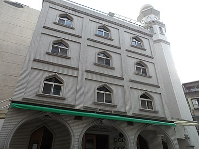
- 台北文化清真寺 Taipei Cultural Mosque,
- 冠德羅斯福招待所,
- 光華堂佛教文物,
- 耕莘文教院,
- 古亭耶穌聖心堂 Sacred Heart of Church,
- 古亭耶穌聖心堂,
- 瑞安聯合診所,
- 辛亥路一段 43巷2號,
- 捷運台電大樓站(2號出口),
- youbike 2.0 台電大樓 2號出口,
- 按摩達人工作室,
- 芳療家 Florihana,
- 基隆路羅斯福路口,
- 楓苑食坊,
- 秋奶奶早餐店,
- 台電大樓,
- MOS Burger (摩斯漢堡 MOS Burger),
- 摩斯漢堡 MOS Burger
Places Near 台北文化清真寺 (中正區)
- 好市多內湖店, 內湖區,
- 好市多 COSTCO(新莊店), 新莊區,
- 濱江市場, 中山區,
- 新莊頤品大飯店, 新莊區,
- 小潘蛋糕坊, 板橋區,
- 新莊宏泰市場, 新莊區,
- 我家牛排(中和連城店), 中和區,
- 新東南海鮮餐廳, 中正區,
- 新北市立殯儀館, 板橋區,
- 好市多中和店, 中和區,
- COSTCO (Chungho) (好市多中和店), 中和區,
- 龍華會館, 板橋區,
- 樹林秀泰影城, 樹林區,
- 小潘鳳梨酥, 板橋區,
- COSTCO (Neihu) (好市多), 內湖區,
- 建國假日花市, 大安區,
- 好市多 Costco, 汐止區,
- 中和Costco好市多, 中和區,
- 重新橋跳蚤市場, 三重區,
- 中和環球購物中心, 中和區
How to get to popular places in Taipei - New Taipei with public transit
Get around 中正區 by public transit!
Traveling around 中正區 has never been so easy. See step by step directions as you travel to any attraction, street or major public transit station. View bus and train schedules, arrival times, service alerts and detailed routes on a map, so you know exactly how to get to anywhere in 中正區.
When traveling to any destination around 中正區 use Moovit's Live Directions with Get Off Notifications to know exactly where and how far to walk, how long to wait for your line, and how many stops are left. Moovit will alert you when it's time to get off — no need to constantly re-check whether yours is the next stop.
Wondering how to use public transit in 中正區 or how to pay for public transit in 中正區? Moovit public transit app can help you navigate your way with public transit easily, and at minimum cost. It includes public transit fees, ticket prices, and costs. Looking for a map of 中正區 public transit lines? Moovit public transit app shows all public transit maps in 中正區 with all Bus, Train, Metro, Light Rail and Gondola routes and stops on an interactive map.
Taipei - New Taipei has 5 transit type(s), including: Bus, Train, Metro, Light Rail and Gondola, operated by several transit agencies, including 臺北捷運 Taipei Metro, 新北捷運 New Taipei Metro, 桃園捷運Taoyuan Metro, 臺鐵 Taiwan Railway, 貓空纜車 Maokong Gondola, 首都客運 Capital Bus Co., Ltd., 欣欣客運 Shin-Shin Bus Co., Ltd., 大都會客運 Metropolitan Bus Co., Ltd., 大有巴士 Citiair Bus Co., Ltd., 東南客運 Southeast Bus Co., Ltd., 大南汽車 Danan Bus Co., Ltd., 指南客運 Zhinan Bus Co., Ltd., 光華巴士 Kuang-Hua Bus Co., Ltd., 中興巴士 Zhongxing Bus and 皇家客運 Royal Bus Co., Ltd.