Directions to 國際展貿中心 (九龍 Kowloon City) with public transportation
The following transit lines have routes that pass near 國際展貿中心
 Bus: 101X, 14X, 215X, 219X, 48.
- Subway: 屯馬綫 TUEN MA LINE, 觀塘綫 KWUN TONG LINE.
- Ferry: 北角 - 九龍城.
How to get to 國際展貿中心 by bus?
Click on the bus route to see step by step directions with maps, line arrival times and updated time schedules.
How to get to 國際展貿中心 by subway?
Click on the subway route to see step by step directions with maps, line arrival times and updated time schedules.
Bus stops near 國際展貿中心 in 九龍 Kowloon City
- 啟隧轉車站 - 啟福道 Kai Tak Tunnel Bbi - Kai Fuk Road, 1 min walk,
- 香港郵政大樓 Hongkong Post Building, 1 min walk,
- 臨華街遊樂場 Lam Wah Street Playground, 5 min walk,
- 常悅道 Sheung Yuet Road, 5 min walk,
- 宏光道, 近臨華街遊樂場 Wang Kwong Road, Near Lam Wah Street Playground, 5 min walk,
- 宏展街 Wang Chin Street, 5 min walk,
- 九龍灣消防局 Kowloon Bay Fire Station, 6 min walk,
- 臨華街, 臨華街遊樂場對面 Lam Wah Street, Opposite Lam Wah Street Playground, 7 min walk,
Ferry station near 國際展貿中心 in 九龍 Kowloon City
- 九龍城渡輪碼頭 Kowloon City Ferry Pier, 15 min walk,
Subway stations near 國際展貿中心 in 九龍 Kowloon City
- 九龍灣 Kowloon Bay, 16 min walk,
- 啟德 Kai Tak, 17 min walk,
Bus lines to 國際展貿中心 in 九龍 Kowloon City
- W2, 佐敦(西九龍站) Jordan (West Kowloon Station) - 觀塘(循環線) Kwun Tong (Circular),
- 14X, 油塘(崇德圍) Yau Tong (Shung Tak Wai) - 尖沙咀(循環線) Tsim Sha Tsui (Circular),
- 49, 青衣(青富苑) Tsing Yi (Ching Fu Court) - 將軍澳工業邨 Tseung Kwan O Industrial Estate,
- 98D, 坑口(北) Hang Hau (North) - 尖沙咀東 Tsim Sha Tsui East,
- 98P, 坑口(北) Hang Hau (North) / 康盛花園 Hong Sing Garden - 尖沙咀東 Tsim Sha Tsui East,
- 101X, 堅尼地城 Kennedy Town - 觀塘(裕民坊) Kwun Tong (Yue Man Square),
- 213E, 安達臣 Anderson - 九龍站 Kowloon Station,
- 215X, 藍田(廣田邨) Lam Tin (Kwong Tin Estate) - 九龍站 Kowloon Station,
- 219X, 麗港城 Laguna City - 尖沙咀(循環線) Tsim Sha Tsui (Circular),
- 296D, 將軍澳(尚德) Tseung Kwan O (Sheung Tak) - 九龍站 Kowloon Station,
- 608, 筲箕灣 Shau Kei Wan,
- 790, 尖沙咀(麼地道) Tsim Sha Tsui (Mody Road),
- 795X, 蘇屋邨 So Uk Estate,
- 796P, 將軍澳站 Tseung Kwan O Station,
- 11X, 安泰(北) On Tai (North) - 紅磡站 Hung Hom Station,
- 15X, 藍田(廣田邨) Lam Tin (Kwong Tin Estate) - 紅磡站 Hung Hom Station,
- 213X, 安泰(南) On Tai (South) - 尖沙咀(循環線) Tsim Sha Tsui (Circular),
- 215P, 藍田(廣田邨) Lam Tin (Kwong Tin Estate) - 九龍站 Kowloon Station,
- 297P, 坑口(北) Hang Hau (North) - 紅磡(紅鸞道) Hung Hom (Hung Luen Road),
- N796, 日出康城 - 尖沙咀 / 旺角 (循環線) Lohas Park - Tsim Sha Tsui / Mong Kok (Circular),
What are the closest stations to 國際展貿中心?
The closest stations to 國際展貿中心 are:
- 啟隧轉車站 - 啟福道 Kai Tak Tunnel Bbi - Kai Fuk Road is 4 meters away, 1 min walk.
- 香港郵政大樓 Hongkong Post Building is 19 meters away, 1 min walk.
- 臨華街遊樂場 Lam Wah Street Playground is 321 meters away, 5 min walk.
- 常悅道 Sheung Yuet Road is 339 meters away, 5 min walk.
- 宏光道, 近臨華街遊樂場 Wang Kwong Road, Near Lam Wah Street Playground is 349 meters away, 5 min walk.
- 宏展街 Wang Chin Street is 374 meters away, 5 min walk.
- 九龍灣消防局 Kowloon Bay Fire Station is 436 meters away, 6 min walk.
- 臨華街, 臨華街遊樂場對面 Lam Wah Street, Opposite Lam Wah Street Playground is 462 meters away, 7 min walk.
- 九龍城渡輪碼頭 Kowloon City Ferry Pier is 1106 meters away, 15 min walk.
- 九龍灣 Kowloon Bay is 1179 meters away, 16 min walk.
- 啟德 Kai Tak is 1257 meters away, 17 min walk.
Which bus lines stop near 國際展貿中心?
These bus lines stop near 國際展貿中心: 101X, 14X, 215X, 219X, 48, 74, 795X, NR342, W2.
Which subway lines stop near 國際展貿中心?
These subway lines stop near 國際展貿中心: 屯馬綫 TUEN MA LINE, 觀塘綫 KWUN TONG LINE.
What’s the nearest subway station to 國際展貿中心 in 九龍 Kowloon City?
The nearest subway station to 國際展貿中心 in 九龍 Kowloon City is 九龍灣 Kowloon Bay. It’s a 16 min walk away.
What’s the nearest bus station to 國際展貿中心 in 九龍 Kowloon City?
The nearest bus stations to 國際展貿中心 in 九龍 Kowloon City are 啟隧轉車站 - 啟福道 Kai Tak Tunnel Bbi - Kai Fuk Road and 香港郵政大樓 Hongkong Post Building. The closest one is a 1 min walk away.
What’s the nearest ferry station to 國際展貿中心 in 九龍 Kowloon City?
The nearest ferry station to 國際展貿中心 in 九龍 Kowloon City is 九龍城渡輪碼頭 Kowloon City Ferry Pier. It’s a 15 min walk away.
What time is the first subway to 國際展貿中心 in 九龍 Kowloon City?
The 觀塘綫 KWUN TONG LINE is the first subway that goes to 國際展貿中心 in 九龍 Kowloon City. It stops nearby at 5:57 AM.
What time is the last subway to 國際展貿中心 in 九龍 Kowloon City?
The 觀塘綫 KWUN TONG LINE is the last subway that goes to 國際展貿中心 in 九龍 Kowloon City. It stops nearby at 1:21 AM.
What time is the first bus to 國際展貿中心 in 九龍 Kowloon City?
The N796 is the first bus that goes to 國際展貿中心 in 九龍 Kowloon City. It stops nearby at 3:21 AM.
What time is the last bus to 國際展貿中心 in 九龍 Kowloon City?
The N796 is the last bus that goes to 國際展貿中心 in 九龍 Kowloon City. It stops nearby at 3:21 AM.
What time is the first ferry to 國際展貿中心 in 九龍 Kowloon City?
The 北角 - 九龍城 is the first ferry that goes to 國際展貿中心 in 九龍 Kowloon City. It stops nearby at 7:05 AM.
What time is the last ferry to 國際展貿中心 in 九龍 Kowloon City?
The 北角 - 九龍城 is the last ferry that goes to 國際展貿中心 in 九龍 Kowloon City. It stops nearby at 7:35 PM.
See 國際展貿中心, 九龍 Kowloon City, on the map
Public Transit to 國際展貿中心 in 九龍 Kowloon City
Wondering how to get to 國際展貿中心 in 九龍 Kowloon City? Moovit helps you find the best way to get to 國際展貿中心 with step-by-step directions from the nearest public transit station.
Moovit provides free maps and live directions to help you navigate through your city. View schedules, routes, timetables, and find out how long does it take to get to 國際展貿中心 in real time.
Looking for the nearest stop or station to 國際展貿中心? Check out this list of stops closest to your destination: 啟隧轉車站 - 啟福道 Kai Tak Tunnel Bbi - Kai Fuk Road; 香港郵政大樓 Hongkong Post Building; 臨華街遊樂場 Lam Wah Street Playground; 常悅道 Sheung Yuet Road; 宏光道; 宏展街 Wang Chin Street; 九龍灣消防局 Kowloon Bay Fire Station; 臨華街; 九龍城渡輪碼頭 Kowloon City Ferry Pier; 九龍灣 Kowloon Bay; 啟德 Kai Tak.
Bus: 101X, 14X, 215X, 219X, 48, 74, 795X, NR342, W2, 49, 98D, 98P, 608, 790, 796P, 11X, 15X, 213X, 215P, 297P.Subway: 屯馬綫 TUEN MA LINE, 觀塘綫 KWUN TONG LINE.Ferry: 北角 - 九龍城.
Want to see if there’s another route that gets you there at an earlier time? Moovit helps you find alternative routes or times. Get directions from and directions to 國際展貿中心 easily from the Moovit App or Website.
We make riding to 國際展貿中心 easy, which is why over 1.5 million users, including users in 九龍 Kowloon City, trust Moovit as the best app for public transit. You don’t need to download an individual bus app or train app, Moovit is your all-in-one transit app that helps you find the best bus time or train time available.
For information on prices of bus and subway, costs and ride fares to 國際展貿中心, please check the Moovit app.
Use the app to navigate to popular places including to the airport, hospital, stadium, grocery store, mall, coffee shop, school, college, and university.
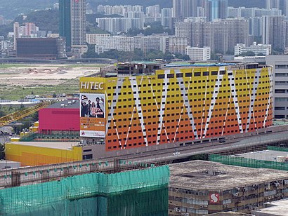
國際展貿中心 Address: 啓福道 观塘区, 九龙 street in 九龍 Kowloon City
- KITEC - The Glass Pavilion (3 / F),
- Viutv,
- 宏展街,
- 煌府婚宴專門店,
- 億京中心停車場,
- Kowloonbay International Trade & Exhibition Centre (KITEC),
- Music Zone,
- The Metroplex (星影匯),
- 星影匯,
- E-Max,
- 匯星 Star Hall,
- 九龍灣國際展貿中心 Kowloonbay International Trade & Exhibition Centre,
- 興力停車場,
- 星影匯 the Metroplex,
- 9 / F, KITEC, 1 Trademart Drive, Kowloon Bay, Hong Kong,
- D-Mop Outlet,
- 九龙湾国际展贸中心,
- 九龍灣國際展貿中心,
- Rotunda Hall 3,
- 香港郵政中央郵件中心 Hongkong Post Central Mail Centre
Places Near 國際展貿中心 (九龍 Kowloon City)
- 香港東涌福朋喜來登酒店,
- Airside, 九龍 Kowloon City,
- Shatin Hospital 沙田醫院, 沙田 Sha Tin,
- 九龍灣健康中心 Kowloon Bay Health Centre, 觀塘 Kwun Tong,
- 大埔海濱公園, 大埔 Tai Po,
- 天水圍(天業路)社區健康中心 Tin Shui Wai (Tin Yip Road) Community Health Centre, 元朗 Yuen Long,
- 入境事務處人事登記處辦事處, 觀塘 Kwun Tong,
- 沙田馬場 Sha Tin Racecourse, 沙田 Sha Tin,
- 屯門兆麟政府綜合大樓 Tuen Mun Siu Lun Government Complex, 屯門 Tuen Mun,
- 啟德體育園 Kai Tak Sports Park, 九龍 Kowloon City,
- 麗豪酒店, 沙田 Sha Tin,
- China Travel Service Tuen Mun Entry Permit Service Centre 中國旅行社屯門證件服務中心, 屯門 Tuen Mun,
- 富麗敦海洋公園酒店 the Fullerton Hotel: Ocean Park,
- 香港教育大學, 大埔 Tai Po,
- 大欖涌燒烤樂園 Tai Lam Chung Bbq Club, 屯門 Tuen Mun,
- 中港城,
- 威爾斯親王醫院, 沙田 Sha Tin,
- 香港駕駛學院沙田安全駕駛中心, 沙田 Sha Tin,
- 宏利金融中心 Manulife Financial Centre, 觀塘 Kwun Tong,
- 林村許願樹, 大埔 Tai Po
How to get to popular places in Hong Kong with public transit
Get around 九龍 Kowloon City by public transit!
Traveling around 九龍 Kowloon City has never been so easy. See step by step directions as you travel to any attraction, street or major public transit station. View bus and train schedules, arrival times, service alerts and detailed routes on a map, so you know exactly how to get to anywhere in 九龍 Kowloon City.
When traveling to any destination around 九龍 Kowloon City use Moovit's Live Directions with Get Off Notifications to know exactly where and how far to walk, how long to wait for your line, and how many stops are left. Moovit will alert you when it's time to get off — no need to constantly re-check whether yours is the next stop.
Wondering how to use public transit in 九龍 Kowloon City or how to pay for public transit in 九龍 Kowloon City? Moovit public transit app can help you navigate your way with public transit easily, and at minimum cost. It includes public transit fees, ticket prices, and costs. Looking for a map of 九龍 Kowloon City public transit lines? Moovit public transit app shows all public transit maps in 九龍 Kowloon City with all Bus, Subway, Light Rail, Ferry, Cable Car and Funicular routes and stops on an interactive map.
Hong Kong has 6 transit type(s), including: Bus, Subway, Light Rail, Ferry, Cable Car and Funicular, operated by several transit agencies, including 港鐵 MTR, 天星小輪 Star Ferry, 九巴 KMB, 城巴 Citybus, 城巴機場快線 Cityflyer, 龍運巴士 LWB, 九巴 KMB / 城巴 CTB, 龍運巴士 LWB / 城巴 CTB, 新大嶼山巴士 NLB, 愉景灣巴士 DB, 香港電車 Hong Kong Tramways, 香港中文大學 The Chinese University of Hong Kong, 港島區專線小巴 GMB HK Island, 九龍區專線小巴 GMB Kowloon and 新界區專線小巴 GMB New Territories