太康街 Tai Hong Street station - Tuesday schedule
| Line | Direction | Time |
|---|---|---|
| 上環(西港城) - 筲箕灣 | 上環街市(西港城)總站 Western Market Terminus | 05:50 |
| 跑馬地 - 筲箕灣 | 跑馬地總站 Happy Valley Terminus | 05:53 |
| 上環(西港城) - 筲箕灣 | 上環街市(西港城)總站 Western Market Terminus | 05:58 |
| 跑馬地 - 筲箕灣 | 跑馬地總站 Happy Valley Terminus | 05:59 |
| 跑馬地 - 筲箕灣 | 跑馬地總站 Happy Valley Terminus | 06:06 |
| 上環(西港城) - 筲箕灣 | 上環街市(西港城)總站 Western Market Terminus | 06:07 |
| 跑馬地 - 筲箕灣 | 跑馬地總站 Happy Valley Terminus | 06:12 |
| 上環(西港城) - 筲箕灣 | 上環街市(西港城)總站 Western Market Terminus | 06:16 |
| 跑馬地 - 筲箕灣 | 跑馬地總站 Happy Valley Terminus | 06:19 |
| 上環(西港城) - 筲箕灣 | 上環街市(西港城)總站 Western Market Terminus | 06:22 |
| 跑馬地 - 筲箕灣 | 跑馬地總站 Happy Valley Terminus | 06:25 |
| 上環(西港城) - 筲箕灣 | 上環街市(西港城)總站 Western Market Terminus | 06:29 |
| 跑馬地 - 筲箕灣 | 跑馬地總站 Happy Valley Terminus | 06:30 |
| 跑馬地 - 筲箕灣 | 跑馬地總站 Happy Valley Terminus | 06:32 |
| 上環(西港城) - 筲箕灣 | 上環街市(西港城)總站 Western Market Terminus | 06:36 |
| 跑馬地 - 筲箕灣 | 跑馬地總站 Happy Valley Terminus | 06:37 |
| 跑馬地 - 筲箕灣 | 跑馬地總站 Happy Valley Terminus | 06:41 |
| 上環(西港城) - 筲箕灣 | 上環街市(西港城)總站 Western Market Terminus | 06:42 |
| 跑馬地 - 筲箕灣 | 跑馬地總站 Happy Valley Terminus | 06:45 |
| 跑馬地 - 筲箕灣 | 跑馬地總站 Happy Valley Terminus | 06:48 |
| 上環(西港城) - 筲箕灣 | 上環街市(西港城)總站 Western Market Terminus | 06:49 |
| 跑馬地 - 筲箕灣 | 跑馬地總站 Happy Valley Terminus | 06:53 |
| 上環(西港城) - 筲箕灣 | 上環街市(西港城)總站 Western Market Terminus | 06:56 |
| 跑馬地 - 筲箕灣 | 跑馬地總站 Happy Valley Terminus | 06:58 |
| 上環(西港城) - 筲箕灣 | 上環街市(西港城)總站 Western Market Terminus | 06:59 |
Directions to 太康街 Tai Hong Street station (東區 Eastern) with public transit
The following transit lines have routes that pass near 太康街 Tai Hong Street
 Bus: 33X, 606, 608, 720, 77.
- Subway: 港島綫 ISLAND LINE.
How to get to 太康街 Tai Hong Street station by bus?
Click on the bus route to see step by step directions with maps, line arrival times and updated time schedules.
How to get to 太康街 Tai Hong Street station by subway?
Click on the subway route to see step by step directions with maps, line arrival times and updated time schedules.
Light Rail stations near 太康街 Tai Hong Street station in 東區 Eastern
- 太康街 Tai Hong Street, 1 min walk,
Bus stops near 太康街 Tai Hong Street stop in 東區 Eastern
- 筲箕灣道,近陽安大廈 Shau Kei Wan Road, Near Yeung on Building, 1 min walk,
- 太富街 Tai Foo Street, 1 min walk,
- 太康樓 Tai Hong House, 1 min walk,
- 太祥街 Tai Cheong Street, 2 min walk,
- 太安樓 Tai on Building, 2 min walk,
- 太康街, 太康樓 Tai Hong Street, Outside Tai Hong House, 2 min walk,
- 西灣河街137號 No. 137 Sai Wan Ho Street, 3 min walk,
Subway stations near 太康街 Tai Hong Street station in 東區 Eastern
- 西灣河 Sai Wan Ho, 2 min walk,
Bus lines to 太康街 Tai Hong Street station in 東區 Eastern
- 32, 望隆街,近峻峰花園D座 Mong Lung Street, Near Perfect Mount Gardens Block D,
- 61, 小西灣道, 藍灣半島第3座外 Siu Sai Wan Road, Outside Tower 3, Island Resort,
- 筲箕灣 - 旺角(砵蘭街), Shau Kei Wan - Mong Kok (Portland St),
- 筲箕灣 - 旺角(銀行中心), Shau Kei Wan - Mong Kok (Bank Centre),
- 筲箕灣 - 紅磡/土瓜灣, Shau Kei Wan - Hung Hom / To Kwa Wan,
- 筲箕灣/柴灣 - 西環, Shau Kei Wan / Chai Wan - Kennedy Town,
- 筲箕灣/柴灣 - 西環 (特快), Shau Kei Wan / Chai Wan - Kennedy Town (Gloucester Rd Express),
- 102, 筲箕灣 Shau Kei Wan - 美孚 Mei Foo,
- 102P, 筲箕灣 Shau Kei Wan - 美孚 Mei Foo,
- 106, 黃大仙 Wong Tai Sin - 小西灣(藍灣半島) Siu Sai Wan (Island Resort),
- 106P, 小西灣(藍灣半島) Siu Sai Wan (Island Resort) - 黃大仙 Wong Tai Sin,
- N122, 美孚 Mei Foo - 筲箕灣 Shau Kei Wan,
- 302A, 慈雲山(北) Tsz Wan Shan (North) - 北角(健康村) North Point (Healthy Village),
- 382, 泥涌 Nai Chung - 柴灣(東) Chai Wan (East),
- 608, 筲箕灣 Shau Kei Wan - 馬頭圍邨 Ma Tau Wai Estate,
- 613, 筲箕灣 Shau Kei Wan - 安泰(西) On Tai (West),
- 613A, 安泰(西) On Tai (West) - 杏花邨 Heng Fa Chuen,
- 678, 上水 Sheung Shui - 銅鑼灣(東院道) Causeway Bay(Eastern Hospital Road),
- 682, 柴灣(東) Chai Wan (East) - 烏溪沙站 Wu Kai Sha Station,
- 682A, 馬鞍山 Ma On Shan - 柴灣(東) Chai Wan (East),
What are the closest stations to 太康街 Tai Hong Street?
The closest stations to 太康街 Tai Hong Street are:
- 太康街 Tai Hong Street is 1 meters away, 1 min walk.
- 筲箕灣道,近陽安大廈 Shau Kei Wan Road, Near Yeung on Building is 21 meters away, 1 min walk.
- 太富街 Tai Foo Street is 33 meters away, 1 min walk.
- 太康樓 Tai Hong House is 71 meters away, 1 min walk.
- 太祥街 Tai Cheong Street is 71 meters away, 2 min walk.
- 太安樓 Tai on Building is 80 meters away, 2 min walk.
- 太康街, 太康樓 Tai Hong Street, Outside Tai Hong House is 91 meters away, 2 min walk.
- 西灣河 Sai Wan Ho is 138 meters away, 2 min walk.
- 西灣河街137號 No. 137 Sai Wan Ho Street is 177 meters away, 3 min walk.
Which bus lines stop near 太康街 Tai Hong Street?
These bus lines stop near 太康街 Tai Hong Street: 33X, 606, 608, 720, 77, 柴灣 - 觀塘(宜安街)/ 九龍灣 KOWLOON BAY.
Which subway line stops near 太康街 Tai Hong Street?
港島綫 ISLAND LINE (往柴灣 To Chai Wan)
What’s the nearest light rail station to 太康街 Tai Hong Street in 東區 Eastern?
The nearest light rail station to 太康街 Tai Hong Street in 東區 Eastern is 太康街 Tai Hong Street. It’s a 1 min walk away.
What’s the nearest subway station to 太康街 Tai Hong Street in 東區 Eastern?
The nearest subway station to 太康街 Tai Hong Street in 東區 Eastern is 西灣河 Sai Wan Ho. It’s a 2 min walk away.
What’s the nearest bus station to 太康街 Tai Hong Street in 東區 Eastern?
The nearest bus stations to 太康街 Tai Hong Street in 東區 Eastern are 筲箕灣道,近陽安大廈 Shau Kei Wan Road, Near Yeung on Building, 太富街 Tai Foo Street and 太康樓 Tai Hong House. The closest one is a 1 min walk away.
What time is the first light rail to 太康街 Tai Hong Street in 東區 Eastern?
The 上環(西港城) - 筲箕灣 is the first light rail that goes to 太康街 Tai Hong Street in 東區 Eastern. It stops nearby at 5:51 AM.
What time is the last light rail to 太康街 Tai Hong Street in 東區 Eastern?
The 堅尼地城 - 筲箕灣 is the last light rail that goes to 太康街 Tai Hong Street in 東區 Eastern. It stops nearby at 1:32 AM.
What time is the first subway to 太康街 Tai Hong Street in 東區 Eastern?
The 港島綫 ISLAND LINE is the first subway that goes to 太康街 Tai Hong Street in 東區 Eastern. It stops nearby at 6:01 AM.
What time is the last subway to 太康街 Tai Hong Street in 東區 Eastern?
The 港島綫 ISLAND LINE is the last subway that goes to 太康街 Tai Hong Street in 東區 Eastern. It stops nearby at 1:15 AM.
What time is the first bus to 太康街 Tai Hong Street in 東區 Eastern?
The 筲箕灣 - 旺角(銀行中心) is the first bus that goes to 太康街 Tai Hong Street in 東區 Eastern. It stops nearby at 3:01 AM.
What time is the last bus to 太康街 Tai Hong Street in 東區 Eastern?
The N122 is the last bus that goes to 太康街 Tai Hong Street in 東區 Eastern. It stops nearby at 3:36 AM.
太康街 Tai Hong Street station
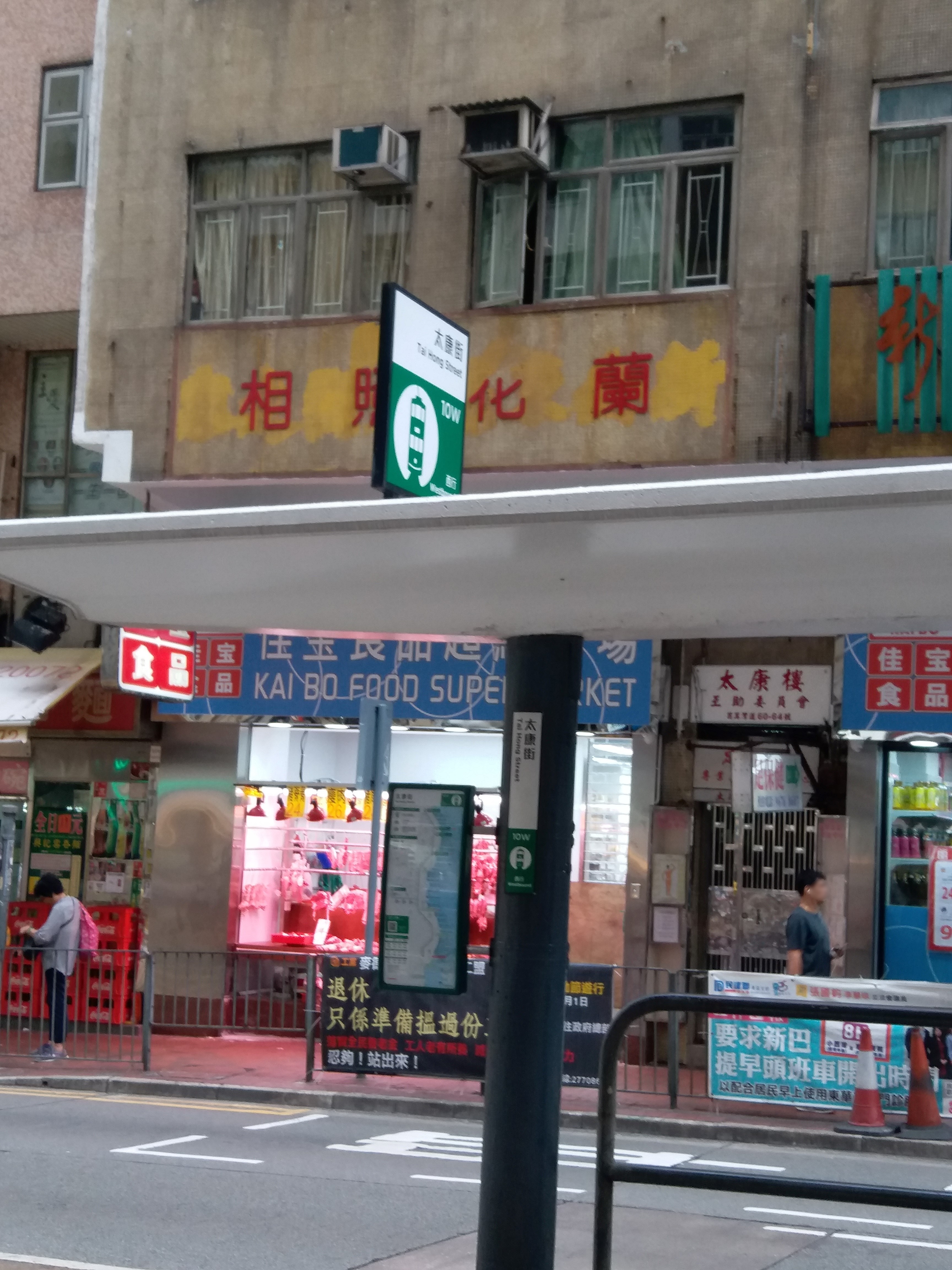 Taken by Anonymous
See 太康街 Tai Hong Street station, 東區 Eastern, on the map
Public transit to 太康街 Tai Hong Street station (ID: 10W) in 東區 Eastern
Looking for directions to 太康街 Tai Hong Street in 東區 Eastern, Hong Kong?
Download the Moovit App to find the current schedule and step-by-step directions for Bus or Subway routes that pass through 太康街 Tai Hong Street.
Looking for the nearest stops closest to 太康街 Tai Hong Street ? Check out this list of closest stops to your destination: 太康街 Tai Hong Street; 筲箕灣道,近陽安大廈 Shau Kei Wan Road; 太富街 Tai Foo Street; 太康樓 Tai Hong House; 太祥街 Tai Cheong Street; 太安樓 Tai on Building; 太康街; 西灣河 Sai Wan Ho; 西灣河街137號 No. 137 Sai Wan Ho Street.
Bus: 33X, 606, 608, 720, 77, 柴灣 - 觀塘(宜安街)/ 九龍灣 KOWLOON BAY, 32, 61, 筲箕灣 - 旺角(砵蘭街), 筲箕灣 - 旺角(銀行中心), 筲箕灣 - 紅磡/土瓜灣, 筲箕灣/柴灣 - 西環, 筲箕灣/柴灣 - 西環 (特快), 柴灣 - 九龍灣, 2A, 2X, N8, 2, 8H, N8X, A12, NA12, 65A, X8, 82X, 682P.Subway: 港島綫 ISLAND LINE.
We make riding on public transit to 太康街 Tai Hong Street easy, which is why over 1.5 million users, including users in 東區 Eastern trust Moovit as the best app for public transit.
Use the app to navigate to popular places including to the airport, hospital, stadium, grocery store, mall, coffee shop, school, college, and university.
太康街 Tai Hong Street station’s code is 10W
The first line to this station is 上環(西港城) - 筲箕灣, at 05:50, and the last line is 堅尼地城 - 筲箕灣 at 00:14.
筲箕灣道 Shau Kei Wan Road, Hong Kong S.A.R.
This station serves HK Tramways’s lines
- 太康街 Tai Hong Street
Light Rail station near 太康街 Tai Hong Street station
- 筲箕灣道,近陽安大廈 Shau Kei Wan Road, Near Yeung on Building,
- 太富街 Tai Foo Street,
- 太康樓 Tai Hong House,
- 太祥街 Tai Cheong Street,
- 太安樓 Tai on Building,
- 太康街, 太康樓 Tai Hong Street, Outside Tai Hong House,
- 西灣河街137號 No. 137 Sai Wan Ho Street
Bus stops near 太康街 Tai Hong Street stop
- 西灣河 Sai Wan Ho
Subway station near 太康街 Tai Hong Street station
- 富豪東方酒店 Regal Oriental Hotel,
- 林護紀念中學 Lam Woo Memorial Secondary School,
- 希慎廣場 Hysan Place,
- 美林巴士總站 Mei Lam B/T,
- 拔萃女書院 Diocesan Girls' School,
- 海富苑 Hoi Fu Court,
- 蘇屋巴士總站 So Uk B/T,
- 大圍 Tai Wai,
- 上水站 Sheung Shui Station,
- 黃大仙下邨龍興樓 Lung Hing House Lower Wong Tai Sin Estate,
- 彌敦酒店 Nathan Hotel,
- 石崗軍營 Shek Kong Camp,
- 元州商場 Un Chau Shopping Centre,
- 浪琴園 Pacific View,
- 九龍維景酒店 Metropark Hotel Kowloon,
- 港鐵黃竹坑車廠 Mtr Wong Chuk Hang Depot,
- 新亞書院 New Asia College,
- 小西灣運動場 Siu Sai Wan Sports Ground,
- 香港抗戰及海防博物館 Hong Kong Museum Of the War Of Resistance And Coastal Defence,
- 靈隱寺 Ling Yan Monastery
Popular public transit stations in 東區 Eastern
Get around 東區 Eastern by public transit!
Traveling around 東區 Eastern has never been so easy. See step by step directions as you travel to any attraction, street or major public transit station. View bus and train schedules, arrival times, service alerts and detailed routes on a map, so you know exactly how to get to anywhere in 東區 Eastern.
When traveling to any destination around 東區 Eastern use Moovit's Live Directions with Get Off Notifications to know exactly where and how far to walk, how long to wait for your line, and how many stops are left. Moovit will alert you when it's time to get off — no need to constantly re-check whether yours is the next stop.
Wondering how to use public transit in 東區 Eastern or how to pay for public transit in 東區 Eastern? Moovit public transit app can help you navigate your way with public transit easily, and at minimum cost. It includes public transit fees, ticket prices, and costs. Looking for a map of 東區 Eastern public transit lines? Moovit public transit app shows all public transit maps in 東區 Eastern with all Bus, Subway, Light Rail, Ferry, Cable Car and Funicular routes and stops on an interactive map.
Hong Kong has 6 transit type(s), including: Bus, Subway, Light Rail, Ferry, Cable Car and Funicular, operated by several transit agencies, including 港鐵 MTR, 天星小輪 Star Ferry, 九巴 KMB, 城巴 Citybus, 城巴機場快線 Cityflyer, 龍運巴士 LWB, 九巴 KMB / 城巴 CTB, 龍運巴士 LWB / 城巴 CTB, 新大嶼山巴士 NLB, 愉景灣巴士 DB, 香港電車 Hong Kong Tramways, 香港中文大學 The Chinese University of Hong Kong, 港島區專線小巴 GMB HK Island, 九龍區專線小巴 GMB Kowloon and 新界區專線小巴 GMB New Territories