开福区政府 stop - Tuesday schedule
| Line | Direction | Time |
|---|---|---|
| W117路 | 望城汽车 | 06:31 |
| 811路 | 嘉年华公交基地 | 06:34 |
| 208路 | 三汊矶大桥东公交首末 | 06:39 |
| W117路 | 望城汽车 | 06:41 |
| 811路 | 嘉年华公交基地 | 06:44 |
| 208路 | 三汊矶大桥东公交首末 | 06:49 |
| W117路 | 望城汽车 | 06:51 |
| 811路 | 嘉年华公交基地 | 06:54 |
| 208路 | 三汊矶大桥东公交首末 | 06:59 |
| W117路 | 望城汽车 | 07:01 |
| 811路 | 嘉年华公交基地 | 07:05 |
| W117路 | 望城汽车 | 07:06 |
| 临131路 | 福元路大桥西 | 07:08 |
| W117路 | 望城汽车 | 07:11 |
| 208路 | 三汊矶大桥东公交首末 | 07:12 |
| W117路 | 望城汽车 | 07:16 |
| W111路 | 长沙医学院 | 07:18 |
| 811路 | 嘉年华公交基地 | 07:18 |
| 112路 | 湘江世纪城 | 07:20 |
| 临131路 | 福元路大桥西 | 07:21 |
| W117路 | 望城汽车 | 07:21 |
| W111路 | 长沙医学院 | 07:23 |
| 208路 | 三汊矶大桥东公交首末 | 07:25 |
| W117路 | 望城汽车 | 07:26 |
| W111路 | 长沙医学院 | 07:28 |
Directions to 开福区政府 stop with public transit
The following transit lines have routes that pass near 开福区政府
 Bus: 112路, 208路, W111路, 临159路, 临131路.
- Metro: 1号线, 4号线.
How to get to 开福区政府 stop by bus?
Click on the bus route to see step by step directions with maps, line arrival times and updated time schedules.
How to get to 开福区政府 stop by metro?
Click on the metro route to see step by step directions with maps, line arrival times and updated time schedules.
Bus stops near 开福区政府 stop
- 渔业分场, 5 min walk,
- 开福区政府, 5 min walk,
- 清水塘二小, 6 min walk,
- 凤亭路, 6 min walk,
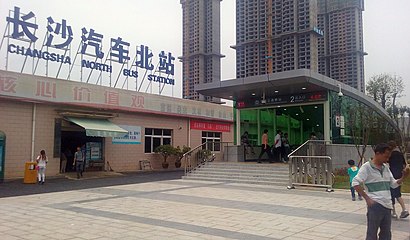
- 汽车北站, 9 min walk,
- 华章路口, 12 min walk,
Metro stations near 开福区政府 station
- 开福区政府, 12 min walk,
- 茶子山, 18 min walk,
Bus lines to 开福区政府 stop
- 临131路, 白沙湾路,
- 星沙2路, 江临天下小区,
- 812路, 湾田国际,
- 931路, 东二环双拥路口,
- W111路, 世界之窗,
- 临149路, 汽车西,
- 临159路, 湖湘艺术品市场,
- 116路, 秀峰公园,
- 128路, 中山亭,
- 208路, 长沙火车南,
- 801路, 嘉年华公交基地,
- 811路, 新开铺路口,
- W105路, 林科大涉外学院,
- 211路, 梅溪湖临时公交首末,
- W117路, 汽车北站 - 望城汽车站,
- 湾田国际专线, 湾田国际 - 汽车北站,
- 129路, 沙坪湘绣广场 - 汽车北站,
- 112路, 营盘路浏阳河大桥西,
What are the closest stations to 开福区政府?
The closest stations to 开福区政府 are:
- 渔业分场 is 329 meters away, 5 min walk.
- 开福区政府 is 361 meters away, 5 min walk.
- 清水塘二小 is 387 meters away, 6 min walk.
- 凤亭路 is 441 meters away, 6 min walk.
- 汽车北站 is 682 meters away, 9 min walk.
- 华章路口 is 889 meters away, 12 min walk.
- 茶子山 is 1399 meters away, 18 min walk.
Which bus lines stop near 开福区政府?
These bus lines stop near 开福区政府: 112路, 208路, W111路, 临159路.
Which metro line stops near 开福区政府?
1号线 (开福区政府)
What’s the nearest metro station to 开福区政府?
The nearest metro station to 开福区政府 is 开福区政府. It’s a 12 min walk away.
What’s the nearest bus station to 开福区政府?
The nearest bus stations to 开福区政府 are 渔业分场 and 开福区政府. The closest one is a 5 min walk away.
What time is the first metro to 开福区政府?
The 1号线 is the first metro that goes to 开福区政府. It stops nearby at 6:30 AM.
What time is the last metro to 开福区政府?
The 4号线 is the last metro that goes to 开福区政府. It stops nearby at 11:47 PM.
What time is the first bus to 开福区政府?
The 星沙2路 is the first bus that goes to 开福区政府. It stops nearby at 5:51 AM.
What time is the last bus to 开福区政府?
The 811路 is the last bus that goes to 开福区政府. It stops nearby at 10:32 PM.
See 开福区政府 stop on the map
Public transit to 开福区政府 stop
Looking for directions to 开福区政府 in 开福区, China?
Download the Moovit App to find the current schedule and step-by-step directions for Bus or Metro routes that pass through 开福区政府.
Looking for the nearest stops closest to 开福区政府 ? Check out this list of closest stops to your destination: 渔业分场; 开福区政府; 清水塘二小; 凤亭路; 汽车北站; 华章路口; 茶子山.
Bus: 112路, 208路, W111路, 临159路, 临131路, 星沙2路, 812路, 931路, 临149路, 116路, 128路, 811路, W105路.Metro: 1号线, 4号线.
We make riding on public transit to 开福区政府 easy, which is why over 1.5 million users, including users in 开福区 trust Moovit as the best app for public transit.
Use the app to navigate to popular places including to the airport, hospital, stadium, grocery store, mall, coffee shop, school, college, and university.
The first line to this stop is W117路, at 06:31, and the last line is 112路 at 22:42.
This stop serves Changsha Bus Group’s lines
Kaifu District Government station is a subway station in Kaifu District, Changsha, Hunan, China, operated by the Changsha subway operator Changsha Metro.Wiki
Get around 开福区 by public transit!
Traveling around 开福区 has never been so easy. See step by step directions as you travel to any attraction, street or major public transit station. View bus and train schedules, arrival times, service alerts and detailed routes on a map, so you know exactly how to get to anywhere in 开福区.
When traveling to any destination around 开福区 use Moovit's Live Directions with Get Off Notifications to know exactly where and how far to walk, how long to wait for your line, and how many stops are left. Moovit will alert you when it's time to get off — no need to constantly re-check whether yours is the next stop.
Wondering how to use public transit in 开福区 or how to pay for public transit in 开福区? Moovit public transit app can help you navigate your way with public transit easily, and at minimum cost. It includes public transit fees, ticket prices, and costs. Looking for a map of 开福区 public transit lines? Moovit public transit app shows all public transit maps in 开福区 with all Bus and Metro routes and stops on an interactive map.
Changsha has 2 transit type(s), including: Bus and Metro, operated by several transit agencies, including 长沙地铁 and 长沙公交集团