Directions to 捷運土城站 (土城區) with public transportation
The following transit lines have routes that pass near 捷運土城站
 Bus: 705, 706, 985萬大樹林先導公車, 藍17, 847區.
- Train: 區間, 區間快, 太魯閣, 新自強, 普悠瑪.
- Metro: 板南線.
How to get to 捷運土城站 by bus?
Click on the bus route to see step by step directions with maps, line arrival times and updated time schedules.
How to get to 捷運土城站 by train?
Click on the train route to see step by step directions with maps, line arrival times and updated time schedules.
How to get to 捷運土城站 by metro?
Click on the metro route to see step by step directions with maps, line arrival times and updated time schedules.
Bus stops near 捷運土城站 in 土城區
- 捷運土城站 Mrt Tucheng Station, 1 min walk,
- 土城區公所 Tucheng Dist. Office, 4 min walk,
- 中正路 Zhongzheng Rd., 5 min walk,
- 土城農會 Tucheng Farmers Association, 8 min walk,
- 土城農會 Tucheng Farmers Assc., 8 min walk,
Metro station near 捷運土城站 in 土城區
- 永寧 Yongning, 15 min walk,
Train station near 捷運土城站 in 土城區
- 樹林 Shulin, 45 min walk,
Bus lines to 捷運土城站 in 土城區
- 706, 三峽 Sanxia - 西門 Ximen,
- 847區, 樹林 Shulin - 捷運亞東醫院站 MRT Far Eastern Hospital Sta.,
- 三峽-中和高中, 三峽 Sanxia - 中和高中 Zhonghe High School,
- 捷運頂溪站-捷運頂埔站, 捷運頂溪站 MRT DingXi Sta. - 捷運頂埔站 MRT Dingpu Sta.,
- 藍17, 五福新村 Wufu New Village - 捷運永寧站 MRT Yongning Sta.,
- 藍40, 華克山莊 Huake Shanzhuang - 土城 Tucheng,
- 570山中湖, 山中湖 Shanzhonghu,
- 572金城路口, 金城路口 Jincheng Rd. Entrance,
- 承天路-南天母廣場, 土城區公所 Tucheng Dist. Office,
- 707, 三峽二站 Sanxia Second Stations,
- 712副, 中正路 Zhongzheng Rd.,
- 573信義國小, 南天母路二 Nantianmu Rd. 2,
- 705, 三峽二站 Sanxia Second Stations,
- 805捷運永寧站, 五股站 Wugu Sta.,
- 1851, 板橋客運站 Banqiao Bus Station - 國光客運臺中車站 Taichung Bus Terminal (KUO-KUANG),
- 1962, 板橋客運站 Banqiao Bus Station - 桃園機場第一航廈 Taiwan Taoyuan International Airport Terminal 1,
What are the closest stations to 捷運土城站?
The closest stations to 捷運土城站 are:
- 捷運土城站 Mrt Tucheng Station is 1 meters away, 1 min walk.
- 土城區公所 Tucheng Dist. Office is 299 meters away, 4 min walk.
- 中正路 Zhongzheng Rd. is 356 meters away, 5 min walk.
- 土城農會 Tucheng Farmers Association is 604 meters away, 8 min walk.
- 土城農會 Tucheng Farmers Assc. is 604 meters away, 8 min walk.
- 永寧 Yongning is 1133 meters away, 15 min walk.
- 樹林 Shulin is 3508 meters away, 45 min walk.
Which bus lines stop near 捷運土城站?
These bus lines stop near 捷運土城站: 705, 706, 985萬大樹林先導公車, 藍17.
Which train line stops near 捷運土城站?
區間 (1135 - 基隆 Keelung - 北湖 Beihu)
Which metro line stops near 捷運土城站?
板南線 (頂埔 Dingpu)
What’s the nearest metro station to 捷運土城站 in 土城區?
The nearest metro station to 捷運土城站 in 土城區 is 永寧 Yongning. It’s a 15 min walk away.
What’s the nearest bus station to 捷運土城站 in 土城區?
The nearest bus station to 捷運土城站 in 土城區 is 捷運土城站 Mrt Tucheng Station. It’s a 1 min walk away.
What time is the first metro to 捷運土城站 in 土城區?
The 板南線 is the first metro that goes to 捷運土城站 in 土城區. It stops nearby at 6:00 AM.
What time is the last metro to 捷運土城站 in 土城區?
The 板南線 is the last metro that goes to 捷運土城站 in 土城區. It stops nearby at 12:44 AM.
What time is the first train to 捷運土城站 in 土城區?
The 區間 is the first train that goes to 捷運土城站 in 土城區. It stops nearby at 5:06 AM.
What time is the last train to 捷運土城站 in 土城區?
The 新自強 is the last train that goes to 捷運土城站 in 土城區. It stops nearby at 12:58 AM.
What time is the first bus to 捷運土城站 in 土城區?
The 1962 is the first bus that goes to 捷運土城站 in 土城區. It stops nearby at 4:46 AM.
What time is the last bus to 捷運土城站 in 土城區?
The 1962 is the last bus that goes to 捷運土城站 in 土城區. It stops nearby at 12:48 AM.
See 捷運土城站, 土城區, on the map
Public Transit to 捷運土城站 in 土城區
Wondering how to get to 捷運土城站 in 土城區? Moovit helps you find the best way to get to 捷運土城站 with step-by-step directions from the nearest public transit station.
Moovit provides free maps and live directions to help you navigate through your city. View schedules, routes, timetables, and find out how long does it take to get to 捷運土城站 in real time.
Looking for the nearest stop or station to 捷運土城站? Check out this list of stops closest to your destination: 捷運土城站 Mrt Tucheng Station; 土城區公所 Tucheng Dist. Office; 中正路 Zhongzheng Rd.; 土城農會 Tucheng Farmers Association; 土城農會 Tucheng Farmers Assc.; 永寧 Yongning; 樹林 Shulin.
Bus: 705, 706, 985萬大樹林先導公車, 藍17, 847區, 三峽-中和高中, 捷運頂溪站-捷運頂埔站, 570山中湖, 572金城路口, 承天路-南天母廣場, 707, 712副, 1851, 1962.Train: 區間, 區間快, 太魯閣, 新自強, 普悠瑪.Metro: 板南線.
Want to see if there’s another route that gets you there at an earlier time? Moovit helps you find alternative routes or times. Get directions from and directions to 捷運土城站 easily from the Moovit App or Website.
We make riding to 捷運土城站 easy, which is why over 1.5 million users, including users in 土城區, trust Moovit as the best app for public transit. You don’t need to download an individual bus app or train app, Moovit is your all-in-one transit app that helps you find the best bus time or train time available.
For information on prices of bus, metro and train, costs and ride fares to 捷運土城站, please check the Moovit app.
Use the app to navigate to popular places including to the airport, hospital, stadium, grocery store, mall, coffee shop, school, college, and university.
捷運土城站 Address: 金城路一段 street in 土城區
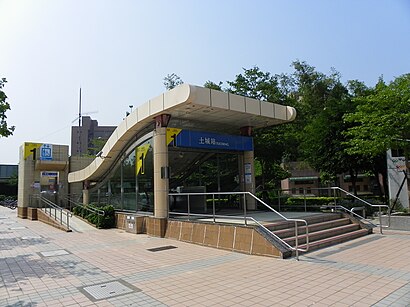
The Tucheng Station of the Taipei Metro is a station on the Bannan line located in Tucheng District, New Taipei, Taiwan. It will soon be a transfer station with the Wanda–Zhonghe–Shulin line in 2028.Wiki
- 饗饌,
- 饗饌火鍋店,
- 饗饌台灣小吃,
- 土城柔道館,
- 新北市政府消防局第五大隊土城分隊,
- 明煌汽車修護廠,
- 土城,
- 國泰世華銀行,
- 土城捷運站,
- 車太炫投幣自助洗車廣場 金城學府店,
- 祐生鋁業有限公司,
- 真耶穌教會土城教會,
- 捷運土城站2號出口,
- 斯味漢堡土城中正店,
- 土城五穀先帝廟,
- 華格納文理珠心算短期補習班,
- 福多吉 傢俱 傢飾 咖啡 城堡之屋,
- 鹿鶴園蔬食養生館,
- 新北市土城區衛生所,
- 新北市政府警察局土城分局
Places Near 捷運土城站 (土城區)
- 好市多 COSTCO(新莊店), 新莊區,
- COSTCO (Chungho) (好市多中和店), 中和區,
- 小潘蛋糕坊, 板橋區,
- 新東南海鮮餐廳, 中正區,
- COSTCO (Neihu) (好市多), 內湖區,
- 好市多內湖店, 內湖區,
- 濱江市場, 中山區,
- 重新橋跳蚤市場, 三重區,
- 建國假日花市, 大安區,
- 小潘鳳梨酥, 板橋區,
- 新北市立殯儀館, 板橋區,
- 龍華會館, 板橋區,
- 好市多中和店, 中和區,
- 中和環球購物中心, 中和區,
- 好市多 Costco, 汐止區,
- 中和Costco好市多, 中和區,
- 新莊頤品大飯店, 新莊區,
- 樹林秀泰影城, 樹林區,
- 我家牛排(中和連城店), 中和區,
- 新莊宏泰市場, 新莊區
How to get to popular places in Taipei - New Taipei with public transit
Get around 土城區 by public transit!
Traveling around 土城區 has never been so easy. See step by step directions as you travel to any attraction, street or major public transit station. View bus and train schedules, arrival times, service alerts and detailed routes on a map, so you know exactly how to get to anywhere in 土城區.
When traveling to any destination around 土城區 use Moovit's Live Directions with Get Off Notifications to know exactly where and how far to walk, how long to wait for your line, and how many stops are left. Moovit will alert you when it's time to get off — no need to constantly re-check whether yours is the next stop.
Wondering how to use public transit in 土城區 or how to pay for public transit in 土城區? Moovit public transit app can help you navigate your way with public transit easily, and at minimum cost. It includes public transit fees, ticket prices, and costs. Looking for a map of 土城區 public transit lines? Moovit public transit app shows all public transit maps in 土城區 with all Bus, Train, Metro, Light Rail and Gondola routes and stops on an interactive map.
Taipei - New Taipei has 5 transit type(s), including: Bus, Train, Metro, Light Rail and Gondola, operated by several transit agencies, including 臺北捷運 Taipei Metro, 新北捷運 New Taipei Metro, 桃園捷運Taoyuan Metro, 臺鐵 Taiwan Railway, 貓空纜車 Maokong Gondola, 首都客運 Capital Bus Co., Ltd., 欣欣客運 Shin-Shin Bus Co., Ltd., 大都會客運 Metropolitan Bus Co., Ltd., 大有巴士 Citiair Bus Co., Ltd., 東南客運 Southeast Bus Co., Ltd., 大南汽車 Danan Bus Co., Ltd., 指南客運 Zhinan Bus Co., Ltd., 光華巴士 Kuang-Hua Bus Co., Ltd., 中興巴士 Zhongxing Bus and 皇家客運 Royal Bus Co., Ltd.