Directions to 松北区 with public transportation
The following transit lines have routes that pass near 松北区
 Bus: 119路, 29路, 35路, 88路, 123路.
How to get to 松北区 by bus?
Click on the bus route to see step by step directions with maps, line arrival times and updated time schedules.
Bus stops near 松北区
- 哈商大(北学区), 10 min walk,
- 松北一路与学海街交口, 10 min walk,
- 银河小区, 11 min walk,
Bus lines to 松北区
- 35路, 哈东,
- 88路, 征跃小区,
- 119路, 军安绿色家园,
- 123路, 绿色湖畔家园,
- 29路, 学子街,
- 122路, 黑龙江科技学院,
- 旅游观光巴士2号环线, 通江湿地公交枢纽,
What are the closest stations to 松北区?
The closest stations to 松北区 are:
- 哈商大(北学区) is 586 meters away, 10 min walk.
- 松北一路与学海街交口 is 692 meters away, 10 min walk.
- 银河小区 is 747 meters away, 11 min walk.
Which bus lines stop near 松北区?
These bus lines stop near 松北区: 119路, 29路.
What’s the nearest bus station to 松北区?
The nearest bus stations to 松北区 are 哈商大(北学区) and 松北一路与学海街交口. The closest one is a 10 min walk away.
What time is the first bus to 松北区?
The 35路 is the first bus that goes to 松北区. It stops nearby at 5:15 AM.
What time is the last bus to 松北区?
The 35路 is the last bus that goes to 松北区. It stops nearby at 9:31 PM.
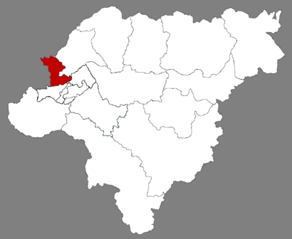
See 松北区 on the map
Public Transportation to 松北区
Wondering how to get to 松北区? Moovit helps you find the best way to get to 松北区 with step-by-step directions from the nearest public transit station.
Moovit provides free maps and live directions to help you navigate through your city. View schedules, routes, timetables, and find out how long does it take to get to 松北区 in real time.
Looking for the nearest stop or station to 松北区? Check out this list of stops closest to your destination: 哈商大(北学区); 松北一路与学海街交口; 银河小区.
Bus: 119路, 29路, 35路, 88路, 123路, 122路, 旅游观光巴士2号环线.
Want to see if there’s another route that gets you there at an earlier time? Moovit helps you find alternative routes or times. Get directions from and directions to 松北区 easily from the Moovit App or Website.
We make riding to 松北区 easy, which is why over 1.5 million users, including users in 松北区, trust Moovit as the best app for public transit. You don’t need to download an individual bus app or train app, Moovit is your all-in-one transit app that helps you find the best bus time or train time available.
For information on prices of bus and metro, costs and ride fares to 松北区, please check the Moovit app.
Use the app to navigate to popular places including to the airport, hospital, stadium, grocery store, mall, coffee shop, school, college, and university.
Location: 松北区, Harbin
- 北岸众和城,
- 哈尔滨大剧院,
- Multi-Functional Theatre,
- Harbin Labour Recreation Centre,
- Harbin International Golf Club,
- 华润万象汇,
- 中关国际,
- 哈尔滨市政府,
- 保利水韵长滩,
- 池塘,
- 市府花园,
- 大润发,
- 哈尔滨冰雪大世界,
- 黑龙江省博物馆,
- 广信新城,
- 永安城,
- 富力城,
- 20,
- 师范附小(松北),
- Science And Technology Museum
Places Near 松北区
- 哈尔滨医科大学附属第一医院, 南岗区,
- Harbin Airport HRB, 道里区,
- 黑龙江中医药大学附属第一医院, 香坊区,
- Harbin Nangang, 南岗区,
- 哈尔滨极地馆, 松北区,
- 医大一院群力院区, 道里区,
- 道外区, 道外区,
- 哈尔滨东站, 道外区,
- 哈尔滨市人民防洪胜利纪念塔, 道里区,
- 中央大街, 道里区,
- 群力国家城市湿地公园, 道里区,
- 哈医大四院, 松北区,
- 肿瘤医院, 南岗区,
- 哈尔滨医科大学附属第二医院, 南岗区,
- 哈尔滨南, 南岗区,
- Volga Manor, 香坊区,
- 华润万象汇, 松北区,
- 哈尔滨西站, 南岗区,
- 极乐寺 - Jile Temple, 南岗区,
- 哈尔滨大剧院, 松北区
How to get to popular places in Harbin with public transit
Get around 松北区 by public transit!
Traveling around 松北区 has never been so easy. See step by step directions as you travel to any attraction, street or major public transit station. View bus and train schedules, arrival times, service alerts and detailed routes on a map, so you know exactly how to get to anywhere in 松北区.
When traveling to any destination around 松北区 use Moovit's Live Directions with Get Off Notifications to know exactly where and how far to walk, how long to wait for your line, and how many stops are left. Moovit will alert you when it's time to get off — no need to constantly re-check whether yours is the next stop.
Wondering how to use public transit in 松北区 or how to pay for public transit in 松北区? Moovit public transit app can help you navigate your way with public transit easily, and at minimum cost. It includes public transit fees, ticket prices, and costs. Looking for a map of 松北区 public transit lines? Moovit public transit app shows all public transit maps in 松北区 with all Bus and Metro routes and stops on an interactive map.
Harbin has 2 transit type(s), including: Bus and Metro, operated by several transit agencies, including 地铁 and 公交