梧桐山南 station - Wednesday schedule
| Line | Direction | Time |
|---|---|---|
| 8号线 | 盐田路 | 06:26 |
| 8号线 | 盐田路 | 06:32 |
| 8号线 | 盐田路 | 06:37 |
| 8号线 | 盐田路 | 06:43 |
| 8号线 | 盐田路 | 06:48 |
| 8号线 | 莲塘 | 06:50 |
| 8号线 | 盐田路 | 06:54 |
| 8号线 | 莲塘 | 06:56 |
| 8号线 | 盐田路 | 06:59 |
| 8号线 | 莲塘 | 07:01 |
| 8号线 | 盐田路 | 07:05 |
| 8号线 | 莲塘 | 07:07 |
| 8号线 | 莲塘 | 07:12 |
| 8号线 | 盐田路 | 07:16 |
| 8号线 | 莲塘 | 07:18 |
| 8号线 | 莲塘 | 07:23 |
| 8号线 | 盐田路 | 07:27 |
| 8号线 | 莲塘 | 07:29 |
| 8号线 | 盐田路 | 07:32 |
| 8号线 | 莲塘 | 07:34 |
| 8号线 | 盐田路 | 07:35 |
| 8号线 | 盐田路 | 07:38 |
| 8号线 | 莲塘 | 07:40 |
| 8号线 | 盐田路 | 07:41 |
| 8号线 | 盐田路 | 07:44 |
Directions to 梧桐山南 station (罗湖区) with public transit
The following transit lines have routes that pass near 梧桐山南
 Bus: 103B, 205, 214, 57, 65.
- Metro: 2号线, 8号线.
How to get to 梧桐山南 station by bus?
Click on the bus route to see step by step directions with maps, line arrival times and updated time schedules.
How to get to 梧桐山南 station by metro?
Click on the metro route to see step by step directions with maps, line arrival times and updated time schedules.
Metro stations near 梧桐山南 station in 罗湖区
- 沙头角, 6 min walk,
- 莲塘, 14 min walk,
Bus stops near 梧桐山南 stop in 罗湖区
- 长岭总站, 6 min walk,
- 莲塘总站, 8 min walk,
- 莲塘梧桐苑总站, 14 min walk,
- 罗湖公安分局, 17 min walk,
- 长岭, 17 min walk,
Bus lines to 梧桐山南 station in 罗湖区
- 57, 长岭总站 - 鹤围村总站,
- 214, 福田南总站 - 长岭总站,
- 218, 长岭总站 - 福田农批市场,
- 333, 长岭总站 - 旭景佳园总站,
- 336, 长岭总站 - 同胜村总站,
- N15, 长岭总站,
- 311, 宝安桃源居,
- 381, 莲塘总站,
- 69, 莲塘梧桐苑总站 - 银湖度假村,
- 113, 莲塘梧桐苑总站 - 蛇口总站,
- K113, 莲塘梧桐苑总站,
- M364, 莲塘梧桐苑,
- 103, 小梅沙总站,
- 205, 火车站,
- 103B, 下沙总站,
- B621, 东方尊峪总站,
- M191, 宝安客运中心,
- M468, 东方尊峪公交总站,
- 65, 东方尊峪总站,
- 85, 盐田北公交总站,
What are the closest stations to 梧桐山南?
The closest stations to 梧桐山南 are:
- 沙头角 is 385 meters away, 6 min walk.
- 长岭总站 is 397 meters away, 6 min walk.
- 莲塘总站 is 548 meters away, 8 min walk.
- 莲塘梧桐苑总站 is 988 meters away, 14 min walk.
- 莲塘 is 1081 meters away, 14 min walk.
- 罗湖公安分局 is 1164 meters away, 17 min walk.
- 长岭 is 1210 meters away, 17 min walk.
Which bus lines stop near 梧桐山南?
These bus lines stop near 梧桐山南: 103B, 205, 214, 57, 65, 85, M191, M362.
Which metro lines stop near 梧桐山南?
These metro lines stop near 梧桐山南: 2号线, 8号线.
What’s the nearest metro station to 梧桐山南 in 罗湖区?
The nearest metro station to 梧桐山南 in 罗湖区 is 沙头角. It’s a 6 min walk away.
What’s the nearest bus station to 梧桐山南 in 罗湖区?
The nearest bus station to 梧桐山南 in 罗湖区 is 长岭总站. It’s a 6 min walk away.
What time is the first metro to 梧桐山南 in 罗湖区?
The 8号线 is the first metro that goes to 梧桐山南 in 罗湖区. It stops nearby at 6:24 AM.
What time is the last metro to 梧桐山南 in 罗湖区?
The 8号线 is the last metro that goes to 梧桐山南 in 罗湖区. It stops nearby at 12:22 AM.
What time is the first bus to 梧桐山南 in 罗湖区?
The 311 is the first bus that goes to 梧桐山南 in 罗湖区. It stops nearby at 5:30 AM.
What time is the last bus to 梧桐山南 in 罗湖区?
The N21 is the last bus that goes to 梧桐山南 in 罗湖区. It stops nearby at 1:22 AM.
See 梧桐山南 station, 罗湖区, on the map
Public transit to 梧桐山南 station in 罗湖区
Looking for directions to 梧桐山南 in 罗湖区, China?
Download the Moovit App to find the current schedule and step-by-step directions for Bus or Metro routes that pass through 梧桐山南.
Looking for the nearest stops closest to 梧桐山南 ? Check out this list of closest stops to your destination: 沙头角; 长岭总站; 莲塘总站; 莲塘梧桐苑总站; 莲塘; 罗湖公安分局; 长岭.
Bus: 103B, 205, 214, 57, 65, 85, M191, M362, 218, 333, 336, 311, 381, K113, M364, 69, 113.Metro: 2号线, 8号线.
We make riding on public transit to 梧桐山南 easy, which is why over 1.5 million users, including users in 罗湖区 trust Moovit as the best app for public transit.
Use the app to navigate to popular places including to the airport, hospital, stadium, grocery store, mall, coffee shop, school, college, and university.
The first line to this station is 8号线, at 06:26, and the last line is 8号线 at 00:17.
This station serves Shenzhen Metro’s lines
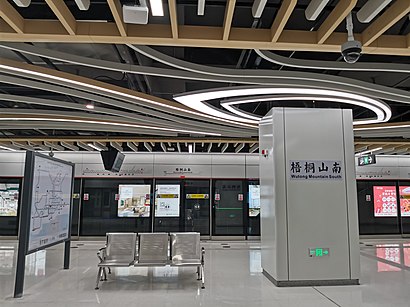
Wutong Mountain South station (Chinese: 梧桐山南站; pinyin: Wútóngshān Nán Zhàn) is a station on Line 8 of the Shenzhen Metro. It opened on 28 October 2020.Wiki
Get around 罗湖区 by public transit!
Traveling around 罗湖区 has never been so easy. See step by step directions as you travel to any attraction, street or major public transit station. View bus and train schedules, arrival times, service alerts and detailed routes on a map, so you know exactly how to get to anywhere in 罗湖区.
When traveling to any destination around 罗湖区 use Moovit's Live Directions with Get Off Notifications to know exactly where and how far to walk, how long to wait for your line, and how many stops are left. Moovit will alert you when it's time to get off — no need to constantly re-check whether yours is the next stop.
Wondering how to use public transit in 罗湖区 or how to pay for public transit in 罗湖区? Moovit public transit app can help you navigate your way with public transit easily, and at minimum cost. It includes public transit fees, ticket prices, and costs. Looking for a map of 罗湖区 public transit lines? Moovit public transit app shows all public transit maps in 罗湖区 with all Bus and Metro routes and stops on an interactive map.
Shenzhen has 2 transit type(s), including: Bus and Metro, operated by several transit agencies, including 深圳地铁, 深圳公交, 社区微巴 and 港铁(深圳)